Leaderboard


Popular Content
Showing content with the highest reputation on 20/05/20 in all areas
-
2 points
-
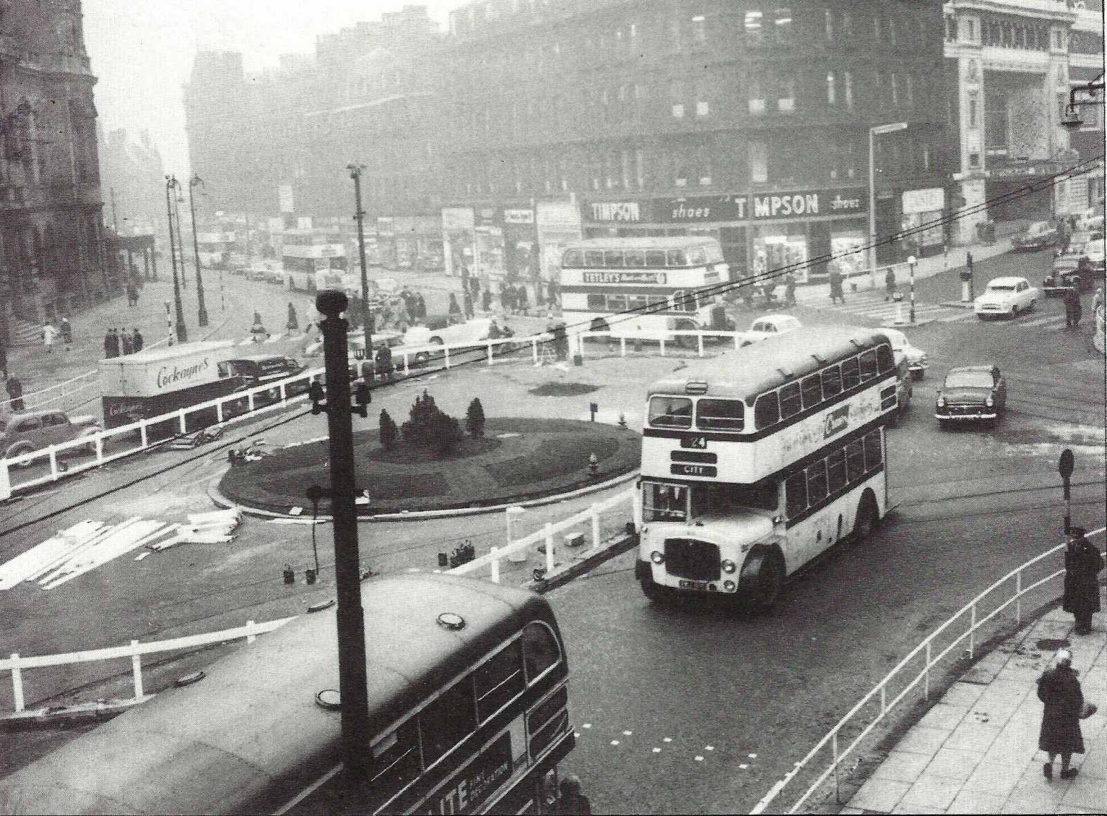
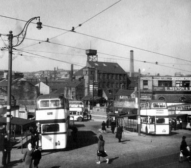
Did you know that in the 1960's there was a roundabout placed at the top of Fargate outside the Town Hall?
 2 points
 -
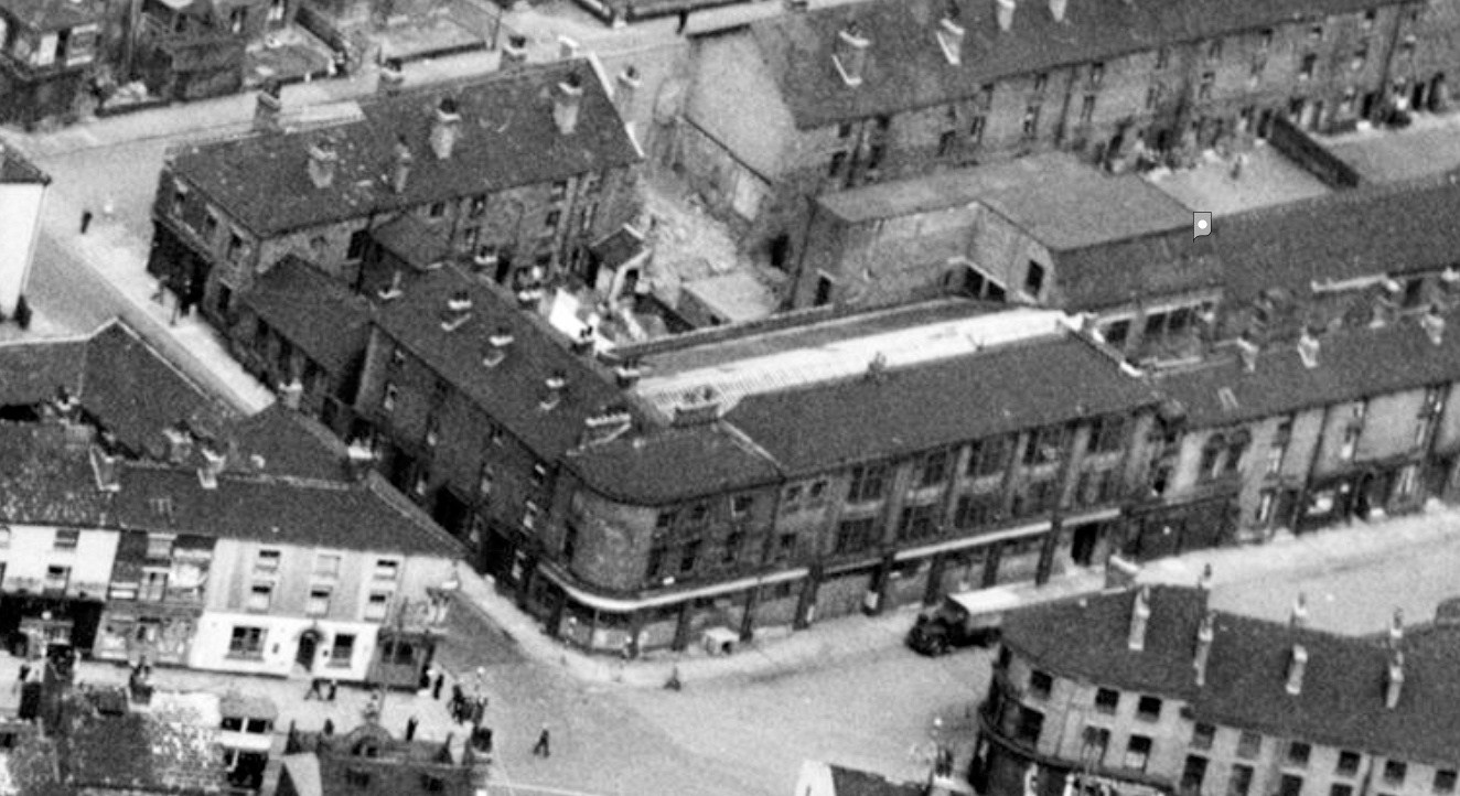
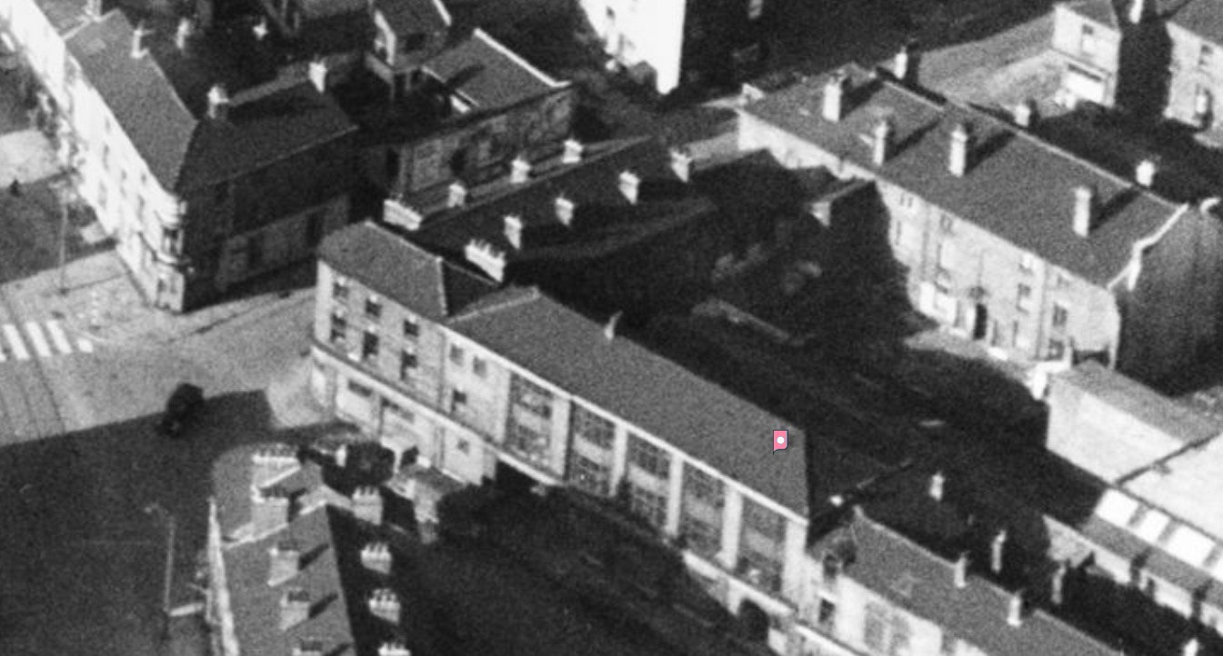
I was thinking the same when I saw that one from Picture Sheffield. A couple of post WW2 shots from Britain from Above, showing the neighbouring buildings as well 1947 1952
 2 points
 -
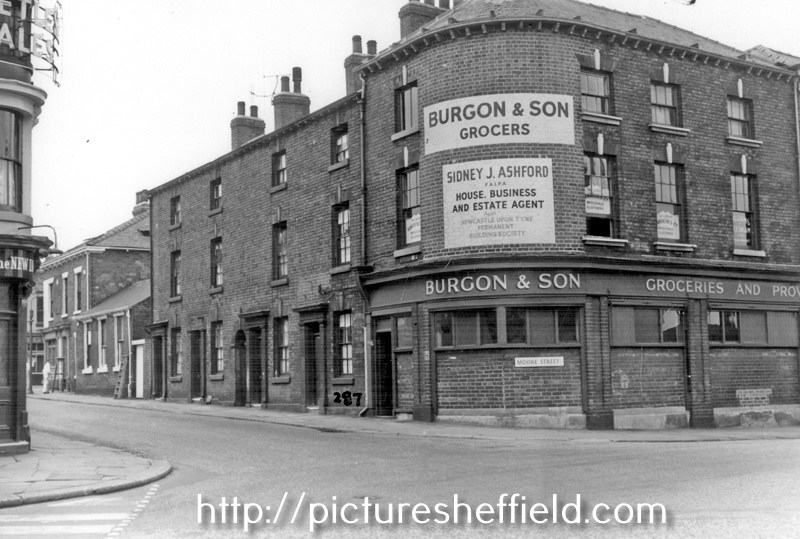
Looks like the same building (look at windows), but appears to have been knocked about a bit? "Moore Street at junction of Hanover Street, from Ecclesall Road, No 152, Moore Street, Burgon and Son Ltd., Grocers " https://www.picturesheffield.com/t00421
 2 points
 -
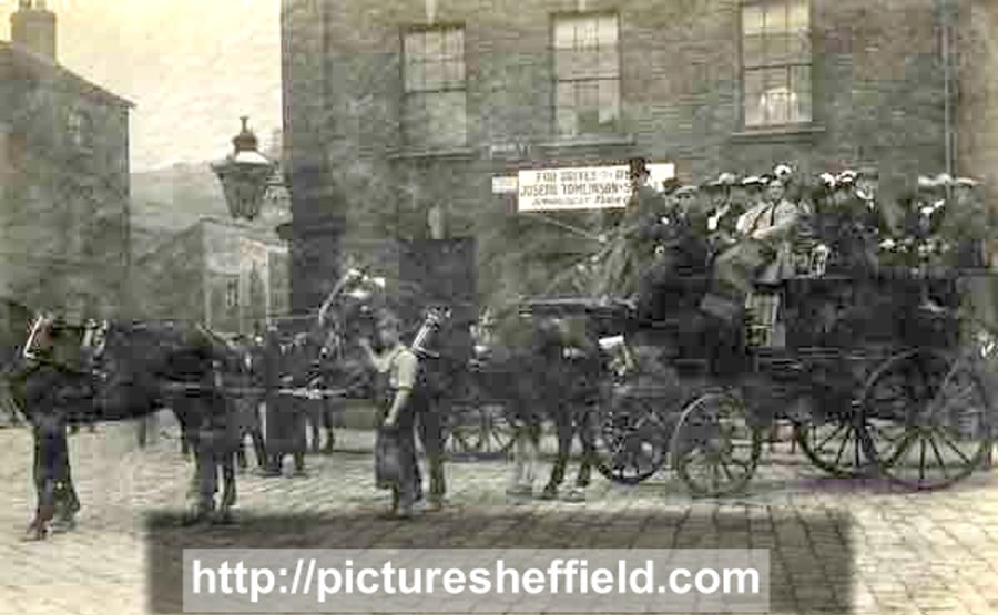
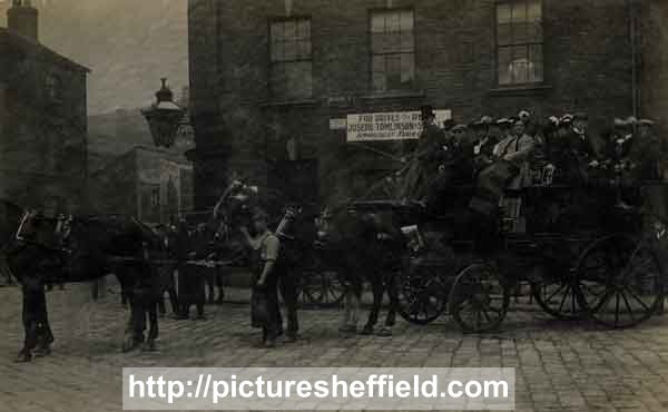
"Horse drawn carriage belonging to Joseph Tomlinson and Sons on Moore Street" https://www.picturesheffield.com/p00308 Image edited
 2 points
 -
I would say it is the building seen here. "Horse drawn carriage belonging to Joseph Tomlinson and Sons on Moore Street" https://www.picturesheffield.com/p00308
 2 points
 -
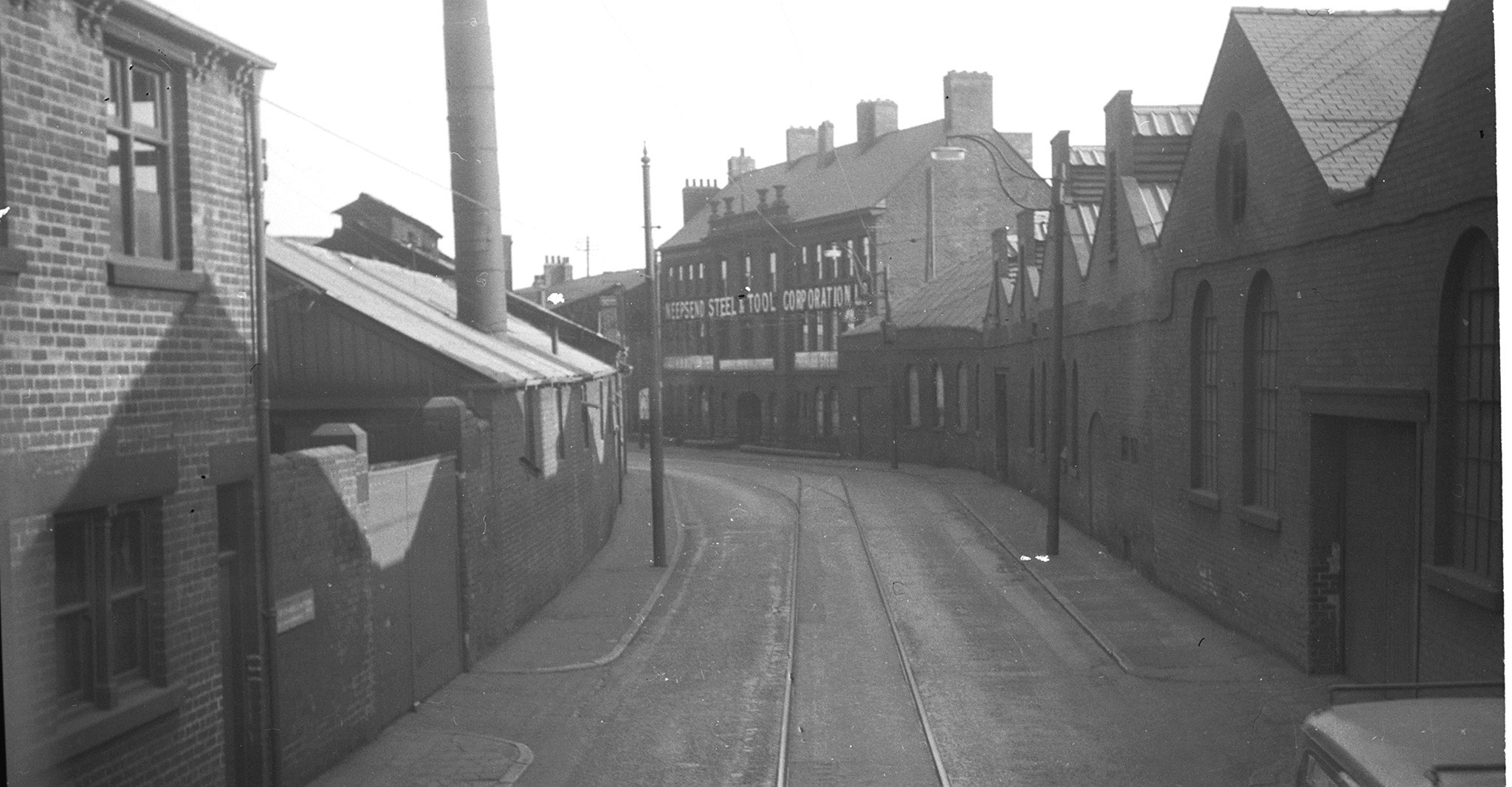
Photo courtesy @Old rider Can anyone remember the Neepsend tram route?
 1 point
 -
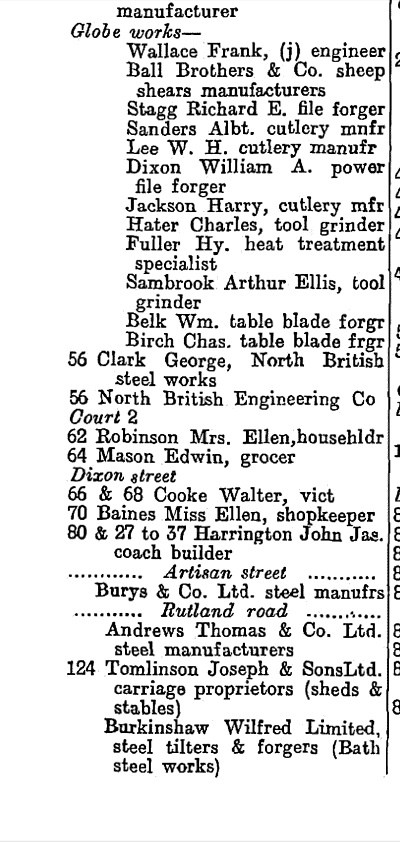
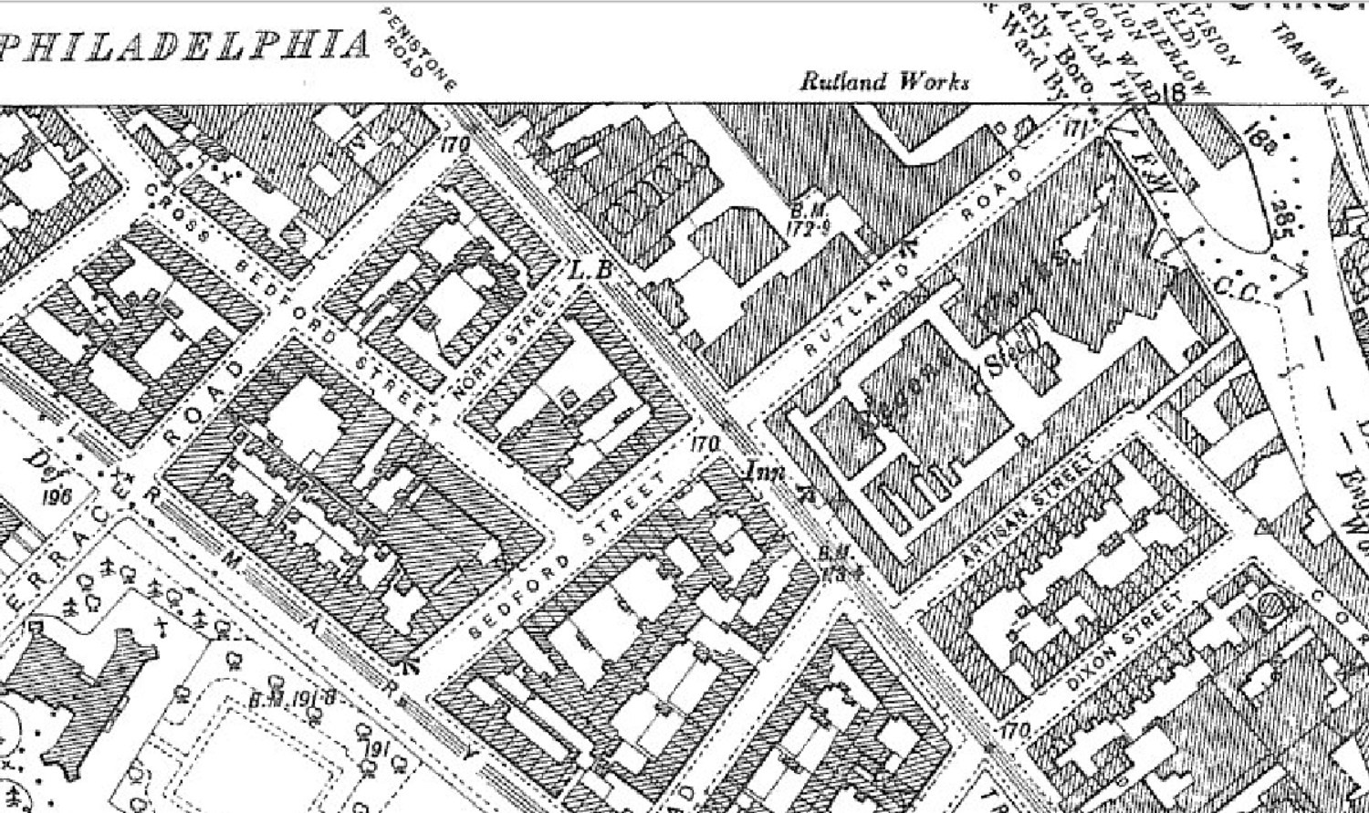
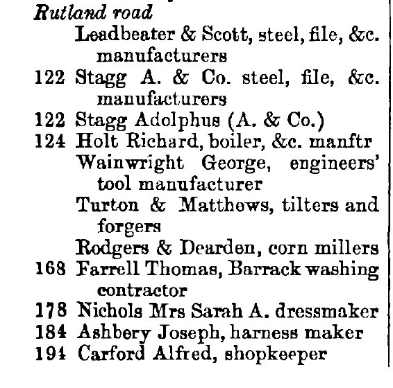
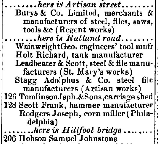
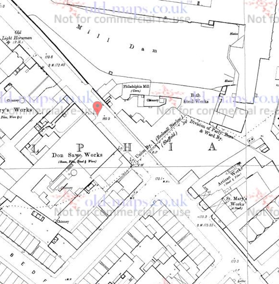
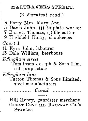
Kelly's published 1925, Penistone Road (S/E to N/W).
 1 point
 -
Yes, in that area neddy c.1903
 1 point
 -
And an 1879 Whites, which doesn't list a 126 in the street listing but gives numbers to some of the un-numbered works in the Kelly's. The alphabetical list does show Joseph Tomlinson at 126, however. The order of the various works is different, but it suggests to me that 126 was somewhere amongst those works towards the bottom of the map posted above. I could be wrong, of course (and often am )
 1 point
 -
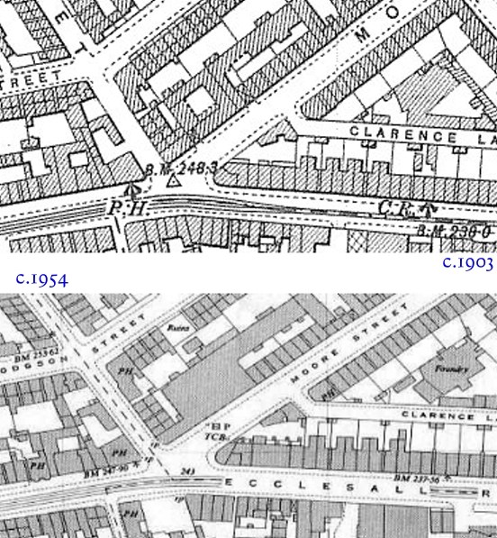
1881 Kelly's Directory Which suggests that it was between the Artisan Works and the Philadelphia Corn Mill 1890ish map showing the works and mill, but no real idea where 126 is.
 1 point
 -
Would have been near the junction of Rutland Road and Penistone Road, just down the road from Bedford St.1 point
-
Does anybody have any info or pictures regarding Oxford Mews? It was occupied by Joseph Tomlinson & Sons Ltd. and was located on the corner of Hanover Street and Ecclesall Road. I’m unsure as to where it was located. I’m wondering if anybody can help me? Thanks1 point
-
Map, coverage area increased1 point
-
1950's https://www.old-maps.co.uk/index. Edit: map area
 1 point
 -
In the bottom picture you can just about see some of Tomlinson’s Ecclesall garage1 point
-
1 point
-
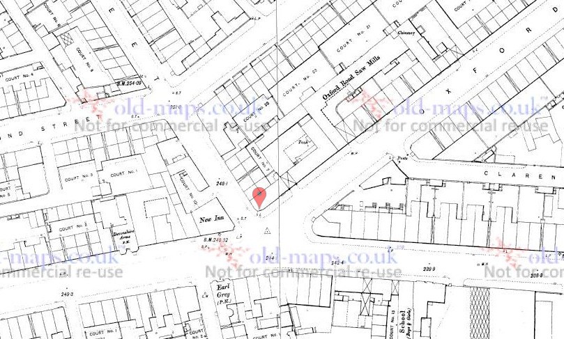
The Pub, seen in most of the photos, is the New Inn, 108 Ecclesall Road.1 point
-
Ahh yes. That definitely is Oxford Mews because in a directory I read, 287 Hanover Street, which has been written on the picture from Picturesheffield above. Thank you both so much!1 point
-
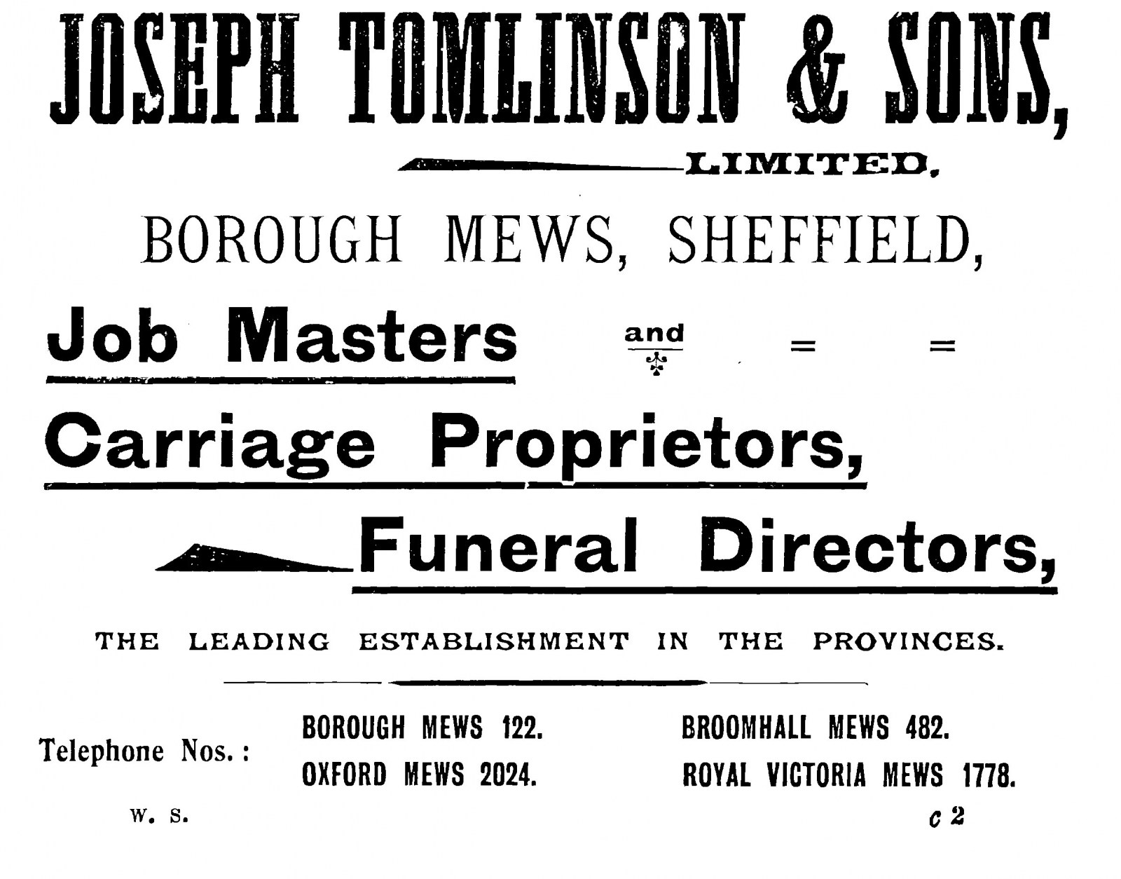
From the 1901 Whites directory advertisement section. Four locations given, all with telephone numbers.
 1 point
 -
Typical that neither of the two Whites I looked at (1901 and 1911) mentions Oxford Mews in the street by street listing. Next time perhaps I should look in the alphabetical listing, where it is mentioned.1 point
-
White's 1905. Tomlinson Joseph & Sons Ltd. cab & carriage proprietors, Oxford Mews, 162 Moore Street.1 point
-
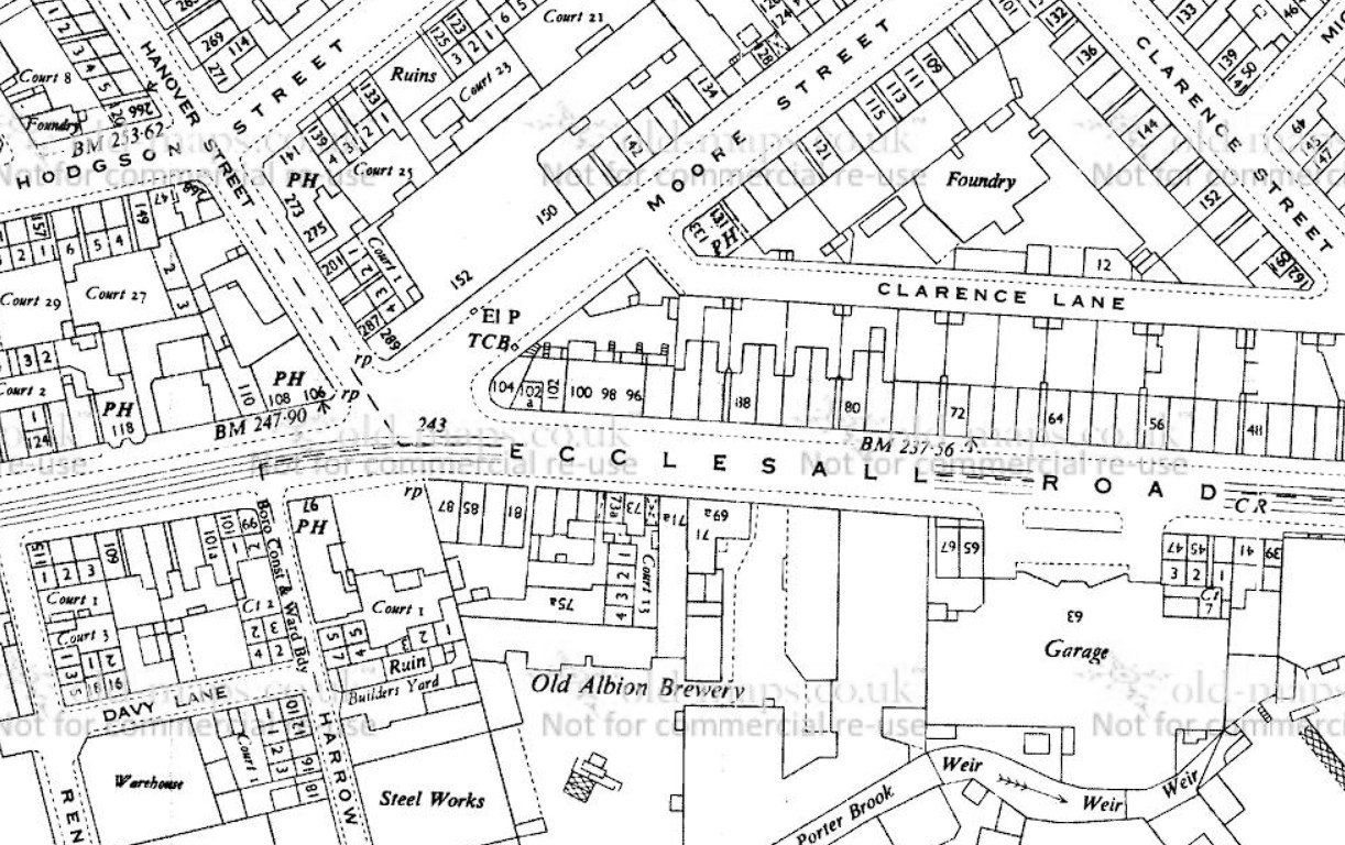
Whites 1901 directory has: 162 Moore Street - Tomlinson Joseph & Sons Lim. Cab proprietors 162 is listed as the last property on Moore Street before the junction with Ecclesall Road. Prior to the end of the 19th century Moore STreet was known as Oxford Road AN 1890 map (from old-maps.co.uk. Ecclesall Road is the road across the bottom of the map, Hanover Street is coming down from the top and Oxford Road is heading off to the top right of the map. Possibly somewhere in the vicinity of the marker was Oxford Mews.
 1 point
 -
Map c.1890 https://www.old-maps.co.uk/index.html#/Map/435740/387882/13/100453
 1 point
 -
Near enough https://maps.nls.uk/geo/explore/side-by-side/#zoom=17&lat=53.38664&lon=-1.45851&layers=6&right=BingHyb1 point
-
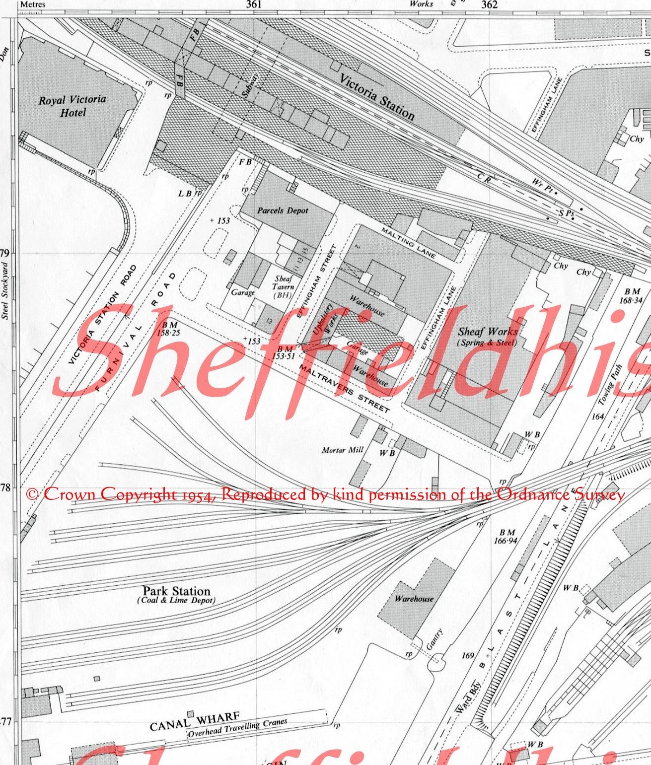
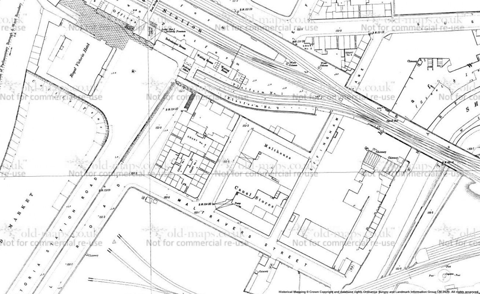
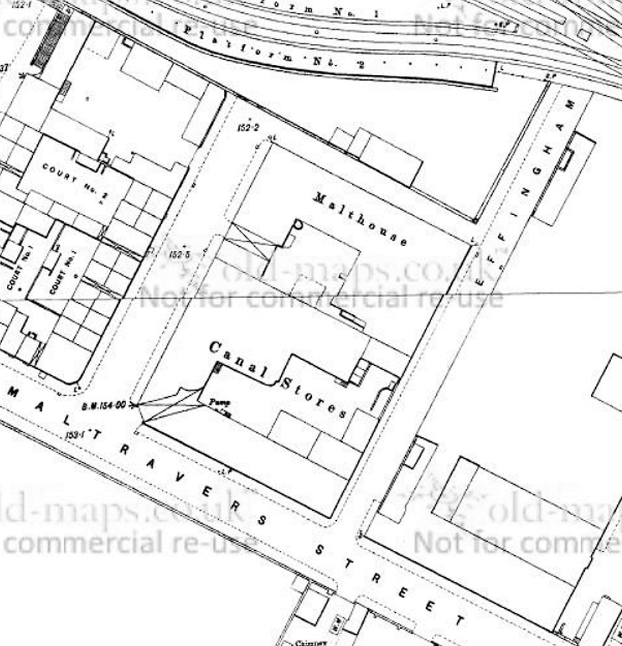
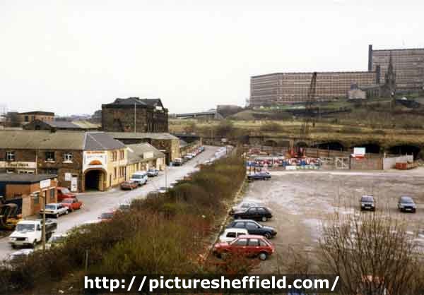
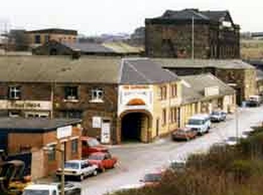
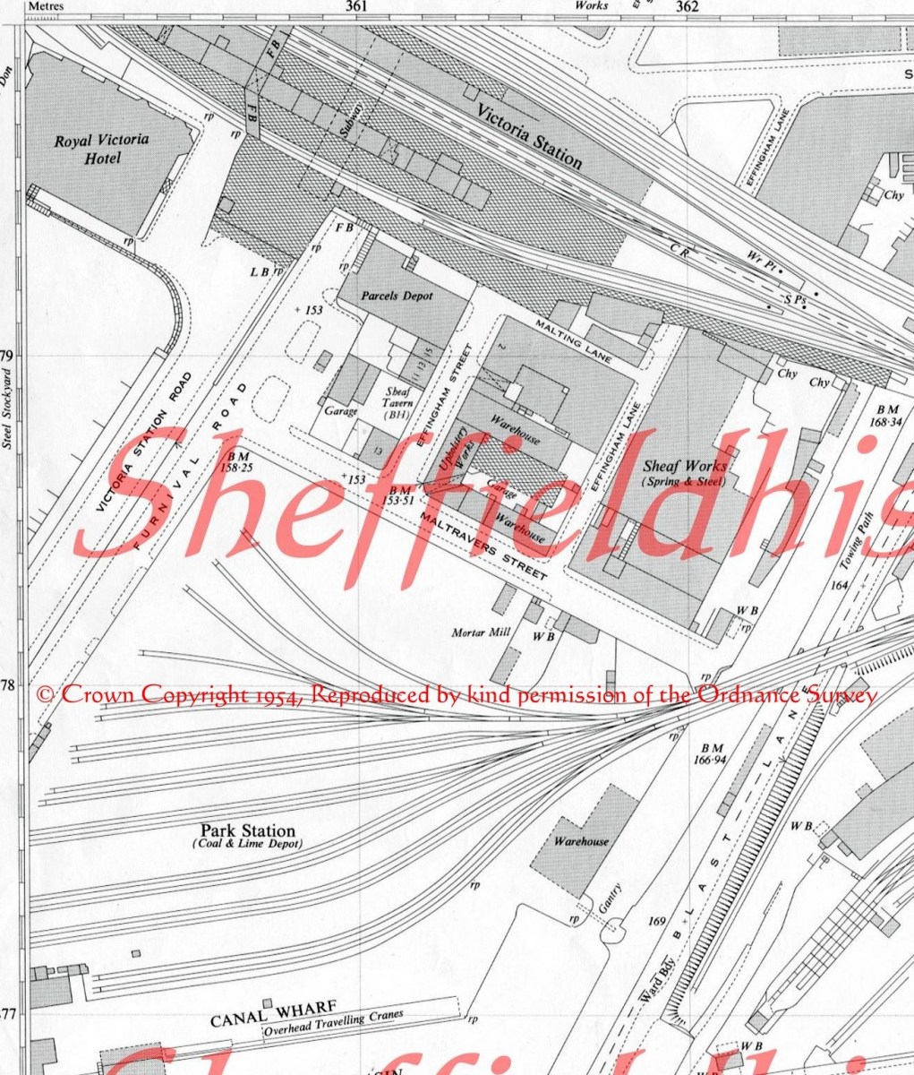
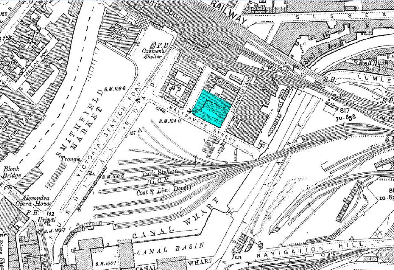
Maltravers Street, c.1988 https://www.picturesheffield.com/t11659 More images of the area https://www.picturesheffield.com/search&keywords=KeywordsMaltravers_Street_Nunnery%3B
 1 point
 -
Section of 1950's OS map #94 Photo (dated 1987) - https://www.picturesheffield.com/t08421 "Deville, curtain equipment designers, junction of Effingham Street and Maltravers Street". To me it looks to be the same building at a later date, note the corner entrance arch!
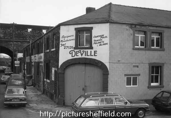 1 point
 -
There was a drainage system under the HITR, otherwise when it rained it would have just filled up, so access is still needed to it. I would guess the props were installed to help support the roof. No amount of fill is going to support the ground above unless it is compacted, and you can't do that in existing tunnels. Over time the building rubble would settle, and Castle Square would start to sink! There was a problem on Park Square some years ago after the Supertram works, one of the 100 foot high street lights started to lean due to the ground settling near the new bridge at Commercial Street, we had to install a new concrete base a few metres away and move the mast.1 point
-
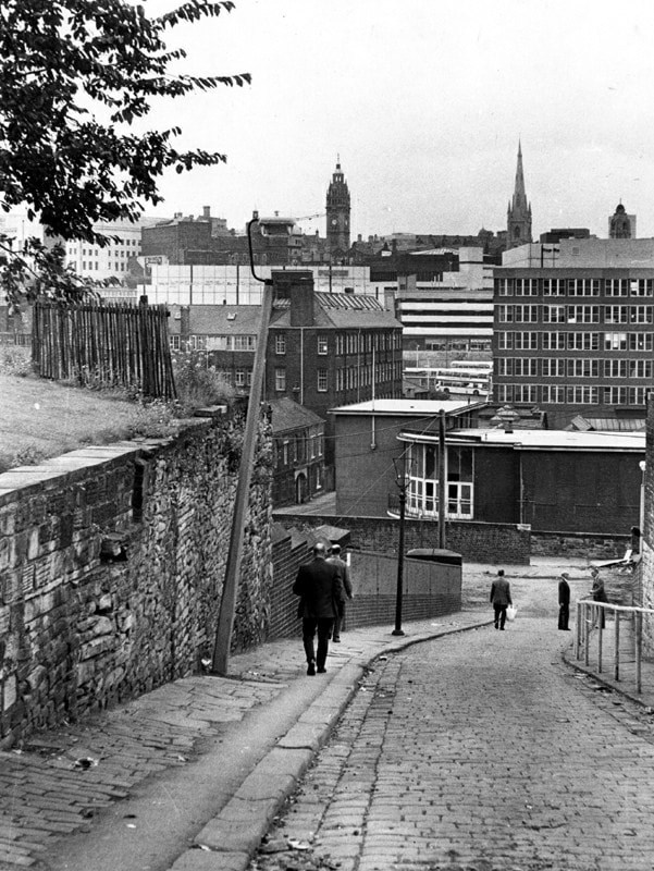
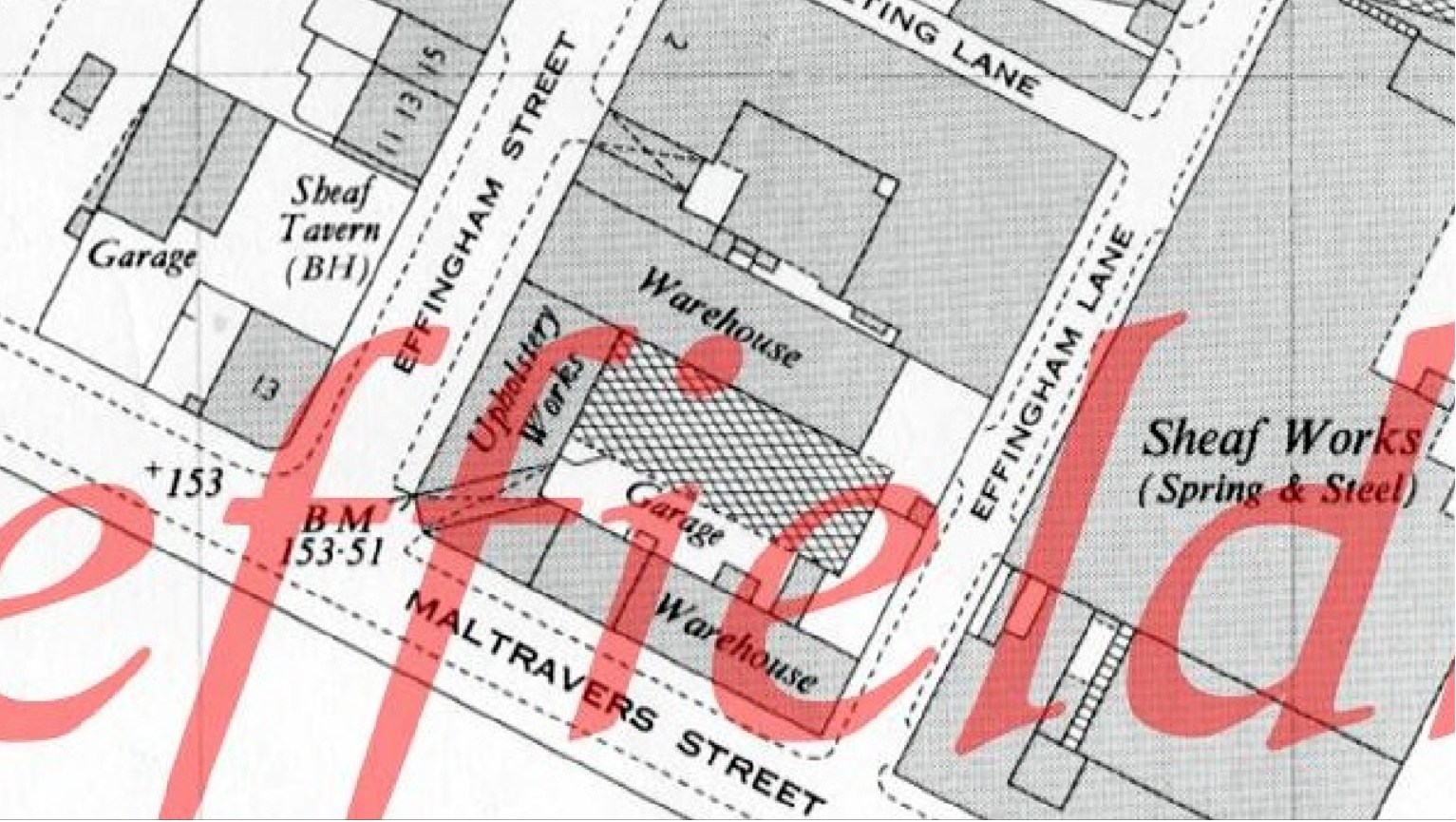
I would guess it is the area marked, map c.1903 White's directory, published 1905
 1 point
 -
There's been quite a few changes to the City centre since this photograph was taken in 2003! The first one to come to mind is the Fire Station on Eyre Street.
 1 point
 -
They were becoming very unsafe 'no go' areas, where all kinds of crime took place. They also stank pretty badly towards the end as they were used as toilets1 point
-
Snig Hill / Bridge Street Bus Station. No idea when it was closed down tho
 1 point
 -
Well, sort of. Each "prefab" had two classrooms with a cloakroom in between. Because of shortage of space in the main building, each lunchtime two ladies used to push our food, in metal containers, up to the prefab and set up stall on a table placed across the entrance of the cloakroom. We'd collect our meals and then go back into our classroom and eat at our desks. This was 1960-ish when I was in Mr. Iossen's class. I remember Mr. Spir, and his then-teenage son Barry who used to come and help out with games from time to time. I also remember visiting the school a few years after I had left, and hearing the sad news of Mr. Spir's death. And finally...I never heardv the park called Hollinsend anything - in my family it was just "Gleadless Park".However, I've just remembered that local children used to talk about "the old rec" and "the new rec", "rec" being short for "recreation ground". Now, The Old Rec was, from memory, off Gleadless Common, with its entrance on the right-hand side as you walked uphill. I wonder if the "New Rec" was Hollinsend Park.1 point