Leaderboard


Popular Content
Showing content with the highest reputation on 14/05/20 in all areas
-
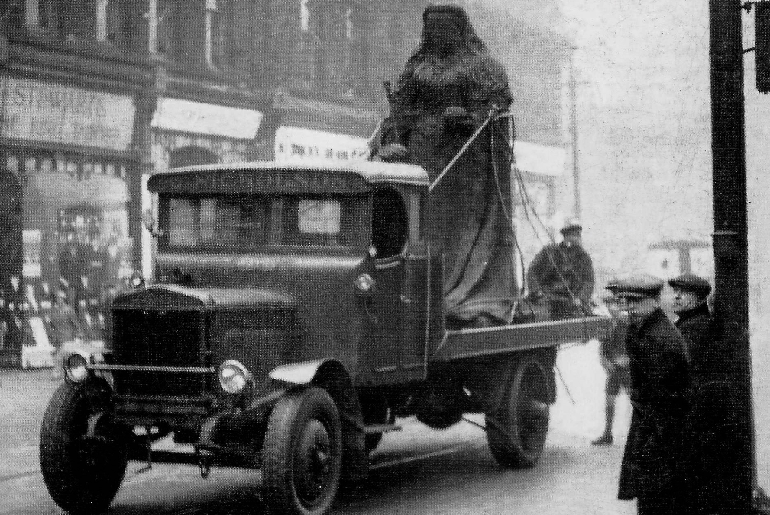
1930 photograph of Pinstone Street showing the statue of Queen Victoria leaving for its new resting place in Endcliffe Park.
 2 points
 -
From a bit further up with a nice pair of Leylands coming up. https://picturesheffield.com/frontend.php?keywords=Ref_No_increment;EQUALS;t04449&pos=22&action=zoom&id=34735
 2 points
 -
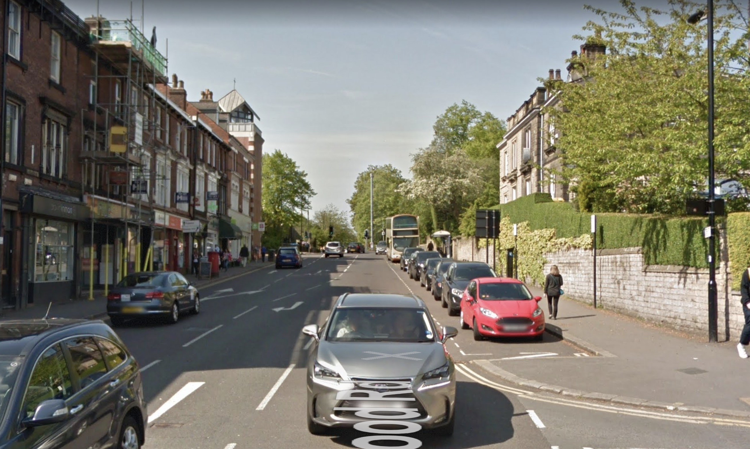
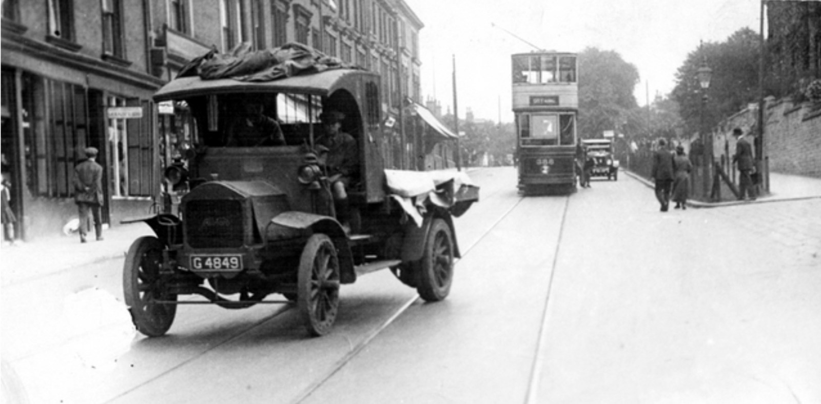
Trying to do a 'then and now' comparison of the top photograph which shows Albion Lorry at Fulwood Road near Glossop Road Am I in the right spot?
 2 points
 -
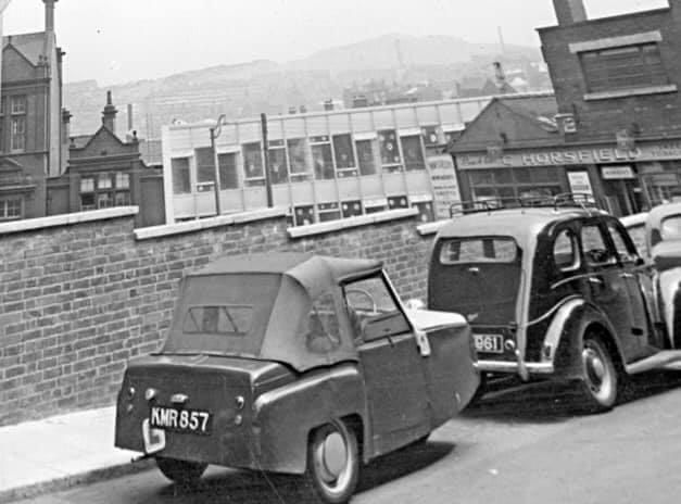
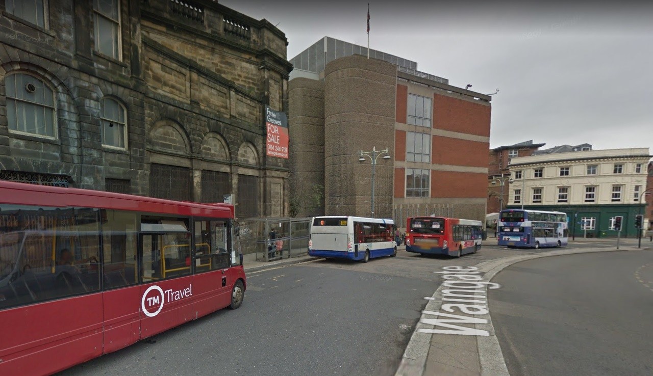
The view over the wall is that of the GPO building on Flat Street so the street where the cars are parked must be Milk Street (If I've remembered the name correctly). It was at the back of the plot of land where the Odeon was built running from Norfolk Street. Strangely enough, I can't remember the business premises with the name Horsefield.2 points
-
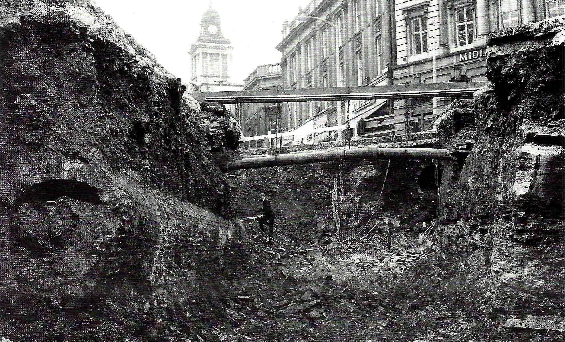
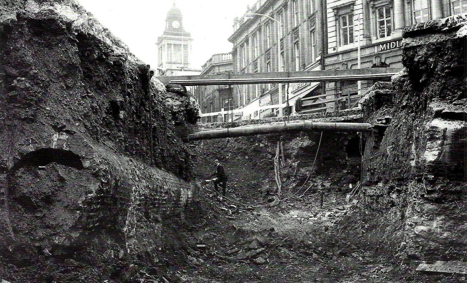
Amazing picture in High Street 1966 of a Victorian sewer. This was found during work to construct the new Castle Square roundabout.
 1 point
 -
What do we know about this place, the businesses, the buildings etc?
 1 point
 -
Take a look at this old Sheffield photo. Can you name the street? Where was this taken?
 1 point
 -
Friends of Burngreave Chapel & Cemetery Edit: link fixed1 point
-
Hi again, I have an old copy of ‘The Working Man’s Model Family Botanic Guide‘ from the 1890s written by Sheffield herbalist William Fox (1810-1877) of Snig Hill and Castle St. Out of interest I have researched some of these herbalists - Fox died of liver & heart disease (despite all his herbal cures) in 1877 and his widow Mary Elizabeth Fox married (wait for it) Joseph Tomlinson soon after. Her son Alfred Russell Fox was a herbalist and town councillor for Crookesmoor and there is a prominent Fox family grave in Crookes cemetery with botanical carvings on it.1 point
-
1 point
-
SteveHB the link doesn't work anymore (for me at least) I hope you don't mind me putting this one on, I think it may be the same. http://www.friendsofburngreavecemetery.btck.co.uk/1 point
-
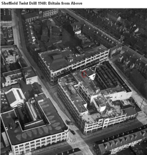
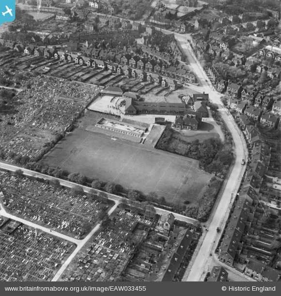
If you've been to the National Emergency Services Museum on West Bar, you might have seen the Dalek shaped wartime air raid/fire warden shelter? Originally located on the roof of the Sheffield Twist Drill on Summerfield Street, it was fabricated by the firm's maintenance department to provide some protection for the guy on fire watch duty. You can see the location of the shelter in these Britain from Above photographs taken in 1948.
 1 point
 -
My cousin did. He was a shop steward when the company was well known for its relatively high rates of pay and being on strike, seemingly,, more often than they were working. 🤔1 point
-
They were Undertakers as well as running passenger coaches etc. Are they related to Tomlinson and Windley, currently Funeral Directors of Crookes?1 point
-
https://historicengland.org.uk/listing/the-list/list-entry/1001603
 1 point
 -
Does anyone know what this building is/was on the corner of York Street and Campo Lane? Does it have a name?
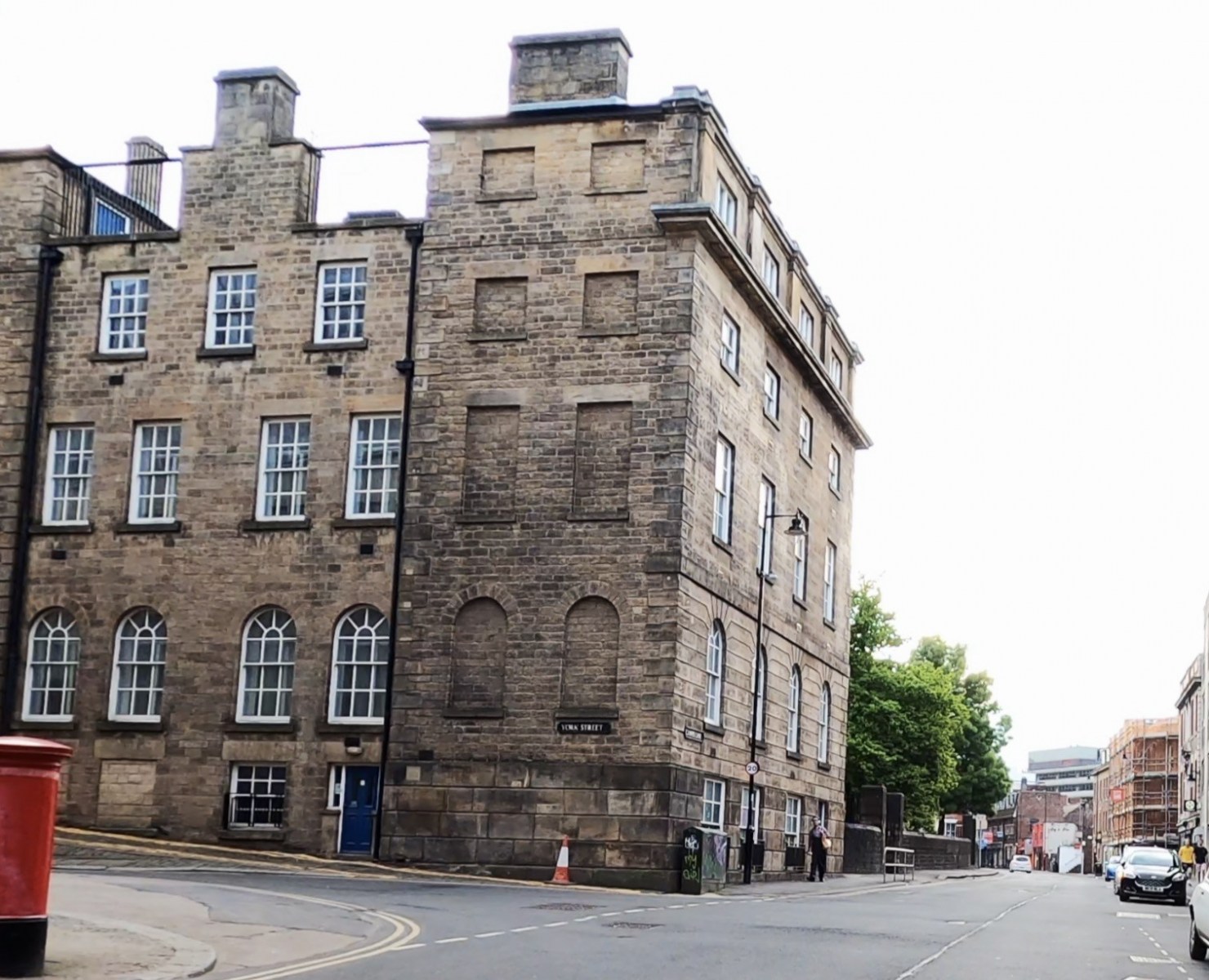 1 point
 -
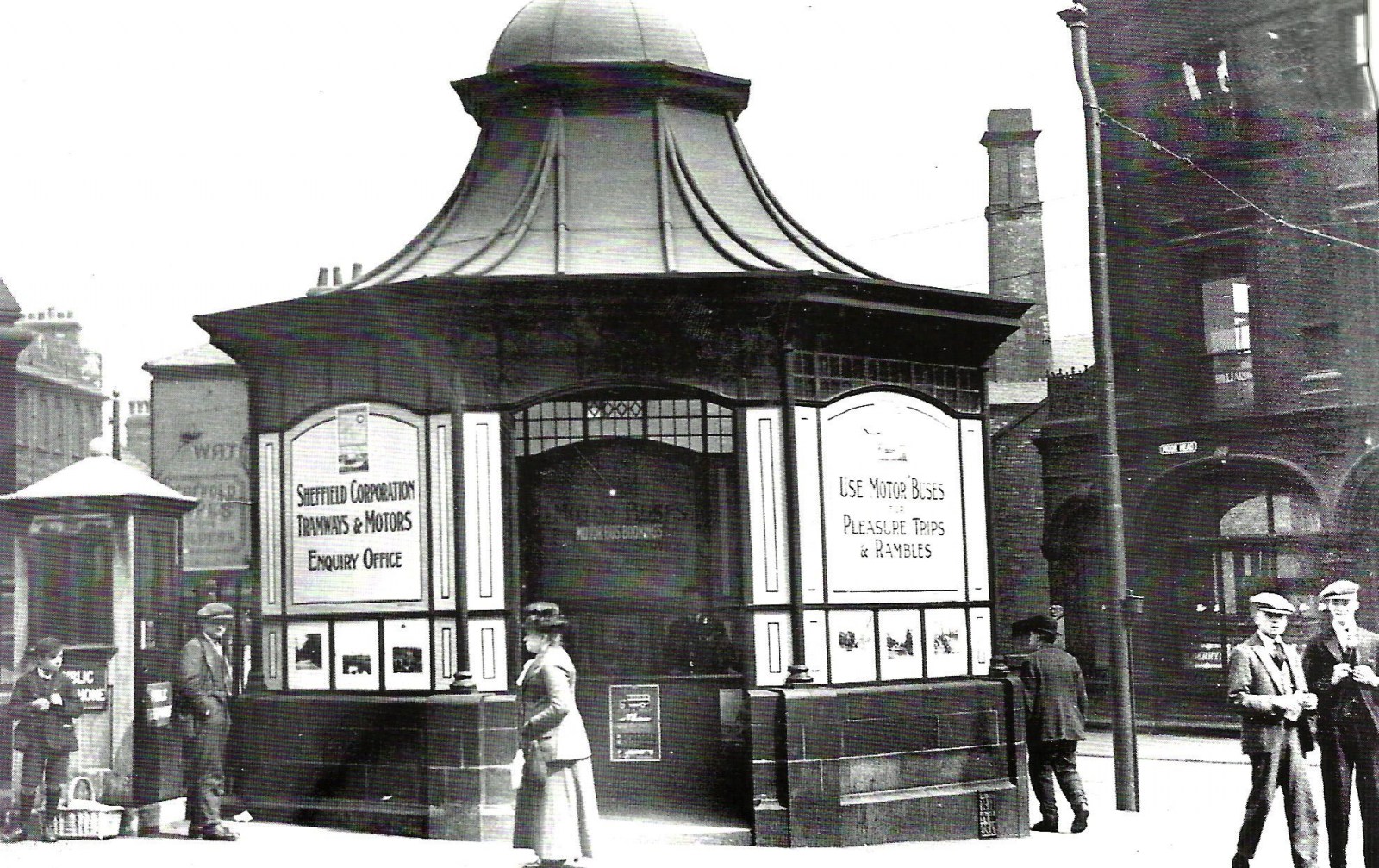
It was the bus enquiry office, you can see it from the other side in this pic:
 1 point
 -
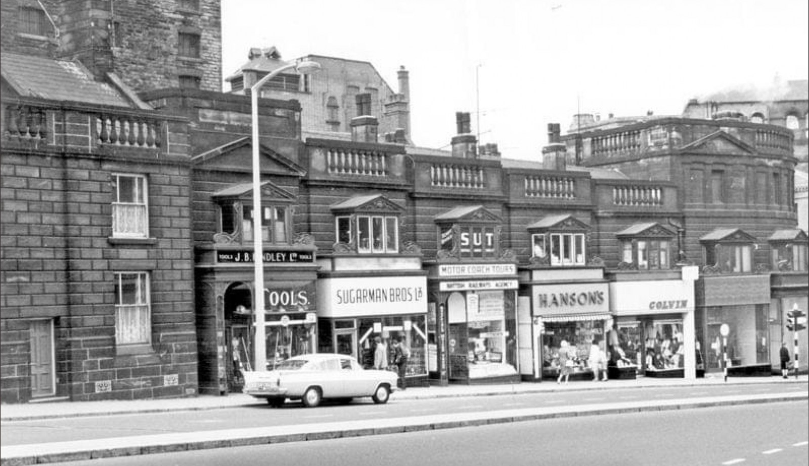
From google maps, the hole where the shops used to be, as it looks today.
 1 point
 -
A lot of character was lost from the area with their demolition, I used the tool shop a lot.1 point
-
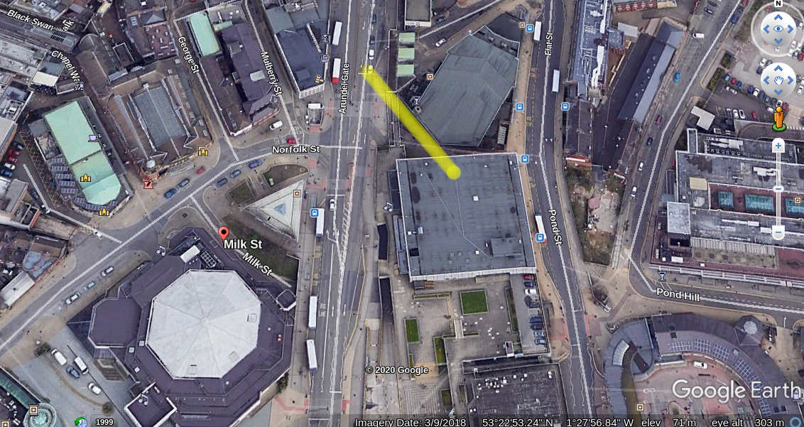
I knew Milk Street well enough but not knowing the modern Sheffield you had me wondering, Does it? EDIT - I just looked on Google Earth and apparently not. https://maps.nls.uk/geo/explore/#zoom=19&lat=53.38180&lon=-1.46550&layers=168&b=1

 1 point
 -
From the blurb on the site: Help Click a subject to view help. - What is LIDAR? LIDAR is a technology which uses laser light to create a 3D representation of the earth's surface. It can be used to find archaeological features which are not immediately visible from the ground or through traditional satellite images. DSM LIDAR DSM (Digital Surface Modelling) includes all terrain and above-terrain features (e.g. buildings, trees etc). DTM LIDAR DSM (Digital Terrain Modelling) includes only terrain features and filters out above-terrain items. It can be useful in situations such as when researching a heavily wooded area.1 point
-
1925 Moorhead. This was the travel enquiry office for the trams and for pleasure trips. Public phone kiosk to the left.
 1 point
 -
Sheaf Street1 point
-
It was originally the Boys' Charity School, built in 1825, and it is a grade II listed building: https://historicengland.org.uk/listing/the-list/list-entry/1270817 This view is effectively the side and rear of the building - the main entrance appears to be on East Parade. Which is all I know about it (at the moment)1 point