Leaderboard


Popular Content
Showing content with the highest reputation on 13/05/20 in all areas
-
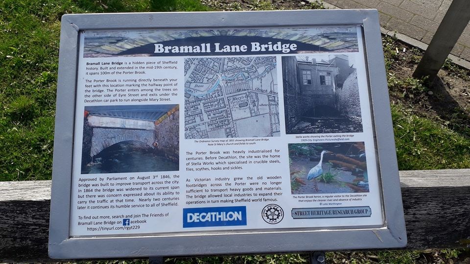
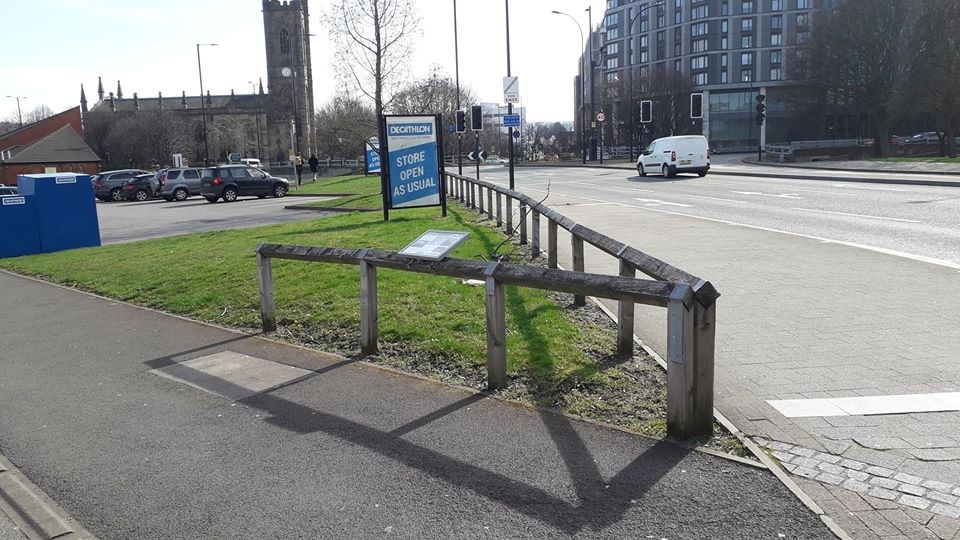
I have recently helped write and install a second information board on the opposite side of the bridge in conjunction with Decathlon, who have been very supportive and interested.
 3 points
 -
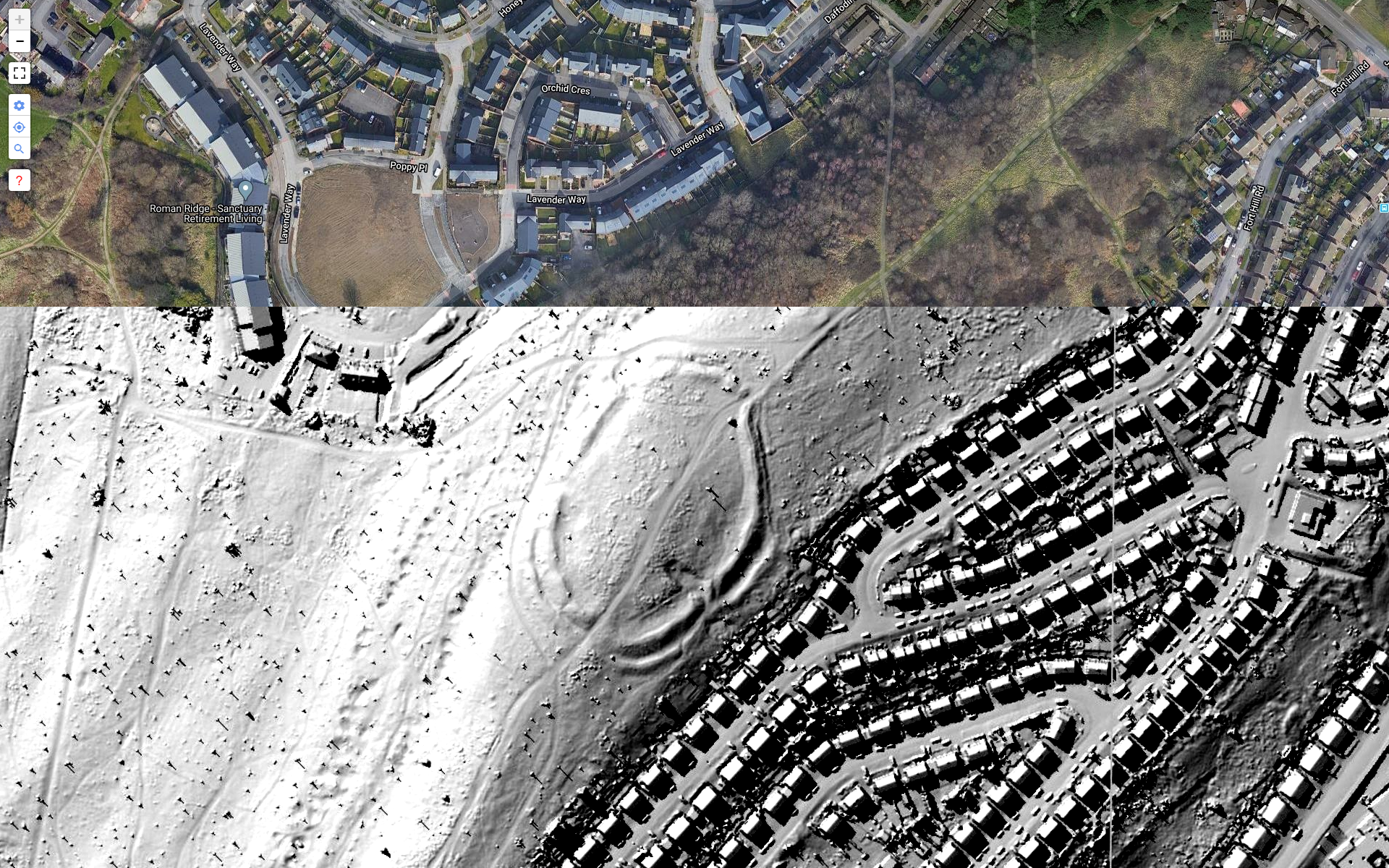
https://www.lidarfinder.com/ Its acutally England and Wales wide. Its free with no registration or anything and very good, take a look at the clarity of Wincobank 'hillfort', the boundry ditches are so clear. Point out any good finds.1 point
-
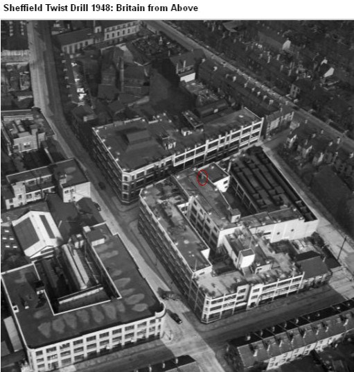
If you've been to the National Emergency Services Museum on West Bar, you might have seen the Dalek shaped wartime air raid/fire warden shelter? Originally located on the roof of the Sheffield Twist Drill on Summerfield Street, it was fabricated by the firm's maintenance department to provide some protection for the guy on fire watch duty. You can see the location of the shelter in these Britain from Above photographs taken in 1948.
 1 point
 -
Photos, YouTube videos and more recollections on another post....1 point
-
It was originally built in 1710, but rebuilt 1825. The first master made a profit by not feeding the boys very well, and hiring out the rooms where they should have slept for card and dance assemblies. That only stopped when the Assembly Rooms were built on the corner of Norfolk Street and Arundel Street in 1762.1 point
-
I sometimes forget what I came for too.1 point
-
I was a railway messenger boy in 1956 and regularly took full National Insurance cards to be exchanged for fresh empty ones. This was to a building on East Parade, well down near the bottom so maybe the Government were using this building as National Insurance offices at that time.1 point
-
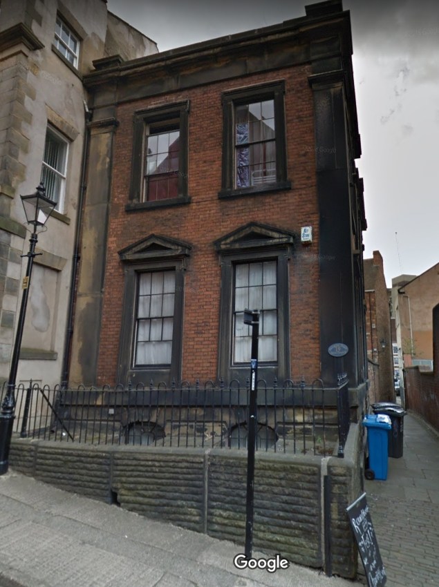
It was originally the Boys' Charity School, built in 1825, and it is a grade II listed building: https://historicengland.org.uk/listing/the-list/list-entry/1270817 This view is effectively the side and rear of the building - the main entrance appears to be on East Parade. Which is all I know about it (at the moment)1 point
-
Building blackened by smoke and industrial pollution, it was purposely left like that as a reminder. https://goo.gl/maps/aSLnQKRvRTyXR3Jv8
 1 point
 -
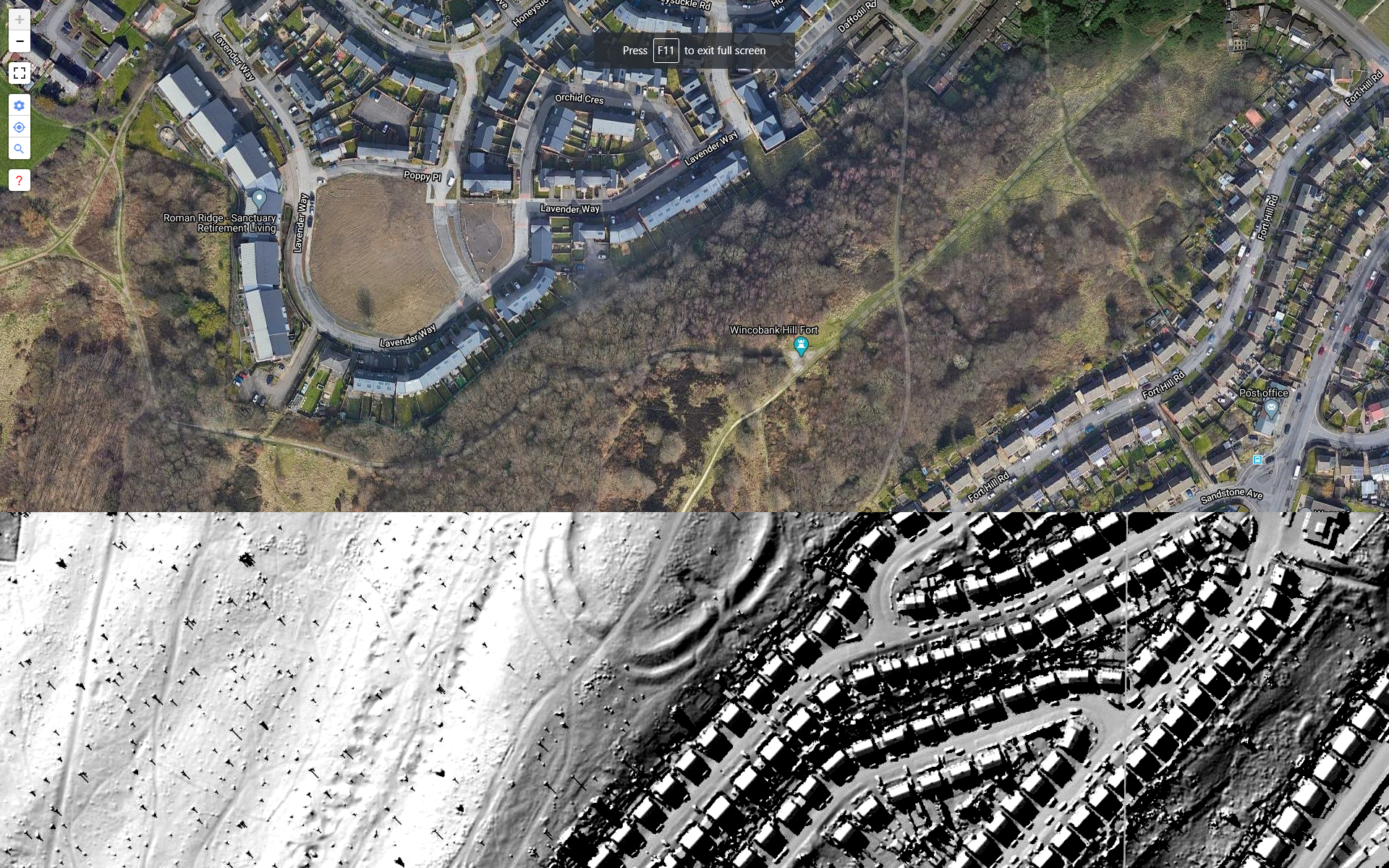
Oh, this is the the view I get. (Moved it to Winco Hillfort to illustrate).

 1 point
 -
Hello All, Yes, that is the location. So now I have a different explanation for the feature than I previously thought and the remnants of wooden beams makes the suggestion of a footbridge interesting. I'll get back there when I can and see if I can take some photos and add to the research on this thread. I'm not very techie I'm afraid. I write and talk and colleagues do the techie stuff. Otherwise I would have nailed this down sooner. I wasn't trying to annoy you all by not posting the precise location1 point
-
This is my photo, same peg on the floor, same bread trays.1 point
-
1 point
-
I used to take horse bets for people to a big yard across from the top of Wood Street, shove em under the outside toilet door, bet the gangs had something to do with that. A shout of Copper used to have the bloke out of the toilet and away, carrying his leather bag just like a rent collector. Happy days.1 point
-
This Photo takes us a bit further along if that helps. But the "ground" closed in 1899 did it not? A bit early for aerial photography.
 1 point
 -
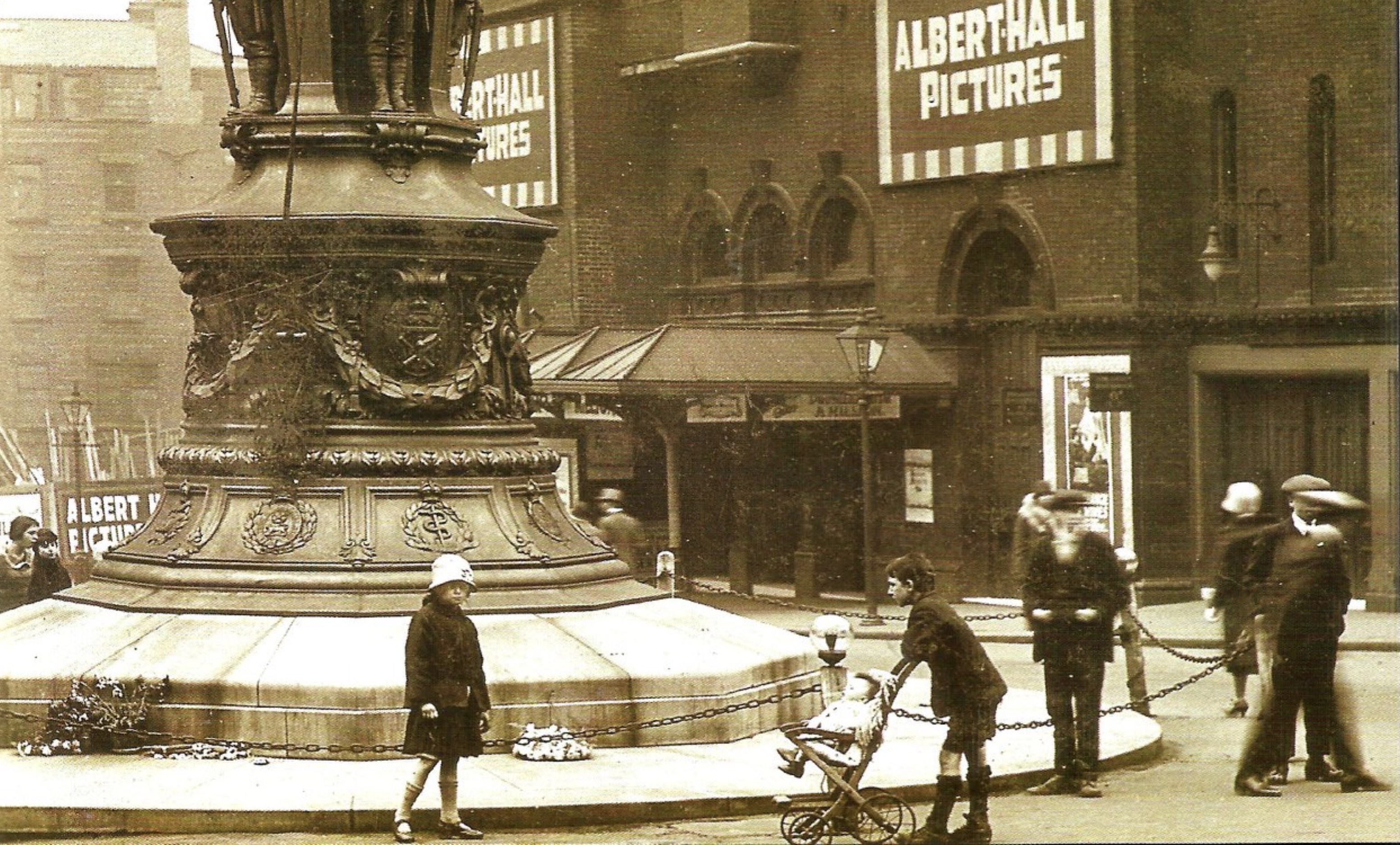
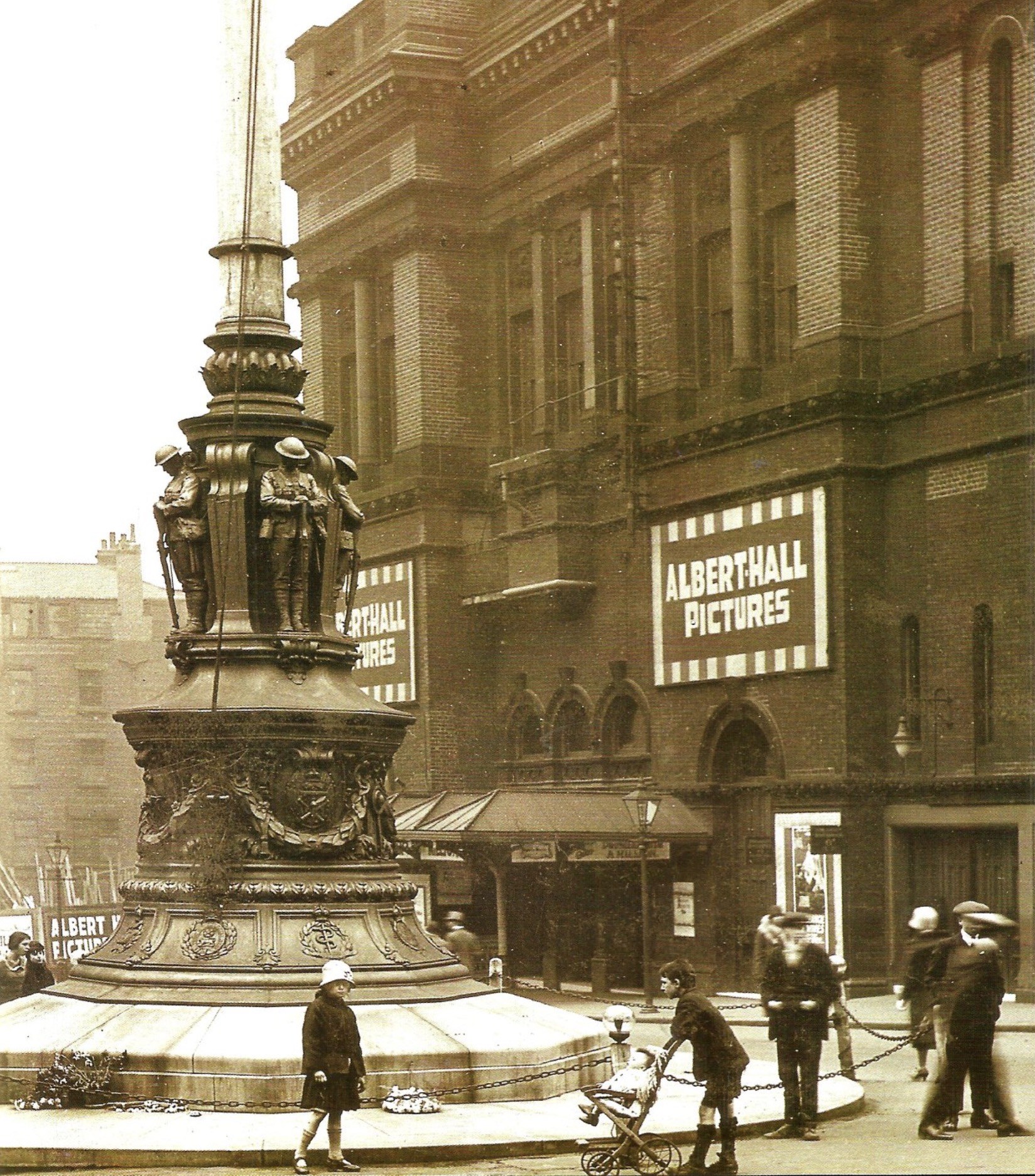
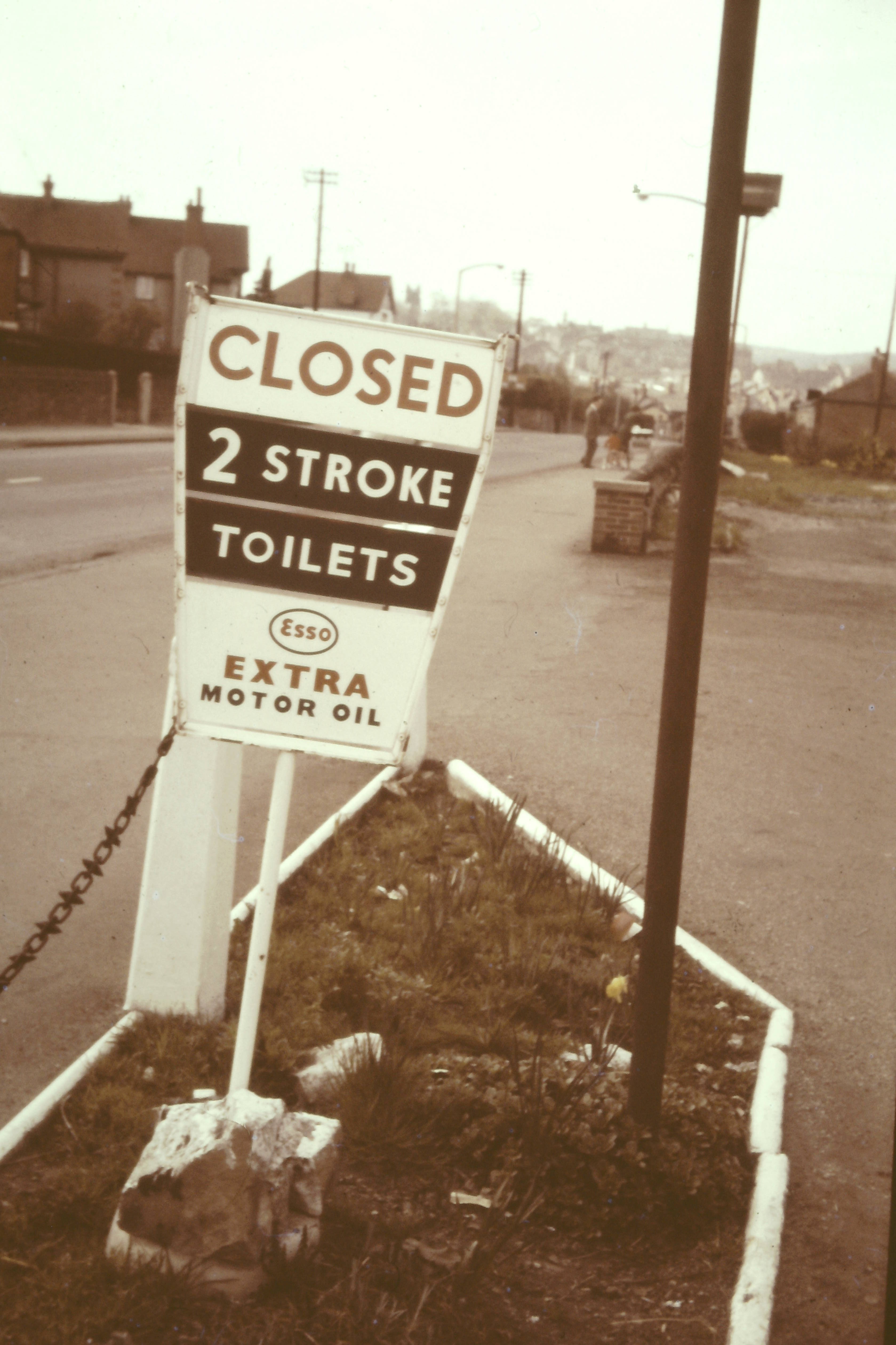
Have you ever taken a photo of something that aroused your curiosity, made you smile, chuckle or laugh out loud? Why not share them here? Here are a couple to get started;
.thumb.jpg.cb168a68a3c7cf4962f8c246d367a8b1.jpg) 1 point
1 point -
Inlet- StanningtonTunnel --Outlet Stannington Tunnel --Rivelin Guage Basin.1 point
-
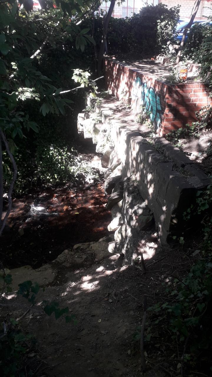
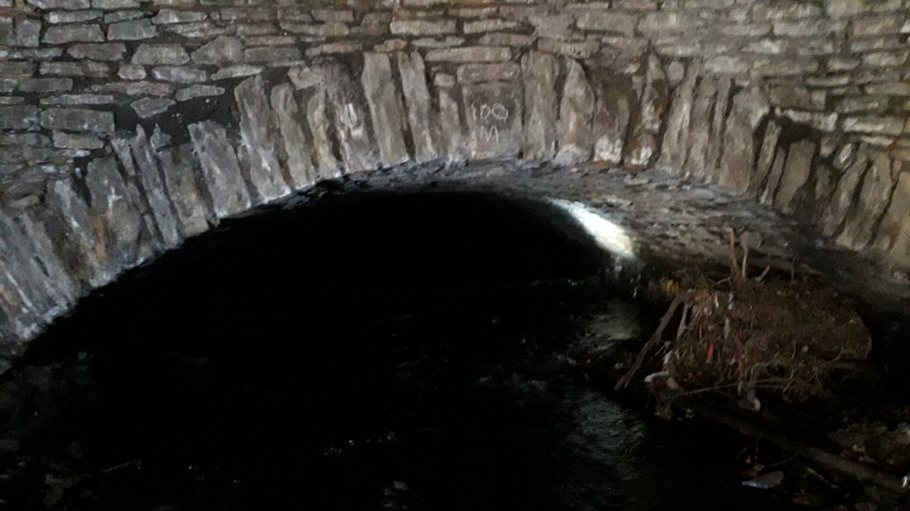
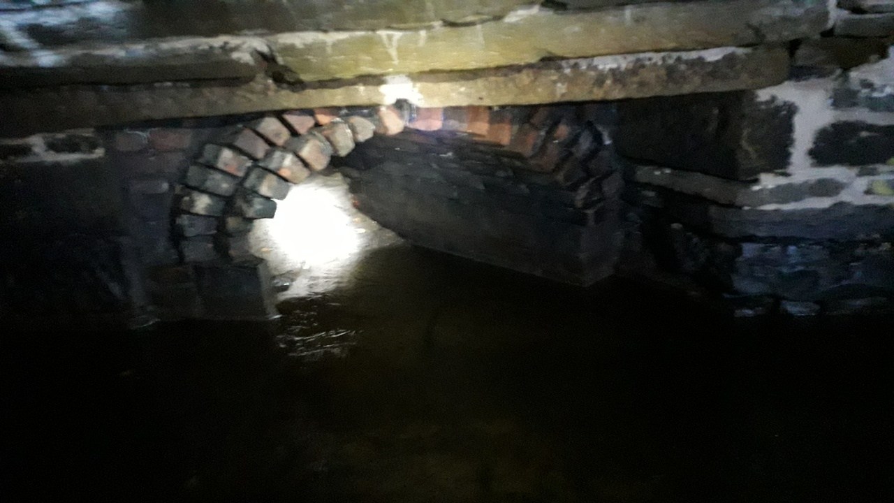
This morning I went under Bramall Lane Bridge and investigated further. The far end of the bridge's route (now under the Decathlon car park) is 100 metres from the Staples car park end already shown on this thread (the measurements are marked along the way to aid workmen). I post pictures of the other end of the bridge and an outflow inside the culvert that I think was originally from the Vulcan works dam and water power site. Although I'm happy to be wrong again
 1 point
 -
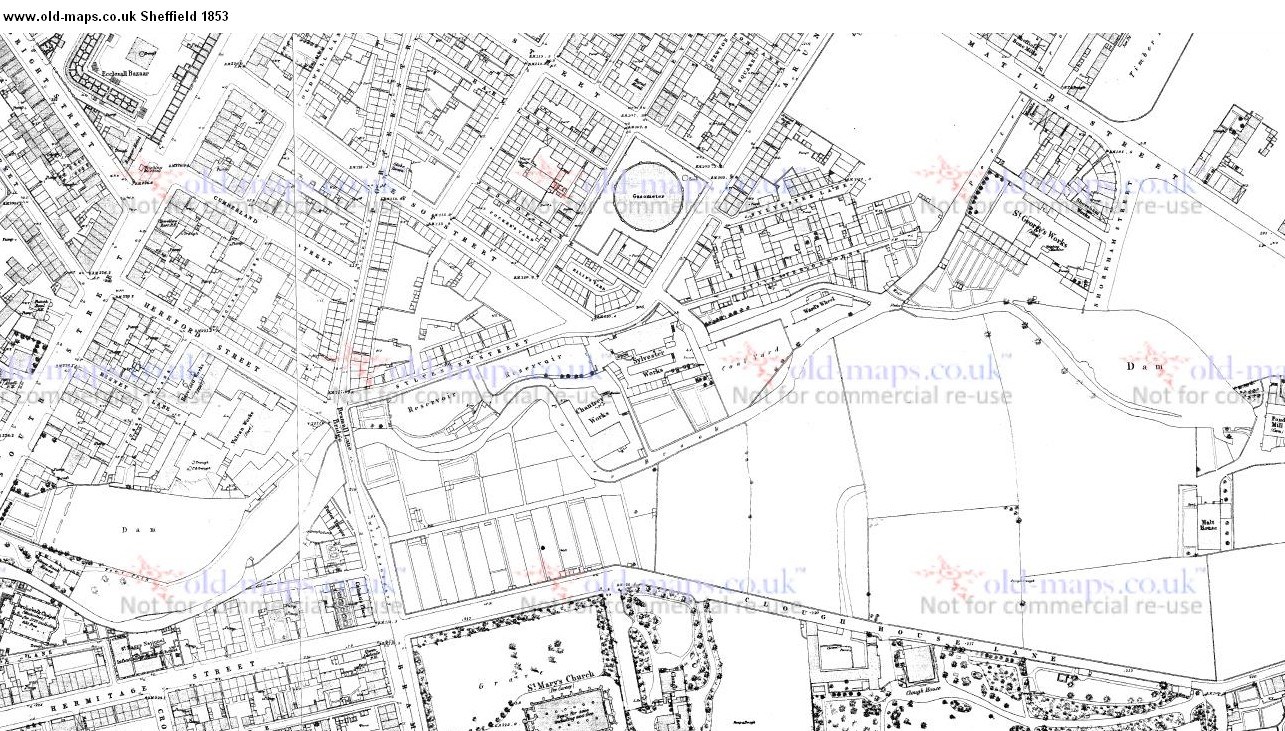
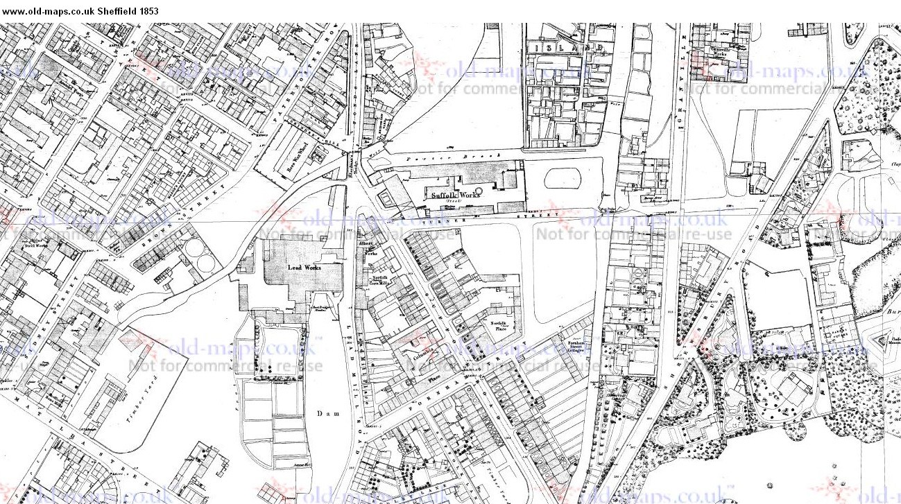
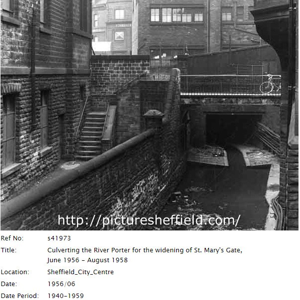
According to the tiny bit of information given in Grace`s guide to British Industrial History, the Vulcan Works in 1797 was in the ownership of Ebenezer Berdikin, Anvil Maker. So i guess it was foundry of some description? httsearch=Vulcan+ps://www.gracesguide.co.Works+Sheffield&fulltext=uk/Special:Search? A couple of maps of the area in 1853 showing the location of Bramall Lane Bridge and a couple of the other bridges over the Porter in 1853. https://www.old-maps.co.uk/#/Map/435500/38750 Also a Picture Sheffield Photograph of the Porter Brook in 1956, you can just about make out the name Yorkshire on the wall of the building in the background, anyone any idea where we are looking towards? http://www.picturesheffield.com/s41973
 1 point
 -
Here is the bridge concealed behind the trees in the above photo.
 1 point


.jpg.056e7f95f29ae727fb55282071cb9f61.jpg)