Leaderboard


Popular Content
Showing content with the highest reputation on 04/05/20 in all areas
-
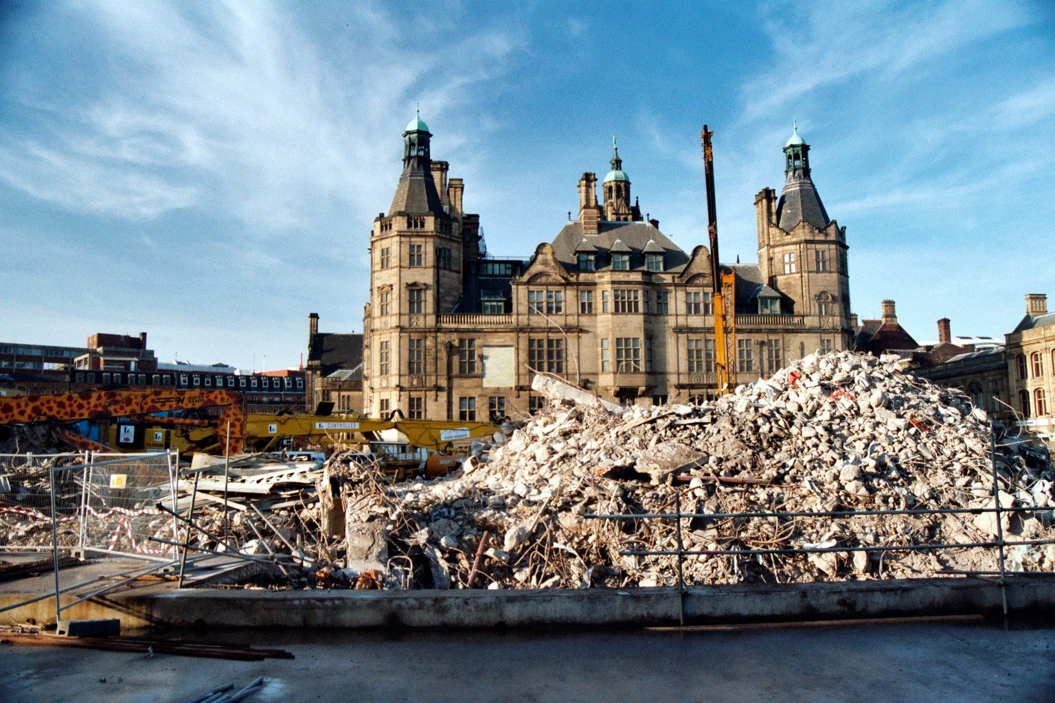
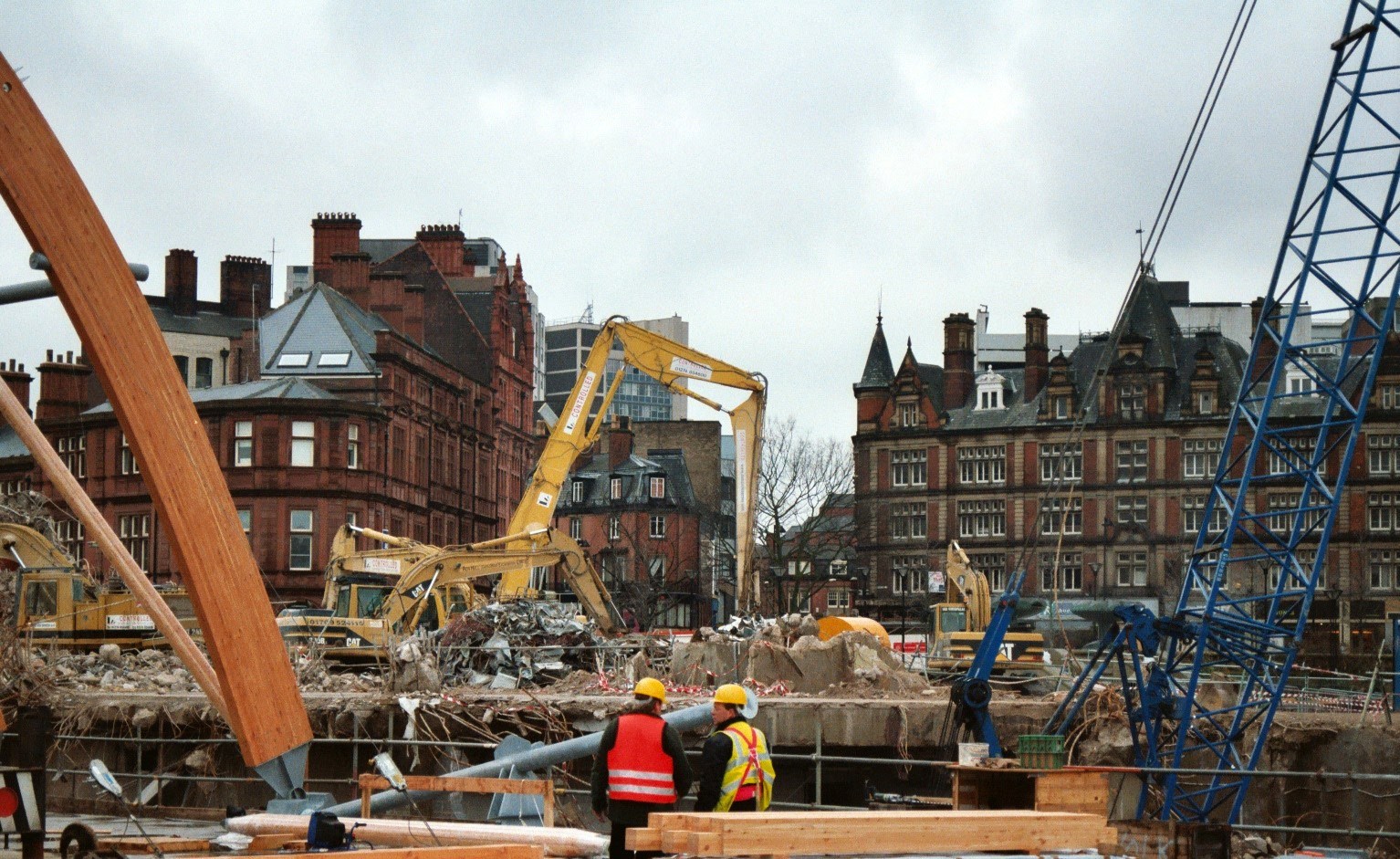
From memory I think it was to widen the road to connect Arundel gate to the Parkway though I can't remember the order of alterations. I agree that new building is awful and think that no right thinking authority would take such an action.2 points
-
It baffles me how such a magnificent piece of architecture can ripped down.2 points
-
2 points
-
2 points
-
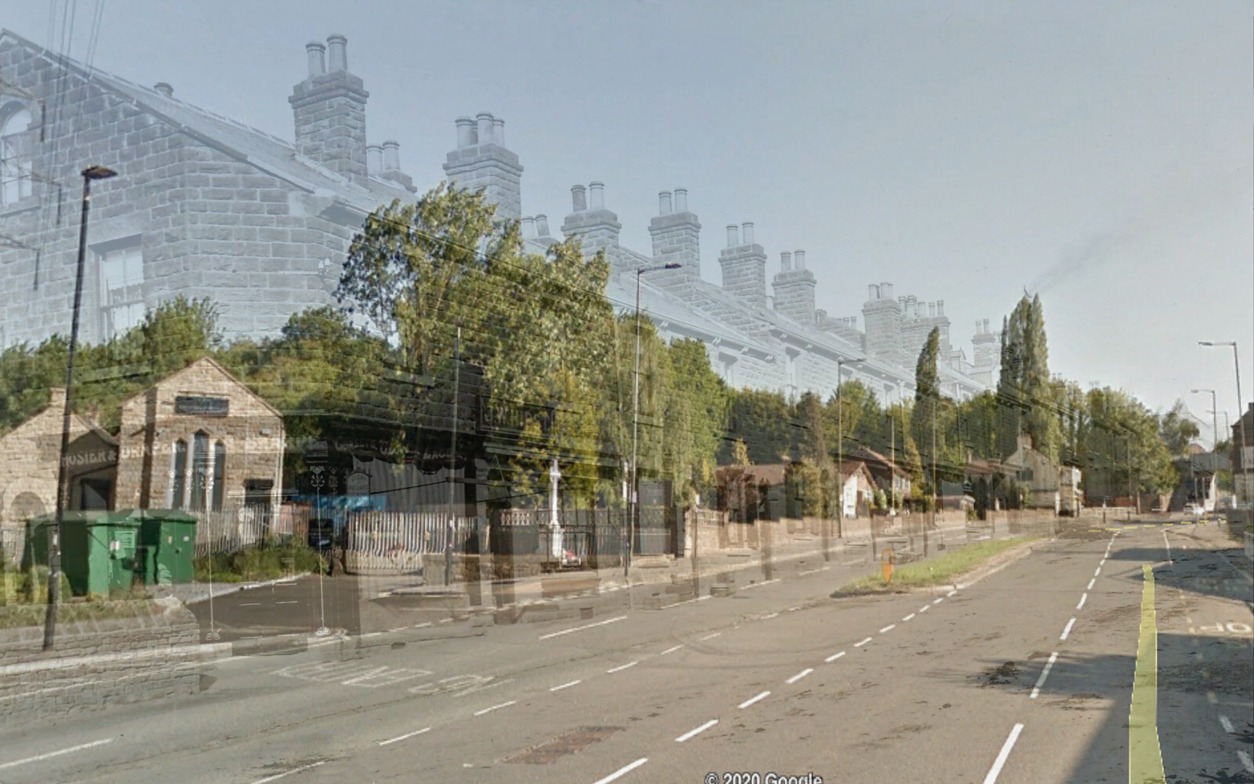
Hi, (very) long time lurker but first post so hope I'm doing this right! The photo is of the bottom bit of Wadsley Bridge and it's still possible to get your bearings from two of the only remaining bits left - the chapel and the war memorial. The boundary of John Fairests follows the old building lines. I can actually remember some of them still being there in the late 60s even though I was little as my mum went to Beres' every week. There was a paved path between what is the drapers and the war memorial to the chapel. Hopefully this is today's view from the same place as the photo was taken: https://www.google.com/maps/@53.4175274,-1.5002646,3a,75y,345.65h,81.7t/data=!3m6!1e1!3m4!1s_eIZqZQR-s6KRBlrifeElw!2e0!7i13312!8i66562 points
-
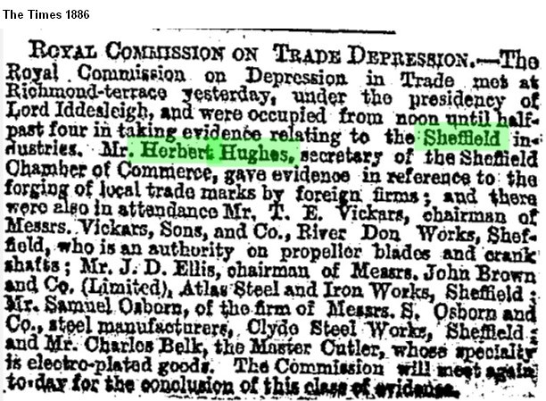
I wonder if the Herbert Hughes in this newspaper article is the same chap?
 2 points
 -
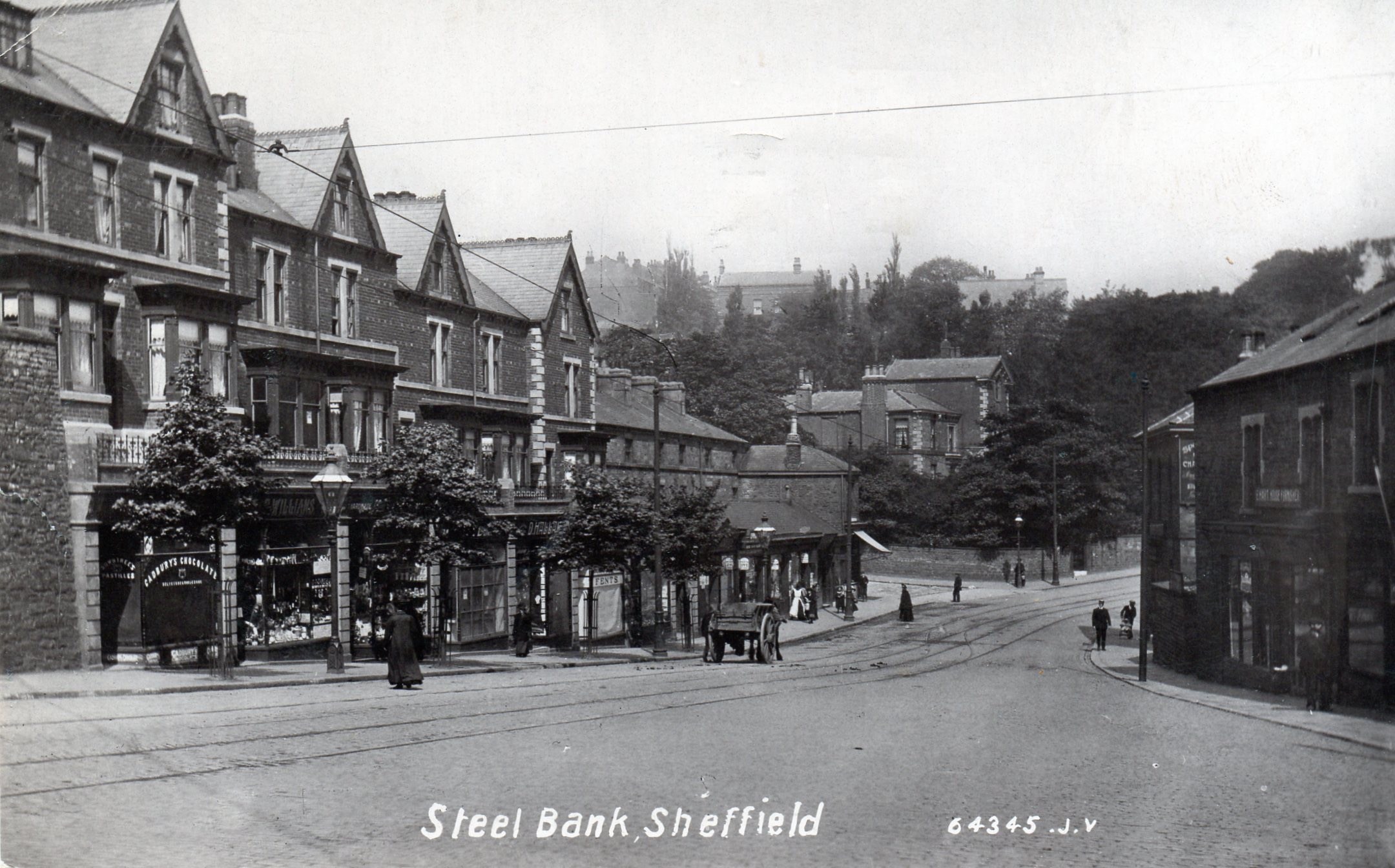
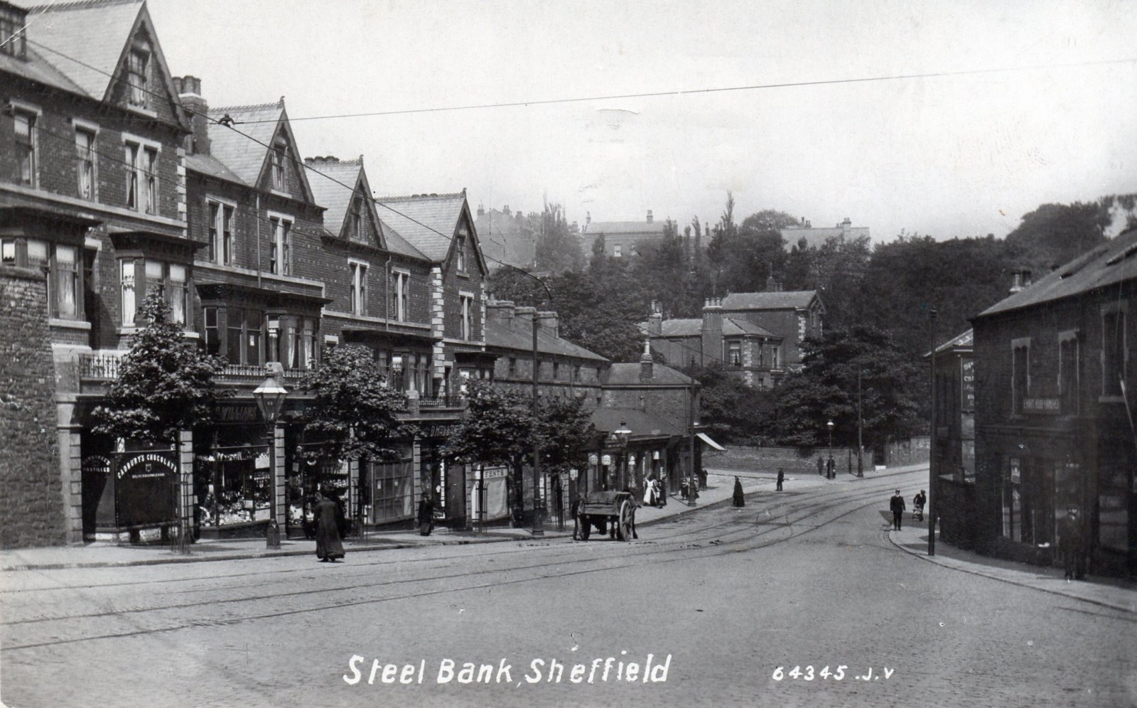
Agreed Penistone Rd. It matches census records for John William Hirst (Butcher) and 1905 directory entry for William Aitkin Sharpe (Draper). Old maps on NLS site show protruding buildings (at the top of the pic) just before where the New Bridge pub is may match the picture. Can't post the evidence from this tablet2 points
-
I was looking through some photos I have on disc yesterday, I forgot I had taken these.
 1 point
 -
1 point
-
Yes, great, find some more, I like a good mystery, though I remember that one well because I was quite disgusted when it was demolished.1 point
-
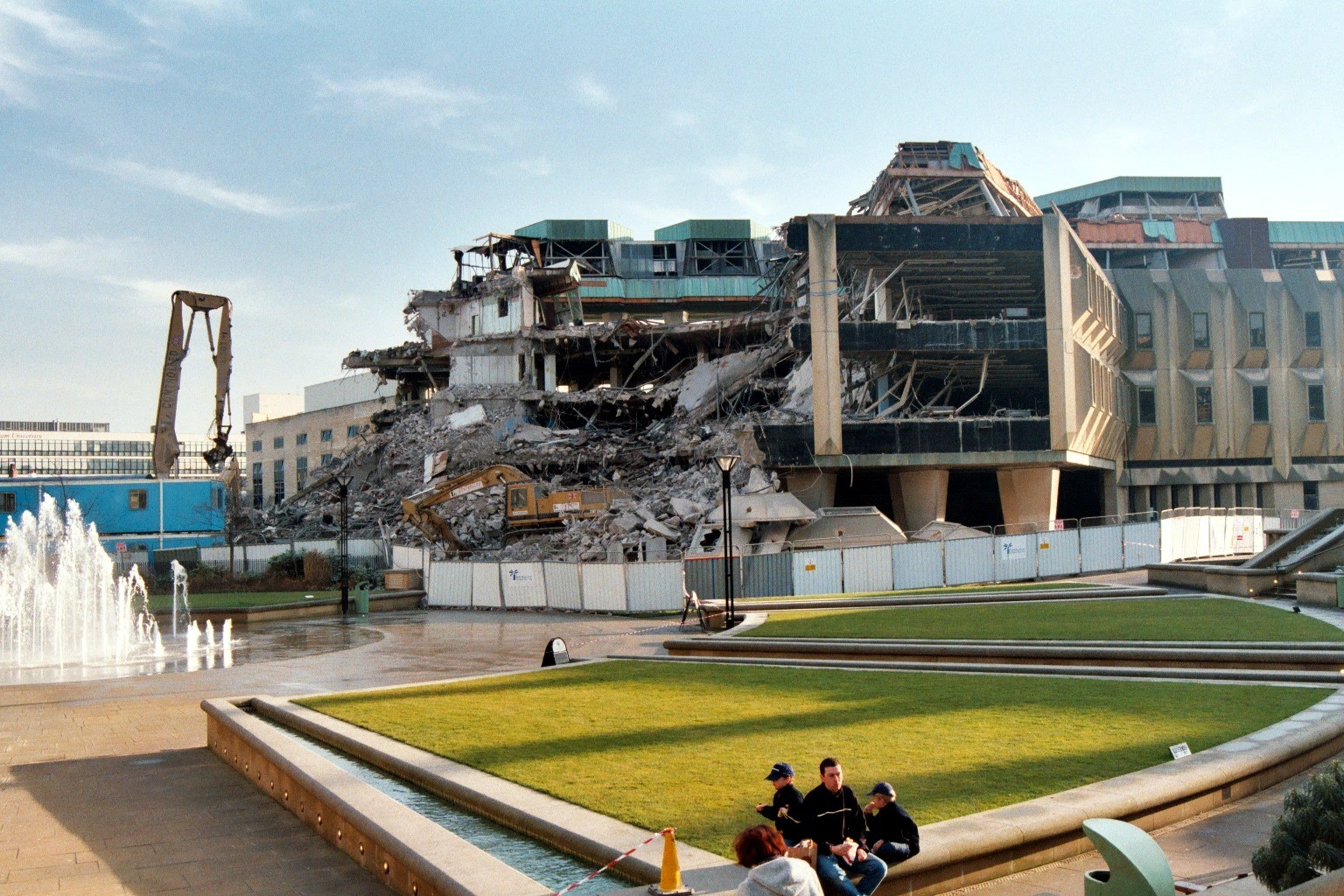
Does anyone know why it was demolished and replaced with this unattractive building?
 1 point
 -
Top o' Commercial Street.1 point
-
Another postcard of the Castle Market in it's early days1 point
-
High Street at some time between 1901 and 1905, with Walsh's and the Westminster Hotel prominent. From my collection1 point
-
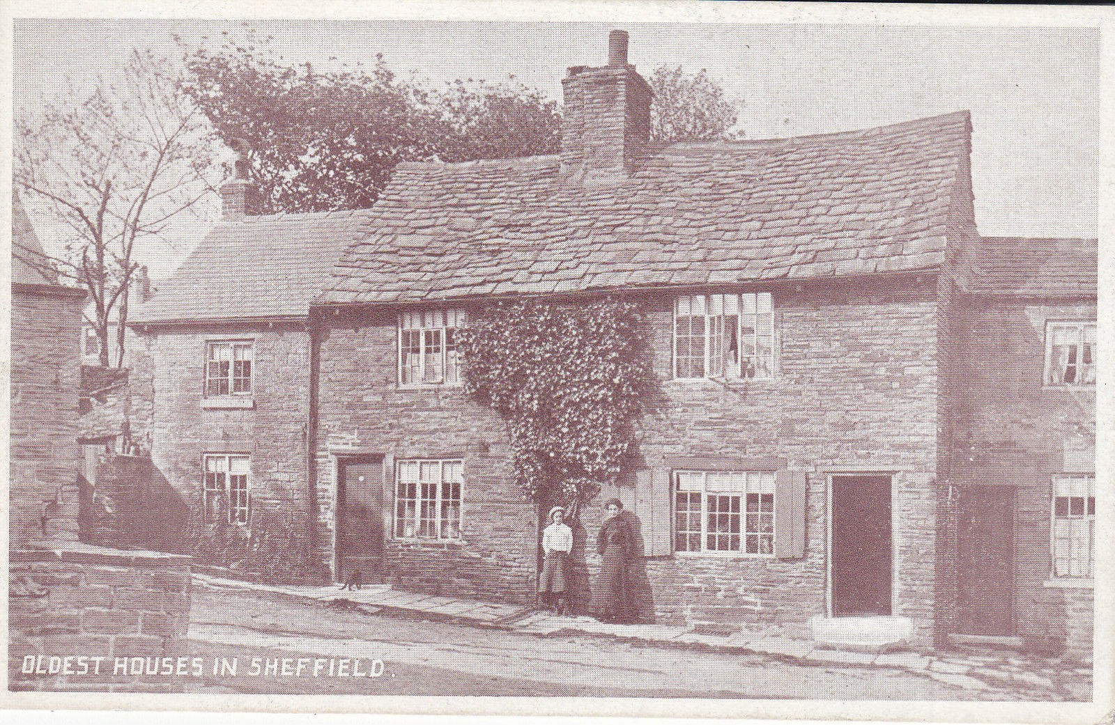
Have a look at the blog of Chris Hobbs - View From A Hill There are a couple of items and photographs that will interest you https://ceegee-viewfromahill.blogspot.com/search?q=commonside https://ceegee-viewfromahill.blogspot.com/2018/11/head-office-of-d-north-homes-ltd-63-73.html and also a memorial https://ceegee-viewfromahill.blogspot.com/2018/11/aircraftman-2nd-class-george-william.html And then of course there is the photograph of the "oldest house in Sheffield" which was on Commonside. This has been discussed at length elsewhere on the Forum
 1 point
 -
We did "New Bridge pub" not long ago, a map was added1 point
-
1 point
-
I seem to remember that the Hallam Historical Buildings Society had an interest in encouraging SCC to preserve the facade. in any redevelopment.1 point
-
Jack Warhurst and his brother Norman lived on Ridgeway Road in the terrace of houses between Kirby Road and Hollinsend Road.Norman was in same class as me so will now be 72,he is on facebook and i was in contact with him a couple of years ago.Jack was living on Base Green at that time.1 point
-
Miss Mary C Martin, no occupation given, 106 Whitham Road, 1901 directory Miss Mary C Martin, boarding house, 106 - 108 Whitham Road. 1905, 1911 and 1925 directories.1 point
-
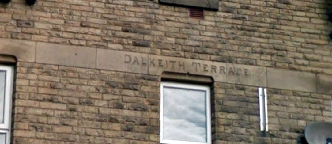
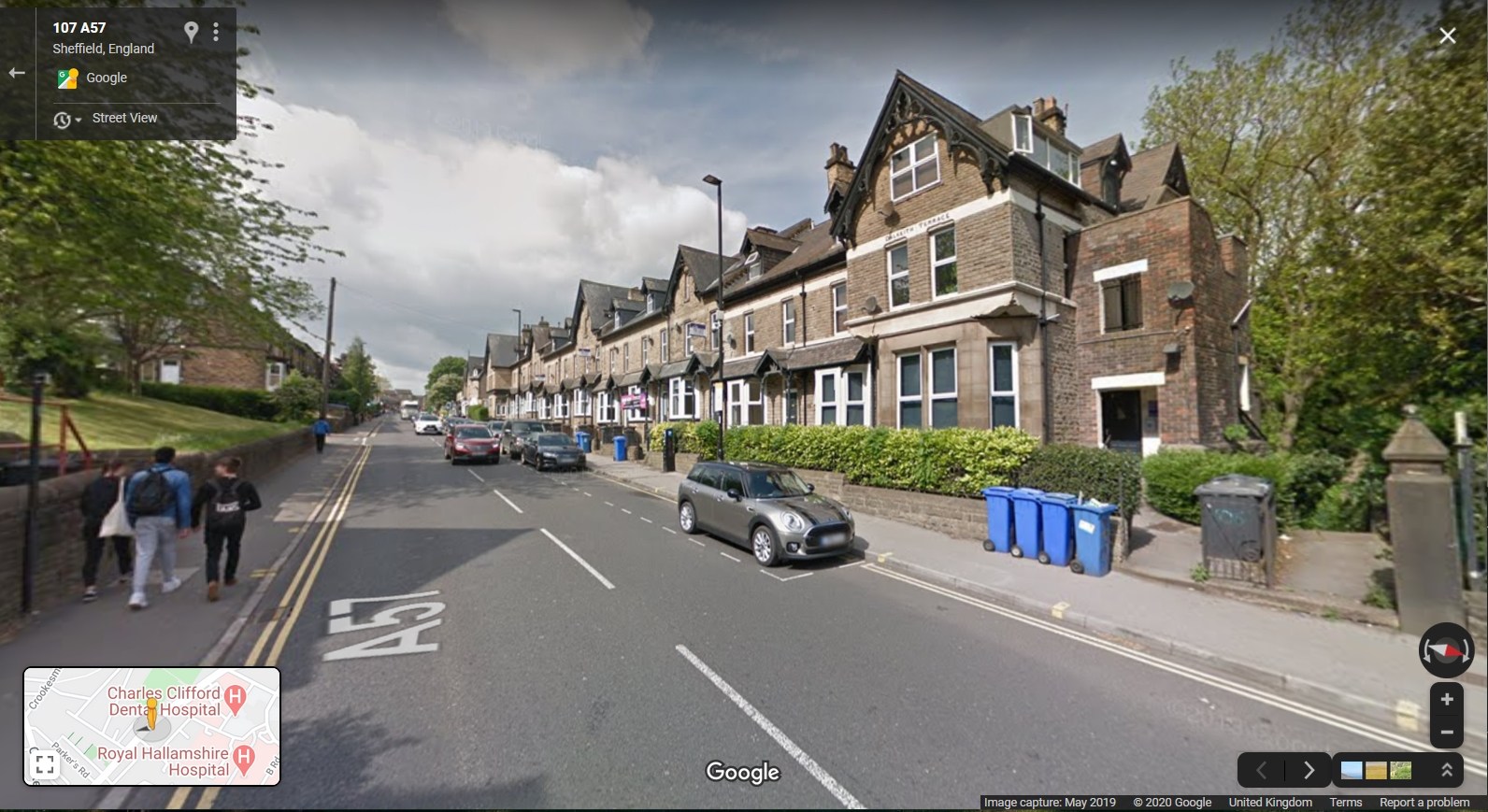
106 Whitham Road is the first house in the row, (106 to 126), named Dalkeith Terrace. https://goo.gl/maps/pB8dfCRXskvALttJ7
 1 point
 -
Laying of a tribute by Sheffield Corporation Tramways and Motors at the War Memorial in Barkers Pool.
 1 point
 -
On the original photo' , if I am in the right place, the railway is at the top of the road and I think the pointed thing was on a building, I think a steel works, at the other side of the railway at the bottom of Fox Hill Road.
 1 point
 -
I can't find the picture I was thinking of but here is the best I can find at the moment. The chip shop is to the right and Beres Pork shop replaces the drapers. I am sure many will remember their pork sandwiches, I think they had a few shops or perhaps still have? EDIT - I see that they are still in business and in a big way. My mouth is watering just thinking of those sandwiches. http://www.beresporkshop.co.uk/about.asp https://picturesheffield.com/frontend.php?keywords=Ref_No_increment;EQUALS;s26405&pos=223&action=zoom&id=28830
 1 point
 -
No 106 Whitham Road - solicitor Herbert Hughes lived there in 18811 point
-
Is that bloke up near the top end of the street collecting horse muck, that can also be seen in the street? Or is it a coal dump? By the way that's one of the dirtiest roads I have seen on one of these old photos.1 point
-
I think that is Penistone Road North, if I am correct one of the shops to the right was a chip shop at some time. I think there is a picture somewhere on here taken a bit further back down the road.1 point
-
This might not be in the precise location that you are looking for but I thought I would post it anyhow. This is from my own collection, the scan at least, so I don't have a postage date, sorry.
 1 point
 -
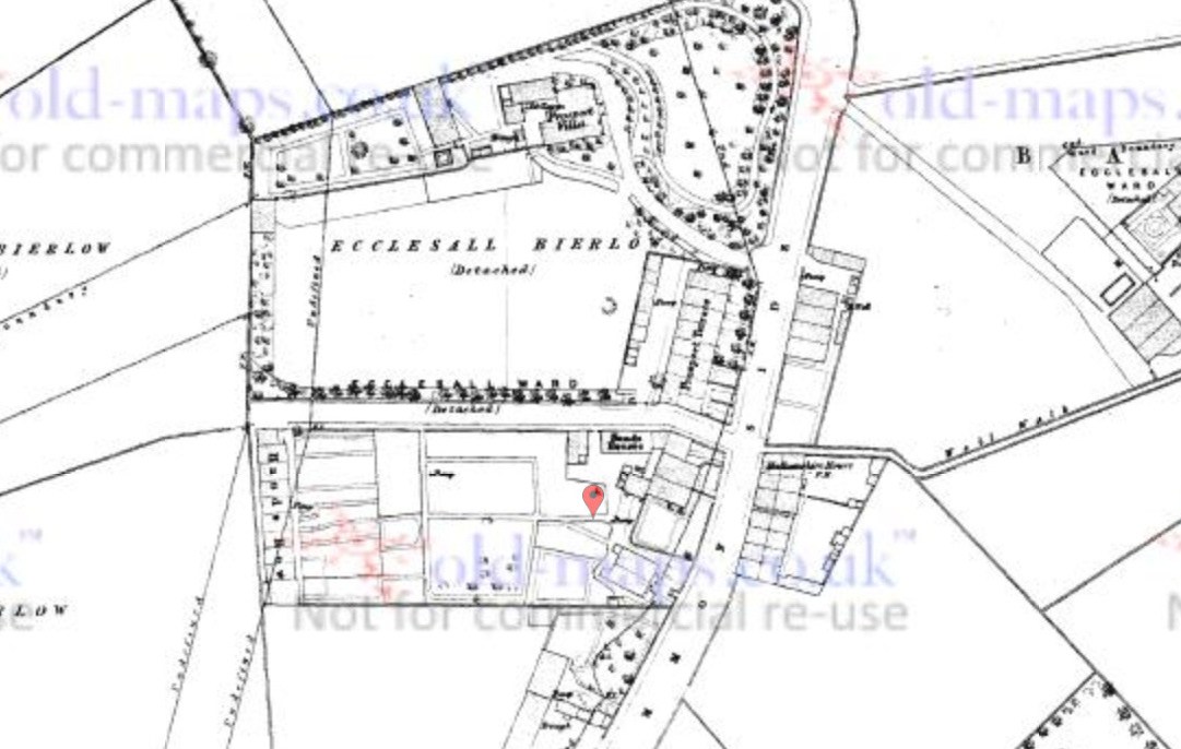
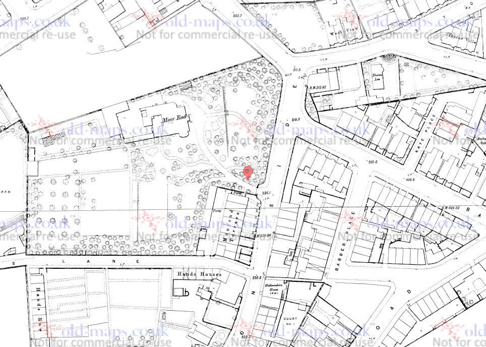
No photos, I'm afraid, but a couple of old maps of the houses in question. 1853 (a bit blurred), when they were named as Prospect Terrace, with the "big house" being Prospect Villa 1890, when they are Moorend Terrace, the "big house" being Moor End Villa. This perhaps points to them belonging to the "big house". On both maps there is a pump marked behind what would be no 40 Commonside. Presumably this was the well. Just realised that i am responding to some points made in another thread .
 1 point