Leaderboard


Popular Content
Showing content with the highest reputation on 07/03/24 in all areas
-
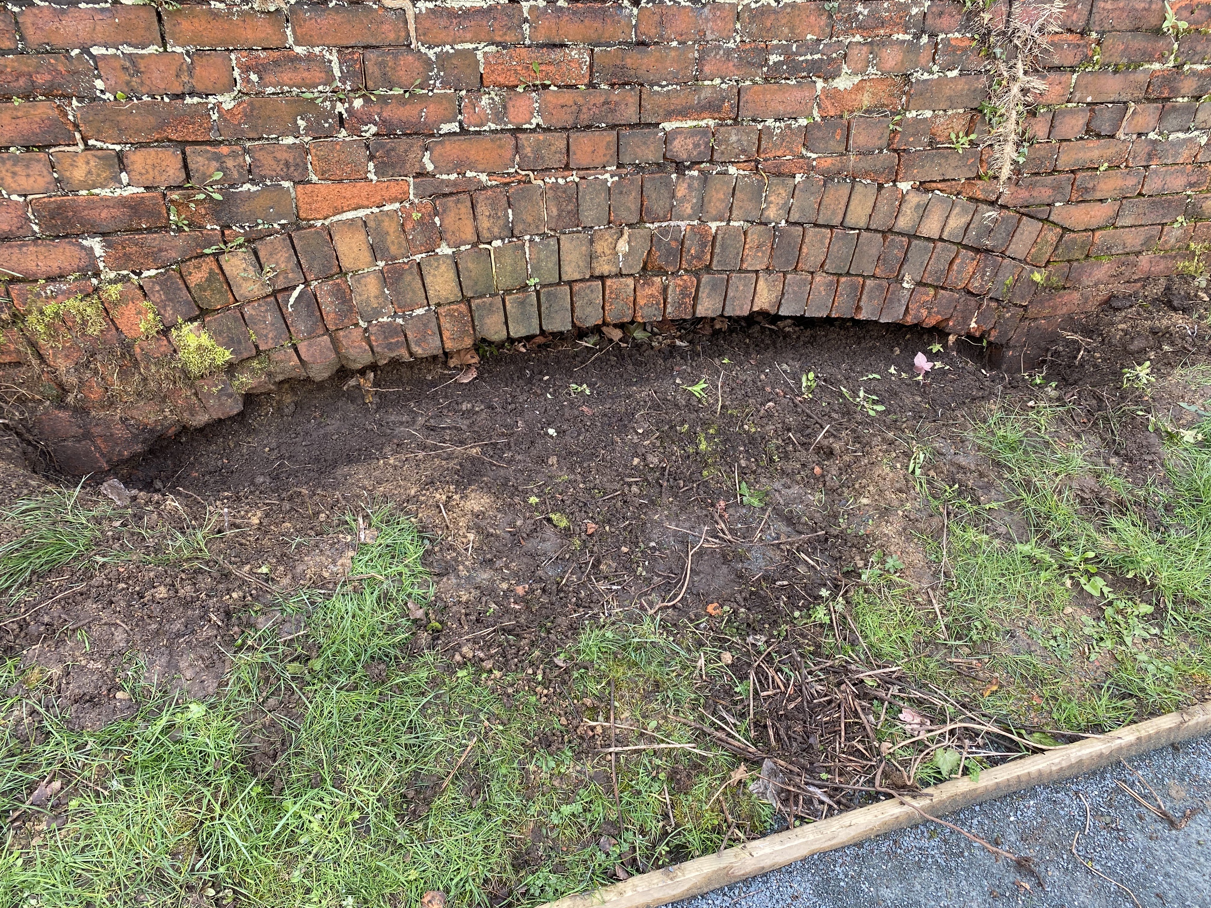
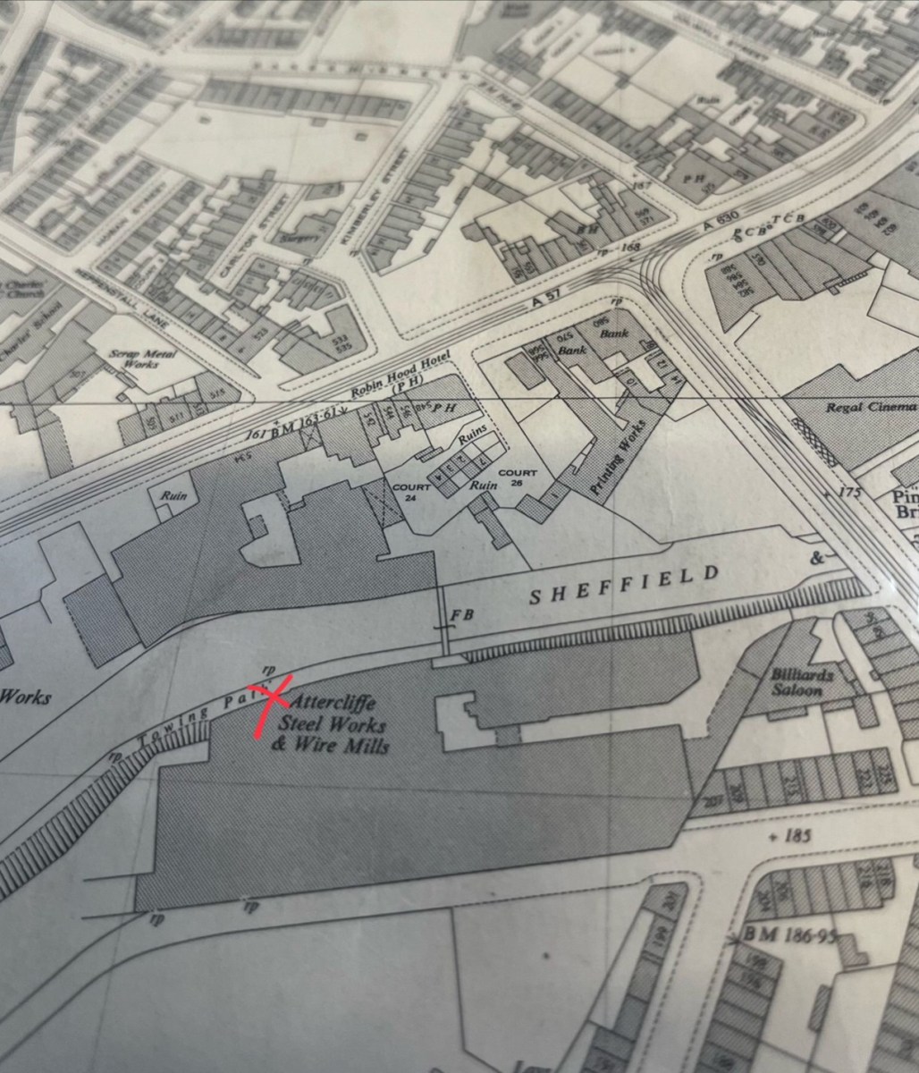
I think that the ones marked on the old map in the post actually are in the ‘timepix’ database? You can search the map and bring up the images, clicking for a full size image of each.... https://www.timepix.uk/Collection-galleries/Attercliffe-Sheffield (I won't paste the actual images in here, as don't want to flout any copyright restrictions, but here are the links) https://www.timepix.uk/Collection-galleries/Attercliffe-Sheffield/i-h6Zf8F6 https://www.timepix.uk/Collection-galleries/Attercliffe-Sheffield/i-K4fXCJZ This photo actually shows your 'arches' in the bottom of the brick buttress https://www.timepix.uk/Collection-galleries/Attercliffe-Sheffield/i-7S44fnP/A Just a guess, but these arches may have been incorporated into the brick buttress as 'weep holes', to allow the ground water in the steelworks above to permeate through the wall and into the canal? I wouldn't imagine there was much by way of pipework drainage built into the groundworks, so this would allow the water to escape and possibly prevent any issues with the wall buckling under the pressure of waterlogged ground? (Just relating this to an issue I had with my garden wall, albeit on a far smaller scale?!) These 114 photos of Attercliffe on Timepix are a great find! I'll be bookmarking this site and checking back when they load more of the 'rp' reference point photos on there. Always some new discovery, from an unlikely topic of conversation?! Thanks!3 points
-
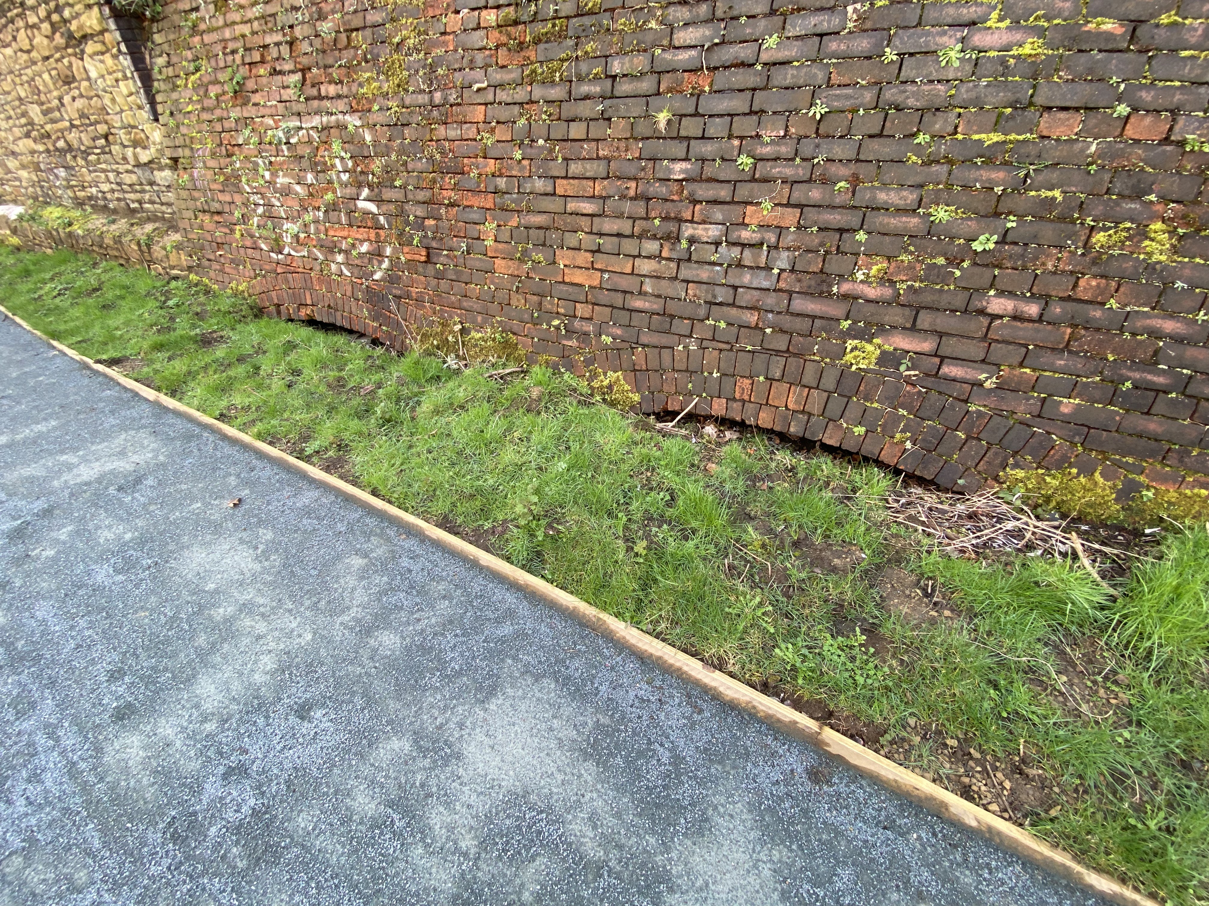
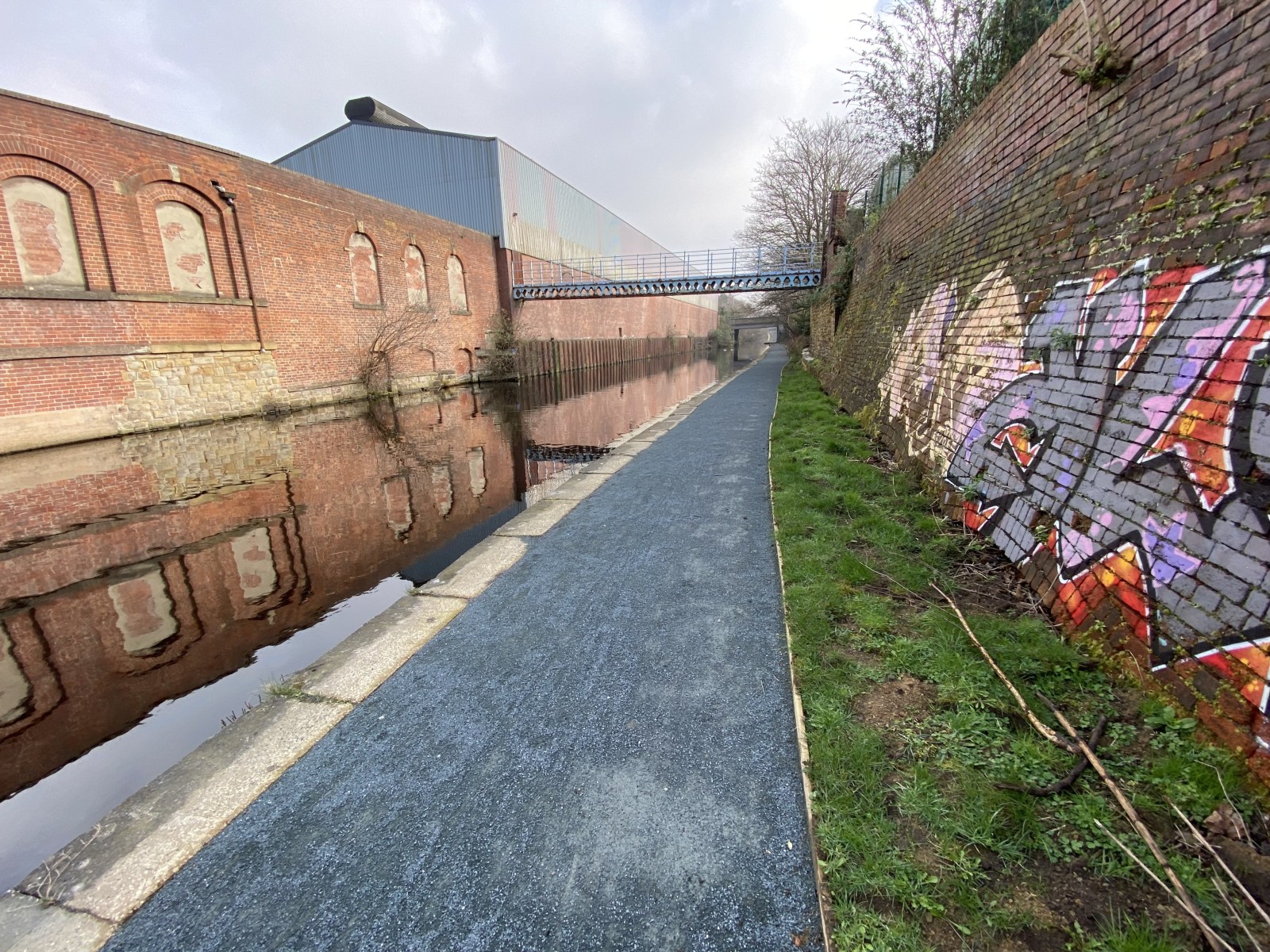
Recently when walking along the canal towards Tinsley, I noticed a line of six brick arches which are on the tow path side opposite the Spartan Steel Works, until recently the archways have been covered by shrubs. Thanks to the volunteers from the Canal and river trust doing a great job clearing and maintaining the tow path they have revealed the arches. So the question is: Anyone know what these archways were for.


 1 point