Leaderboard


Popular Content
Showing content with the highest reputation on 21/04/18 in Posts
-
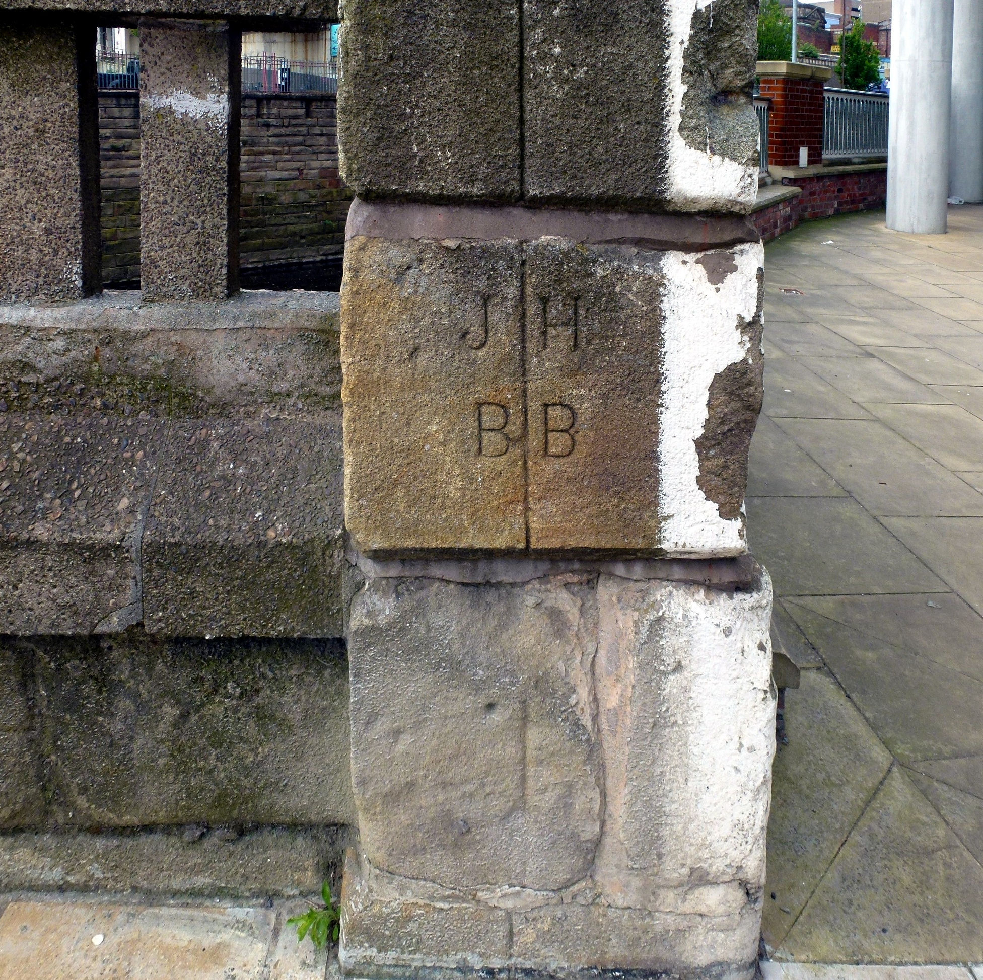
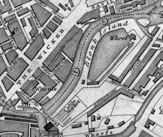
For your information the letters on the bridge BB & JH refer to Benjamin Blonk and John Huntsman. Blonk Street was so called because when it was made the "tilt" shown on the map on the river side of Blonk St.was "The Wicker ***" belonging to the Blonk Family. On the other side of Blonk St. was "The Wicker Wheel" also belonging to the Blonk Family. You will also see a third grinding shop belonging to the Blonks at the end of the dam to the right of "Blonk Island". Later on John Huntsman had a Huntsman Melting Furnace at the end of the Wicker Tilt building. If you look through the large window nearest to Blonk Bridge you will see the chimney of the Huntsman furnace preserved as a monument. Remember the old Sheffield saying "Down T'Wicker were t'water goes o'er t'weir" the weir on the upstream side of Ladys Bridge diverted water to the Wicker Tilt and Wicker Wheel. I learnt all about this by carrying out research for descendants of this branch of the Blonk family who live in Australia. My Blonk family come from a later branch of the Blonk family
 2 points
 -
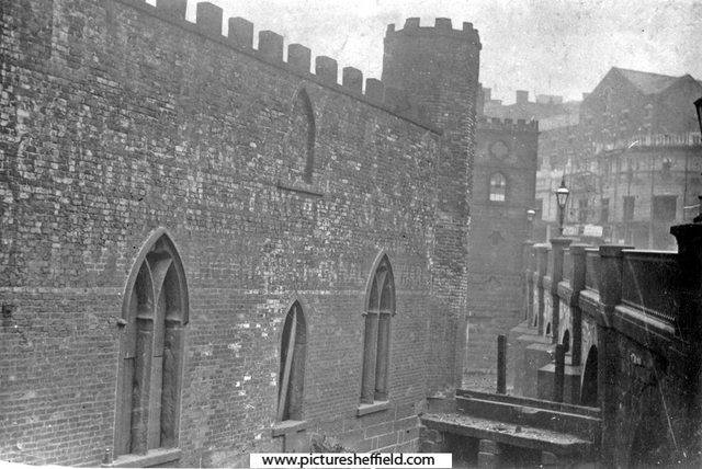
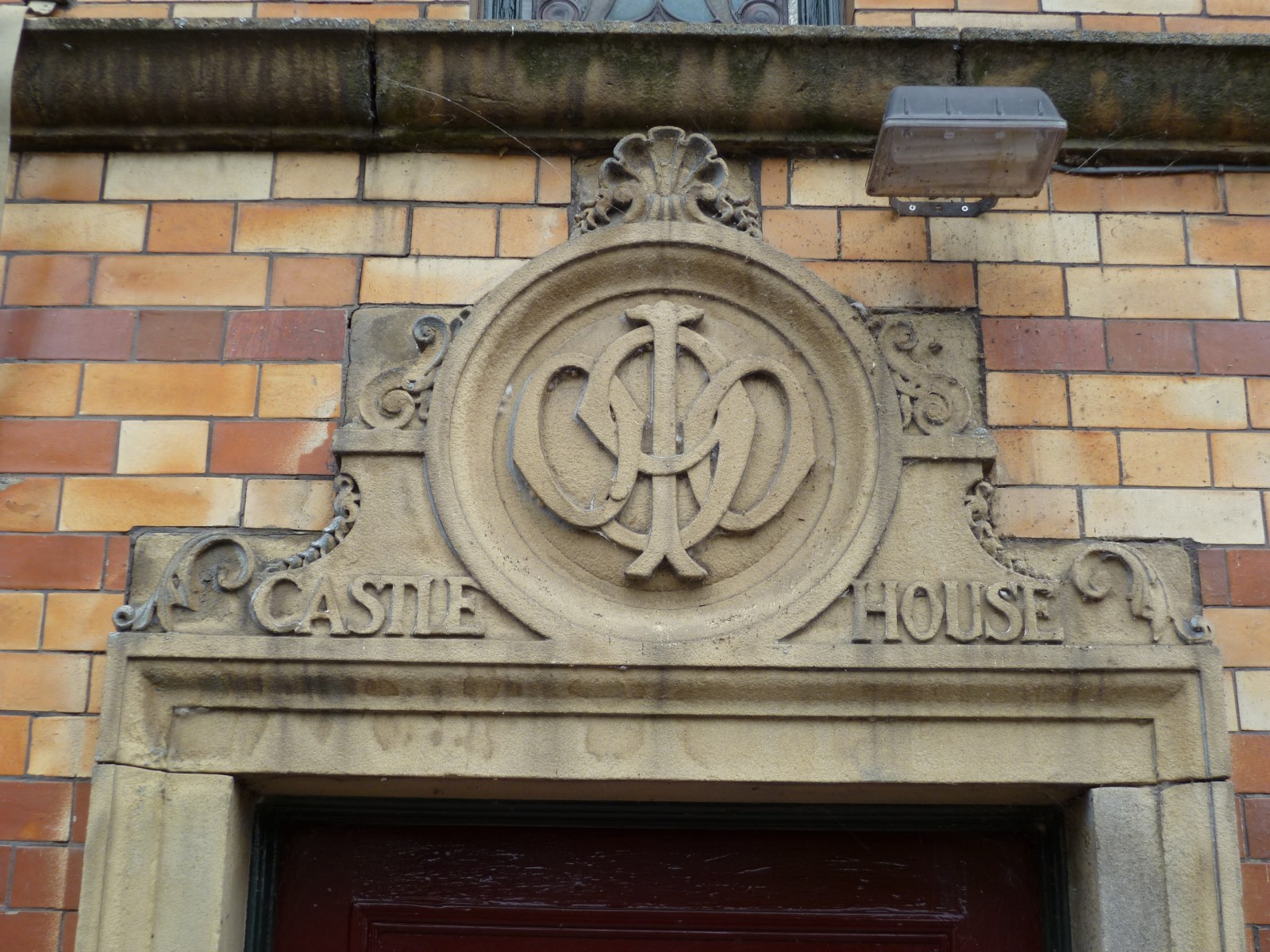
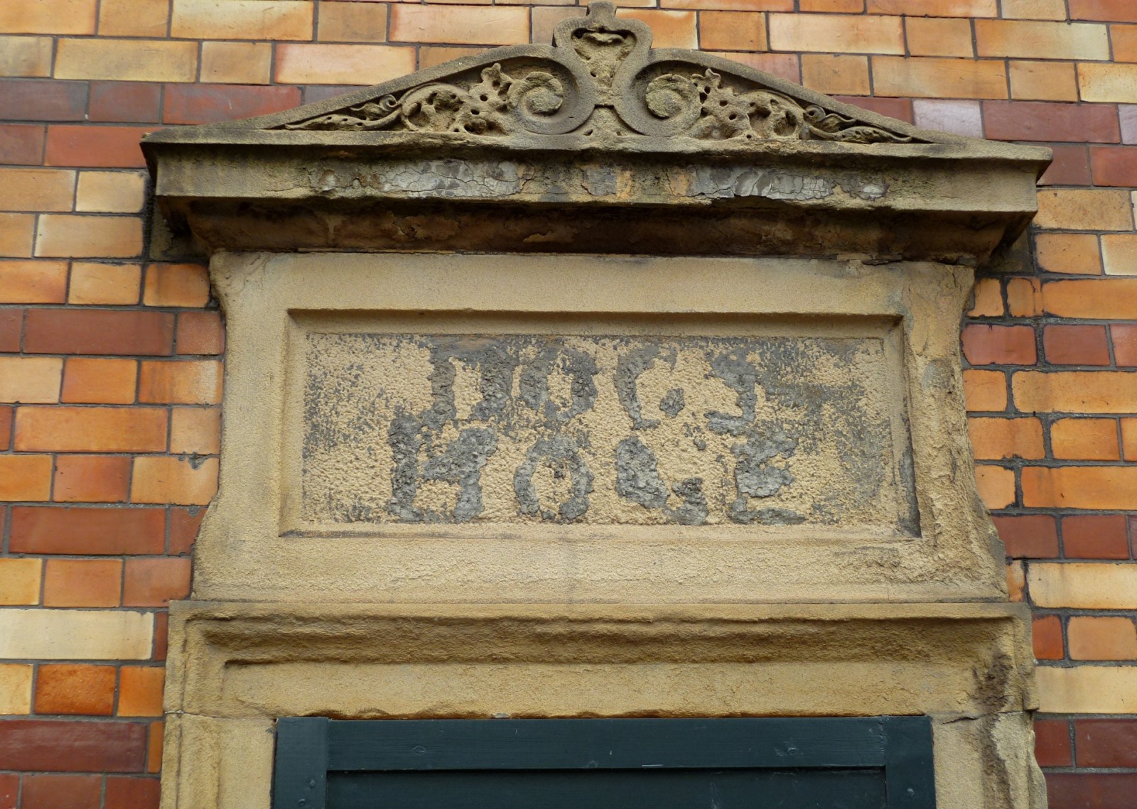
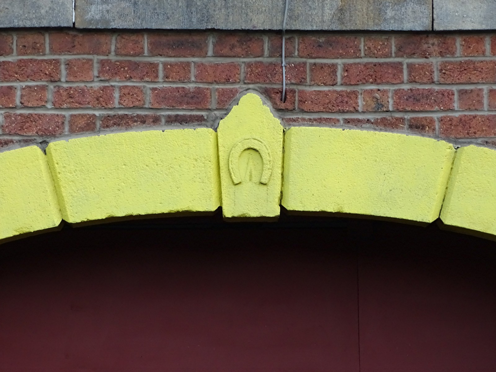
I've read somewhere that the flats that face Lady's bridge and Nursery Street were originally called Castle House, the windows just above the river was where the dogs were kept when it was a Dogs Home when it re-located there from the Pond Street area in c1900 I think , it wasn't used for long as it was always damp because of the river often flooding the place. The ornamental front door was the entrance and you can still make out the name. At the end of the walk on Blonk Street bridge you can see the initials of one of the men who ran the stables there plus possibly the vets initials too, the chap that owned and ran the stables also had stabling and shoeing available at 30-36 Burton Road now known as the Yellow Arch Recording Studios but the Horseshoe above the arch tells just what it was .


 2 points
 -
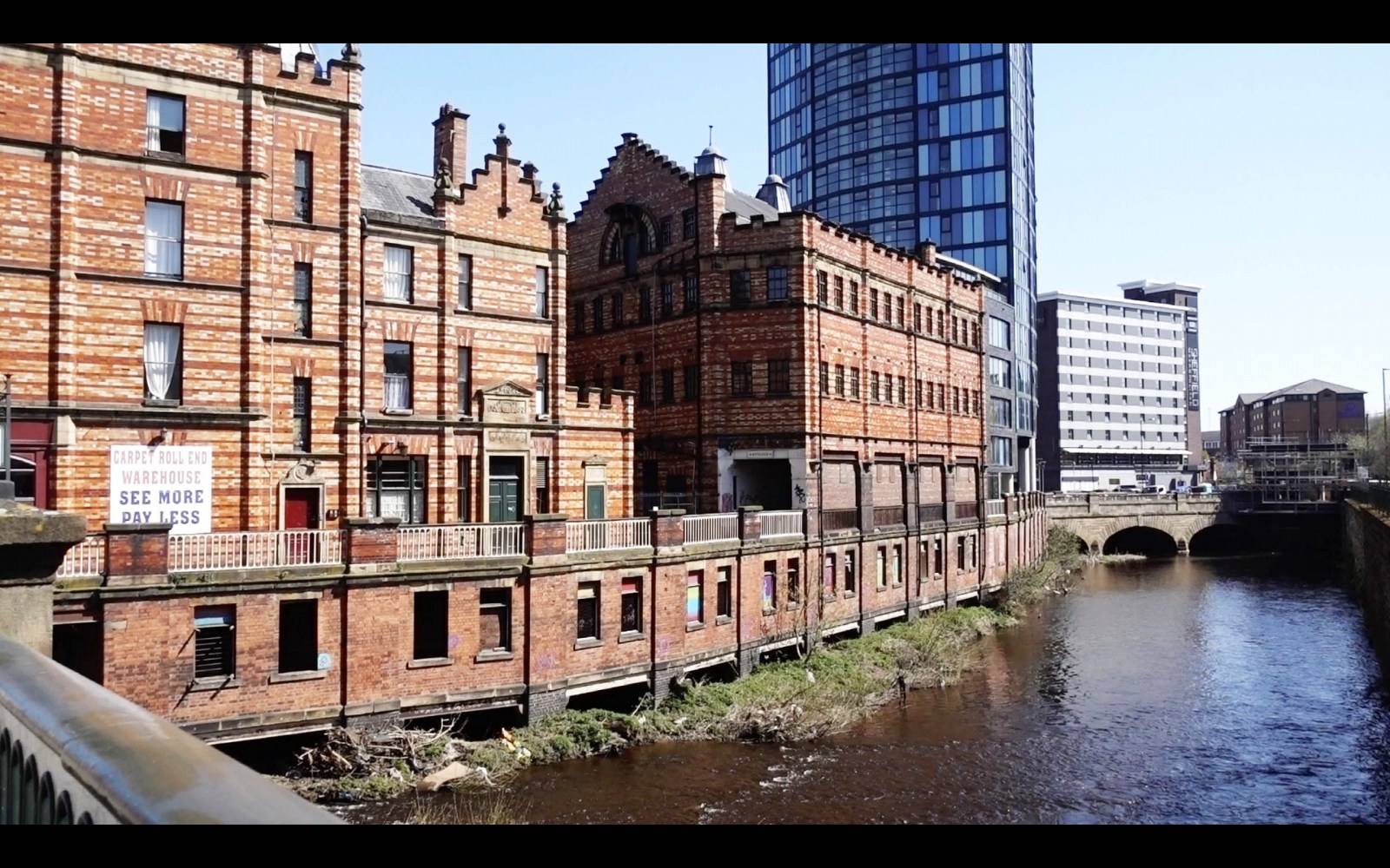
Here's a photo of Lady's Bridge area taken from a video walk I shot there the other day. Looking at the buildings on the left in the foreground - are these buildings relatively new or have they always been there?
 1 point
 -
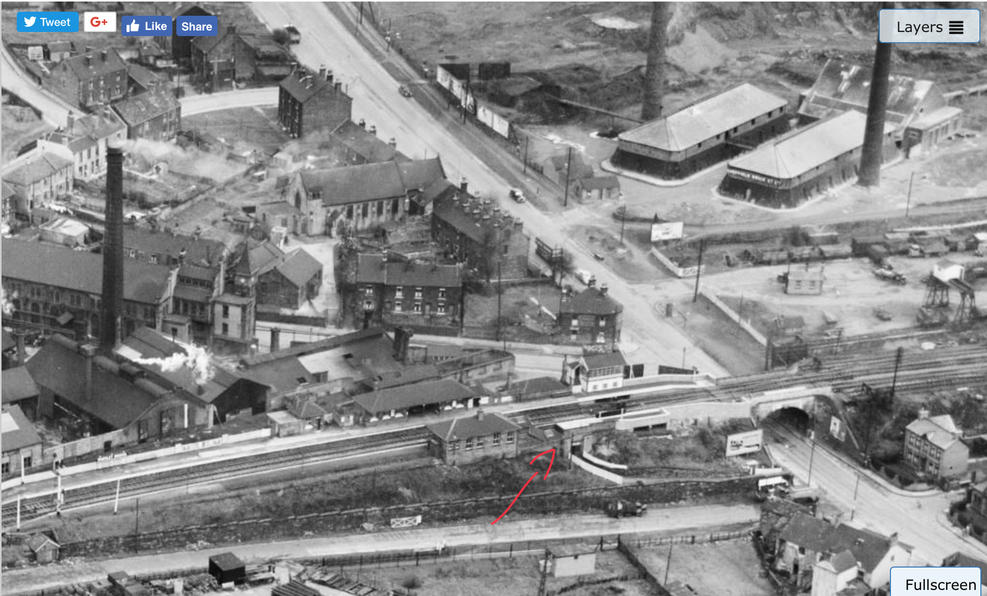
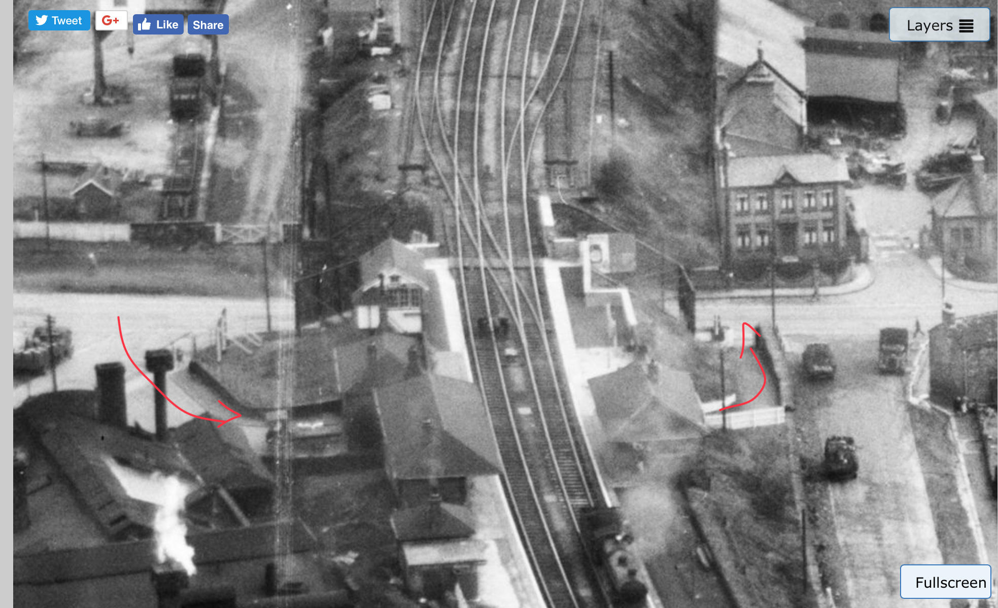
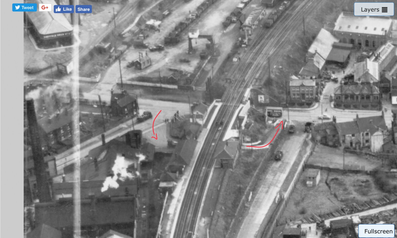
Some nice aerial photos from 1949, showing views of the station and underpass / subway...

 1 point
 -
I know SADACCA was a project funded by Sheffield Council's D.E.E.D. - Department of Employment, Economic Development, during the 1980's. It was one of several projects aimed at combating economic problems in Sheffield. Others included the Unemployment Centre on West Street and The Manor Employment Project (later to become Matrec) plus Star Works in Darnall and another project in Frechville.1 point
-
I like the fact that when they built it somebody was thoughtful enough to put an handrail(s) in for the workers going up down the step weirs as seen on the picture.1 point
-
The line was called the " Manchester, Sheffield and Lincolnshire Railway"...Sheffield was then a very important railway centre especially after the railway built its extension to London and changed its name to the Great Central Railway. I was a regular visitor to the Royal Vic as a company representative to the meetings of the Sheffield and District Rollers and Tilters Association1 point
-
A few photo's on Picture Sheffield, there is also a bit of information with this one -------- http://picturesheffield.com/frontend.php?keywords=Ref_No_increment;EQUALS;s27784&pos=16&action=zoom&id=30174
 1 point
 -
https://www.youtube.com/channel/UCotAaGWMZeAJ5Mj_pCj94CQ/videos?disable_polymer=11 point
-
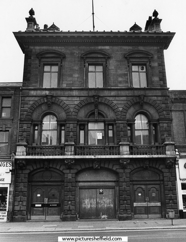
Steelmaker Samuel Osborn's offices.1 point
-
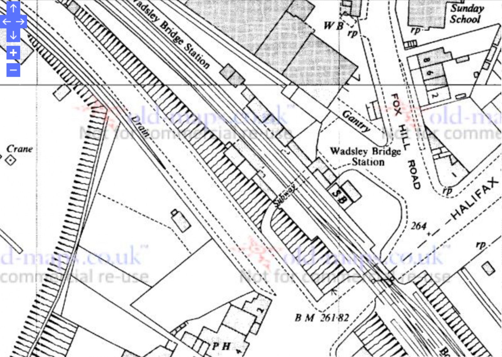
It closed to general passengers in 1959, but was in occasional use for football special services the last of which was in 1996 (I guess that was for Euro '96). I didn't know the subway was there until they dug it out last year some time. I've seen some old pics though and there was originally a building there which you would have had to pass through to access the subway, maybe the ticket office so that customers could pay on the way to access the platforms? Might be going down that way today, if I do I'll get a photo of the excavations.1 point
-
You can still see the letter "W" at each end of what was Woolworths.1 point
-
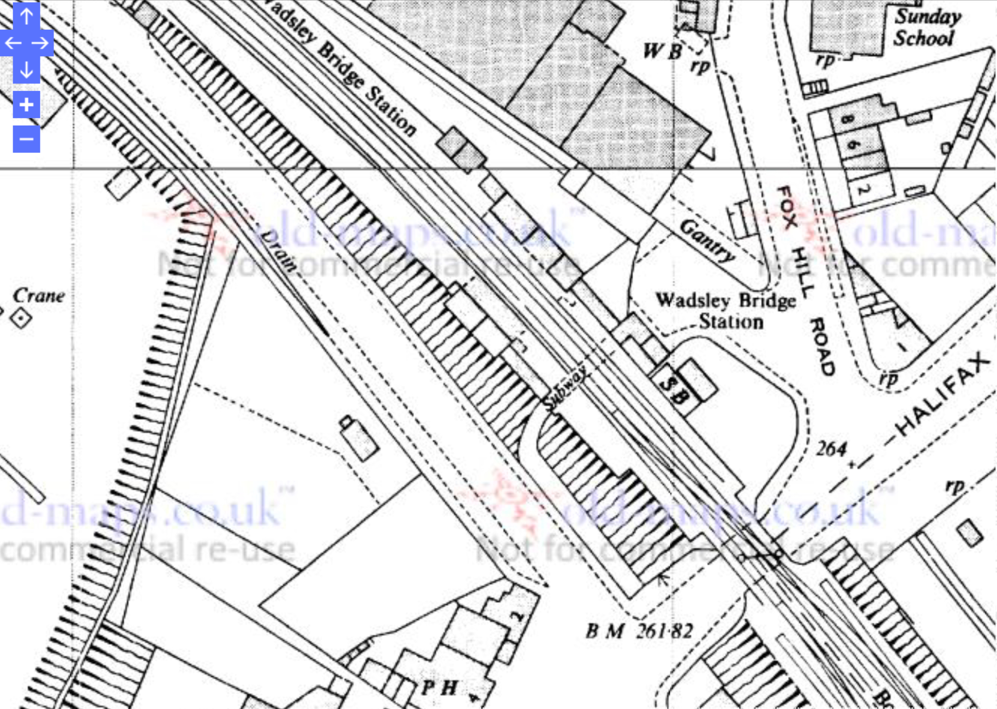
Looking back at old maps of the station, an underpass / subway was always there. Not sure why, but one would assume it allowed passengers to get from one platform to another, although it hardly seems necessary? Probably another example of Victorian over-engineering, when corners were never cut and civil engineering was built to last?! Latest map here from 1967 and station appears to still be in service?....
 1 point
 -
I would just like to add one of my favourites, Buddy Holly played two shows on March 4, 1958. This subject was well covered on this thread, perhaps they could be merged. ------- https://www.sheffieldhistory.co.uk/forums/topic/6136-they-appeared-at-the-city-hall/1 point
-
I think this bloke is great, I would certainly have "bottled out" going up the Meers Brook culvert. I have seen a few of his underground exploits but wonder if I have missed some. Has anyone got a full list of them please?1 point
-
Bradleys came to mind as soon as I read 'B'1 point