Calvin72 Posted April 27, 2020 Share Posted April 27, 2020 Hello All, On Abbey Lane near the junction with Abbeydale Road South is this marker. It's close to the railway and I've seen similar railway company property markers. Is that what this is? I could only see one. 2 Link to comment Share on other sites More sharing options...
MartinR Posted April 27, 2020 Share Posted April 27, 2020 It looks like a boundary former for crown property. The broad arrow is certainly used by government, and the top looks like GR around a crown. I can't get a clearer view on Google Street View, but I assume it is the marker at the property edge of 451 Abbey Lane. Does anyone know what was here before the housing development? Link to comment Share on other sites More sharing options...
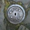
tozzin Posted April 27, 2020 Share Posted April 27, 2020 It’s something to do with officialdom , it’s either a hydrant / water main marker etc the arrow is the Government mark Link to comment Share on other sites More sharing options...
Edmund Posted April 27, 2020 Share Posted April 27, 2020 Here it is marked on the Ordnance Survey map - which I think indicates that it has an importance in itself, rather than marking something else. I was told at school that the arrow marks underneath a line, indicated where Ordnance Survey height measurements had been taken, though I've never seen a post like this before. They are normally carved into a gatepost or similar. Link to comment Share on other sites More sharing options...
SteveHB Posted April 27, 2020 Share Posted April 27, 2020 Same location? Link to comment Share on other sites More sharing options...
boginspro Posted April 27, 2020 Share Posted April 27, 2020 I can't remember seeing one with a crown on before but the map symbol is for an Ordnance Survey Bench Mark, They were erected / cut by Ordnance Survey leveling staff to provide a network of points at which height has been precisely measured above sea level. There used to be about half a million bench marks in Great Britain but they are not needed any more due to GPS mapping and many have now disappeared. If that is GR on it I hope it survives. EDIT How about a new post something like "carved broad arrow marks in stone". 1 Link to comment Share on other sites More sharing options...
MartinR Posted April 27, 2020 Share Posted April 27, 2020 Broad arrow is government, specifically particularly military. One outfit that historically belonged to the military was the Ordnance Survey - hence their use of it. The OS map certainly shows a benchmark at this point. Incidentally it is the V section horizontal line that is the level, not the tip of the arrow. I must say though that I've never seen one on such a lightweight structure before, typically they are in walls. Edit note: Agreed not just military, but in the C20 onwards military was more common, possibly due to two world wars. Link to comment Share on other sites More sharing options...
Voldy Posted April 28, 2020 Share Posted April 28, 2020 4 hours ago, Edmund said: Here it is marked on the Ordnance Survey map - which I think indicates that it has an importance in itself, rather than marking something else. I was told at school that the arrow marks underneath a line, indicated where Ordnance Survey height measurements had been taken, though I've never seen a post like this before. They are normally carved into a gatepost or similar. https://www.geograph.org.uk/photo/4317837 5 years ago apparently. Link to comment Share on other sites More sharing options...
tozzin Posted April 28, 2020 Share Posted April 28, 2020 8 hours ago, MartinR said: Broad arrow is government, specifically military. One outfit that historically belonged to the military was the Ordnance Survey - hence their use of it. The OS map certainly shows a benchmark at this point. Incidentally it is the V section horizontal line that is the level, not the tip of the arrow. I must say though that I've never seen one on such a lightweight structure before, typically they are in walls. The Arrow is the Government “ Trade Mark “ so to speak and not specifically Military, everything they own has the mark, cartoon prisoners are dressed in a uniform covered in arrows, as are these two Suffragettes. Link to comment Share on other sites More sharing options...
SteveHB Posted April 28, 2020 Share Posted April 28, 2020 GPO marker plates http://www.canterbury-archaeology.org.uk/gpo/4590809492 Link to comment Share on other sites More sharing options...
Calvin72 Posted April 28, 2020 Author Share Posted April 28, 2020 Well this has been interesting - thanks everyone! Makes sense there only being the one now. I had a look around expecting a few more if they were boundary markers Link to comment Share on other sites More sharing options...
Voldy Posted April 28, 2020 Share Posted April 28, 2020 Perseverance has its reward! Well found SteveHB, keep up the spotting Calvin72 we need more mental stimulation this year! 2 Link to comment Share on other sites More sharing options...
kidneystone Posted April 28, 2020 Share Posted April 28, 2020 Found this one on Hollow Gate, near Burncross Road. Link to comment Share on other sites More sharing options...
southside Posted April 28, 2020 Share Posted April 28, 2020 Looks like it's a GPO cable marker. https://www.geograph.org.uk/photo/5222641 Link to comment Share on other sites More sharing options...
Calvin72 Posted April 28, 2020 Author Share Posted April 28, 2020 Now there are a few of these around. What's interesting about them is the slot for numbers in the front centre. Some of them are still intact with numbers inserted. A different object but a whole new discussion to begin Link to comment Share on other sites More sharing options...
Voldy Posted May 1, 2020 Share Posted May 1, 2020 There are a lot of photos if you google 'GPO markers', what isn't clear is when the concrete posts were introduced. They all would have a distance in feet, as hydrant plates indicate pipe size and distance, earlier GPO versions feet and inches. Maybe the 1930's and certainly later as the demand for telephones increased. Link to comment Share on other sites More sharing options...
Calvin72 Posted June 8, 2020 Author Share Posted June 8, 2020 I was sent this pic today - near Wire Mill Dam. A better example Link to comment Share on other sites More sharing options...
John Russell Posted June 8, 2020 Share Posted June 8, 2020 The fact it has feet and inches cast into and a space underneath where the measurements could be added, specific to that location, suggests it is a marker post indicating that there is a cover in the road surface, that distance from it. Much as water hydrants are marked today. Is there a corresponding cover in the road or has it been covered during resurfacing? Link to comment Share on other sites More sharing options...
Derek Tylden-Pattenson Posted September 17, 2020 Share Posted September 17, 2020 On 08/06/2020 at 17:24, Calvin72 said: I was sent this pic today - near Wire Mill Dam. A better example Joining in a bit late here - only just joined the group! As others have said, these are indeed GPO cable joint marker posts, dating from the Victorian, Edwardian and Georgian reigns. There are many remaining around the country, yet they are under-reported and (I think!) under-appreciated. Like many people, it was only on my "local" walks during lockdown that I first noticed these, and it took some detective work to rule out fire hydrant, benchmark and various other options. I've now set up a website dedicated to these relics, at gpo-markers.derektp.co.uk where I give some historical background (more to come I hope), and a catalogue of known remaining posts. I have over 150 at present, with search features and interactive map. I've located the one that sparked this thread and documented it, but would love to use Calvin72's pic, with permission of course. I'd also like to know more detail about the location of the one at Wire Mill Dam - have explored via Google Streetview but can't spot it. Finally if any of you know of other posts, or come across them in future, please would you be so kind as to report them via the above site - there is a form for you to enter details and, if possible, upload pictures. Many thanks! 2 Link to comment Share on other sites More sharing options...
Calvin72 Posted September 18, 2020 Author Share Posted September 18, 2020 Of course feel free to use anything I post on this site - great pic above 1 Link to comment Share on other sites More sharing options...
kidneystone Posted October 17, 2020 Share Posted October 17, 2020 Ecclesfield Road near Chapeltown 1 Link to comment Share on other sites More sharing options...
Derek Tylden-Pattenson Posted October 19, 2020 Share Posted October 19, 2020 Following on from Kidneystone's report, I've used Google Streetview to find a further six posts along the A6135. If anyone's passing and is able to get a picture of any of the following, please do send them to me via gpo-markers.derektp.co.uk ... the database is very nearly at 200 marker posts, so any others elsewhere in Sheffield (or further afield) also very much welcomed! :-) Here are the locations of the ones I've found but would like close-ups of: 252 High Greave 198 The Common, Ecclesfield 148 The Common, Ecclesfield 200 White Lane, Chapeltown 62 White Lane, Chapeltown 52 White Lane, Chapeltown (Numbers might be approximate!) Link to comment Share on other sites More sharing options...
kidneystone Posted October 19, 2020 Share Posted October 19, 2020 I always walk around this area so I will take some photos for you if I can find them. I have looked on street view and found the 1st and the 5th on the list you have posted on Sheffield History but I can't see the others. Can you send me some street view links to show where they are. 42 minutes ago, Derek Tylden-Pattenson said: Following on from Kidneystone's report, I've used Google Streetview to find a further six posts along the A6135. If anyone's passing and is able to get a picture of any of the following, please do send them to me via gpo-markers.derektp.co.uk ... the database is very nearly at 200 marker posts, so any others elsewhere in Sheffield (or further afield) also very much welcomed! 🙂 Here are the locations of the ones I've found but would like close-ups of: 252 High Greave 198 The Common, Ecclesfield 148 The Common, Ecclesfield 200 White Lane, Chapeltown 62 White Lane, Chapeltown 52 White Lane, Chapeltown (Numbers might be approximate!) Link to comment Share on other sites More sharing options...
kidneystone Posted October 19, 2020 Share Posted October 19, 2020 Forget my last post. Found them all now except 52 White Lane. A street view link to that one would be appreciated. Link to comment Share on other sites More sharing options...
tozzin Posted October 20, 2020 Share Posted October 20, 2020 Seems the lead strips have been removed by someone, I suppose the measurements were impressed on them. Link to comment Share on other sites More sharing options...

Recommended Posts
Create an account or sign in to comment
You need to be a member in order to leave a comment
Create an account
Sign up for a new account in our community. It's easy!
Register a new accountSign in
Already have an account? Sign in here.
Sign In Now