Calvin72 Posted July 3, 2023 Share Posted July 3, 2023 I recently read that there was some remains of the 19th century SWWC conduit from Redmires to Crookes Valley to be found in Ranmoor. I didn't know what to find and the definition of 'remains' can be quite wide! However there is a great stretch alongside Tetney Rd which is well preserved and easily seen. Does anyone know of any more of the old conduit left? There really isn't much to find online about it, but I understand it served into the 20th century and there must be some photos out there... Link to comment Share on other sites More sharing options...
Ponytail Posted July 3, 2023 Share Posted July 3, 2023 This might be of interest to you. Plan of land situated in Ranmoor which also shows Sheffield Water Works Co. Conduit between "Cross Pool Road" and Darwin Lane. Sale Plan Dated 29th June 1869. https://www.picturesheffield.com/frontend.php?keywords=Ref_No_increment;EQUALS;y12222&pos=1&action=zoom&id=81725 1 Link to comment Share on other sites More sharing options...
Ponytail Posted July 3, 2023 Share Posted July 3, 2023 Plan of land in Upper Hallam showing Sheffield Water Works Co. Conduit near Carsick Hill Road and underneath Snaithing Lane. Sale Plan Dated 20th August 1867. https://www.picturesheffield.com/frontend.php?keywords=Ref_No_increment;EQUALS;y11279&pos=15&action=zoom&id=104288 1 Link to comment Share on other sites More sharing options...
Ponytail Posted July 3, 2023 Share Posted July 3, 2023 Contoured Plan of Rivelin Valley Road showing Sheffield Water Works Co. Rivelin Conduit. https://www.picturesheffield.com/frontend.php?keywords=Ref_No_increment;EQUALS;arc02953&pos=13&action=zoom&id=93731 1 Link to comment Share on other sites More sharing options...
Edmund Posted July 3, 2023 Share Posted July 3, 2023 The 1837 Whites Directory tells us that: The New Water Company determined to appropriate the surplus water of the Wyming-Brook. The water intended to be collected there would have to be conveyed through property belonging to a great number of owners, legislative powers were rendered necessary; consequently on 29th May 1830, the royal assent was obtained. HADFIELD RESERVOIR, at Crookes was completed in 1833. This is now the principal service reservoir, being at an elevation of 450 feet above the lower parts of the town, and 200 feet higher than the spire of the Parish Church, so that, from it water can be sent even to the tops of the houses in the highest parts of the town and suburbs. The water is drawn from it by means of sluices, 18 inches square attached to the waste-pit, whence it passes under the bank, and after being gradually contracted to a diameter of 9 inches, is distributed through the street pipes, most of which are cast iron. The waste-pit, in the deepest part of the Hadfield Reservoir, is of a circular form, 8 feet in diameter, and 42 feet deep, and down it the spare water is precipitated into the old reservoirs, which are now used solely for the supply of the lower parts of the northern side of the town. The REDMIRES RESERVOIR and CONDUIT, which supply the Hadfield Reservoir, were commenced at the same time as the latter, and completed in 1836. Bounded on three sides by extensive ranges of hills, the waters from are collected by means of a catch-water drain to one point, where a meter is fixed for the protection of the mill owners on the Riveling, after satisfying which, the surplus passes into the reservoir. Th water is drawn off into the conduit in the same manner as at the Hadfield Reservoir, down to which is a fall of 500 feet. The CONDUIT is about 4 1/2 miles in length, of which 1,200 yards passes under-ground, through a tunnel 3 feet in diameter, and the remainder is an open channel lined with stone, enclosed by a wall on each side, and crossed by numerous stone bridges. In some places where the declivities are abrupt, the conduit is broken into perpendicular falls of from 10 to 14 feet, forming in flood-times, beautiful cascades, and the stream is conveyed over the Tapton Valley through an iron aquaduct, supported by stone piers, at an elevation of more than 30 feet. 2 Link to comment Share on other sites More sharing options...
Edmund Posted July 3, 2023 Share Posted July 3, 2023 There's a 500m stretch of it preserved as a footpath from the southeast end of Hallam Grange Rise to the southwest end of Carsick Hill Road. 1 Link to comment Share on other sites More sharing options...
Calvin72 Posted July 4, 2023 Author Share Posted July 4, 2023 11 hours ago, Edmund said: There's a 500m stretch of it preserved as a footpath from the southeast end of Hallam Grange Rise to the southwest end of Carsick Hill Road. Yes, towards the Redmires end quite a bit of the route is still marked out on the ground. Either side of Lodge Moor Rd it can still be seen where the conduit passed underneath too. Any remnants in the built-up areas are going to harder to find, Tetney Rd may be the last such bit left. Link to comment Share on other sites More sharing options...
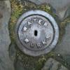
Calvin72 Posted July 7, 2023 Author Share Posted July 7, 2023 Today I've explored the conduit route from Blackbrook Rd out to Redmires and there is loads of it intact at that end - I had no idea, but a few people have pointed me in good directions! A remarkable thing and something I'd only read about before, a new piece of Sheffield history for me - love it 3 Link to comment Share on other sites More sharing options...
Edmund Posted July 13, 2023 Share Posted July 13, 2023 On 03/07/2023 at 19:26, Edmund said: There's a 500m stretch of it preserved as a footpath from the southeast end of Hallam Grange Rise to the southwest end of Carsick Hill Road. I had a walk along this footpath today. There are several small stone walls (photos below). My guess would be that they are the remains of footbridges across the conduit, the notches being to allow pedestrian access along the line of the conduit, and the foot high barriers in the notches to prevent any excess/flood water overflowing onto the bridges. Perhaps. Any better ideas? 3 Link to comment Share on other sites More sharing options...
Calvin72 Posted July 14, 2023 Author Share Posted July 14, 2023 Very interesting. I don't have any better ideas about what the structures are, they are certainly similar to the surviving bridges further down towards Redmires. The whole thing is like walking a disused railway with loads of remnants and clues to the past use of the route. It's great that so much remains, but also amazing how much construction and detail was put into the conduit in the 1830s! Going back to the 1837 White's posted by Edmund earlier there is this description; "The CONDUIT is about 4 1/2 miles in length, of which 1,200 yards passes under-ground, through a tunnel 3 feet in diameter, and the remainder is an open channel lined with stone, enclosed by a wall on each side, and crossed by numerous stone bridges. In some places where the declivities are abrupt, the conduit is broken into perpendicular falls of from 10 to 14 feet, forming in flood-times, beautiful cascades, and the stream is conveyed over the Tapton Valley through an iron aquaduct, supported by stone piers, at an elevation of more than 30 feet." I have read elsewhere about the conduit being carried on stone piers in places. I wonder exactly whereabouts that would have been necessary? It's all fascinating Link to comment Share on other sites More sharing options...
Edmund Posted July 14, 2023 Share Posted July 14, 2023 Here's a 1930 photo taken from Manchester Road, of the aquaduct that crossed the Tapton Valley (St John's Ranmoor spire in the distance) and present day, showing the contours flattened for the School playing fields: 2 Link to comment Share on other sites More sharing options...
Edmund Posted August 1, 2023 Share Posted August 1, 2023 Another section of the conduit route found? Up until 1891 there was no access from Lawson Road into Hallam Gate Road, as the Water Department owned the land that the conduit (piped) crossed, and it was a minor nuisance. The route follows the 200 metre contour line, falling from 220 metres on the school playing field area. 1 Link to comment Share on other sites More sharing options...
Calvin72 Posted August 14, 2023 Author Share Posted August 14, 2023 On 14/07/2023 at 15:57, Edmund said: Here's a 1930 photo taken from Manchester Road, of the aquaduct that crossed the Tapton Valley (St John's Ranmoor spire in the distance) and present day, showing the contours flattened for the School playing fields: I recently went looking for the wall running under the conduit in the 'then' photo above. The conduit appears to cross the wall on the stone pillars. In the undergrowth just out of sight in the 'now' view the wall is still there, and I will return to have a poke around to see if any trace remains of the pillars or their bases. Link to comment Share on other sites More sharing options...
Calvin72 Posted September 23, 2023 Author Share Posted September 23, 2023 The aqueduct was clearly still present in 1950 as seen on the 'Britain From Above' website. https://www.britainfromabove.org.uk/image/EAW031263 1 Link to comment Share on other sites More sharing options...
southside Posted September 23, 2023 Share Posted September 23, 2023 You can follow the course of the conduit on this 1851 Library of Scotland map, there appears to be a sluice gate controling the flow over the aqueduct. https://maps.nls.uk/view/102345217 Link to comment Share on other sites More sharing options...
Ponytail Posted November 22, 2023 Share Posted November 22, 2023 Fairbanks Map, including the Pipe conveying water to Broom Hall. and Dams from which the Town of Sheffield is supplied with water. Always the case when you look for one thing you come across something else that takes your attention. In this case: The plan of Crookes Moor in the parish of Sheffield, drawn by W. Fairbank. 1780. https://www.picturesheffield.com/frontend.php?keywords=Ref_No_increment;EQUALS;arc06730&pos=52&action=zoom&id=105916 Link to comment Share on other sites More sharing options...
Archaeo Posted December 15, 2023 Share Posted December 15, 2023 The conduit has been nominated for the local heritage list and is currently open to public consultation: https://local-heritage-list.org.uk/south-yorkshire/asset/14644 (You need to register to view) Link to comment Share on other sites More sharing options...
Ponytail Posted February 13 Share Posted February 13 Plan of an Estate near Fulwood. 1868. Architects: Fowler and Son, Sheffield. Pawson and Brailsford, Lithographers, Sheffield. https://www.picturesheffield.com/frontend.php?keywords=Ref_No_increment;EQUALS;y11281&pos=49&action=zoom&id=104296 Shows Brown Hills Lane; also Sheffield Water Works conduit from Redmires to Sheffield. (at the top of the map) Owners / tenants: John Sheldon, esquire, Joseph Green and Sprotley School, Stephen Fox, Samuel Shore, esq., John Broomhead, The Duke of Norfolk, and William Waterfall, esq. Original at Sheffield Local Studies Library: Sale Plans 4 August 1868. Link to comment Share on other sites More sharing options...

Recommended Posts
Create an account or sign in to comment
You need to be a member in order to leave a comment
Create an account
Sign up for a new account in our community. It's easy!
Register a new accountSign in
Already have an account? Sign in here.
Sign In Now