Search the Community
Showing results for 'coal pit lane'.
-
Birley Collieries Branch Line
History dude replied to Paolo Coopio's topic in Sheffield Buses, Trams and Trains
If you look at R Longden's map and at Fields 504 and 505 at the top end, you can see that the cutting cuts away and indicates a bridge over lane/path. If you look in the background of my photo, you can see the school building of City School, which ties in nicely with the modern academy on the modern satellite image and following it down the large green blob of trees might indicate that the bridge is still there. So the "tunnel" is not a tunnel, but a bridge with the railway line on top and the path below it. I have had a look around Google Street View, and modern buildings now block the original view I took in the 1980s. However, there is a footpath at the back which can be accessed via Haxby Street and the cul-de-sac off it. Near where the large building that crosses over the boundary line of the estate.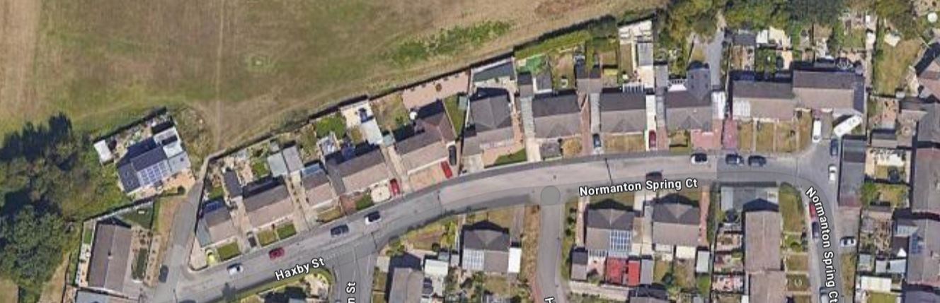
-
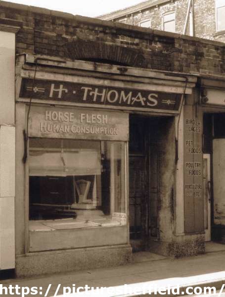
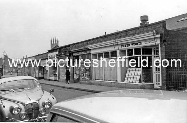
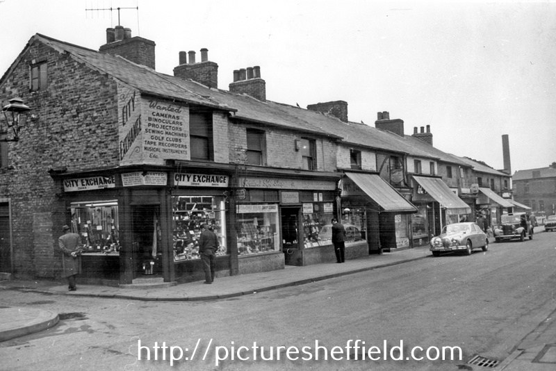
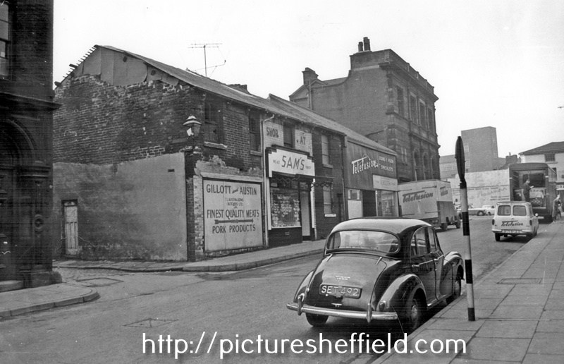
Not Part of the Shops built by Thomas Rowbotham. H. Thomas, horse flesh dealer, No. 28 Hereford Street. Sign reads: Horse Flesh Human Consumption. rb00024 Photographer: Ray Brightman, FRPS AFIAP DPAGB Hon PAGB. From The Ray Brightman exhibition collection. Hereford Street, premises include Peter Worth, Estate, and Insurance Agents, No 26, Jn. Mace Ltd., Pet Stores, No 28, H. Thomas, Horse Flesh Dealer, No 30, William Marsden and Son, Bakers. March 1965. s17124 Photographer: Estates Surveyors Department. Hereford Street at junction with South Lane, premises include No. 21 City Exchange, secondhand radio and television supplies, Nos. 23 - 25 Yospa Gordon, retail jeweller, No. 27 Wm. Talbot, Butcher. March 1965s17129 Photographer: Estates Surveyors. Hereford Street at Forge Lane junction, looking towards The Moor, No 14, Thos. J. Austin and Sons (Butchers) Ltd., No 10, Telefusion Ltd., Television Supplies. March 1965.s17122 Hereford Street after the demolition of Nos. 45 - 47 Bridge Inn, premises still remaining include No. 41 A.P. Smith and Bros. Ltd., butchers, No. 39 Fras. Turner, tobacconist, No. 35, Ernest Speechley, snack bar. July 1961.s17120 Photographer: J Lythgoe.
-

Birley Collieries Branch Line
RLongden replied to Paolo Coopio's topic in Sheffield Buses, Trams and Trains
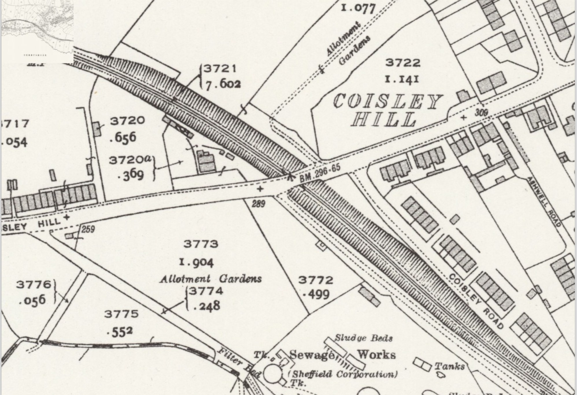
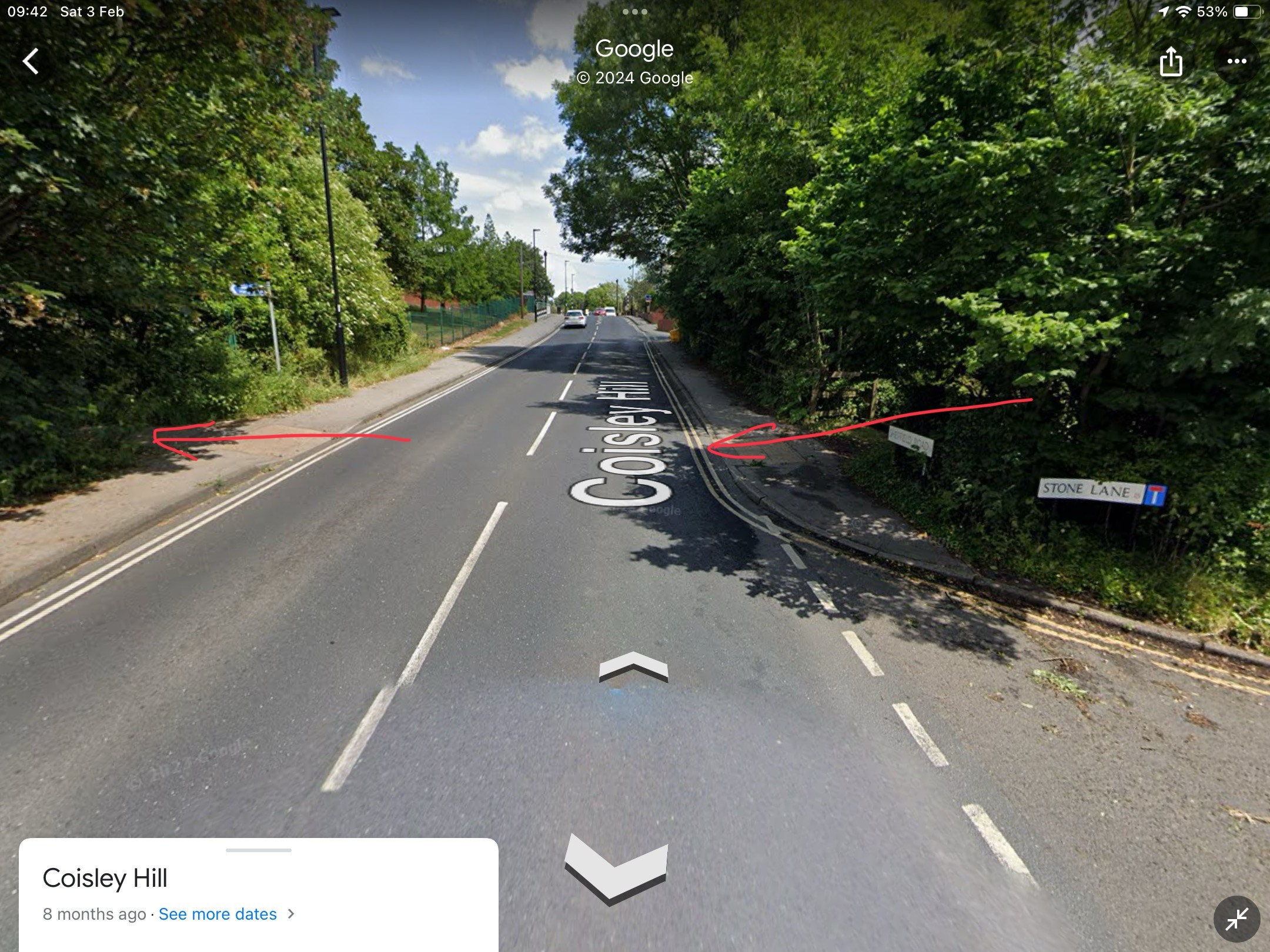
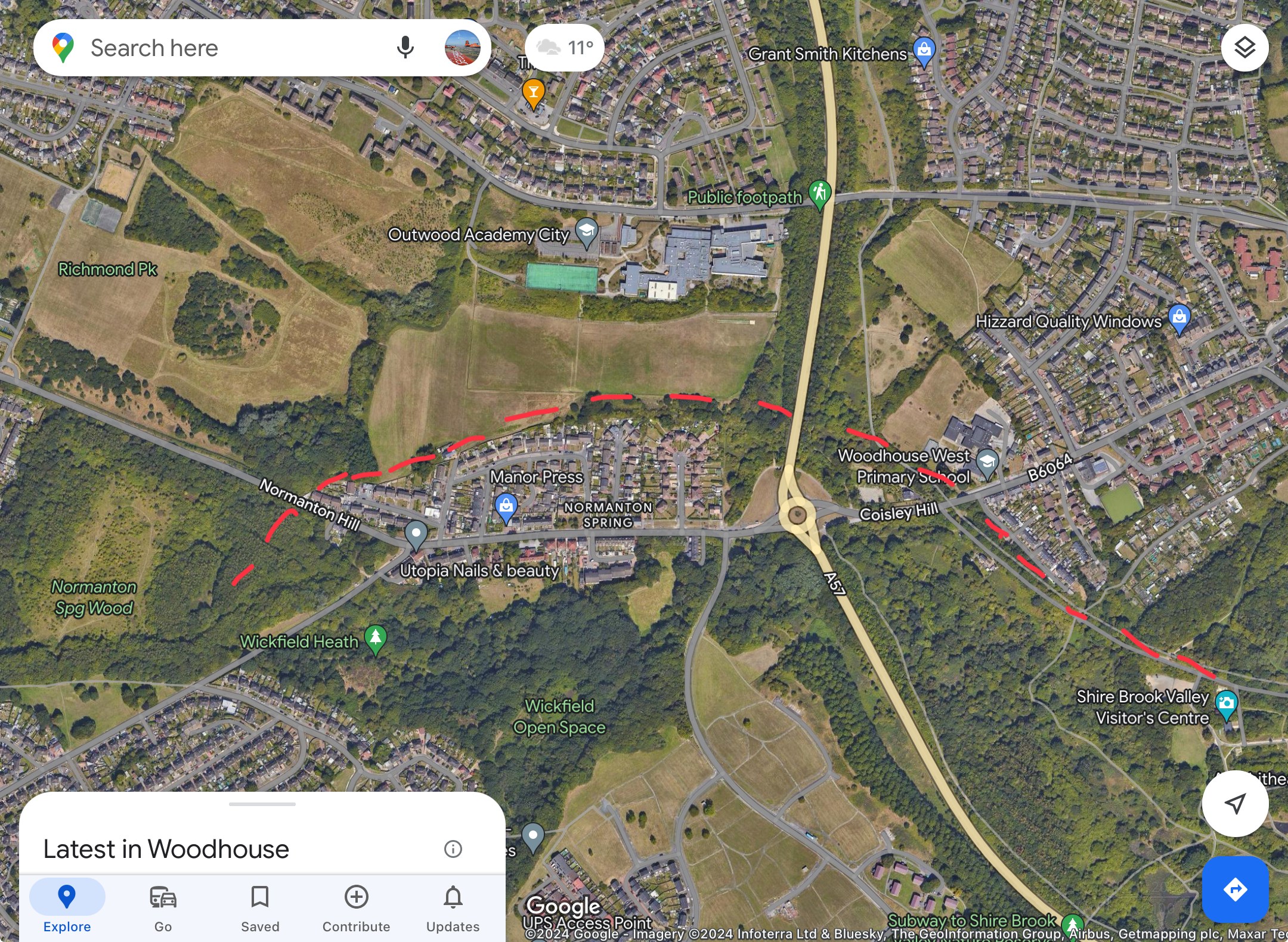
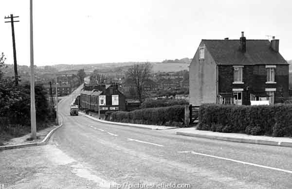
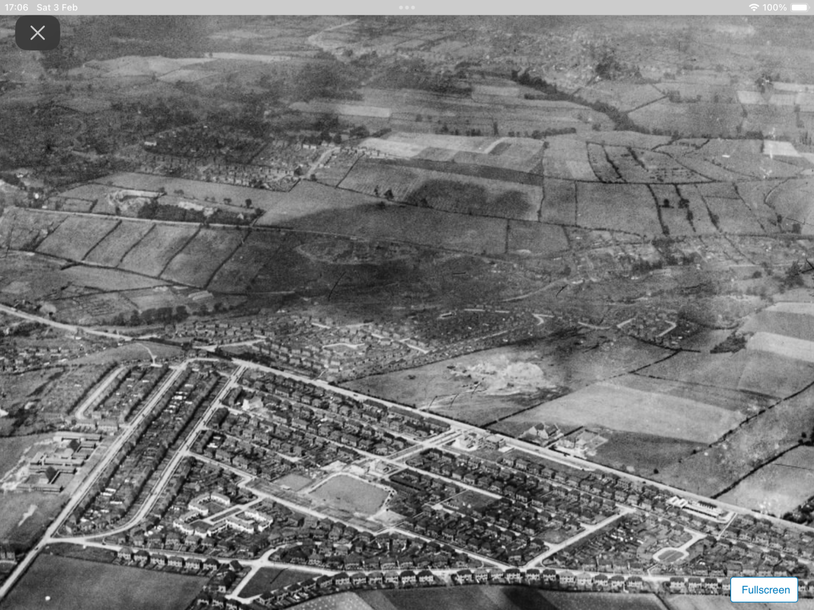
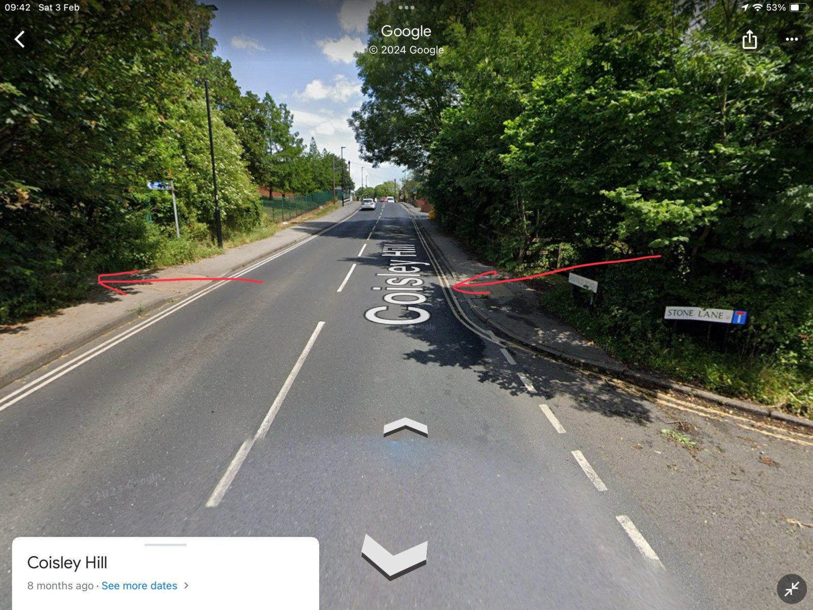
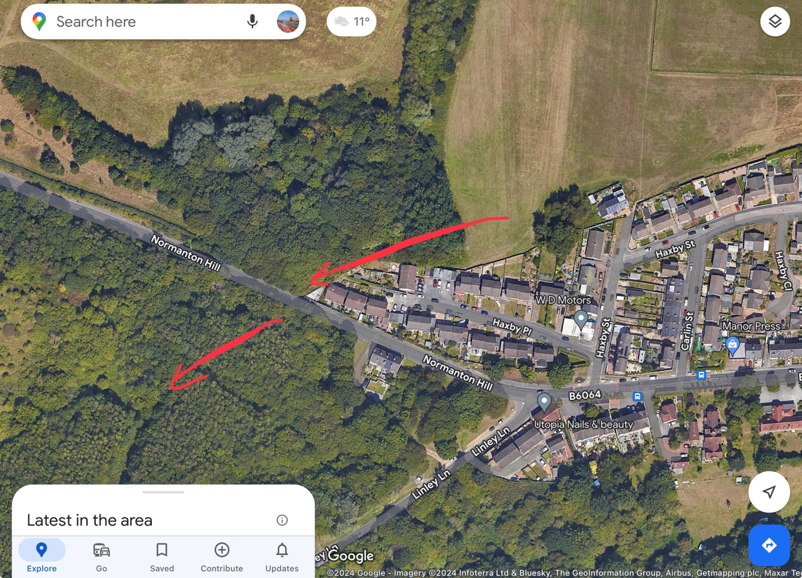
Yes you’re right, the line was in a cutting as it went under Coisley Hill, as you can see from the map detail https://maps.nls.uk/view/125651476 Also, you can see in the image, the photographer must have been stood on the pavement on the bridge, with Stone Lane to their left and the two cottages on the right… the rail line is just out of shot on the right. https://www.picturesheffield.com/frontend.php?keywords=Ref_No_increment;EQUALS;s43471&pos=11&action=zoom&id=85665 An aerial view from 1939, taken over Frecheville, looking over towards Stradbrooke Road, you can see Birley West Colliery in the junction of Linley Lane and Normanton Hill. The rail line passes under Normanton Hill, curves right in an arc, through the fields and it disappears off the right edge of the page, before it crosses Coisley Hill. https://www.britainfromabove.org.uk/en/image/EPW062831 Amazing really that roads and houses have encroached on the area, yet the route it still visible today 😁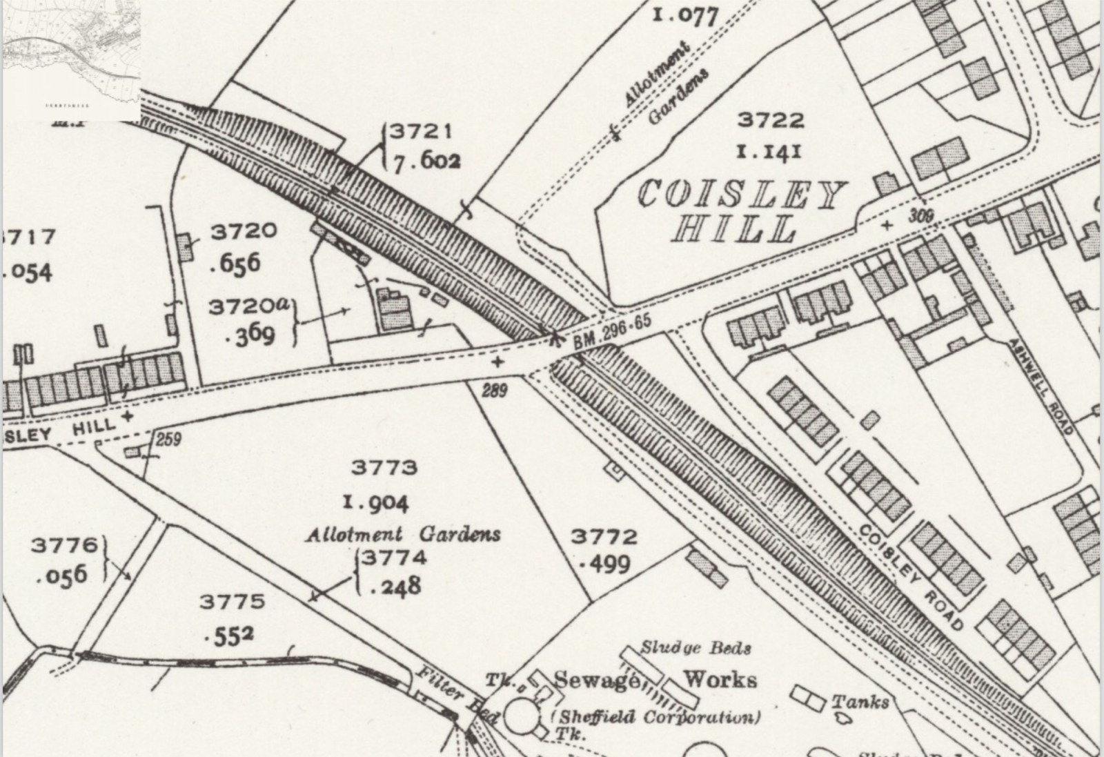
-

Birley Collieries Branch Line
Lemmy117 replied to Paolo Coopio's topic in Sheffield Buses, Trams and Trains
Thanks to that map it seems there was a bridge on Coisley Hill which I was not aware of. From the current pictures it seems the cutting has been filled in next to Stone Lane to bring the path up to road level. That's the good thing about this site, you learn something new every day! -
Birley Collieries Branch Line
RLongden replied to Paolo Coopio's topic in Sheffield Buses, Trams and Trains
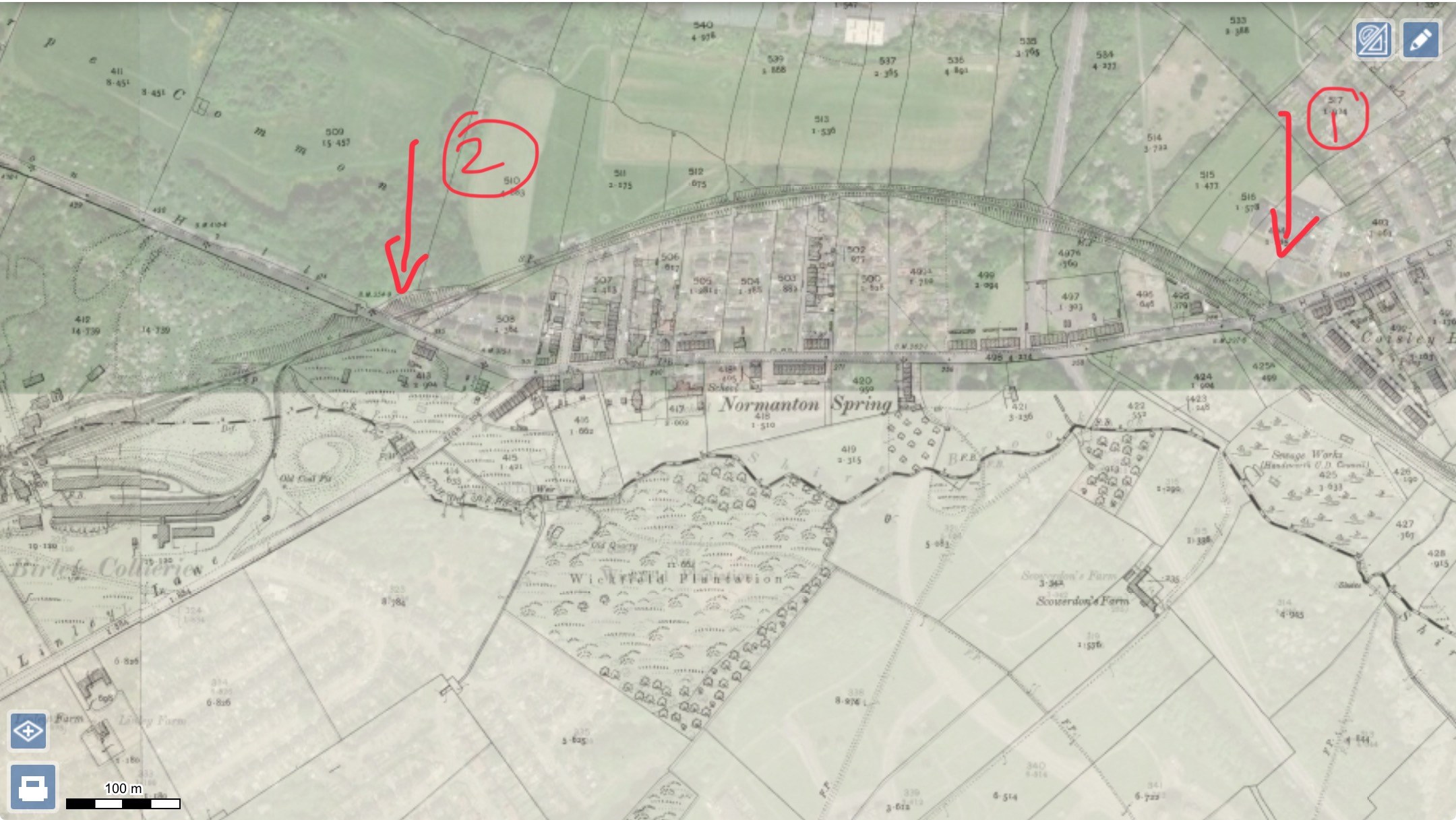
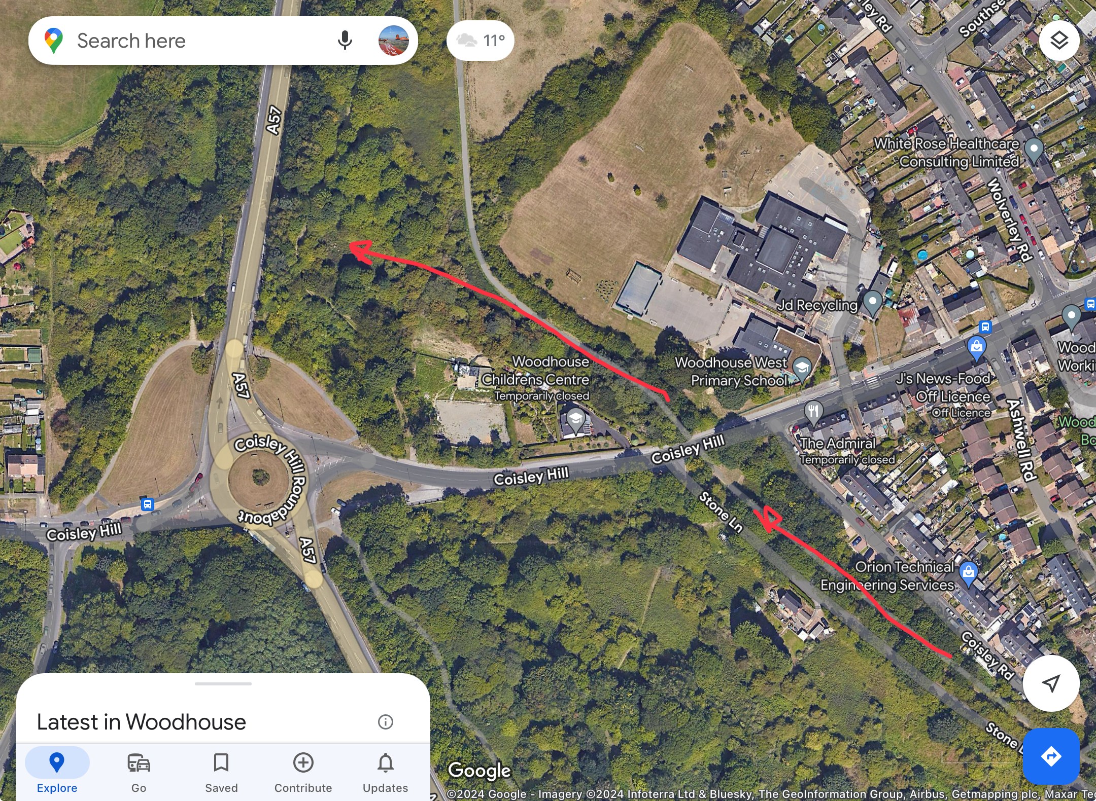
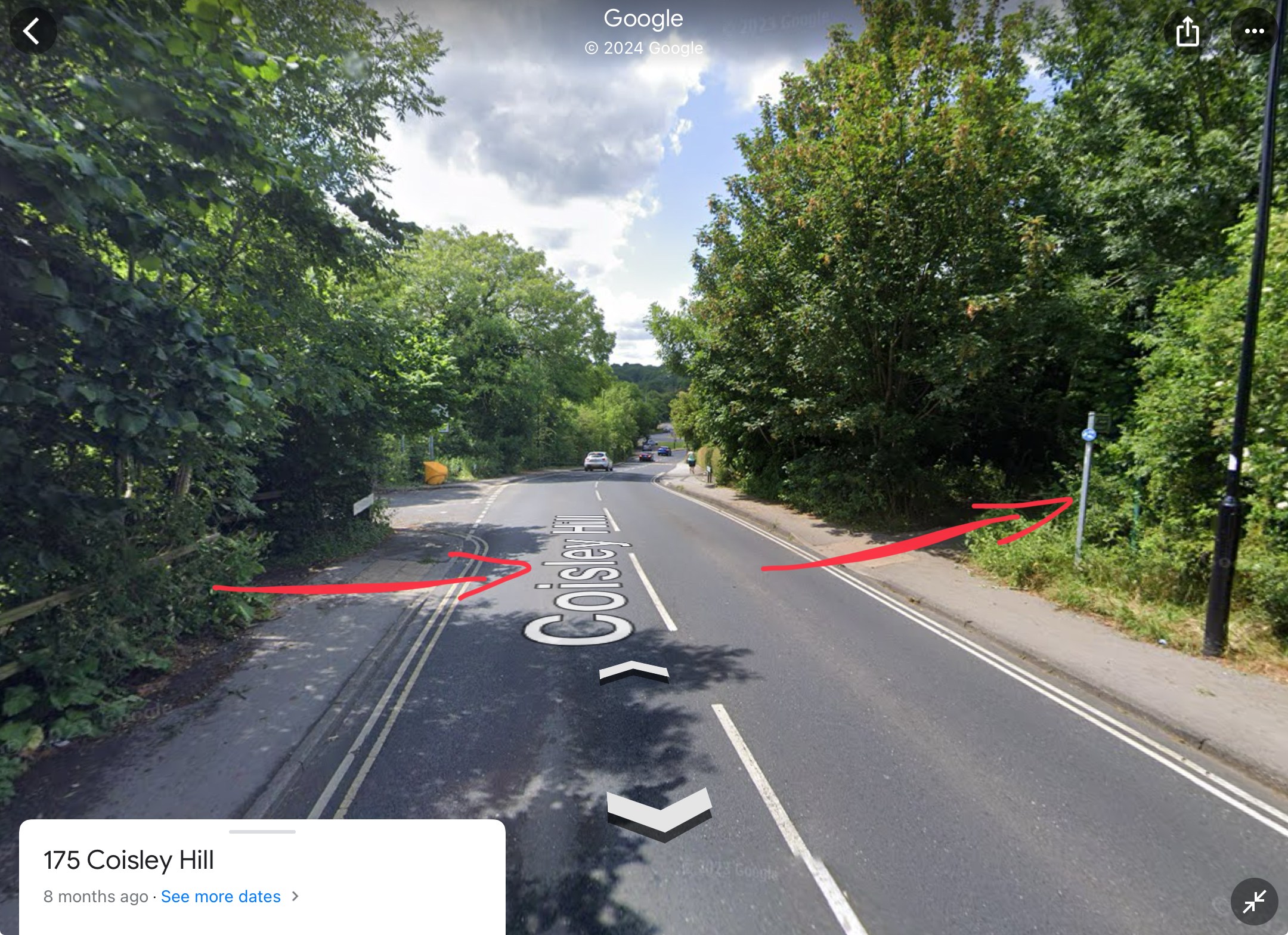
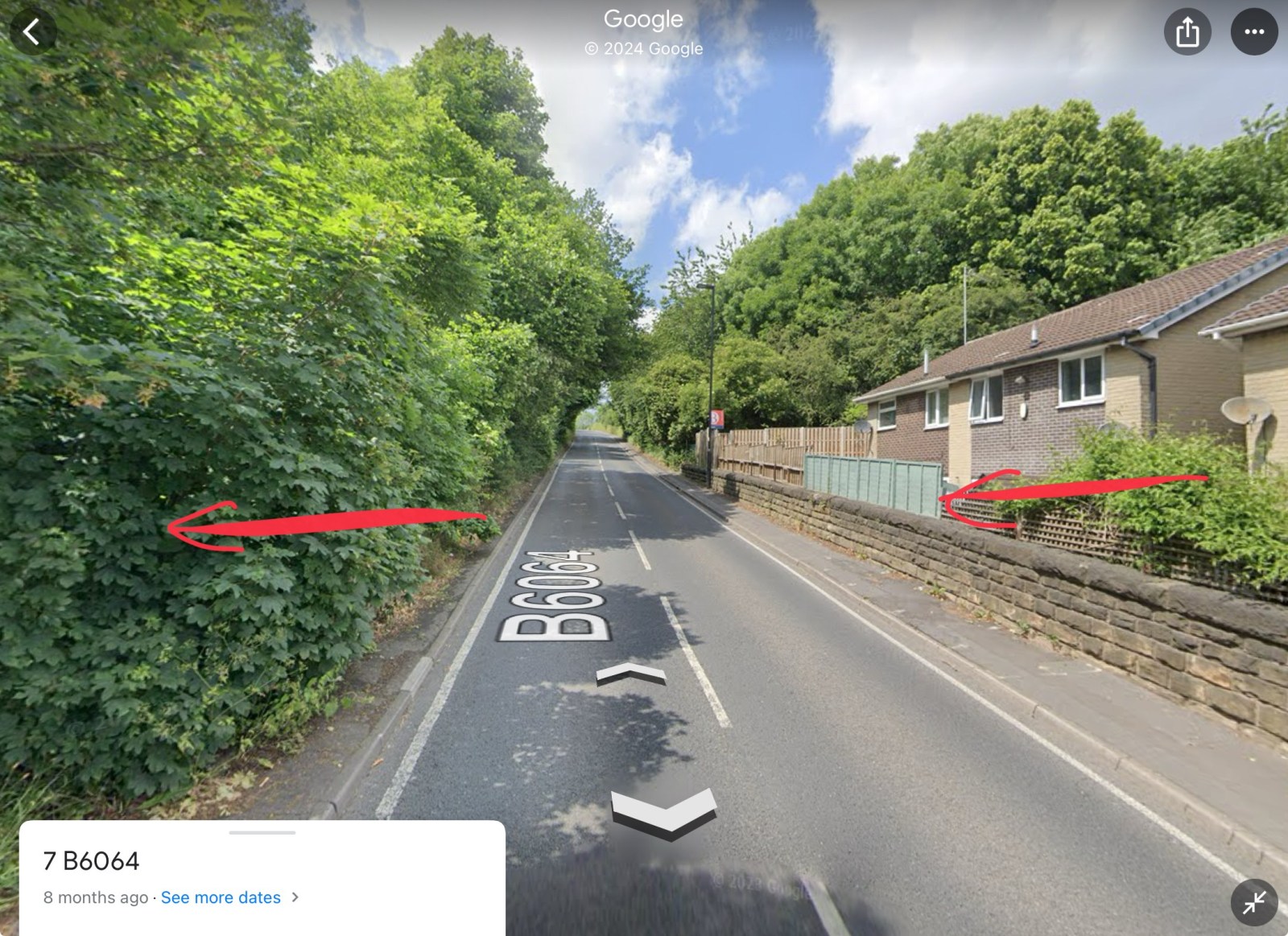
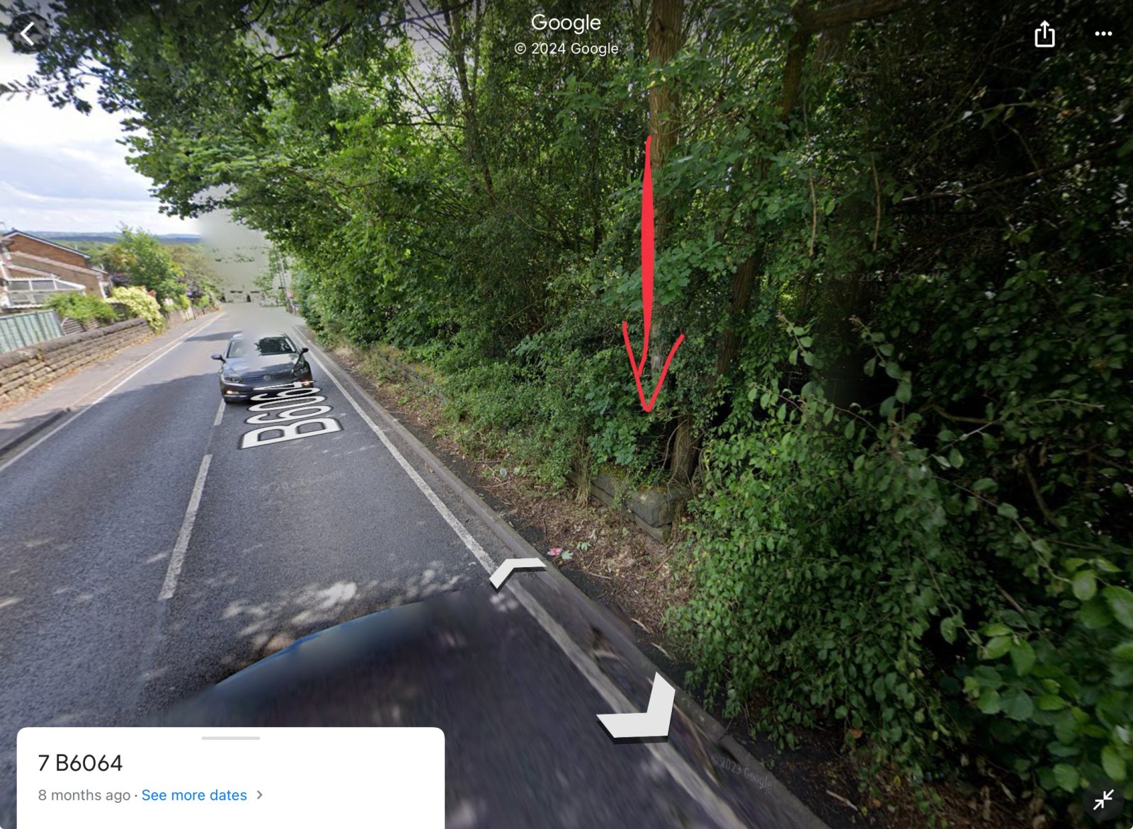
The line cut the road at 2 points. 1) Coisley Hill and 2) Normanton Hill. 1) You can see where the track bed was, as it’s now a part of the Trans Pennine Trail. It crosses Coisley Hill just up from Stone Lane, where the kerbs have been dropped either side 2) Just above the end house on the right going uphill, you can see the wall either side and the ‘drop’, where the tunnel cut under the road. Assume the level of the ground was backfilled to accommodate the houses, though if you peer over the wall/fence, it is still well below road level The trace of the line can still be seen in the vegetation, wall and property boundaries Hope this helps to visualise the route and crossing points?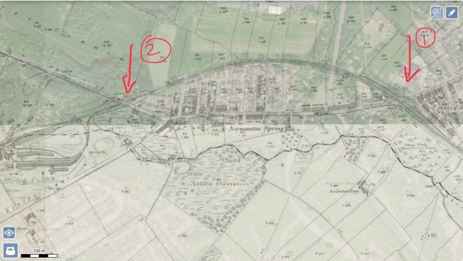


-

Birley Collieries Branch Line
boginspro replied to Paolo Coopio's topic in Sheffield Buses, Trams and Trains
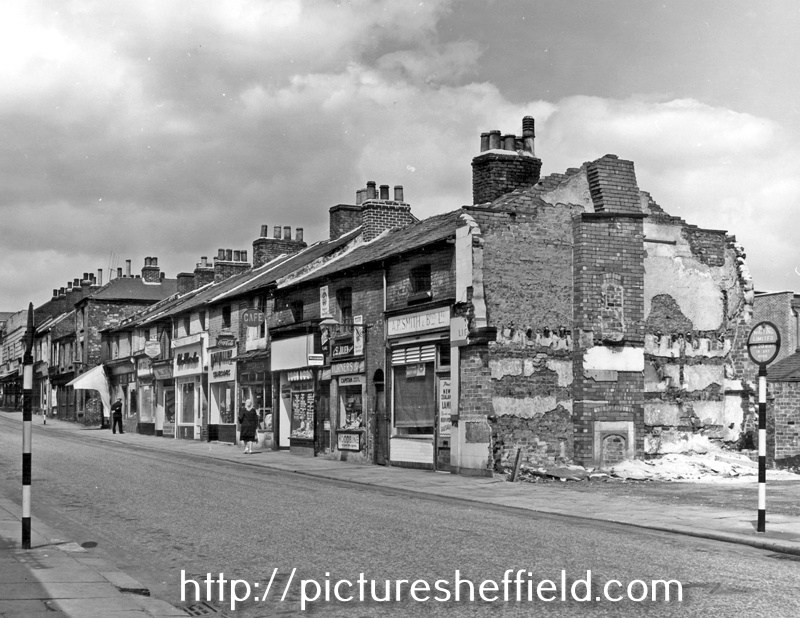
I may be wrong here and apologise if I am but the original picture put on by History dude looks to me like the tunnel/bridge at Coisley Hill just below the Block Houses on Coisley Road. If that is so as kids it was always known as The Tunnel though I think it was just quite a long under bridge. It seems to me to have been accepted as the bridge under Normanton Hill into Birley West pit but if you look at the 1938 picture above of a wagon loading coal at the land-sale site of the old Birley West site you can see how steep that hill is and the difference in gradient to the first picture. -
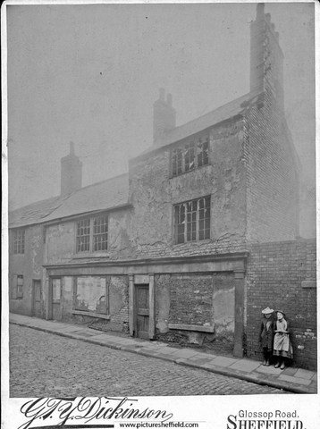
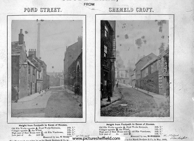
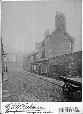
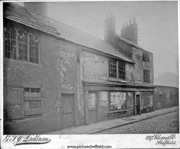
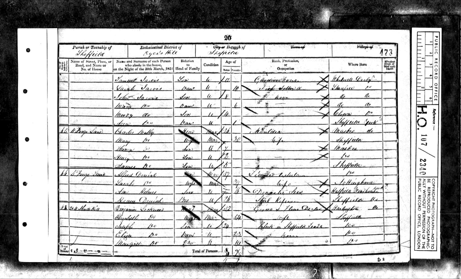
Plan of freehold premises in Forge Lane agreed to be purchased by William Gregson Hinde, Thomas Marrian and Henry Bolsover of William Webster. September 1837. https://www.picturesheffield.com/frontend.php?keywords=Ref_No_increment;EQUALS;arc03568&pos=178&action=zoom&id=98910 "A right of Road from Forge Lane through the covered passage into the yard at the back of the Public House is sold to these Premises and which road is to be used in Common with the other Premises of William Webster." Marked: Forge Lane; Golden Lion Public House; covered passage; joint wall; grate; midden; privy; passage & brewhouse. Also marked: John Grundy & late James Shemeld. A Map of the dams, goights and other works belonging to the Pond Forge Co together with some other intermediate properties. 1820. Shows Forge Lane and Premises marked T Rawson & Co., probably the Golden Lion. https://www.picturesheffield.com/frontend.php?keywords=Ref_No_increment;EQUALS;arc04213&pos=22&action=zoom&id=105197 Forge Lane later named Shude Hill. Golden Lion situated next to Ponds Works and backed onto Ponds Dam. Shude Lane, derelict premises, opposite Ponds Works, building on extreme left was No 2, Golden Lion public house. s02113 Shude Lane, Left Image, Shude Lane from junction of Shude Hill and Pond Street, Marsh Brother's Pond Works, right, second building on left, No 2, Golden Lion public house, Right Image, Shude Lane looking towards Shude Hill from junction with Shemeld Croft. 1889. s02112 Photographer: Marsh Brothers Chimney belongs to Electric Light Works. Buildings on right were demolished several years later. Shude Lane, derelict premises, looking towards Shude Hill, premises on right include No 2, former Golden Lion public house. s02114 Shude Lane, derelict premises, opposite Marsh Brother's Ponds Works, No 2, former Golden Lion public house, left. s02115 Sheffield History A-Z Public Houses. Golden Lion 3 or 5 Forge Lane (also 2 Shude Hill) Open. 1822 Closed. Comments. 1882 Old Golden Lion 1822 Mary Webster 1825 Mary Webster 1828 George Greaves 1830 William Swallow 1833 William Swallow 1834 James Askam 1837 Samuel Gray 1839 James Bland 1841 John Branch 1845 John Askham 1846 John Askham 1849 Alfred Denial 1851 Alfred Denial (5, Forge Lane - census) 1852 Alfred Denial 1854 George Elliott 1856 J. Staniforth 1859 F. Middleton 1862 William Etches 1864 Mary Baxter Alfred Denial - 1851 census. 5 Forge Lane.
-
Estates of the late Joseph Ellin, esquire, very valuable freehold building land, villa residences, works and dwelling-houses in and near Sheffield. 1868. (property near Sylvester Wheel) https://www.picturesheffield.com/frontend.php?keywords=Ref_No_increment;EQUALS;y11246&pos=59&action=zoom&id=82993 Bramall Lane; New Hereford Street; Sylvester Street; River Porter; Jessop Street; Eyre Lane; Jessop Lane; Arundel Street; tail goit. Messrs Robertson & Carr; Executors of the late William Butterell & John Snow.
-
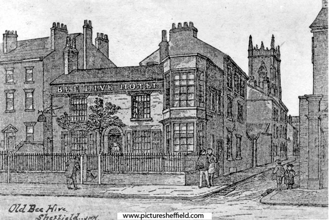
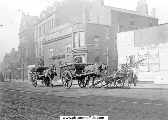
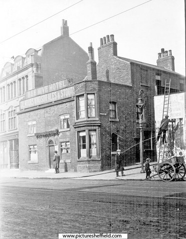
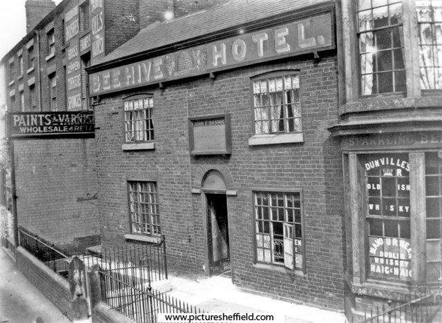
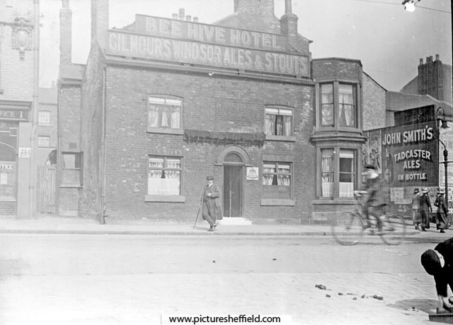
Artists Impression of the Bee Hive Hotel, No 240, West Street. Portland Lane, right. St. George's Church in background. The railings were there 1870-1880.s06859 Extract from: Reminiscences of old Sheffield, it's Street and its People. Editor Robert Eadon Leader, from articles and letters in The Sheffield and Rotherham Independent 1872/3. Page 155. "I well remember the time when the house, now enlarged and occupied as the Bee Hive public-house, was built in the cross garden walk (now Glossop Road) just mentioned, which terminated at the top of Broomhall Street. (then called Black Lamb Lane) It was erected by a shoemaker, named Thomas Rose. He was a little man, wore top boots, and kept a hive of bees in the garden beside the house. He got a license for the house and called it the Bee Hive. His pear tree (in the sketch) on the front yet retains enough vitality to show yearly a few leaves. With the exception of the old houses with gardens and palisades at the top of West Street, and the large house in Broomhall Street, beside which until lately the rooks have built, there were, I believe, no houses (except some garden cottages) from Portobello down to Holy Green, and the top of Bright, Gaol, and Young Streets. All the intervening space was occupied with fields and gardens." It was in 1817 that the Town Trustees agreed to lend towards the making of a Turnpike Road from Glossop to Sheffield providing the said road enters the town through West Street. and as the Beehive was earlier than Glossop Road we can fix the date of its erection somewhere in the opening years of the nineteenth century. s00470 Photographer: B E Drury There was also stabling to the rear. Photographs by C H. Lea of the Bee Hive Hotel in 1913.y01684 Night soil carts passing the Beehve Hotel, Portland Lane, right. Night Soil Carts collected the human waste from the Earth Closets, Water Closets (WC's) gradually replaced them. y01682 A Bill Poster on West Street at the junction with Portland Lane; balancing on his ladder across from the Beehive Hotel. y01683 Ordnance Survey Map, sheet no. Yorkshire No. 294.7.25. 1889. Bee Hive Hotel top left. https://www.picturesheffield.com/frontend.php?keywords=Ref_No_increment;EQUALS;q00075&pos=7&action=zoom&id=107161 Bee Hive Hotel, 10th February 1982. https://www.picturesheffield.com/frontend.php?keywords=Ref_No_increment;EQUALS;s21408&pos=3&action=zoom&id=24014 In the 1990s, The Bee Hive was extended and renamed the Foundry and Firkin. No 248, West Street Post Office, (later incorporated into the Foundry and Firkin) https://www.picturesheffield.com/frontend.php?keywords=Ref_No_increment;EQUALS;t09986&pos=3&action=zoom&id=90513
-
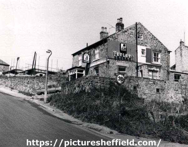
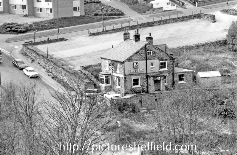
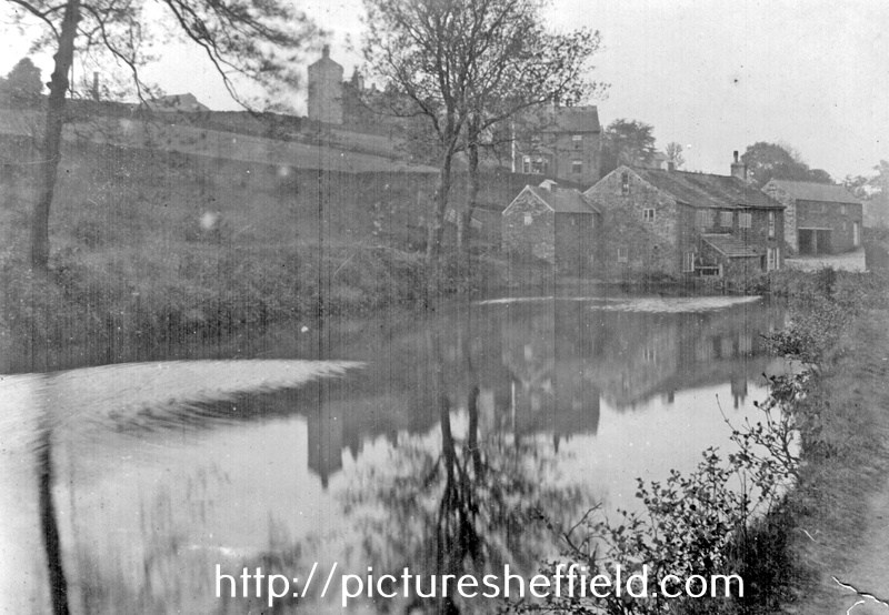
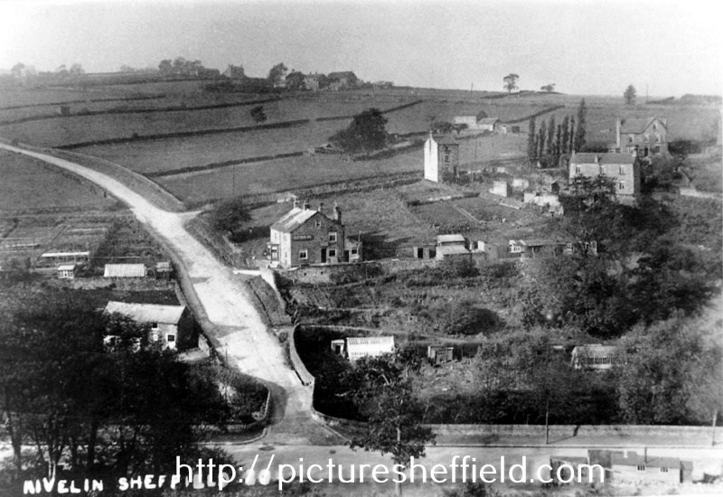
Holly Bush Inn, Hollins Lane, Stannington. 1973.u11810 Elevated view of Rivelin Valley Road (bottom) and Hollins Lane at Hollins Bridge, River Rivelin with Hollins Bridge Corn Mill (Riverlin Bridge Wheel) left; Holly Bush Inn (centre) and Hollins Farm (left) u05747 Holly Bush Inn, Hollins Lane, viewed from Walker Lane. 19th April 1978.s21806 Rivelin near Woodend View, Hollins Bridge Corn Mill, (known earlier as Rivelin Bridge Mill, prior to conversion to corn mill) and Dam, Holly Bush Inn, Holly Lane, behind Mill, Hollins Farm (side view) in background. u01693 Map of the Rivelin Valley Estate. https://www.picturesheffield.com/frontend.php?keywords=Ref_No_increment;EQUALS;y10390&pos=8&action=zoom&id=66881 Taken from a Report of Special Conference regarding the Development of the Rivelin Valley, Sheffield City Council, Sep 1934. Rivelin Mill, Rivelin Valley Road, Rivelin Hotel, St Michael's RC Cemetery, The Hagg, Roscoe Wheel, Hollins Bridge Mill, Holly Bush Inn, Walkley Bank Tilt, Walkley Bank Plantation, Mousehole Forge, Holme Head Wheel. E Partington, Estates Surveyor. Geography, photograph every grid square. The Holly Bush SK3288. https://www.geograph.org.uk/photo/1701642 Star Pubs & Bars, Holly Bush, includes photographs of the interior. https://www.starpubs.co.uk/pubs/holly-bush-sheffield
-
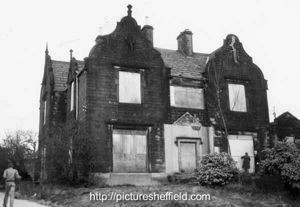
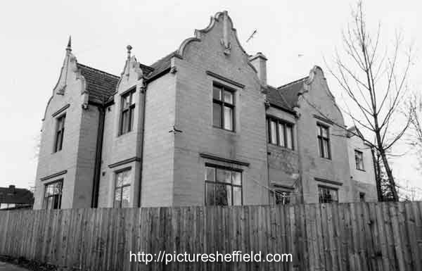
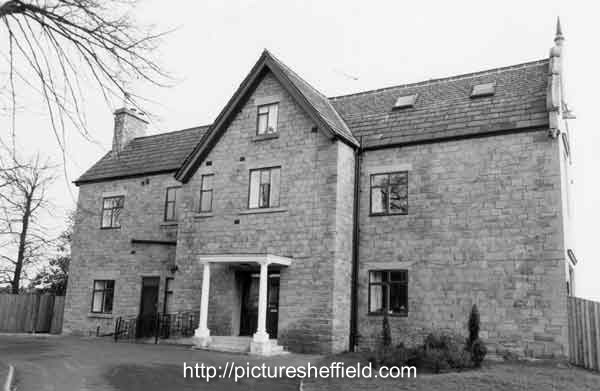
Norwood Grange, junction of Longley Lane, Herries Road and Norwood Grange Drive. 15th March 1983 s38698 December 1988.s38697 December 1988s38696 Norwood Grange now a Care Home. https://www.norwoodgrange.co.uk/
-
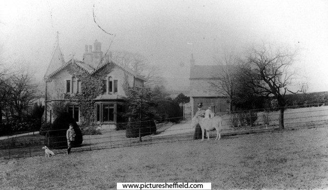
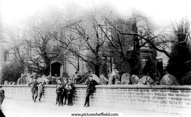
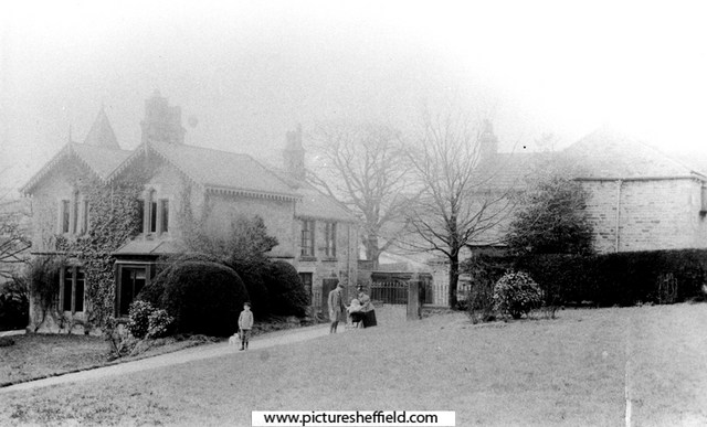
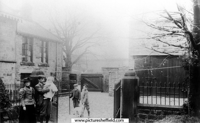
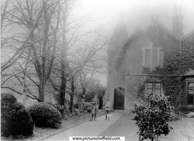
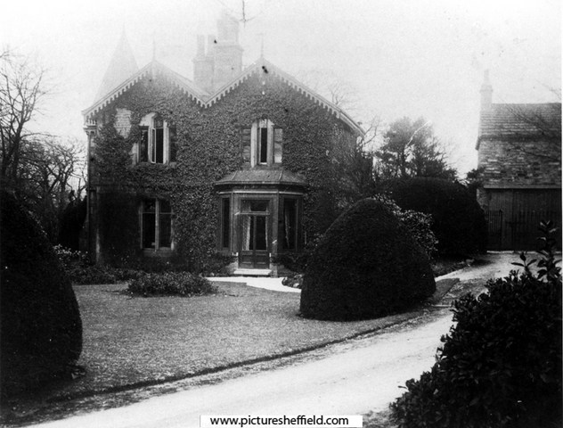
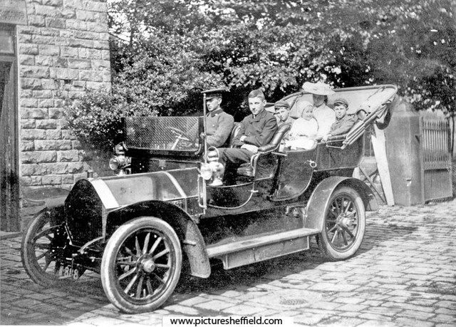
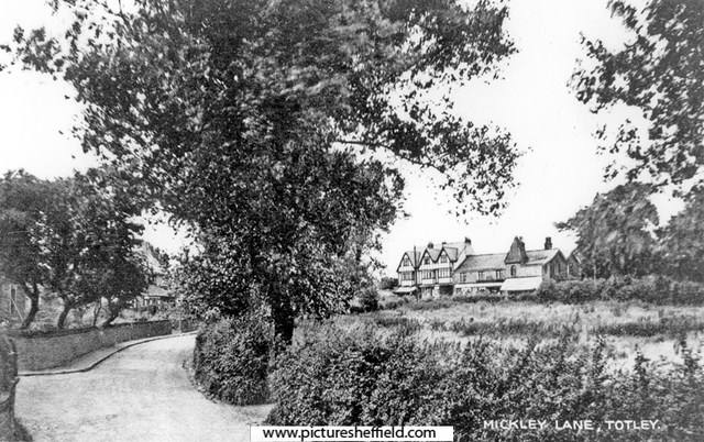
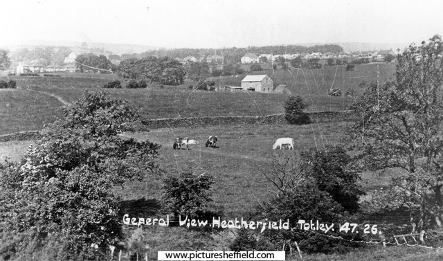
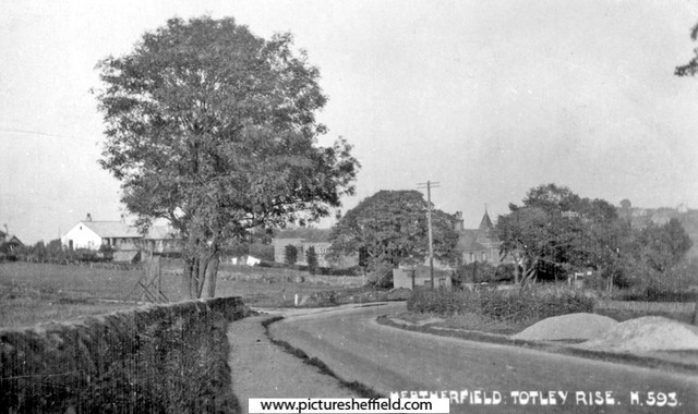
Greenoak House, Baslow Road, Totley At the time of the photographs (about 1900), rented from Ebenezer Hall of Abbeydale Park, by Athol Capron and family. The house was formerly a Farm and Greenoak Inn. Converted and extended into a family residence in the late c19th. See 'Totley District in Old Photographs', by Brian Edwards, Cat. No. 942.74 S. Mickley Lane, Totley, with a view of the buildings on Baslow Road including Greenoak House (the former Greenoak Inn). The smaller part in the middle was the original Greenoak Inn, built 1812. The extension on the right was added much later when it became Greenoak House. The part on the left was added early 1900's. s11439 The family of Athol Capron (consisting of his wife, 4 children and donkey) moved into Greenoak House in 1899, paying £90 p.a. rent to Ebenezer Hall of Abbeydale Park. Greenoak House from Baslow Road. s06092 Family of Athol Capron in Humber car at Greenoak House, Maurice (front seat), John (behind), Clare (on lap) and Gérard. 1906. s09007 From Donkey Field. Mrs. Capron and Maurice.s06089 Greenoak House from Baslow Road. A. C. Capron, Maurice (son) and Roy (dog) with village boys.s06087 Mr and Mrs Athol Capron with children, Maurice (with Roy the dog) and either John or Gerard in pram. s06088 In the yard, Greenoak House, Mr and Mrs Athol Capron with children- Gerard? in Father's arms. Maurice with the garden boy and Roy the dog.s06090 Mr Athol Capron, Maurice (son) and Roy the dog. 1906.s06091 General View of Greenoak and Heatherfield, Totley, leading to Main Avenue, before houses were built.s11438 Early construction of Heatherfield Estate, Baslow Road, Totley Rise. The Crescent, left. Greenoak Toll House is behind the telegraph pole. y01872 Photographer: R Sneath
-
Ivy Cottage/former Catch Bar Cottage, Barnsley Road
Ponytail posted a topic in Sheffield History Chat
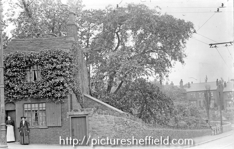
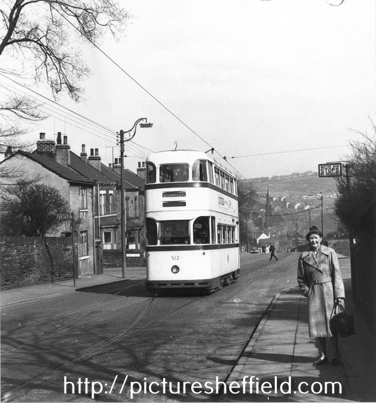
Ivy Cottage, Osgathorpe, corner of Barnsley Road and Batley Street with houses on Crabtree Lane in the background. 1905. s13399 u10512 Photographer: J.E.Vickers Former Pitsmoor Side-Bar or Catch-Bar. Ivy Cottage was built to catch Wayfarers travelling up Barnsley Road, who'd by-passed Pitsmoor Toll Bar by turning up Osgathorpe Road. Hence the phrase Catch-Bar as they 'had' to pay here. Tram No. 512, Barnsley Road looking towards Fir Vale, showing No. 307 Ivy Cottage, former Pitsmoor Side-Bar or Catch-Bar at the from the junction with Batley Street (left) and the junction with Osgathorpe Road (right). April 1960.s25156 Photographer: Mr. D.J. Smithies.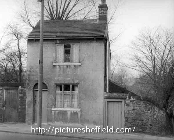
-
Link to: Little Man's Museum /Grapes Inn, Furnace Lane. https://www.sheffieldhistory.co.uk/forums/topic/12408-little-mans-museum-grapes-inn-furnace-ln/
-
Snippets of information about Furnace Hill from an extract of: Reminiscences of old Sheffield, it's Street and its People. From letters Editor Robert Eadon Leader, from articles and letters in The Sheffield and Rotherham Independent 1872/3. Pages 129-131. Twiss: There is a curious story told of the manner in which the further part of Westbar was raised to its present level. At one time, it is said, that portion between Westbar Green and Gibraltar Street was so low, that a person standing at the bottom of Furnace Hill might with ease have leapt upon a load of hay passing down the street. There was then a converting furnace at the bottom of the hill, which was worked with only one box or pot. By some mismanagement the whole mass of iron was melted together in one huge solid block of steel, there being in the furnace at the time some ten tons of metal. Nothing could be done with this when it was cold, and after it had lain in the yard a great number of years, proceedings began to be taken for filling up the road below. The best employment that could be thought of for the mass of steel, was to let it go towards filling up the road. The tradition has been handed down by very old men, and if there be any truth in it the steel is still there, waiting to astonish some antiquaries of the future. Wragg: The Bower Spring troughs were reputed to contain the best drinking water in the town. It came from Furnace Hill, as was proved when Messrs. Hudson & Clarke erected their engine. That stopped the water, and Messrs. Gaunt & Turton's works were then built where the troughs had been. Johnson: It was Mr. Turton who built the Bower Spring works in the old Workhouse gardens, leaving Mr. Gaunt on Furnace Hill. This would be between the years 1825-8. The history of Mr. Gaunt 's business is worth tracing. It was sold to Richard Griffiths, who, having come to the town from his native Wales as a carter to Brittain and Wilkinson's, of Carver Street, got initiated into the mysteries of steel converting, and ultimately became manager at Sanderson's. His son, for whom the business was intended, died; his son-in-law let it slip, and it was sold to Thomas Gatley, the son of a gardener at Attercliffe who had kept one of the stalls on the King Street side of the market. Young Gatley was himself apprenticed to Isaac Deakin, penblade maker (son-in-law of George Merrill, fork maker, Harvest Lane), and afterwards had a scrap shop in Gibraltar Street, near "The Cherry Tree." Then he was at the bottom of Furnace Hill, late Mr. Joshua Wortley's. Having acquired money, he bought Gaunt's business, and subsequently sold it to Mr. Wm. Jackson, Sheaf Island Works. He acquired much of the property about here. Like so many other worthies whom we have had to notice, Mr. Gatley was connected with Queen Street Chapel — until 1834, when he seceded and was the means of establishing Mount Zion Chapel, the congregation of which met in a room over a shop in Carver Lane while the chapel was building. Leighton: Furnace Hill was formerly called "t' Cock Tail;" I haven't the remotest notion why. "The Cock Tail Lady" was celebrated by Mather; and "Buck Hathard," the son of a tailor, was also one of the "characters" it produced. Mr. Peech, a scissor manufacturer here, was the father-in law of Henry Steel, who has made himself a name among the frequenters of the turf, and "t' Cocktail" had the honour of contributing a soldier to the Life Guards in the person of Samuel Wragg, who, and his son as well, was a cutler here. Wragg: The Quaker family, the Broadheads, have been associated with Westbar and the neighbourhood throughout the present century. Mr. John Broadhead, then a maltster, was in Scotland Street, next door to the chapel. Then he came to the bottom of Furnace Hill, subsequently crossing to the other side of Westbar, where the grocer's shop has been ever since. Mr. John Broadhead died in 1838. It is a little singular that not only did his son Alfred succeed to his own grocery business, but that four of his five daughters married grocers. Johnson: Two trade notes may be made here. One is that "frame polishing" may be said to have had its birth in Furnace Hill — that is polishing spring knives without the aid of steam or water power. It was originated by l Mark Blackwell (landlord of "The Grapes") and his brother George, by way of resisting a strike of the grinders. And it succeeded too. The other is that the first nail cut in Sheffield is said to have been made down the yard by the "Dog and Partridge the old public-house almost opposite to the bottom of the hill. Wragg: The Andrew family is closely identified with this locality. Old Joseph Andrew was a prosperous grocer and tallow chandler in Furnace Hill before this century began. Three of his sons, Isaac, Matthew and Joseph, were grocers, the first-named in West bar at the corner of Hicks Lane, the second in Charles Street, and the third, first (1825) in Paradise Square and afterwards (1833) in West Bar Green. Two other sons, twins, were William Henry and Albert George. They succeeded to the business of Messrs. George Butler and Co., spring knife cutlers, in Trinity Street, which was afterwards removed to Trinity Works, Eyre Street, the old premises becoming Mr. Longden's foundry. Isaac Andrew was, in his later years, blind. His brother Joseph was the father of John Henry Andrew, steel manufacturer, a member of the present Corporation, and of Mrs. Crowther, Fargate. The Butlers employed a larger number of men than any other house in the trade when the "statements" of 1810 and 1814 were made.
-
Dixon Lane, bridge over the river.
Ponytail replied to Roger Stevenson's topic in Sheffield History Chat
The Canal Basin measured for the Duke of Norfolk, with the line of Exchange Street plotted, [1817] https://www.picturesheffield.com/frontend.php?keywords=Ref_No_increment;EQUALS;arc04186&pos=50&action=zoom&id=104945 Marked: The Wicker, Blonk Street, Ladys Bridge, weir, River Dun [River Don], intended bridge [Blonk Bridge], Wain Gate, Town Hall, Castle Hill, Castle Street, Castle Folds, Hay Market, Tontine [Tontine Inn], Dixon Lane, Sheaf Bridge, River Sheaf [intended bridge], Broad Steet, hospitals and chapel [Shrewsbury Hospital], shuttle, warehouses, [canal] Basin, Soap House. Plan of Sheffield Castle about 1700 (1706?) drawn in the 1930s https://www.picturesheffield.com/frontend.php?keywords=Ref_No_increment;EQUALS;y09509&pos=56&action=zoom&id=64229 A plan of the House, Croft, etc. near the Hospitals held under the Duke of Norfolk by George Crook, containing in all 3a [acres], 3r [rods], 3p [perches] 1769. https://www.picturesheffield.com/frontend.php?keywords=Ref_No_increment;EQUALS;arc03384&pos=61&action=zoom&id=98620 Land between Broad Street, the River Sheaf and South Street. Crookes [Crook's] Croft, on the west bank of the Sheaf, south of the Shrewsbury Hospital; new Coal Road marked, with acreage taken for it; buildings, summer house and well; acreage of the whole. Coloured, on parchment. (Sheaf Lane, Sheaf Street, Granville Hill, South Street, Shrewsbury Hospital) -
Dixon Lane, bridge over the river.
Ponytail replied to Roger Stevenson's topic in Sheffield History Chat
Property on the corner of Castle Folds and Broad Street, on the bank of the River Sheaf, [1821-1827] https://www.picturesheffield.com/frontend.php?keywords=Ref_No_increment;EQUALS;arc03421&pos=3&action=zoom&id=98685 The site of Castlefolds Market. Shows Dixon Lane & Hospital Bridge. Needs a bit of manipulation to view. Scanned upside down. Plan of the property on the west bank of the River Sheaf, between the Hospital bridge and the bridge leading to the Canal basin [Exchange Street], [c. 1817-1821] https://www.picturesheffield.com/frontend.php?keywords=Ref_No_increment;EQUALS;arc03420&pos=2&action=zoom&id=98683 Premises numbered and listed with tenants and yardages. Tontine Inn. (site of Castlefolds Market). Dixon Lane. -
Dixon Lane, bridge over the river.
Ponytail replied to Roger Stevenson's topic in Sheffield History Chat
The Canal Basin measured for the Duke of Norfolk, with the line of Exchange Street plotted, [1817] https://www.picturesheffield.com/frontend.php?keywords=Ref_No_increment;EQUALS;arc04186&pos=5&action=zoom&id=104945 Marked: The Wicker, Blonk Street, Ladys Bridge, weir, River Dun [River Don], intended bridge [Blonk Bridge], Wain Gate, Town Hall, Castle Hill, Castle Street, Castle Folds, Hay Market, Tontine [Tontine Inn], Dixon Lane, Sheaf Bridge, River Sheaf [intended bridge], Broad Steet, hospitals and chapel [Shrewsbury Hospital], shuttle, warehouses, [canal] Basin, Soap House. -

Dixon Lane, bridge over the river.
SteveHB replied to Roger Stevenson's topic in Sheffield History Chat
Pond Hill (Dyer's Hill), and Harmer Lane, Bedford Dam (south), Ponds Dam (north). c.1853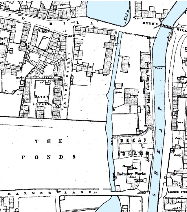
-
Dixon Lane, bridge over the river.
Ponytail replied to Roger Stevenson's topic in Sheffield History Chat
Plan of part of the town of Sheffield, comprising the site of the present and proposed corn, hay and cattle markets, also various improvements connected with the latter. 1827. https://www.picturesheffield.com/frontend.php?keywords=Ref_No_increment;EQUALS;arc04183&pos=13&action=zoom&id=104936 With illustrations of proposed Corn Exchange, elevation of the houses fronting the new Hay Market, and an elevation of the bridge over the Dun [Don]. Reference a - proposed corn exchange and office, b - erections on each side of Corn Exchange, c - weighing machine, d - row of shops. Inns in the immediate vicinity of the present Hay and Corn Markets 1 George, 2 King’s Head, 3 Angel, 4 Commercial, 5 Yellow Lion, 6 Tontine, 7 Healeys Hotel. The sites of the present Hay, Corn and Cattle markets are coloured red, and proposed are coloured blue. Other improvements are shown in yellow. Marked are: Market Place, Angel Street, Angel Inn, old corn market, King Street, post office, Change Alley, Kings Head, Fruit Market, Market Street, Norfolk Street, John Street, Commercial Inn, Hay Market, Yellow Lion, Pond Lane, Shude Hill, Fish Market, Dixon Lane, Tontine Inn, Castle Folds, Castle Hill, Healeys Hotel, Sheaf Bridge, River Sheaf, canal bridge, proposed Hay market, proposed Corn Market, Broad Street, Canal Basin, Canal Warehouse, market for fat cattle, lean cattle and milch cows, pig market, sheep market, River Dun [River Don], Willey Street, Blonck Street, Wicker, Cattle Market, Ladys Bridge, Bridge Street, Wain Gate, Town Hall, Killing Shambles and Castle Street. Plan of part of the town of Sheffield showing the existing markets, the property of His Grace the Duke of Norfolk, and the projected improvements. 1847. https://www.picturesheffield.com/frontend.php?keywords=Ref_No_increment;EQUALS;arc04187&pos=14&action=zoom&id=104946 Marked: Change Alley, Norfolk Street, Bakers Hill, Pond Lane, Market Street, Shude Hill, present Shambles, King Street, Old Hay Market, Angel Street, Post Office, Castle Street, Snig Hill, Town Hall, Waingate, Killing Shambles, Castle Hill, Castle Folds, Dixon Lane, proposed market [Norfolk Market Hall], River Sheaf, new market ground, fountain, Corn Market, Broad Street, Hay Market, Exchange Street, canal warehouse, Canal Wharf, Canal Basin, Blast Furnace Road, Sheaf Works, Wharf Street, Effingham Street, Maltravers Street, fair ground [fairground], cattle market, River Don, reservoir, Willey Street, Blonk Street, Wicker, Nursery Street, Wicker Lane, Stanley Street, Stanley Lane, Andrew Street, Johnson Street, Walker Street, Manchester Sheffield and Lincolnshire Railway, Midland Railway Station [Wicker Railway Station] and railway station [Bridgehouses Station]. -
Dixon Lane, bridge over the river.
Ponytail replied to Roger Stevenson's topic in Sheffield History Chat
This Map shows Dixon Lane and the "Bridge" known as Hospital Bridge and the confluence of the Rivers Sheaf & Don. A map of the dams, goights and other works belonging to the Pond Forge Co together with some other intermediate properties. 1820. https://www.picturesheffield.com/frontend.php?keywords=Ref_No_increment;EQUALS;arc04213&pos=15&action=zoom&id=105197 Boardman's Bridge, wear [weir], Porter Brook, goight, River Sheaf, Upper Dam, Sheaf Lane, bridge, Upper Forge Wheel, dam, Upper Forge, Sheaf Mill, steam engine, Lower Forge, grinding wheel, arched goight, tail goight, Shude Hill, Hospital Bridge, hospitals, Sheaf Bridge, Castle Orchards Wear [weir], River Dun [River Don], Pond Street, Forge Lane, Pond Well Hill. Late Joseph Ward, John Hounsfield, Josiah Blackwell, late Abraham Wright, S. Woodcock and Sons, Joseph Blackburn, Thomas Mearbeck and Co., S. Rawson and Co. [?Thomas Rawson and Co], Joseph Shimmeld, John Vickers, Sheffield Gas Light Co., S. and S. Darwin, Sarah Beeley, Widow Beardsall, John Hale, Widow Badger, and J. B. Ward. -
When was the course of the river in the Ponds and the Dixon Lane area covered over ? I'm talking about the stretch from Pond Hill to the junction of the River Don When open to view, were any photos taken ? Remains of the bridge over the river at the bottom of Dixon Lane were discovered when the new building at that location was being constructed. Time wasn't allowed by contractors for a detailed examination, what a shame !
-
Thomas Otley & Sons, a Chinaman and Teapot.
Ponytail replied to Kalfred's topic in Made In Sheffield
Looking towards Howard Street and Eyre Lane from Howard Street (Dinner Hour) Club for Working Women and Girls (left), former premises of Thomas Otley and Sons, Britannia Metal Manufacturers, left. 1963. s15501 Photographer: P Fletcher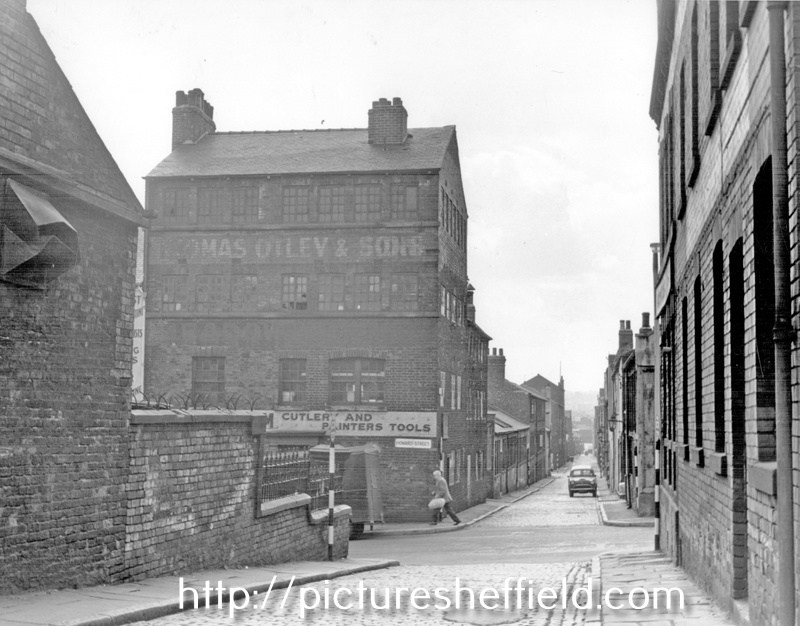
-
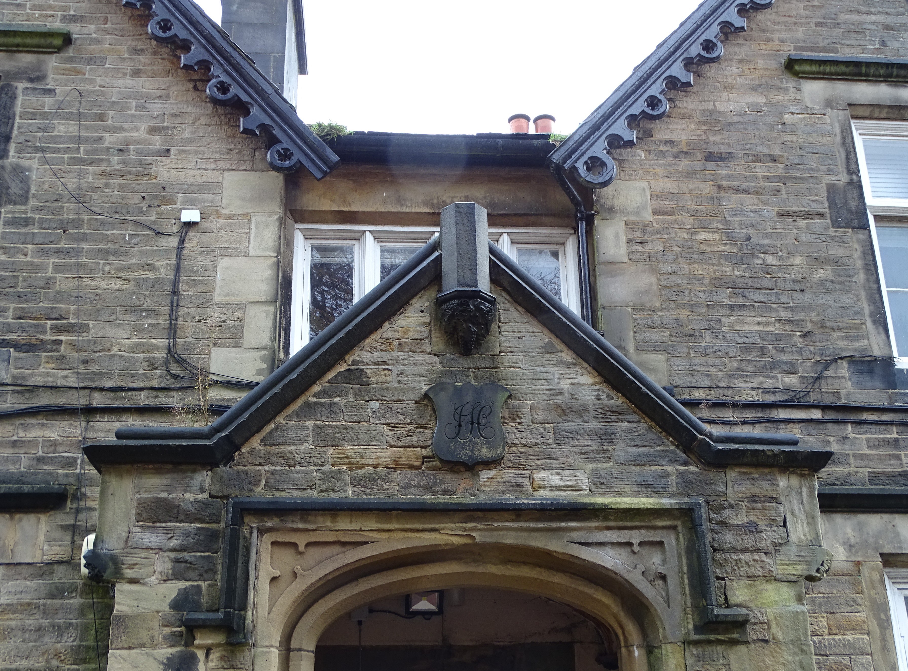
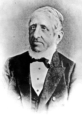
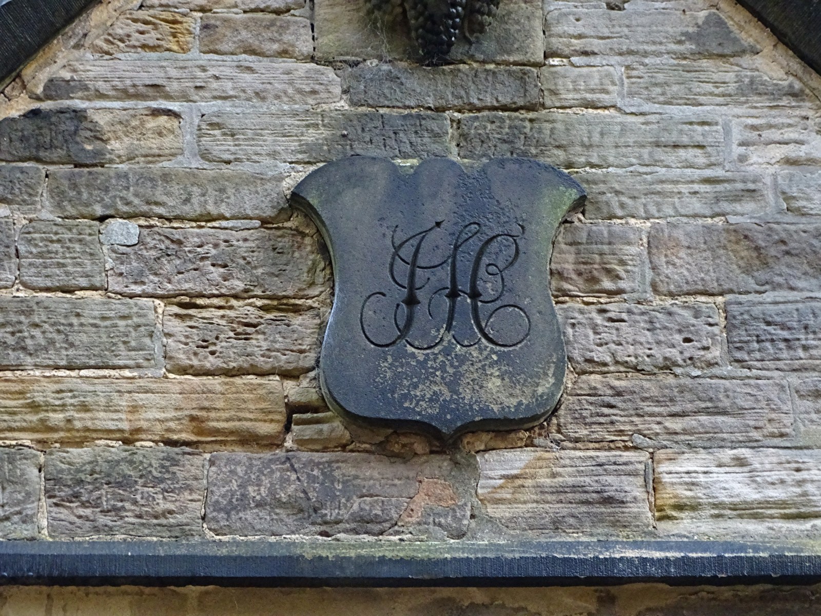
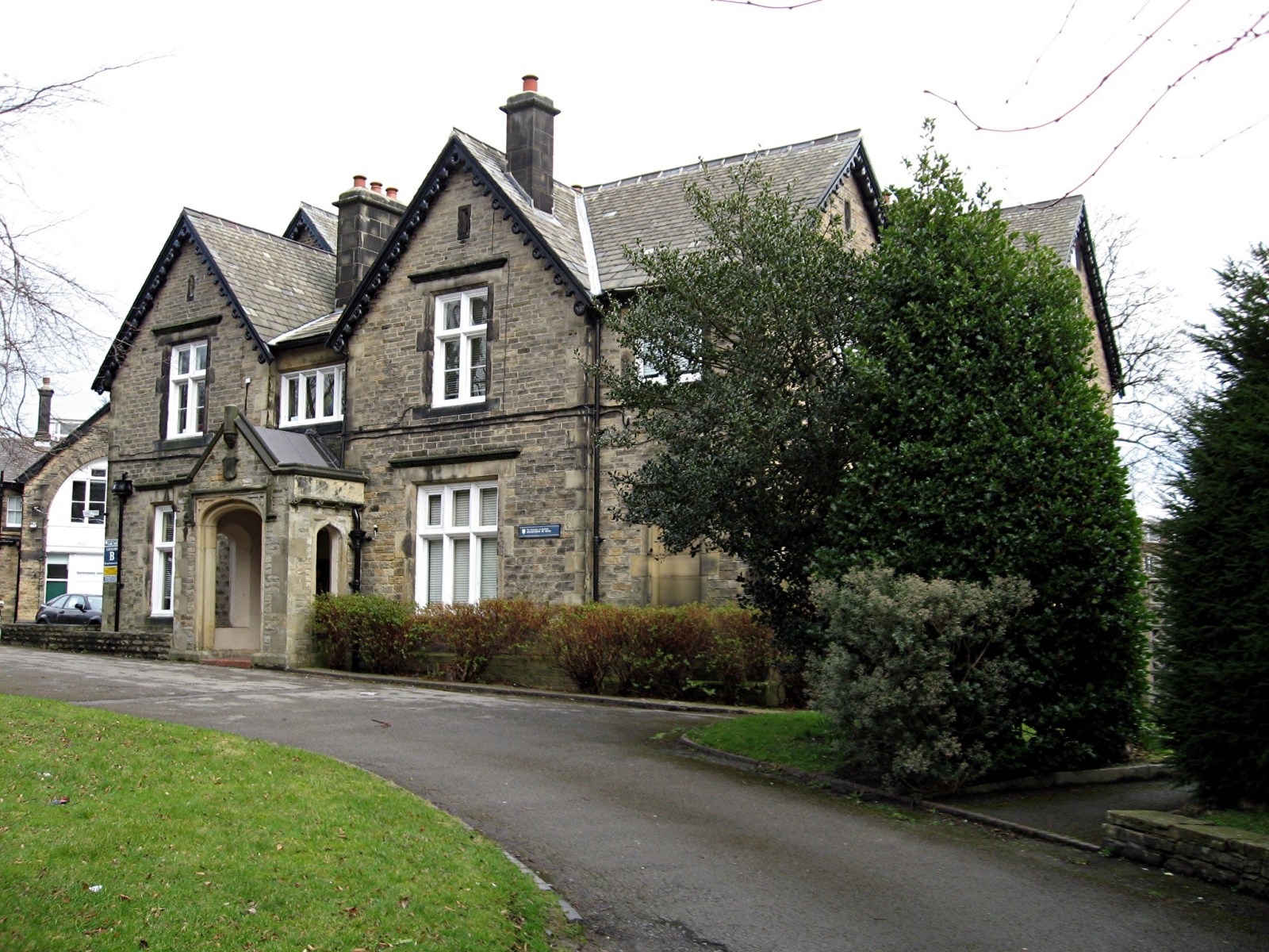
Mr John Hobson Scissor Manufacturer 38 Taptonville Road The finely worked initials of J H can be seen over the entrance to what was John Hobson’s front door at 38 Taptonville Road, the following pre-amble is from the great work done by the Broomhill Social History Group. In 1850 Sheffield was entering a period of major expansion and Broomhill was a favoured location for the homes of successful manufacturers and professional classes. In the 18th century the fields now occupied by Taptonville Rd were owned by Samuel Shore Esq., a local gentleman who lived in Tapton Grove, situated on Shore Lane where Tapton Hall (the Masonic Hall) now stands. A comparison of the 1851 map of the area with the present day illustrates how the pattern of the modern streets closely follows the pre-development field boundaries and lanes. Typically, the streets run through the centres of the original fields and the field boundaries are along the back garden walls of the houses. In 1850, Scissor manufacturer John Hobson purchased the fields that would become Taptonville Road and planned the development of the road, placing his own family home, Tapton Elms, in prime position on the highest ground at the head of the road. The gentility of the neighbourhood was assured by laying out the street with sizeable plots that were developed during the 1850s and 1860s with large, elegant houses of individual design standing in spacious gardens. Many of the successful industrialists in Sheffield were investing in property during this period. • No.1: was built in 1853 by Joseph Wright Bishop, one of a pair with 246 Fulwood Rd. • No’s 2, 4 and 6 were all built in 1855 by Robert Booth (originally a tailor, then property developer). • No’s 3, 5 and 7: were built in 1852 by William Greenwood, (property investor), who lived for a time in no.3 and then later in no. 5. • No.8 Built in 1861 by Charles Fleming (an engraver) as his own family home • No.10 Built in 1870 by J F Littlewood (a cooper) as his own family home • No’s 9 to 19: Built 1852 by George Deakin (originally a silversmith, then property developer) who lived for a while in no.17. The Hobson’s originated from Bradfield, the founder of the scissor empire, Joseph married a certain Miss Hinchcliffe who’s father was already making a good living producing scissors, Joseph Hobson is listed in the 1787 directory of the town, he was still in Bradfield at that time along with his son George, sometime before 1825 he had moved to Sheffield as he’s listed as a fine scissor maker, producing scissors from his works at 8 New Church Street, the yard where he made is scissors was named Hobson’s Yard after him, this street along with the yard was demolished and the present town hall was built over it, Josephs house was at 3 Surrey Street, it’s a strong possibility that he had access to the rear of his works from the rear of his house, by 1845, Joseph died on the 14th of September 1847 aged 75, the production was moved to 71 Arundel Street, his son John also moved house to 18 Surrey Street. I don’t know the circumstances but in 1879 John is working at 95 Arundel Street which probably stood near to where the Cossack stood, his old premises at 71 Arundel Street became the Talbot public house, which was run by two women, Miss Mary Norris and Miss Agnes Parsons in 1878ish. John Hobson’s family house was started in 1851 and completed in 1853. The gardens of Tapton Elms dominate the vistas north and south along Taptonville road. The ornamental garden to the south of the house’s principal façade has been lost under the two L-shaped disused student residence blocks now standing within this area. Further south, the half-acre walled kitchen garden of Tapton Elms has a highly decorative entrance gateway facing the street; all four boundary walls and gateways of this garden are still intact. Tapton Elms was the home for more than 70 years of the Hobson family. They were an old Sheffield family with a long history in the scissor manufacturing industry dating back to the 17th century .The Hobson’s’ business enterprises linked them to several of Sheffield’s best-known companies through a series of alliances and mergers, as well as trading under their own name for many years. For nearly half a century John Hobson drove the family business, it was known for its fine tailors shears and scissors, in the census of 1871 the firm employed 120 people half of which were women. John the driving force of the firm retired in 1882 and he died unexpectedly at Tapton Elms on the 20th of February 1889, after visiting his friend Frederick Mappin ( Mappin & Webb / Mappin's Brewery) at Thornbury, now Thornbury Hospital, as Tony Morton now knows after brilliant surgery there. The business was passed on to one of his sons, Albert, when John retired, who was just 21, this young man was severely crippled and could not walk without two strong walking sticks, when his father died he sold the business and order book to Joseph Rodgers, Albert along with his brother Wilfred joined the board of directors. Albert suffered great loss in the WW I his two sons, Leslie aged 19 was killed on 12th of July 1915 and his other son Alan lost his life on 28th of August 1916 age 23, for what? Tapton Elms is now being turned into flats by the look of it a sad end to a great house. I must point out that the history of Hobson & Son was gleaned from Geoff Tweeddale’s Directory of Sheffield Cutlery Manufacturers , thanks Geoff.

-
The Pheasant Inn (Beerhouse) / Stumble Inn
Ponytail replied to dunsbyowl1867's topic in Sheffield Pubs and WMC's
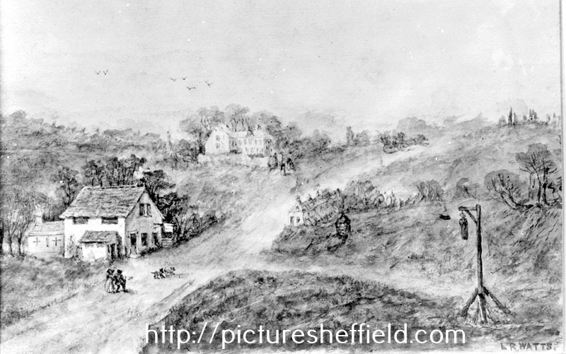
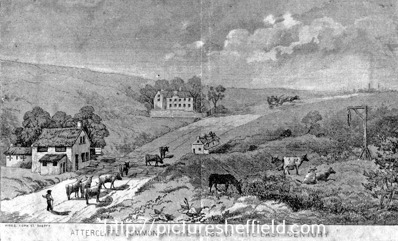
Artists impression of Attercliffe Common at the close of the 18th Century, near Greenland Engine Road (now Broughton Lane), buildings shown are the Arrow Inn, now pulled down, the Pheasant Inn and Carbrook Hall and gibbet post of Spence Broughton. t00983 Hides, engraver. On February 9, 1791 Spence Broughton along with John Oxley robbed the Sheffield to Rotherham postboy and stole the postbag containing a Bill of Exchange payable to Joseph Walker of Rotherham. Broughton was executed at York Tyburn and gibbeted at the scene of his crime where his remains hung for 36 years. Another Artists impression of Attercliffe Common at the close of the 18th Century. s13124 Engraver, Hides.