
Search the Community
Showing results for 'coal pit lane'.
-

Sheffield Water Works Company conduit remains
Ponytail replied to Calvin72's topic in Sheffield History Chat
Plan of an Estate near Fulwood. 1868. Architects: Fowler and Son, Sheffield. Pawson and Brailsford, Lithographers, Sheffield. https://www.picturesheffield.com/frontend.php?keywords=Ref_No_increment;EQUALS;y11281&pos=49&action=zoom&id=104296 Shows Brown Hills Lane; also Sheffield Water Works conduit from Redmires to Sheffield. (at the top of the map) Owners / tenants: John Sheldon, esquire, Joseph Green and Sprotley School, Stephen Fox, Samuel Shore, esq., John Broomhead, The Duke of Norfolk, and William Waterfall, esq. Original at Sheffield Local Studies Library: Sale Plans 4 August 1868. -
Plan of several Estates the property of [William - changed to James] Boothby situate at West Grove near Sheffield, 1828. https://www.picturesheffield.com/frontend.php?keywords=Ref_No_increment;EQUALS;arc04200&pos=12&action=zoom&id=105084 Marked: Birley's Charity Land, Turnpike Road from Barnsley to Sheffield [Pitsmoor Road], Harvest Lane, proposed streets; land [belonging to George Bustard Greaves Esquire, Mr Duke’s property, Jonathan Marshall, Esquire; Mr Harmer, Thomas Naylor, Pie Bank [Pye Bank], pleasure ground, farm yard, Middle Field Garden, Far Field, gardens occupied by Mr Needham, Lingard, Hewitt, Rawson, Richardson and Wostenhome, Robinson, Kent, Bingley, Twigg, and Kitchen.
-
Booth & Co., Park Iron Works, Brightside Forge & Royds Mill.
Ponytail posted a topic in Made In Sheffield
History of Booth & Co. https://www.gracesguide.co.uk/Booth_and_Co#General A Map of the Lands and Works in the north park of Sheffield Park. 1788. https://www.picturesheffield.com/frontend.php?keywords=Ref_No_increment;EQUALS;y09966&pos=2&action=zoom&id=65481 Amongst others named: John Booth & Co. 19. Little Bank with House. 21.The Meadow. 22 & 20. Furnace Foundry and other Works. Road to the from Attercliffe Bridge, Dam and other Watercourses, Banks above the Dam and by the River. (Property near to Royds Mill Weir) Also Marked: River Sheaf; Hospital Grounds; Land held by Wm. Shipley; Road to the Farms in the Park, Cricket Inn Road; Castle Orchards; wear (weir); River Dun (Don); Simon Wheel Upper Dam; Simon Wheel Lower Dam; Simon Wheel; Walk Mill Wear (Weir); Royds Mill Wear (Weir); Furnace Dams; Dewee Close; Other Tenants: Thomas Taylor; Isaac Mower; Robert Rawson at Castle Orchards; Thomas Rodgers; Benjamin Blonk & Co. at Simon Wheel; John Woollas; John Froggatt; Benjamin Taylor; Samuel Revil; Hannah Hodgkinson; William Shipley; James Furniss; William Lord; R. Magnall and Ric'd Falkner; John Barber; James Kaye; John Steer; William Smith; William Kent & John Jowel. (Top of left of Map think it says) "Pencil? Numbers? Harrison Survey 1639. Also (parts listed) Surveyed W Fairbank 1789. A Plan of the Forges Tenements and works Brightside held of the Duke of Norfolk by John Booth and Co, drawn 1790, updated c.1810. (dated 2nd September 1811) https://www.picturesheffield.com/frontend.php?keywords=Ref_No_increment;EQUALS;arc01852&pos=1&action=zoom&id=18564 "The Fall from the top of Brightside Forge Wear (Weir) to the top of Brightside Paper Mill Wear to the middle of the wear at (a) is 8ft 7 1/2. From (d) to the south end of the wear at (b) is 8ft 5 1/2." "Held by the first long lease along with the Goights and Dam marked *. No. 3 New Forge and Rolling Mill with the Ground. No. 4 Dwelling House and Garden. No. 5 Close or Croft. No. 6 Forge and other buildings Dam Gardens & Lane leading to the Forge." Coloured Green (gives measurements) "Held by the second long lease Coloured Yellow No. 2 Two Houses with Gardens and other Ground." "Held by Common Lease No.1 A Close called The Holme. No. 7 The Island." (gives measurements) "* From the Compting House corner to the Company's Hedge next Lucy Southerons is Four Feet. August 5th 1804." Marked: River Dun (Don); Brightside Forge Wear (Weir); Forge & etc (Brightside Forge); Garden; Charcoal Yard; Road to Sheffield; Brightside Green; Road to Tinsley and Rotherham; New Forge & Brightside Paper Mill Wear (Weir). Also named: Earl Fitzwilliam's Land; John Whetham Esq.; Duke of Norfolk and late John Hartops. A Plan of the Houses and Ground near Brightside demised to J. Booth and Co. 1789. (Between Weedon Street and the River Don.) https://www.picturesheffield.com/frontend.php?keywords=Ref_No_increment;EQUALS;arc02690&pos=2&action=zoom&id=91532 Marked: Lane from Carbrook to Brightside & The Dun (River Don). Other Tenants: William Binks, tenant; Close held by the Widow of John Hartop. House, Garden, etc proposed to be taken of the Duke of Norfolk for the term of 99 years by John Booth and Co. 1796. (Between modern Effingham Road and the Park Furnace Dam.) https://www.picturesheffield.com/frontend.php?keywords=Ref_No_increment;EQUALS;arc03392&pos=3&action=zoom&id=98631 Also marked: Furnace Dam & Road to the works of J. Booth & Co. Iron Works of William Booth & Co, https://www.picturesheffield.com/frontend.php?keywords=Ref_No_increment;EQUALS;arc03547&pos=1&action=zoom&id=98880 Heald (Held) by a Common Lease: Upper Meadow; Lower Meadow; Little Bank; Above the Dam including the road and road by the River; upper part of H. Hodgkinsons Close. Heald by the first long lease: Old Dam with the goight leading to it from the River. Heald by second long lease: New Reservoir Banks & Watercourses round it. Furnace and other Works & Ground about them. House & Garden. Booth & Co. Park Foundry: (Copy) Minutes of meeting of the partners (Sayle, Shore, Binks, Hartop and Booth). 6th Jan 1825. https://discovery.nationalarchives.gov.uk/details/r/39bd2d25-afae-4ae7-9af9-8a1f07e8159d -
S. Newbould’s premises on Little Sheffield Moor, and John Taylor’s house, 1787. https://www.picturesheffield.com/frontend.php?keywords=Ref_No_increment;EQUALS;arc03771&pos=28&action=zoom&id=99407 Land purchased of the Duke of Norfolk by Samuel Newbould and Thomas Holy at Little Sheffield. 1803. https://www.picturesheffield.com/frontend.php?keywords=Ref_No_increment;EQUALS;arc04083&pos=7&action=zoom&id=72460 Several fields between Broom Hall Lane and The Moor, across which Clarence Street was afterwards made. The line is indicated on this plan. Shows Broomhall Lane, Younge Street and Samuel Newbould’s property. William brother of Samuel Newbould. (Information from Grace's Guide, "The second son William (1749-1802) married Sarah, daughter of Thomas Holy, button manufacturer, and was in partnership with his father-in-law.") Ground on Little Sheffield Moor demised by the Marquis of Rockingham to T Holy and William Newbould, 1776. https://www.picturesheffield.com/frontend.php?keywords=Ref_No_increment;EQUALS;arc03770&pos=27&action=zoom&id=99406 House, workshops, erected on the leasehold ground of Thomas Holy and William Newbould, [The Moor], 1790. https://www.picturesheffield.com/frontend.php?keywords=Ref_No_increment;EQUALS;arc04259&pos=23&action=zoom&id=34922 Marked: William Newbould, T. Holy's house, warehouse, etc. (Information from Grace's Guide "The Newboulds were tilting at Loxley. Miller remarked: “Old Wheel Dam . . . would seem to have run both a tilt and a grinding wheel in the early part of the nineteenth century, when for seventy or eighty years, the property was owned by the Newboulds. Messrs. Samuel Newbould and Co. were tilters here for a considerable period but the Dentons leased the forge from somewhere about 1845 to 1885.”) Plan of an Estate situated at the Old Wheel in the Parish of Bradfield the property of S Newbould. 1820. https://www.picturesheffield.com/frontend.php?keywords=Ref_No_increment;EQUALS;y09601&pos=4&action=zoom&id=3529 Plan of land at Loxley intended to be sold to Samuel Newbould (part between Old Wheel Dam and Storrs Wheel), by W. and J. Fairbank. 1825. https://www.picturesheffield.com/frontend.php?keywords=Ref_No_increment;EQUALS;y09598&pos=6&action=zoom&id=44514
-
Maps of the Parish of Handsworth, based on the Enclosure Award Maps (1805) and corrected up to 1855.
Ponytail replied to Ponytail's topic in Sheffield Maps
Map of Woodhouse Junction area, c.1855. https://www.picturesheffield.com/frontend.php?keywords=Ref_No_increment;EQUALS;arc02940&pos=1&action=zoom&id=93148 Includes: Green Gate Lane; Birley Vale Branch Railway, Beighton Branch Railway, Manchester Sheffield and Lincolnshire Railway; River Rother; Woodhouse Colliery; Woodhouse Mills; Shirecliffe Brook; Cinderhill Green Road; Furnace Lane, Woodhouse Junction Station; Shaft. From a volume of Maps of the Parish of Handsworth, based on the Enclosure Award Maps (1805) and corrected up to 1855. Dimensions of original: 34 x 51cm. Original at Sheffield City Archives: CA369/1. -
Maps of the Parish of Handsworth, based on the Enclosure Award Maps (1805) and corrected up to 1855.
Ponytail replied to Ponytail's topic in Sheffield Maps
Map of Beighton Lane area, c.1855. https://www.picturesheffield.com/frontend.php?keywords=Ref_No_increment;EQUALS;arc02939&pos=2&action=zoom&id=93343 Includes: Birley Vale Branch Railway, Beighton Lane, Lamb Croft Lane, Quarry, Ochre Dyke, Cliff Bridge and Green Gate Lane. From a volume of Maps of the Parish of Handsworth, based on the Enclosure Award Maps (1805) and corrected up to 1855. Dimensions of original: 34 x 51cm. Original at Sheffield City Archives: CA369/1. -
Maps of the Parish of Handsworth, based on the Enclosure Award Maps (1805) and corrected up to 1855.
Ponytail replied to Ponytail's topic in Sheffield Maps
Map of Woodthorpe Common, c.1855 https://www.picturesheffield.com/frontend.php?keywords=Ref_No_increment;EQUALS;arc02932&pos=6&action=zoom&id=93431 Includes: Woodhouse Road, Richmond Road, Normanton Hill, Four Lane Ends, Birley Vale Branch Railway and Intake. From a volume of Maps of the Parish of Handsworth, based on the Enclosure Award Maps (1805) and corrected up to 1855. Shows: Coke Ovens. Dimensions of original: 34 x 51cm. Original at Sheffield City Archives: CA369/1. -
Maps of the Parish of Handsworth, based on the Enclosure Award Maps (1805) and corrected up to 1855.
Ponytail replied to Ponytail's topic in Sheffield Maps
Map of Richmond, Woodthorpe, etc. c.1855 https://www.picturesheffield.com/frontend.php?keywords=Ref_No_increment;EQUALS;arc02933&pos=7&action=zoom&id=93433 Includes Woodhouse Road, Richmond Road, Normanton Hill, Four Lane Ends, Birley Vale Branch Railway and Intake. From a volume of Maps of the Parish of Handsworth, based on the Enclosure Award Maps (1805) and corrected up to 1855. Shows: Coke Ovens. Dimensions of original: 34 x 51cm. Original at Sheffield City Archives: CA369/1. -
Dore Enclosure Map. 1822. https://www.picturesheffield.com/frontend.php?keywords=Ref_No_increment;EQUALS;arc07355&pos=15&action=zoom&id=106542 Marked: Manor of Hathersage, Burbage Brook, Burbage Rocks, Road from Buxton, Fox House, Buxton Turnpike Road [Hathersage Road], Road from Dronfield, Road from Stoney Middleton, Wooden Pole Road Stony Ridge Road], Dore Turnpike Road, Totley Moors, Dore, Chapel, Oxen Green, Road from Totley, Newfield Lane Road, Limb Gate [on Limb Lane], Standhills, Limb Dyke, Barber Fields, Spring, Ringing Low [Ringinglow], Site of Ringinglow Toll House and Norfolk Arms pub, Ringing Low Road [Long Line], Sparrowpit Gate Turnpike Road [Ringinglow Road], Ox Stones, Oxstone Dale Road, Parkinsons Spring, Red Car Road [Sheephill Road], Aqueduct, Sheep Hill Sping, Me and Jane [Meg and Jane?] Spring White Low Spring, White Low Road, Round Seats, Strawberry Lee Road, Upper Causeway Head, Intake Road [Ash House Lane], Nether Causey Head Road [Parkers Lane / Causeway Head Road], Whirlow Road [Rushley Road]. Tenants / owners marked: Numerous plots - Duke of Devonshire; 29, 30 James Wagstaff; 42 John Frith; 41, 44 Vicar of Dronfield; 50 Curate of Dore; 2, 36, 36a and 85 John Shearwood; 74, 75 Charles Greenwood; 65, 65a, 78, 79 School and Poor; 66 G. B. Greaves; 63, 86 Samuel Shore; 51, 87 Thomas Biggin; 31, 88 Hollis's Hospital; 73, 89 Edward Sampson; 62, 90 W. C. Bagshawe; 52, 91 John Cartledge; 34, 93 John Unwin; 93a I. Shepherd; 14, 32, 94 Henry Hancock; 61, 95 Thomas Fernehough; 6, 33, 96 Robert Moss; 37, 98 and 98 William Cunliffe Shawe; 49, 99 Sir George Sitwell; 48, 100 Dr Ewes Coke; 101 Thomas Bingham, clerk; 102 Joseph Badger's devisees; 103-104 George Canning Esquire; 71 W.G.; 70 P.T.?; 69 P.P.; 68 J.D.; 76 H.M. Scale: approx 5 inches : 1 mile. Surveyors: W and J Fairbank. Signed by the Enclosure Commissioners. Original at Sheffield City Archives: CA361/2.
-
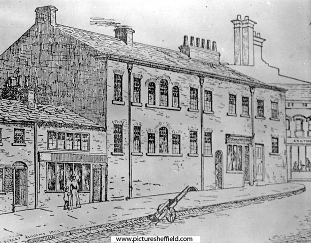
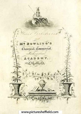
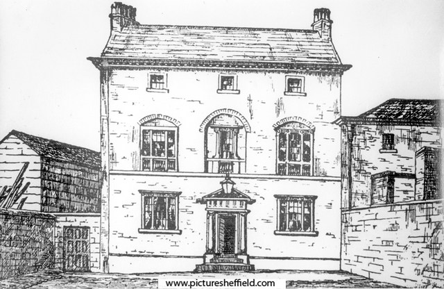
Milk Street Academy. s06474 Brief History of Milk Street and the Academy https://sheffielder.net/2022/11/03/milk-street-swept-away-by-the-construction-of-arundel-gate/ Book Plate for Mr Bowling's Classical, Commercial and Mathematical Academy, Milk Street, Sheffield. y06440 Original at Local Studies MP 6443 M. Leeds Library Special Collections, Milk Street Academy ( Sheffield) https://explore.library.leeds.ac.uk/special-collections-explore/participant/68118 Includes Milk Street Academy. https://blogs.princeton.edu/cotsen/2017/05/good-job-reward-books-from-early-19th-century-english-schools/ Milk Street from Norfolk Street, Nos. 43-45 Harry Hartley and Son Ltd., hardware store (former Milk Street Academy). February 1964. https://www.picturesheffield.com/frontend.php?keywords=Ref_No_increment;EQUALS;s17929&pos=7&action=zoom&id=20613 https://www.picturesheffield.com/frontend.php?keywords=Ref_No_increment;EQUALS;s17930&pos=8&action=zoom&id=20614 A Plan of the Tenements and Ground held of the Earl of Surrey by the Heirs of the late John Trout and assigned by them to John Schofield containing in the whole 398 yards, 1778. Surveyor: William Fairbank II. Property on the corner of Norfolk Street and Milk Street, including the School House (1771 Petticoat Lane); erectors of buildings named; measurements. https://www.picturesheffield.com/frontend.php?keywords=Ref_No_increment;EQUALS;arc03211&pos=22&action=zoom&id=98297 A plan of the tenement and ground held of the Earl of Surrey by the heirs of John Trout and assigned by them to John Schofield. 1778. https://www.picturesheffield.com/frontend.php?keywords=Ref_No_increment;EQUALS;arc03656&pos=23&action=zoom&id=99206 A Plan of the Sundry Tenements [property] of the Earl of Surrey in Norfolk Street, Arundel Street [Sycamore Lane] and Pond Lane. 1780. https://www.picturesheffield.com/frontend.php?keywords=Ref_No_increment;EQUALS;arc04171&pos=25&action=zoom&id=104512 Shows Norfolk Street, Arundel Street, Bowling Green Lane, Pond Lane, Pond Mill Dam, Shude Hill, road to Pond Mill, Slaughter House Lane, Milk Street, Pond Well, Pond Well Hill, and Change Alley. Note: Sycamore Street is named Arundel Street on this plan; probably by a mistake, as the Arundel Street shown on FC/P/SheS/745 (1787) is the same as the modern street. Tenants: Joseph Ibberson, Joseph Mitchell, Ann Genn, Thomas Siddall, Margaret Nutt, Mary Naw, Robert Higginbottom, John Schofield, Eliz. Dickinson, John Linthwaite and sister, Eliz. Rodgers, Titus Salt, George Clark, James Kaye, Thomas Pearson, Robert Baxton, Thomas Lambert, John Hammond, John Walter, Thomas Laycock’s heirs, William South, Edward Hawke, Josephus Parkin, John Greaves, Thomas Law’s heirs, Thomas Darwin, Samuel Shepley, Thomas Wilkinson, The Whitelead Co., The Widow Newton, Samuel Broomhead, Robert Lambert, George Badger, Jonathan Hale, Joseph Hall, Sarah Chapman, William ?, Robert [Unwin], John Parkes, Richard Wilson, and others (illegible). The property which became John Schofield property is The Unmarked Property between Benjamin Damms & Milk Street was later part of the Milk Street Academy. Property between Norfolk Street and Sycamore Street, occupied by Benjamin Damms, John Barber and George Dalton, 1828. https://www.picturesheffield.com/frontend.php?keywords=Ref_No_increment;EQUALS;arc04173&pos=21&action=zoom&id=104514 Shows: Milk Street, Mulberrry Street, George Street, and Sycamore Street.Tenants / owners: Benjamin Damms, John Barber, George Dalton and Thomas Caverley. Extract from: Reminiscences of old Sheffield, it's Street and its People. From letters Editor Robert Eadon Leader, from articles and letters in The Sheffield and Rotherham Independent 1872/3. Page 247-248. Wragg: ..... Near, in Milk Street, is Mr. Bowling's School, celebrated as being kept by the late Mr. J. H. Abraham, who, besides having the best school in the town, was of a mechanical turn of mind, for in 1822 he invented a magnetic apparatus for the protection of persons employed in dry grinding. Twiss: A testimonial was presented to him in that year, "in token of respect for his talents, and in acknowledgment of his services to an afflicted class of workmen by his ingenious invention;" and he also received the gold medal of the Society of Arts for the same invention. Johnson: Like many other things that are theoretically sound, the magnetic apparatus was practically useless. The great complaint against it was, I believe, that it was speedily choked with the fragments of metal attracted, and then the respiration of the workman was distressingly hindered. Holy Green House, The Moor, between Eldon Street and Prince Street. Home of Thomas Holy, who entertained John Wesley there. Mr. Abraham, principal of Milk St. Academy, resided here, also used for boarders and evening classes y01674 Thomas Holy, a member of a very old Sheffield family of manufacturers and merchants lived at Holy Green House which stood in a large garden, with a long green lawn in front, on Sheffield Moor, between Eldon Street and Prince Street. Mr Abraham, the Principal of the Milk Street Academy, had Holy Green House for boarders and evening classes. Mr Abraham also resided here, but left in 1839. It was afterwards used by the Sisters of Notre Dame prior to their premises in Convent Walk. In 1870 it was the Ecclesall Club.
-
Wednesday team 1892 - one of the Woolhouses front right Harry was born in 1868 the son of Thomas and Mary, both filecutters of Ecclesfield. Two of Harry's younger brothers, Fred and Dan, were also successful footballers (at Wednesday and Barnsley). Harry probably came to the notice of Wednesday in March 1888, when he performed well in the Ecclesfield team which played against Wednesday at Bramall Lane (3-2 to Wednesday). By September he was a new man in the Wednesday team which lost 3-1 to West Bromwich Albion at Olive Grove. In March 1889 the entire Wednesday team were players at the Alexandra Theatre in a benefit for John Lisbourne (an entertainer). Harry played the part of a swell. In May 1891 Harry briefly became landlord of the Rose and Crown in Paternoster Row. In October 1892 Toddles was out of the Wednesday team, and playing a non-league game for them against Stoke, in the hope of re-invigorating his performance and regaining a place in the team. In December 1893 he was in a benefit match for Wednesday against Attercliffe. In January 1894 Harry had earned a place again in the Wednesday first team (as centre forward) against top of the league Aston Villa. A knee in the stomach in a match against Notts County in February 1889, though he was quickly out of the infirmary, detuned his performance. In April 1894 the champions of the Sheffield and Hallamshire Cup Competition, Mexborough, played a home match against a side selected from the other clubs in the league. Harry "Toddles" Woolhouse of Wednesday Wanderers was in that side. Toddles had a good second half but received a caution for a foul on "Cousin" Walter. The final score was one all. His last game for Wednesday was in March 1895. His first game for Barnsley was in August 1895. In January 1896 Barnsley played against Newcastle, Harry scoring three goals. Harry was in court in February 1897 summoned by a butcher for a £3 4 shillings debt for meat. His wife Ada testified that he was a professional footballer for the Barnsley St Peter's Club, earning £1 a week - when he got it - but had not been paid for some months, despite Barnsley recently doing well financially with the Cup-tie with Derby County. A month later the Secretary of Barnsley St Peters was subpoenaed to testify on Harry's earnings and stated that he received 30 shillings a week from September to April but nothing during the summer months, during which Harry had to maintain himself with his trade as a filecutter. Harry's wife re-appeared but could not explain his failure to pay the debt, and Harry was sentenced to 14 days in prison, though execution was suspended for a month, unless he paid the debt, which he promised to do. From the Sheffield Daily Telegraph of Wednesday 6th December 1911: OLD WEDNESDAY PLAYER'S DEATH - HARRY WOOLHOUSE Harry Woolhouse, of Ecclesfield, better known as "Toddles" Woolhouse, had the misfortune last Saturday week to injure his head by a fall. He was removed home, and attended by Dr. Stainsby, but his condition becoming worse, he was taken to the Sheffield Infirmary , where he died on Monday evening. "Toddles" was a member of the Wednesday team in their palmiest days, at OLive Grove, and was considered one of their best inside forwards. He had several accidents during his 14 years as a first team player, the most serious being when playing in a Cup-tie against Notts County at Olive Grove, when he was acidentally hurt by Clements, one of The Notts backs. Woolhouse had to decline all engagements after that occurrence. [In fact he played for three seasons after the incident] He will be buried at Ecclesfield tomorrow at 3.30. Toddles was only 43 years old.
-
Yes! In the early 2000s one was seen by a few people in the Killamarsh, Mosborough, Eckington area. I and my wife were travelling toward Eckington from the Marsh Lane area when ,on our left, we both spotted a low flying, almost shapeless, bright object which maintained our speed for the length of the Moss Valley then took off at an amazing speed. I seem to recall that the Star carried a small piece on the sighting…quoting people in Killamarsh who around the same time of day had seen something similar.
-
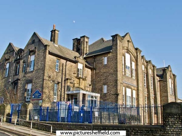
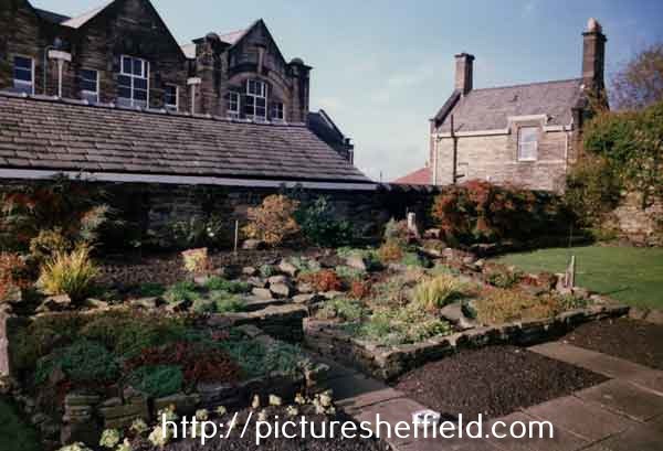
Plans of Lydgate Lane School. 1905. Architect: W. J. Hale, FRIBA, St. James Row, Sheffield. Elevations (South West, North West and South East) . https://www.picturesheffield.com/frontend.php?keywords=Ref_No_increment;EQUALS;arc06816&pos=8&action=zoom&id=106212 Elevation (North East) https://www.picturesheffield.com/frontend.php?keywords=Ref_No_increment;EQUALS;arc06817&pos=9&action=zoom&id=106213 Sections https://www.picturesheffield.com/frontend.php?keywords=Ref_No_increment;EQUALS;arc06818&pos=10&action=zoom&id=106214 Floor Plans (ground and first floor) https://www.picturesheffield.com/frontend.php?keywords=Ref_No_increment;EQUALS;arc06819&pos=11&action=zoom&id=106215 Originally Lydgate Council School formally opened Nov. 1907 by Lord Mayor, Alderman H.P. Marsh J.P. See: City of Sheffield, Education Committee, Handbook of Information, 1964/65. Local Studies Ref. 379.4274 S Lydgate Infant School, Lydgate Lane. 3rd March 2012 c04322 Photographer: Alex Ekins Carved stonework above the entrance to Lydgate Infant School, Lydgate Lane. 2003 https://www.picturesheffield.com/frontend.php?keywords=Ref_No_increment;EQUALS;t10770&pos=2&action=zoom&id=92430 Caretakers House and Lydgate Lane Infant School. 29th January 1979. https://www.picturesheffield.com/frontend.php?keywords=Ref_No_increment;EQUALS;s24993&pos=9&action=zoom&id=27773 Playshed, Lydgate Lane School. 1989.t10120
-
Plan of the Pheasant Inn, 10 Broad Street included in: Plan showing location of New Market Hotel, proposed to be purchased and also leasehold premises to be surrendered. https://www.picturesheffield.com/frontend.php?keywords=Ref_No_increment;EQUALS;arc03510&pos=3&action=zoom&id=98730 Shows Sheaf Lane, Sheaf Street, Sheaf Market, Broad Street, Pheasant Inn, Horse and Jockey and Queen's Head.
-
Plan of a projected street between Queen Street and West Bar Green. 1817. https://www.picturesheffield.com/frontend.php?keywords=Ref_No_increment;EQUALS;arc04217&pos=13&action=zoom&id=105201 Marked: Tenter Street, Pea Croft, West Bar Green, Silver Street, Paradise Square, Workhouse Croft, Queen Street, workhouse, reservoir, fitting up shop, boring mill, Foundry, warehouses, smiths shops, fetling shop [?fettling shop], counting house, lumber house and model chambers, engine house. Tenants / owners: John Haslehurst, W. B. Thomas, John Clayton, Joseph Whitehead, Samiel Eadon, Robert Burnand, S. B. Ward, George Smith, - Eyre, Charles Rhodes coopers shops, John White, John Darwin, Benjamin Hounswind?, John Sevrap?, and Edward Gains. Town land, extending from Broad Lane End to West Bar, 1778. https://www.picturesheffield.com/frontend.php?keywords=Ref_No_increment;EQUALS;arc04287&pos=18&action=zoom&id=105972 The plan has notes made in 1784. Marked Broad Lane End, Hollis Croft, Rotten Row, West Bar Green, Pea Croft, White Croft, Hawley Croft, Gregory Row, Silver Street, Hick Stile Field, Queen Street, Workhouse Croft, and Workhouse. George Hounsfield, Samuel Radford, John Birks, George Allen, George Oates, John Haywood, Hollis Hospital land, Thomas Wilkinson, Josh. Bower of Hollis Hospital, Martha Hill, John Foster, William Thornton, John Thompson, Matthew Lambert, John Goodwin, Ebenezer Wall, George Greaves, Thomas Radford, Joseph Hepworth, Mary Cowley, Samuel Crook, Widow Bradshaw, George Pears, John Holberry?, Catherine Dixon, Mark Skeltens?, John Hobson, Stephen Green, John and George Wild, [?] Green, The Overseers of the Poor in the Township of Ecclesfield, Ecclesfield Workhouse [tenants of this parcel of land], John Longden, Mary Pearson, John Darwin and Co., and Samuel Marshall.
-
Plan of the Queen's Foundry, Queen Street and premises adjoining in Sheffield. 1842. https://www.picturesheffield.com/frontend.php?keywords=Ref_No_increment;EQUALS;arc04225&pos=4&action=zoom&id=105209 Marked: Model warehouses, stable, stable loft, manure, old warehouse, shed, smiths and joiners shops, foundry, boring and turning mil, engine house, dwelling house, ash pit, privy, reservoir, counting house, fetling shops, sand and core shed, fitting shops, model and lumber rooms, and furnaces. Wardle & Bentham 1814-1815 Iron founders & Masters Darwin & Co., Queens Foundry, Chapeltown, Elsecar & Worsbrough. General & Commercial Directory of Sheffield. 1825. Darwin & Co. mill & engine work in all of its branches, Queens Foundry, Queen Street. White's General Directory 1849. Darwin & Co, New Queen Street, iron founders; stove grate; mill and engine work manufacturers, Queens Foundry, New Queen Street. Thomas Darwin, iron founder & etc. h. 77 Occupation Road. Whites Directory 1852. Darwin & Co. iron founders; stove grate; engine and mill work manufacturers, Queens Foundry, 68 New Queens Street. Thomas Darwin, iron founder & etc. h Handsworth. Whites Directory 1862 Darwin & Co. iron founders & stove Grate & etc manufacturers, Queens Foundry 68 Queens Street. John Darwin, public weighing machine proprietor, 68 New Queen Street. Samuel Darwin, iron founder & Co. (Darwin & Co) h. 8 Hanover Square. Thomas Darwin, iron founder & etc., h. Blenkarn Place, Rock Street. White's Directory 1872 . Darwin & Co. engineers, millwrights, iron founders; general stove grate manufacturers; silversmiths; coppersmiths; tinner brazier tool manufacturers, 98-108 Queen Street. Thomas Darwin, (D & Co) h. 99 Rock Street. Which Queen? Thought it would be Queen Victoria until discovered it was named Queens Foundry earlier. Probably Queen Charlotte wife of George III. Queen, 8th September 1761-17th November 1818. Crowned. 22nd September 1761.
-
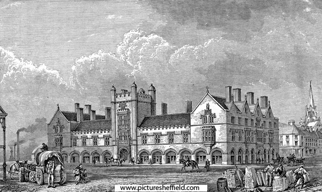
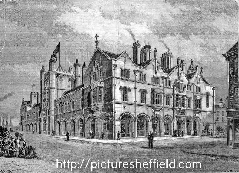
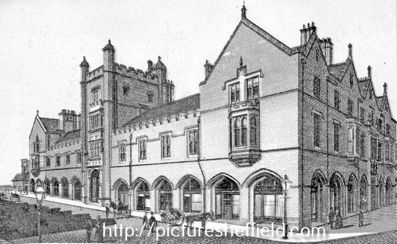
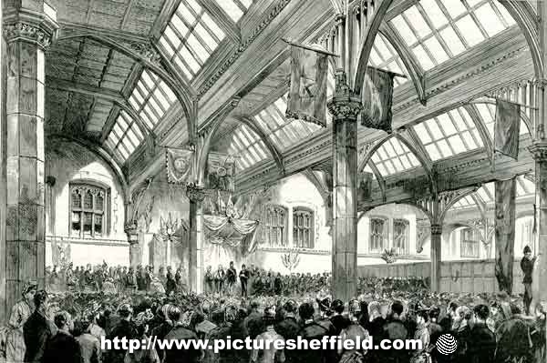
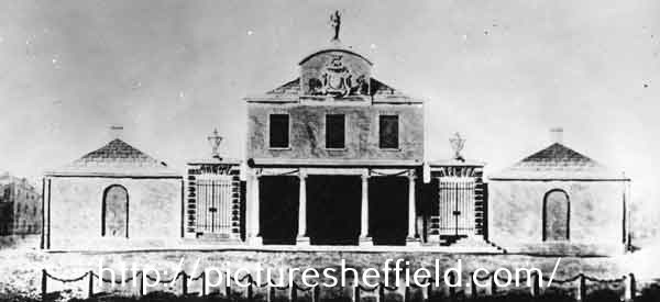
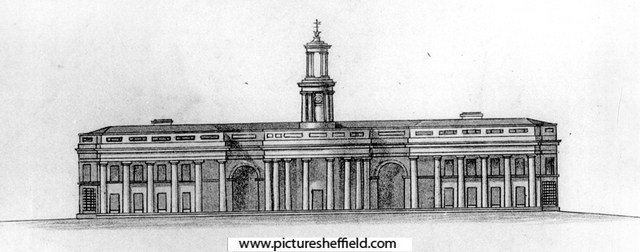
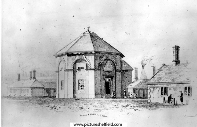
New Corn Exchange, built early 1880-81, Broad Street, right. s00292 Corn Exchange - built for the Duke of Norfolk in 1881 The Central Hall of the Corn Exchange was gutted by fire in 1947 and the offices surrounding it were demolished in 1964. Engraving of the newly built Corn Exchange, Broad Street, right. s22437 H.W. Brewer (Etcher) u02332 The Shah of Persia [Iran] in England - scene in the Corn Exchange, Sheffield, during the presentation of an address from the Mayor. 1889.y11829 Image from The Graphic, 20 July 1889. Sheffield Local Studies Library: MP 1834 L. Architects drawing for the Old Corn Exchange, Broad Street erected 1830. This design was never built. s41155 Architects design for the old Corn Exchange - 1830 (this was not the adopted design) s01896 The old Shrewsbury Hospital, Castlefolds, founded 1616. The Corn Exchange later stood on this site. 1st January 1819.s07452 E. Blore, Artist Plan of part of the town of Sheffield, comprising the site of the present and proposed corn, hay and cattle markets, also various improvements connected with the latter. 1827. With illustrations of proposed Corn Exchange, elevation of the houses fronting the new Hay Market, and an elevation of the bridge over the Dun [Don]. https://www.picturesheffield.com/frontend.php?keywords=Ref_No_increment;EQUALS;arc04183&pos=14&action=zoom&id=104936 Reference a - Proposed Corn Exchange and office, b - erections on each side of Corn Exchange, c - weighing machine, d - row of shops. Inns in the immediate vicinity of the present Hay and Corn Markets 1 George, 2 King’s Head, 3 Angel, 4 Commercial, 5 Yellow Lion, 6 Tontine, 7 Healeys Hotel. The sites of the present Hay, Corn and Cattle markets are coloured red, and proposed are coloured blue. Other improvements are shown in yellow. Marked are: Market Place, Angel Street, Angel Inn, old Corn Market, King Street, Post Office, Change Alley, Kings Head, Fruit Market, Market Street, Norfolk Street, John Street, Commercial Inn, Hay Market, Yellow Lion, Pond Lane, Shude Hill, Fish Market, Dixon Lane, Tontine Inn, Castle Folds, Castle Hill, Healeys Hotel, Sheaf Bridge, River Sheaf, canal bridge, proposed Hay Market, proposed Corn Market, Broad Street, Canal Basin, Canal Warehouse, Market for fat cattle, lean cattle and milch cows, pig market, sheep market, River Dun [River Don], Willey Street, Blonk Street, Wicker, Cattle Market, Ladys Bridge, Bridge Street, Wain Gate, Town Hall, Killing Shambles and Castle Street. Sheffield Markets. 1847. https://www.picturesheffield.com/frontend.php?keywords=Ref_No_increment;EQUALS;arc04188&pos=16&action=zoom&id=104947 Marked: Old Haymarket, Dixon Lane, Castle Folds, Exchange Street, new market ground, Cheese Market, Corn Exchange, Broad Street. New Corn Exchange - plan showing groups of desks. 28th November 1881. Architects: M E Hadfield and Son, Architects, New Corn Exchange Chambers. https://www.picturesheffield.com/frontend.php?keywords=Ref_No_increment;EQUALS;arc04419&pos=8&action=zoom&id=151747 Corn Exchange - office doors, panels and rails, etc., c.1881? Not dated. https://www.picturesheffield.com/frontend.php?keywords=Ref_No_increment;EQUALS;arc04417&pos=6&action=zoom&id=151745 Corn Exchange - doorway, etc., c.1881? Not dated. https://www.picturesheffield.com/frontend.php?keywords=Ref_No_increment;EQUALS;arc04418&pos=7&action=zoom&id=151746 Maunche Hotel and Corn Exchange, Exchange Place / Wharf Street on Ordnance Survey Map. 1890. https://www.picturesheffield.com/frontend.php?keywords=Ref_No_increment;EQUALS;y06787&pos=3&action=zoom&id=59989
-
Not sure how these plans help but anything I find mentioning Golden Cross I'll post. A map of a Close belonging to the Duke of Norfolk now subdivided into gardens, and late under Lease with the Golden Cross in Sheffield. 1777. https://www.picturesheffield.com/frontend.php?keywords=Ref_No_increment;EQUALS;arc03127&pos=4&action=zoom&id=98112 The second close as shown in ACM/MAPS/SheS/1532a, now entirely divided into gardens; numerical list with tenants names, descriptions and measurements; both these closes may be seen also on ACM/MAPS/SheS/1534. Shows 'Burying ground of the people called Quakers'. Also shows the proposed route of Garden Street. Original at Sheffield City Archives ref. ACM/MAPS/Shes/1533L. A plan of the Ground and Tenements in Campo Lane the property of the Duke of Norfolk, formerly let with the Golden Cross, containing in all 1,080 yards. 1777. https://www.picturesheffield.com/frontend.php?keywords=Ref_No_increment;EQUALS;arc03117&pos=3&action=zoom&id=98098 Surveyor: William Fairbank II. This plan supplements ACM/MAPS/SheS/1581, showing in detail the tenements at the point later to be the junction of Vicar Lane with Campo Lane; tenants; buildings named. (south side of Campo Lane; Hawley Street, Lee Croft). Original at Sheffield City Archives: ACM/MAPS/SheS/1576s.
-
Plan of Samuel Mitchell and Co's premises in Furnival Street, measured for sale. 1835. https://www.picturesheffield.com/frontend.php?keywords=Ref_No_increment;EQUALS;arc04112&pos=313&action=zoom&id=103724 Refers to steel warehouse, converting furnace, steel room, shed, privies, melting furnace, iron warehouse, pump, clay shed, hearths, coke shed, casting shed, reservoir, stable, and warehouse. Premises are situated between Union Lane and Eyre Street.
-
For Reasons Which Will Become Apparent Eventually ...
Ponytail replied to RichardB's topic in Sheffield Genealogy
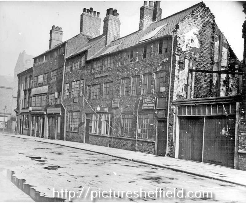
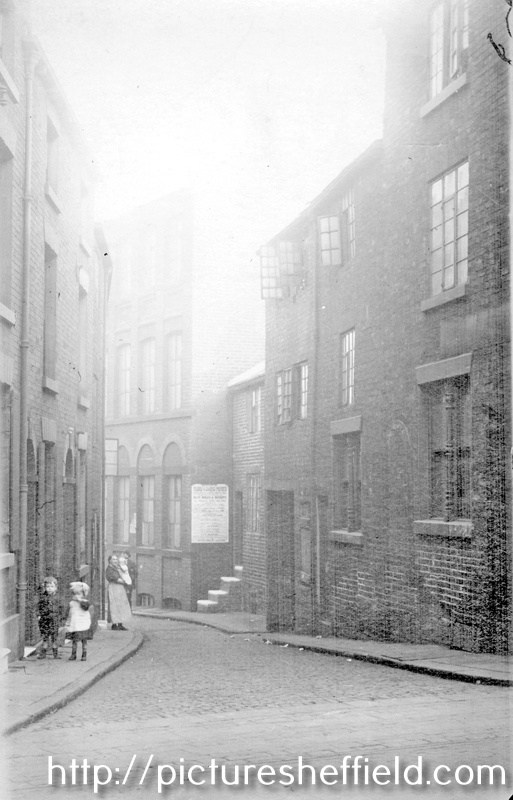
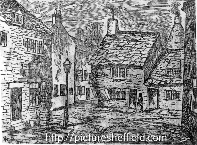
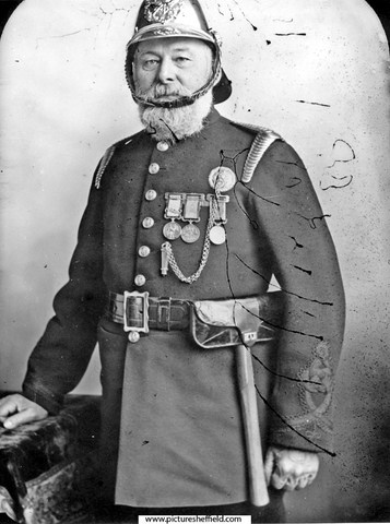
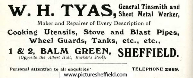
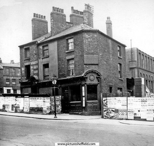
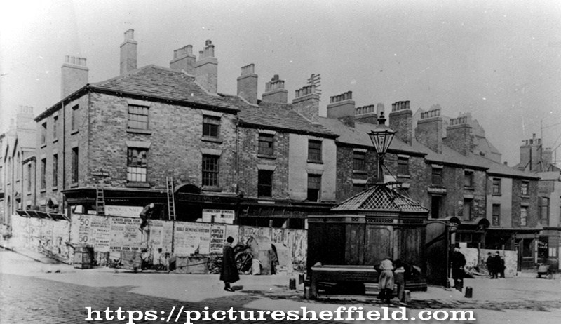
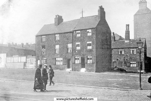
Plan of the corner of Balm Green and Blind Lane, measures taken in Balm Green to fix the line of Division Street where it will pass through the Towns' property; sketch showing the street after the demolition of the old Town property, [1792], 18. https://www.picturesheffield.com/frontend.php?keywords=Ref_No_increment;EQUALS;arc04094&pos=301&action=zoom&id=103509 Three plans pasted together. Shows Division Street, Coalpit Lane, Blind Lane and Balm Green. Tenants / owners marked: Thomas Sayles, Thomas Bennett, John Smith, Edward Brownell, Edward Harrison, Thomas Bennett, Sarah Potter, John Beavans, Timothy Millington, late Sephton, now Thomas Marshall. An outline of the land between Barker's Pool and Church Street, with Brelsforth's Orchards coloured green, 1804. https://www.picturesheffield.com/frontend.php?keywords=Ref_No_increment;EQUALS;arc04039&pos=123&action=zoom&id=103300 Leopold Street, Balm Green, Orchard Lane and Fargate shown (but not labelled). Refers to S. A. Younge, furnace, James Creswick, Jonathan Moor, Malin Gillott and others, Allen and White, Richard Ibberson, Edward Brownell, Christopher Oates, Edward Adamson, Thomas Maxfield and others, Thomas Sayles's freehold, Thomas Bennett, John Smith, Town Land, John Brookes, Sarah Potter, Barkers Pool, John Lindley's freehold, Duke of Norfolk - given in exchange to the To-- [Josep Holland?], George Woollen, William Pavell, Samuel Younge, Rose, Charles Milner, John Jenning, - Webster, William Rowley and tenements and ground proposed to be taken by E? Brook [Brookes?]. Photographs Date Period:1900-1919 Cottages at Balm Green, site of City Hall, on the left are the furnaces of the Queen Steel Works belonging to John Lucas, iron and steel merchant on Holly Street. 1900.s00689 Balm Green, including F. Oldale and Co., joiner and undertaker, No 2 Balm Green. s13218 Fred Oldale (1878-1940) appears on censuses as journeyman joiner until the 1921 census when he is recorded as a joiner and undertaker in the employ of Robert Moss a joiner, builder and undertaker. Robert Moss is listed in Whites 1901 directory at Balm Green as a joiner, builder and undertaker. Balm Green from Holly Street. s19361 Artists Impression of the Cottages at Balm Green, site of City Hall. Entrance to Court No 4, left. Furnaces in the background belong to the Queen Steel Works belonging to John Lucas, iron and steel merchant on Holly Street. 1876.s13220 W. Topsham, Artist. Partly demolished row of buildings known as Pool Place, Barker's Pool (later the site of the City Hall). Former premises include New Music Hall Tavern, No 116, Barker's Pool, on corner. s00243 Shops on Barkers Pool known as Pool Place, prior to demolition in preparation for the War Memorial, note the 'Iron Man' Public lavatory. Holly Street, left. 1923. s00374 Barkers Pool, later site of City Hall, looking towards housing on Balm Green. Houses on right front Court No. 2. 1927.y01592 Balm Green from Division Street. Court No. 4 left (note sign for Robert Moss, joiner and undertaker), Court No 2, right (behind wall)y01403 Photograph shows Grand Hotel in process of building. Balm Green was behind Barkers Pool on site of City Hall. The sign of a joiner and undertaker shows the name R. Moss. Prior to this, Robert Moss, whose residence was at 16 Monmouth Street, owned the Wentworth Temperance Hotel in Holly Street, where the Grand Hotel later stood. Robert Moss had one son and a daughter. He had a lifelong connection with Bethel P.M. Chapel in Cambridge Street and was choir master and Sunday School Secretary for many years. At the Anniverary Services he often entertained the members of the voluntary instrumentalists who accompanied the singing, to dinner and tea between the services at the Wentworth Hotel, being near to the Chapel. John Charles Pound (c.1833-1918), Superintendent of Fire Brigade, c.1870 s08453 Pound was born in Sittingbourne in Kent c.1833. In the 1850s he was a fireman at Lambeth. He relocated to Sheffield c.1870. In the 1880s he was living at Balm Green with his wife and seven children. His first two children were born in Surrey – the remainder in Sheffield. During his time at Sheffield he applied to join Birmingham and Glasgow fire services but presumably was unsuccessful. He resigned from the Sheffield Fire Service in September 1895. He died on 25th October 1918 and was buried in the Sheffield General Cemetery. Advertisement for W. H. Tyas, general tinsmith and sheet metal worker, Nos. 1-2 Balm Green. 1916. y05257 Image from Sheffield Telegraph Year Book 1916 (page 110) (Local Studies 032.74 S).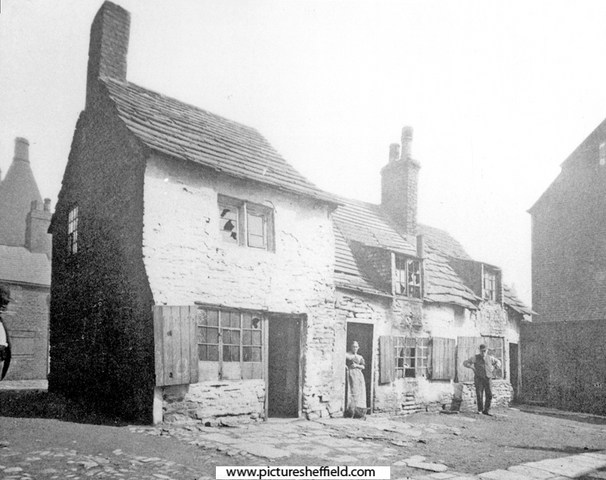
-
Plan of the premises in Arundel Street and Sycamore Street belonging to Parker, Potts and Denton, and of the adjoining premises belonging to James Hibberson, 1827. https://www.picturesheffield.com/frontend.php?keywords=Ref_No_increment;EQUALS;arc04033&pos=1&action=zoom&id=103278 Shows Arundel Street, [Arundel Lane], Sycamore Street, foot road from Pond Street, John Wilson's furnaces, stable, carriers warehouse, counting house, brewhouse, gateway, house, passage, Balloon Tavern, workshops, merchant's warehouse, etc. Note a trade directory of 1829 lists Parker, Potts and Denton as Edge Tool Manufacturers of Arundel Street; and - Hibberson, as a carrier (with carriages to Hull, Liverpool, Manchester and Cheshire) Land sold by Parker, Potts and Denton to their neighbour, James Hibberson. No date. https://www.picturesheffield.com/frontend.php?keywords=Ref_No_increment;EQUALS;arc04034&pos=2&action=zoom&id=103279 Shows Arundel Street, Arundel Lane, Sycamore Street, and Parker, Potts and Denton's premises, comprising cart house (hay loft), stable and workshops. Also shows James Hibberson's new stables. Plan of the freehold premises in [Arundel] Street and Sycamore Street belonging to Parker, Potts and Denton. 1828 https://www.picturesheffield.com/frontend.php?keywords=Ref_No_increment;EQUALS;arc04035&pos=3&action=zoom&id=103280 Shows: Arundel Street, Arundel Lane, Sycamore Street, and Parker, Potts and Denton's premises, comprising cart house (hay loft), stable and workshops. Also shows James Hibberson's property, together with a theatre further up Sycamore Street (at junction with Arundel Street) [?Theatre Royal].
-
Plan showing the Balloon Tavern, Sycamore Street. Plan of the premises in Arundel Street and Sycamore Street belonging to Parker, Potts and Denton, and of the adjoining premises belonging to James Hibberson, 1827. https://www.picturesheffield.com/frontend.php?keywords=Ref_No_increment;EQUALS;arc04033&pos=293&action=zoom&id=103278 Shows Arundel Street, [Arundel Lane], Sycamore Street, foot road from Pond Street, John Wilson's furnaces, stable, carriers warehouse, counting house, brewhouse, gateway, house, passage, Balloon Tavern, workshops, merchant's warehouse, etc. Sheffield History A-Z Public Houses Listing. Balloon Tavern, 21 Sycamore Street Open. 1825 or earlier, Closed. 1900 Span. 75. 1825. William Baker 1828. William Baker 1830. William Baker 1833. Francis Chambers 1834. Francis Chambers (died 18/2/1837, Lung inflammation, aged 49) 1854 Joseph Birks [6 Sycamore Street]
-
Shows Edgestones Jessop Street & South Street. Improvements in South Street, Coalpit Lane, Balm Green and Hereford Street, with a selection of part of South Street and Jessop Street, 1825. https://www.picturesheffield.com/frontend.php?keywords=Ref_No_increment;EQUALS;arc04251&pos=2&action=zoom&id=105413 Marked: South Street [The Moor], road from Manchester, Younge Street [Young Street], Bennets Lane [Bennett Lane], Hereford Street, [Jail, Fail, Tail Street?], Bright Street, Cumberland [Street], Jessop Street, T. Holy's garden [Holy Green], Earl Street, Rockingham Street, Landers Lane, Duke Street, Carver Street, Ward Street, Porter Lane, Union Street, Sugar House, Furnival Street, Coalpit Lane, Burgess Street, Cross Street, Pinston Street [Pinstone Street], St Paul's, Charles Street, Norfolk Street, Balm Green, Far Gate, an Division Street.
-
Plan of Thomas Rawson and Co., Pond Street Brewery, c. 1832. https://www.picturesheffield.com/frontend.php?keywords=Ref_No_increment;EQUALS;arc04208&pos=22&action=zoom&id=105173 Marked: Pond Street, Arundel Lane, houses, malt houses, joiners shops, stables, shed, coopers shops, scalding room, malt warehouse with vat houses under, drying kilns, boilers, engine house, coat yard, brew house, dwelling house, kitchen, counting house, Harmers open [presumably Harmer Lane]. Owners / occupiers marked: Septimus Priestley and Joseph Levick. Shows progression of plan https://www.picturesheffield.com/frontend.php?keywords=Ref_No_increment;EQUALS;arc04206&pos=20&action=zoom&id=105169
-
Is this the same sort of thing as previous post or are they just measuring the road out? Section of land near Broad Lane. Not dated. https://www.picturesheffield.com/frontend.php?keywords=Ref_No_increment;EQUALS;arc04051&pos=128&action=zoom&id=57011 St George’s Square. Section near Broad Lane, for St George’s Church, 1806. https://www.picturesheffield.com/frontend.php?keywords=Ref_No_increment;EQUALS;arc04054&pos=129&action=zoom&id=61724 St George’s Square. Section across the lower street in Broad Lane for St George’s Churchyard, 1806. https://www.picturesheffield.com/frontend.php?keywords=Ref_No_increment;EQUALS;arc04053&pos=130&action=zoom&id=62214

