Search the Community
Showing results for 'coal pit lane'.
-
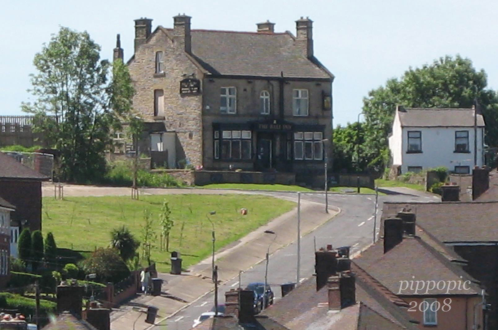
The Ball Inn Spurr Lane, was post #154 and The Ball Inn Myrtle Road, was post #148 are both the same pub, It was the road name that changed when Myrtle Road was extended to join Easbank Road. Or a link to Gallery

-
Hi Gramps According to Mel Jones, Storrs is a corruption of Storth. Croft was usually the name of a field or enclosure next to the house, so as the town expanded, each house would have a piece of land next to it where the householder would grow his veg, or keep a pig or a cow. The other name that used to puzzle me was Bents, as in Bents green, Totley Bents, and Benty Lane. Apparently Bent is a kind of coarse grass which is no good for grazing.
-
Thanks for that POPPYCHRISTINA, the Baths are not listed in a trade directory dated 1904, or indicated on the Godfrey Map: Sheffield Park 1903. I had, incorrectly, assumed that the buildings on Bramall Lane, between Clough Road and John Street were taken up solely by the Britannia Brewery. Regards Leipzig
-
As with the Sportsman on Barnsley road and the Pheasant at Lane Top the High Greave Inn may have built - or rebuilt, for the turnpiking of the road to Barnsely and Wakefield in 1758-ish. I believe there was legislation about the facilities a hostelry had to provide fo travellers to be designated as an Inn. Not sure where you could find early records - perhaps in the proceedings of the West Riding justices responsible for licensing ? I think these are held by the Wakefield Record Office.
-
Are you sure? The last time I looked there were photos from both the Lydgate Lane end and the Congregational Church end. Excellent photos of old cottages where the flats are now (at both ends). I've found those photos when searching under Crosspool and Tapton. HTH Ian
-
HI tsavo, l should say 1922, the Nelson to the right of the MEMORIAL at the left the old Angel Inn end of Button lane, plainly to the left , and above the Cathedrel is Eadon & Lockwood auctioneers ,opposite was an architect's office Morton's, Taxi rank in front on Church st , my dad stood on this rank for many yrs then on to Leopold st out side of the Education Office's, the Cinema house looks fairly new, but those white marble blocks stayed white till it was demolished, the big building opposite would be the Albert Hall destroyed by fire 1930, Skeets.
-
Hi Mike, The field in question was part of the old Lodge Moor Hall estate still there in 1855, to the far east there was a farm called Wiggins, Blackbrook Road was then classed as part of Bole Hill Lane.
-
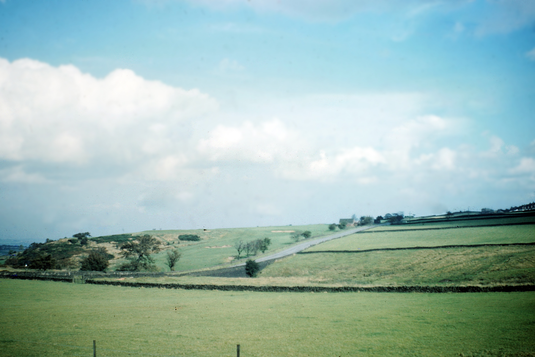
Does anyone know what the field was called that was to the east of Blackbrook Rd before the estate was built there in the early 1960s? My mother would be most grateful. This is a picture (1958) of the field from Blackbrook Rd looking towards Redmires Rd, with the golf course beyond and you can just see Crimicar lane in the distance and the edge of the old isolation hospital. Thanks in advance if anyone knows.

-
Looks like the top of Mickley Lane to me. The Co-op would be to the right of the shot. The tree at the entrance to Green Oak park (centre picture) still stands, I think, although there are more houses around it now. The houses at the bottom of Lemont Road are just to the right of the tree Regards Ayfer
-
Looks like the top of Mickley lane or somewhere close - the CoOp was just to the left off picture. Second thoughts - it's where Laverdene road joins Baslow road - there was no vehicle access when I were a lad, just a footpath. Google maps 53.3162°N 1.5285°W
-
Stuart0742 Is it, Abbeydale Rd South, Baslow Rd area looking towards Dronfield, taken from around Mickley Lane ?
-
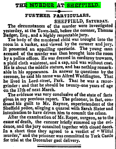
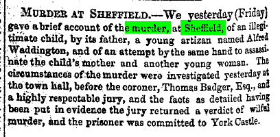
A Child Murder. And Two Attempted Murders on women living in Brown Street and Duke Lane, Park 1852 Waddington a Grinder by trade, from Lord Street , Park, said .... 'I carried it into Cutlers Wood, Heeley near Sheffield and there cut its head off' .. He was later executed on Sat: the 8th of Jan: 1853 at 12 Noon


-
From Saturday's Star - just what's needed more flats! Flats scheme at Full Monty club Published Date: 27 September 2008 By Tony Belshaw A SHEFFIELD working men's club immortalised in the smash-hit movie The Full Monty could be bulldozed to make way for houses and flats. The club's owner Chatsworth Inns has applied for permission to knock down Shiregreen Working Men's Club, which was the venue for the famous stripping scene in the 1997 movie, and to build 10 houses and nine apartments in a three storey block. The ADVERTISEMENT club celebrated its 80th birthday just days ago but unless it can block the development it could be curtains for the club on Shiregreen Lane. Hundreds of people have signed petitions objecting to the plan. They say it is the only club in the community where they can meet and socialise and it acts as "a lifeline" for people who enjoy bingo, quizzes and a drink with friends. Just two weeks ago it hosted a fundraising evening attended by Nicolette Williams, the mother of Shiregreen soldier Christopher Bridge, who was killed a year ago while serving in Afghanistan. The evening helped to raise £1,200 for Help for Heroes. Objectors include local councillors Peter Price, who said the loss of the club would be "a massive blow to the local community" and that its concert room is fully booked up until Christmas with events by local community groups and families. He added that over the past five years the Wincobank Working Men's Club, the Roman Ridge pub, the Horseshoe pub and the Sicey pub had all closed down in the area. To lose another would leave the area "short of a balanced community provision." But planning officers, in their report to Sheffield Council's City Centre planning board on Monday, say there are other community buildings nearby such as Shiregreen Community Centre, Brushes Community Centre, Grimesthorpe Family Centre and the Flower Estate Community Centre. Officers say: "It is regrettable that the proposed development would result in the loss of what appears to be a widely used community facility." But they say that by law they would be powerless to refuse the application on planning grounds. Club committee member James Lappin vowed to fight the plan all the way.
-

Pheasant Sheffield Lane Top
dunsbyowl1867 replied to dunsbyowl1867's topic in Sheffield Pubs and WMC's
Perhaps they drank with Royalty then - I was reading that Edward VII used to stay there when he visited the nationally famous stud/stables which was at Sheffield Lane Top! -
Not quite the Dixon Lane I remember.


-
Charles Batty Sheffield Local Register (Digest of local newspaper stories) 2 Oct 1835 Charles Batty committed to York, charged with cutting and maiming Elizabeth Brown. 5 Mar 1836 Charles Batty tried at York, for cutting and wounding Elizabeth Brown, at Sheffield, with intent to murder. Found guilty, and sentenced to be hanged. Robert Nall Sheffield Local Register 28 Nov 1841 Mary Nall murdered by Robert Nall, her husband, at the house of Lucy Nall, her sister, Beehive lane, Glossop road, where they were sleeping together. Nall was in bed with the dead body, when taken, several hours after the commission of the murder. At the request of the Jury, the Coroner made a representation to the Home Office on the frequency of stabbing. 17 Mar 1842 Robert Nall found guilty of the murder of Mary, his wife. Sentenced to death. 9 Apr 1842 Robert Nall executed at York for the murder of his wife. Hugh
-
The Cross Inn , Bradfield [Woodfall Lane? ] 1918 Harry Parkin --------------------- Main record (Cross Daggers, Upper Bradfield) updated. Thank you.
-
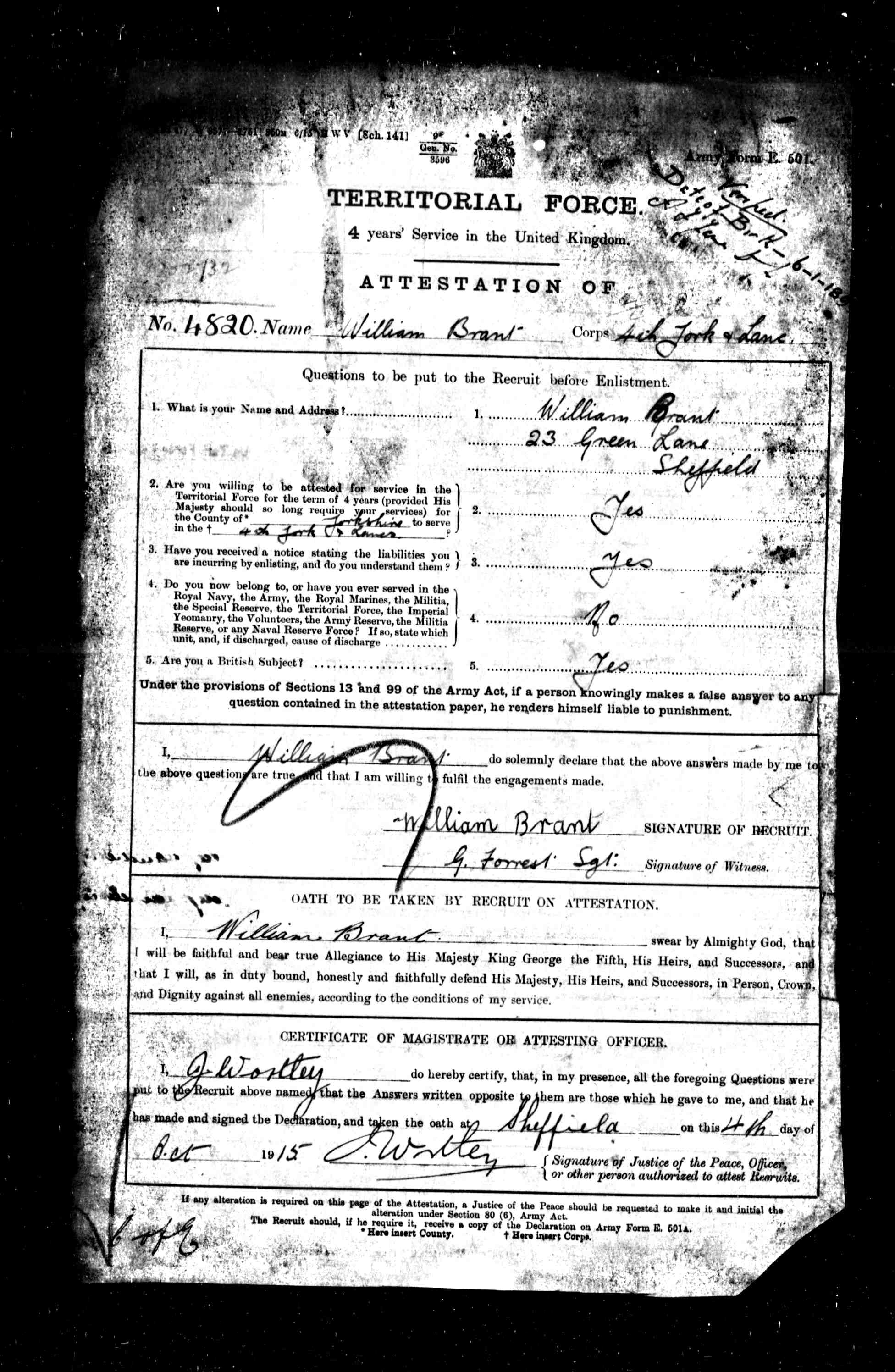
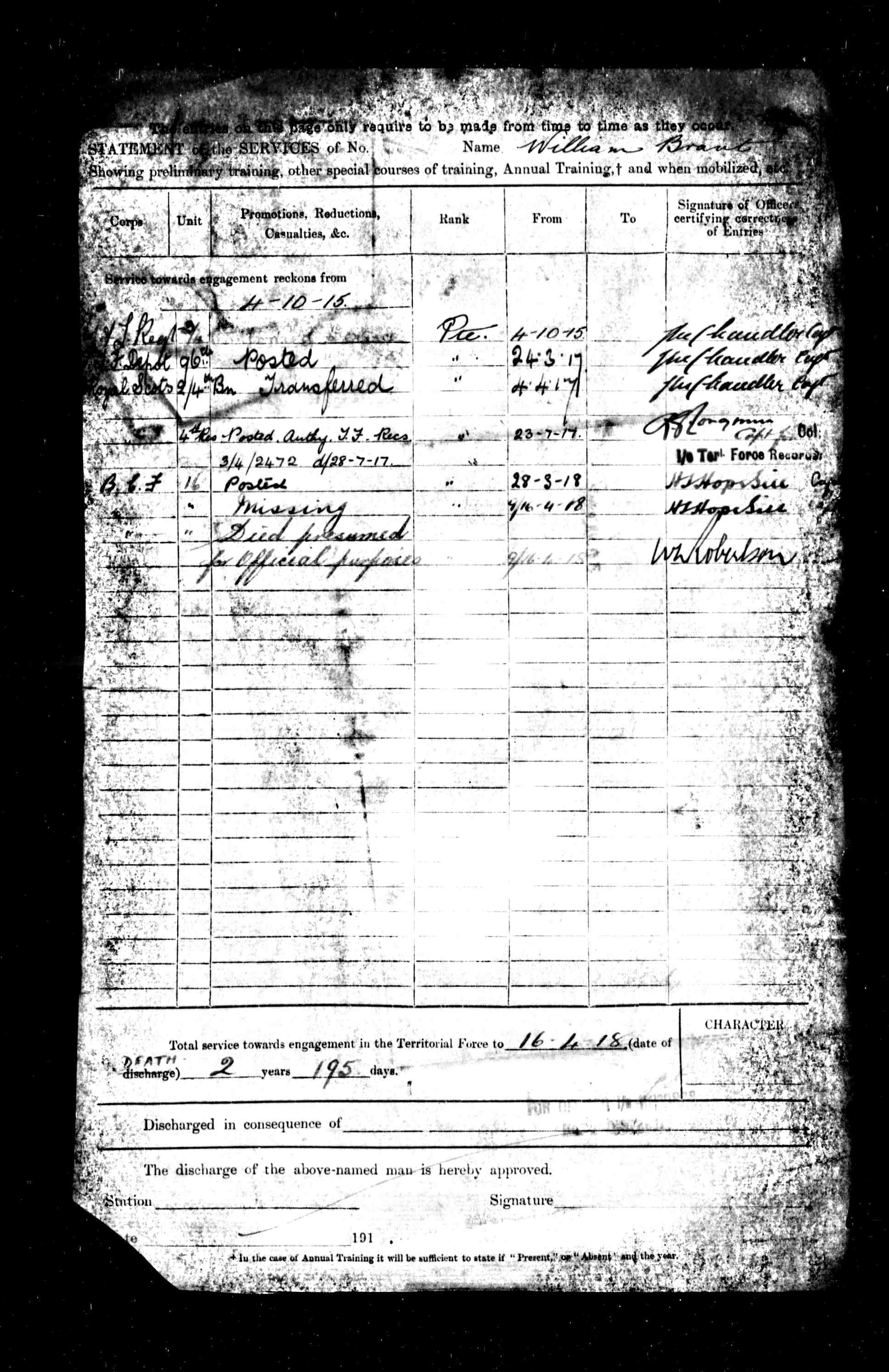
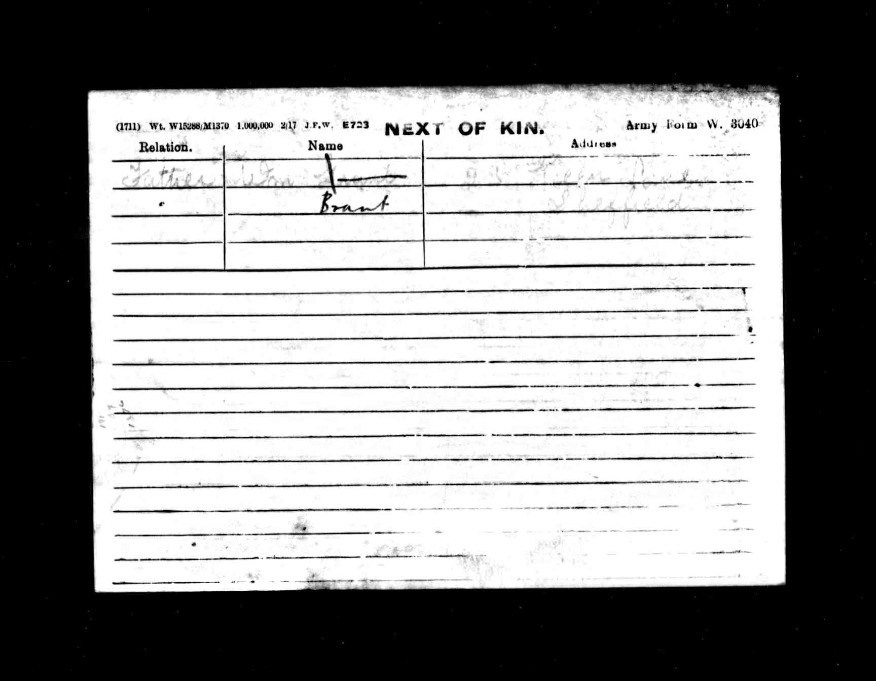
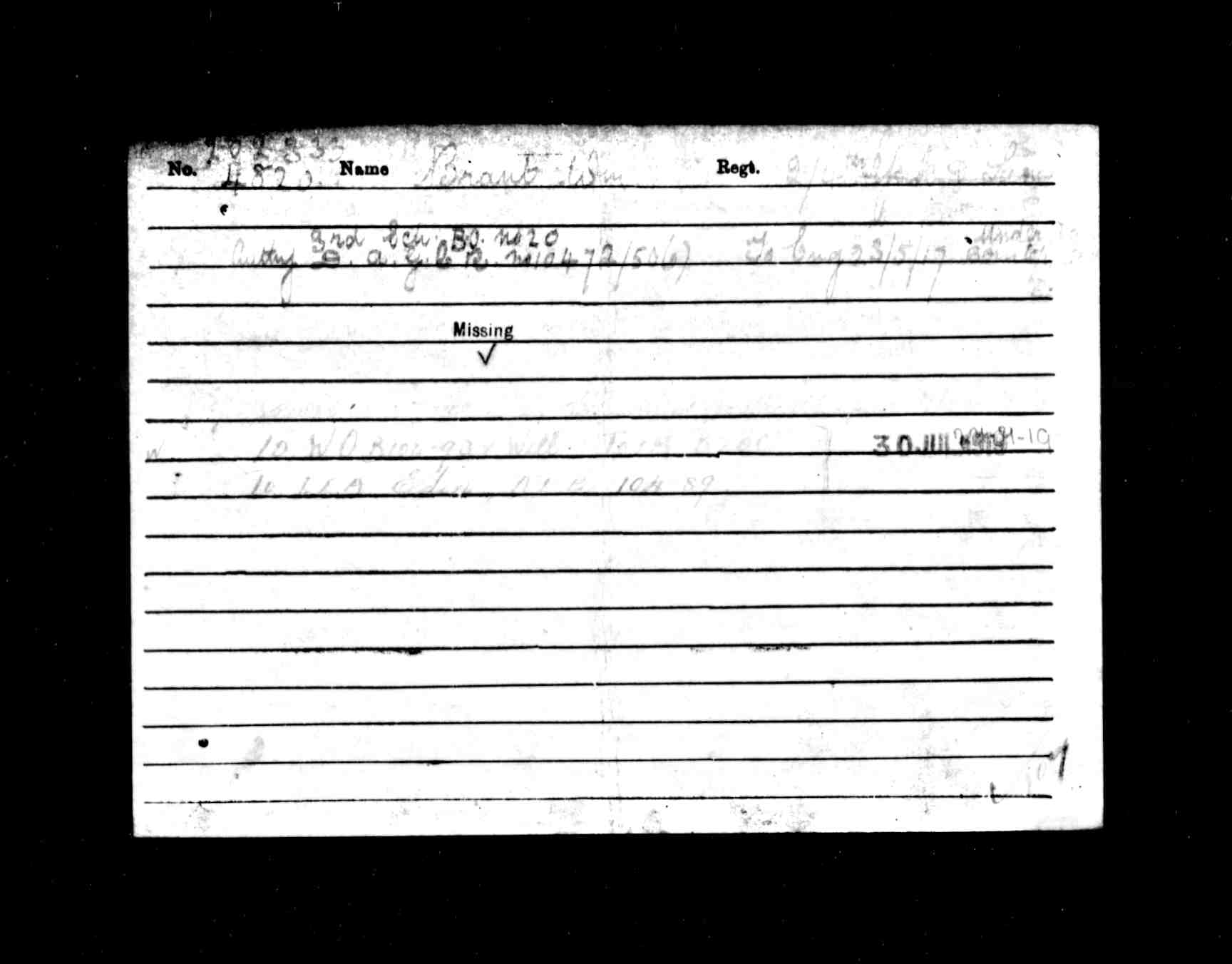
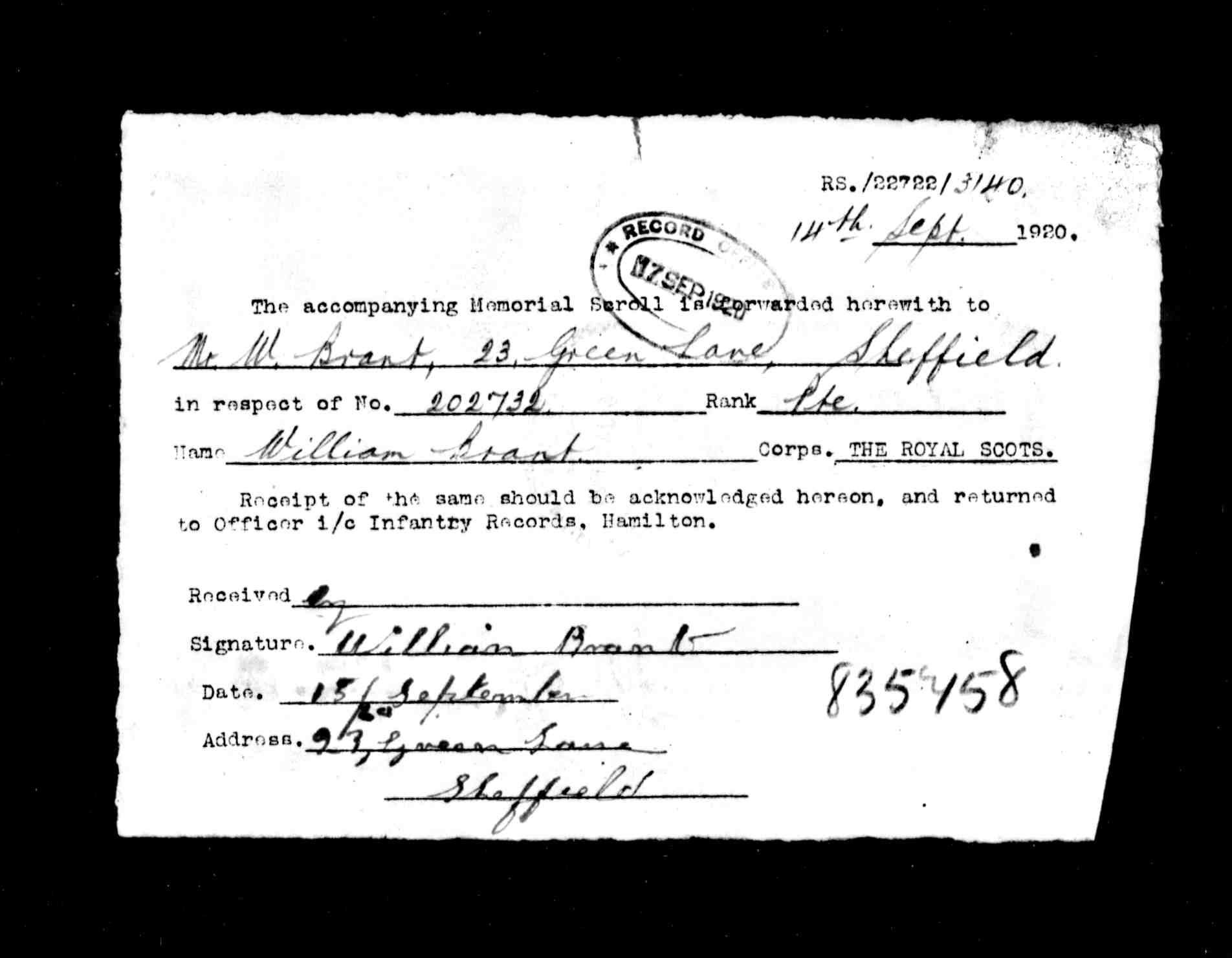
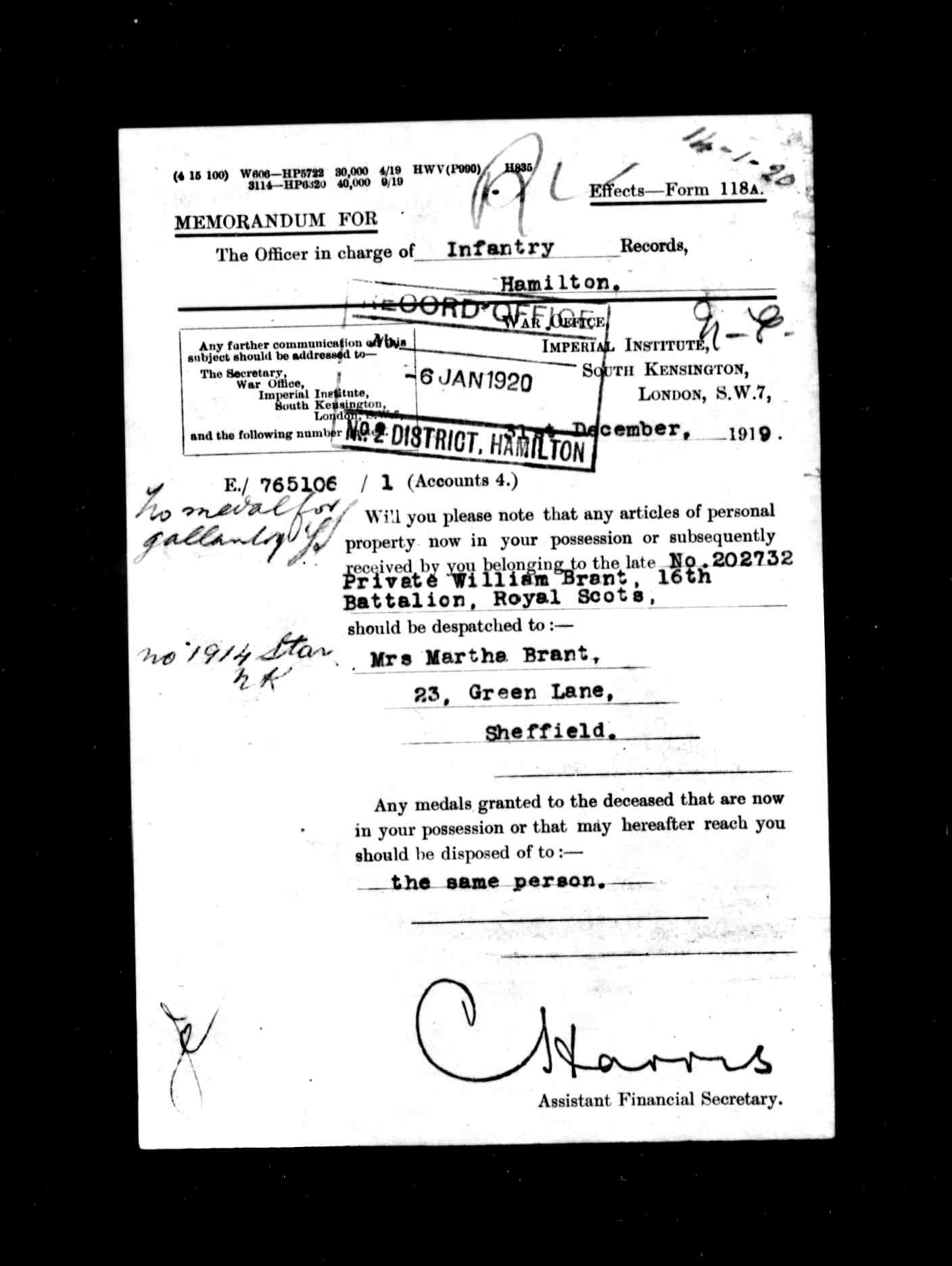
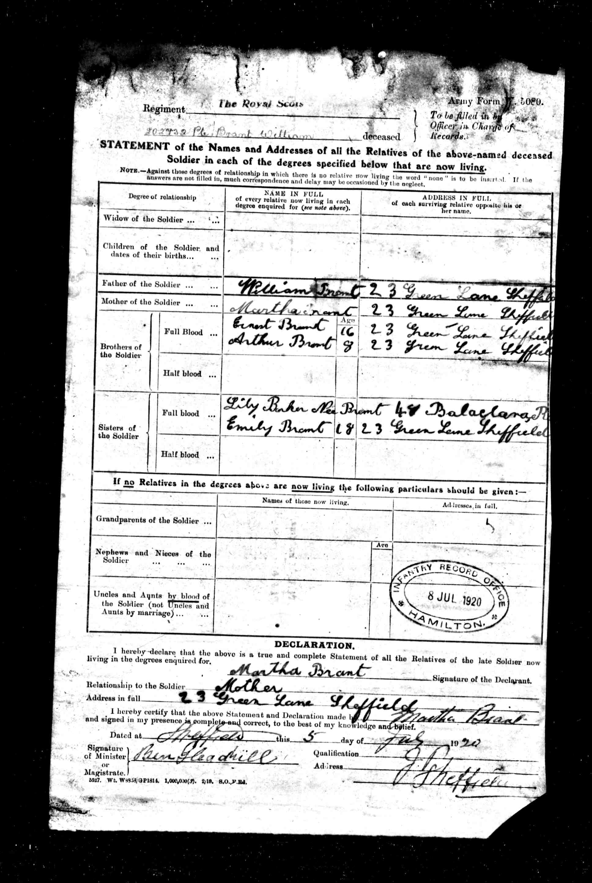
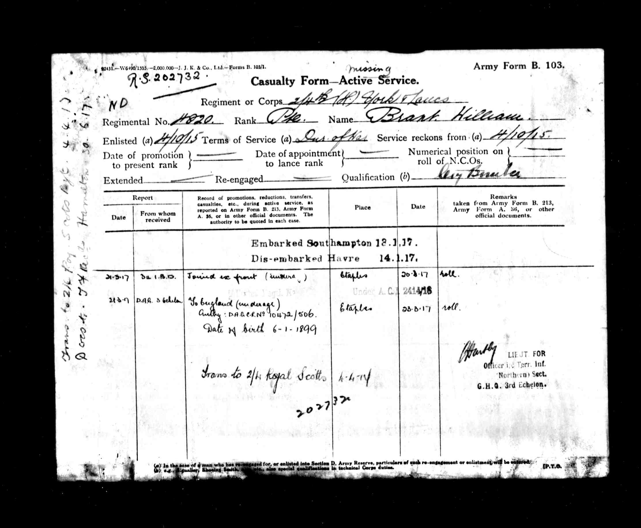
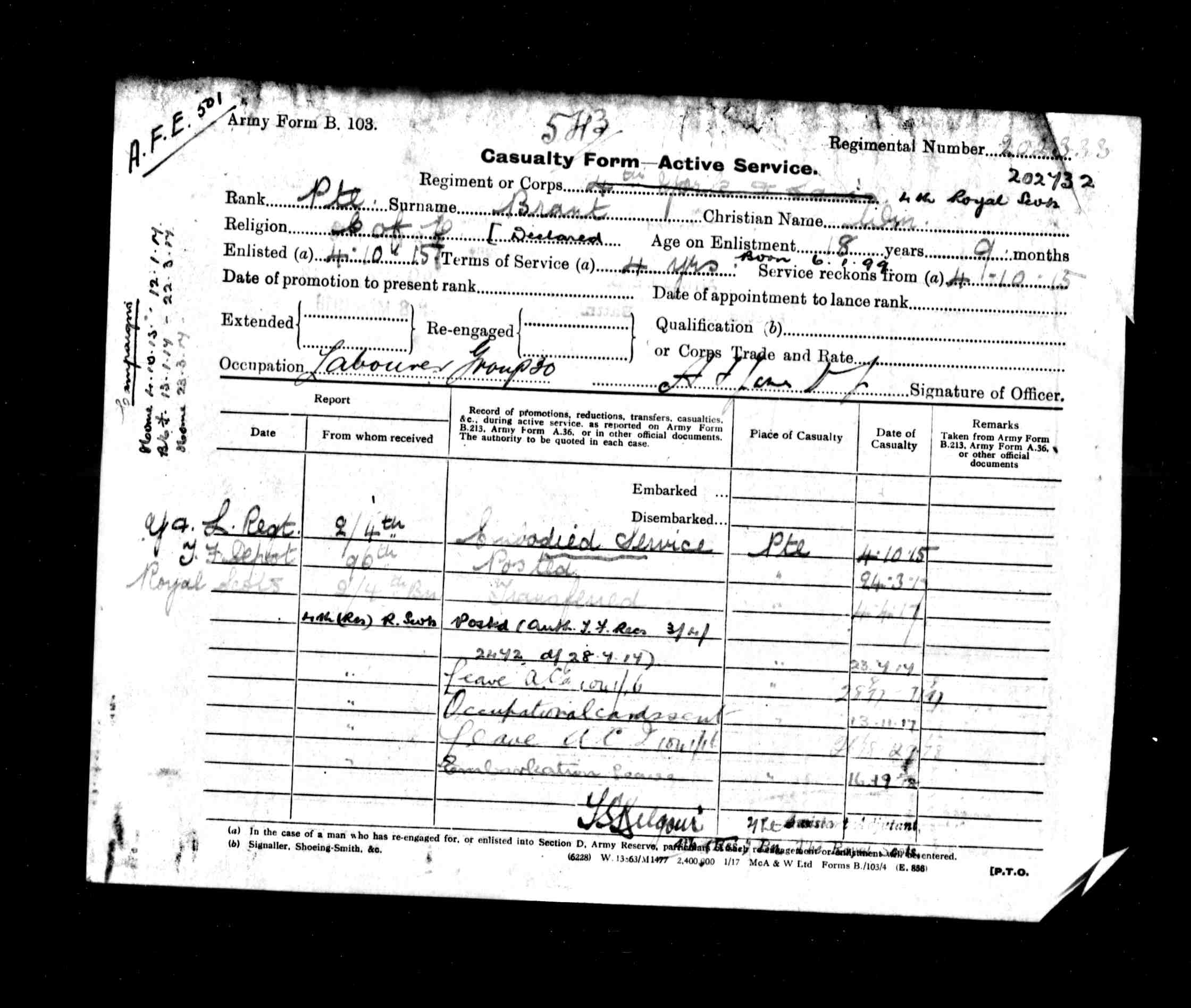
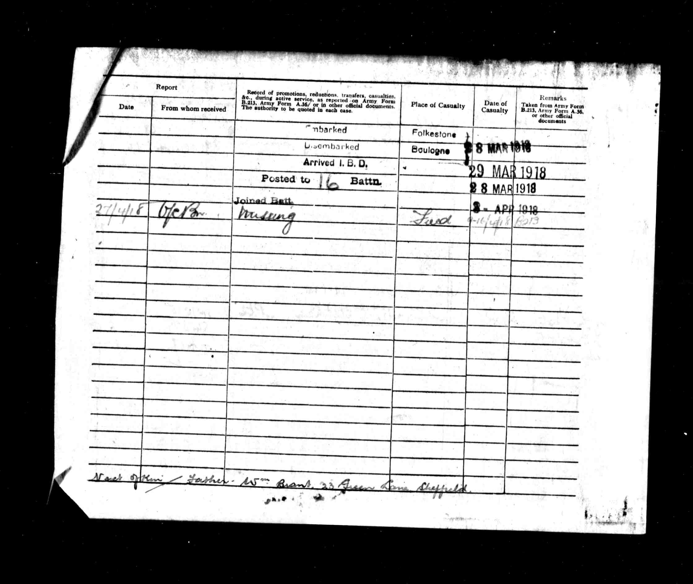
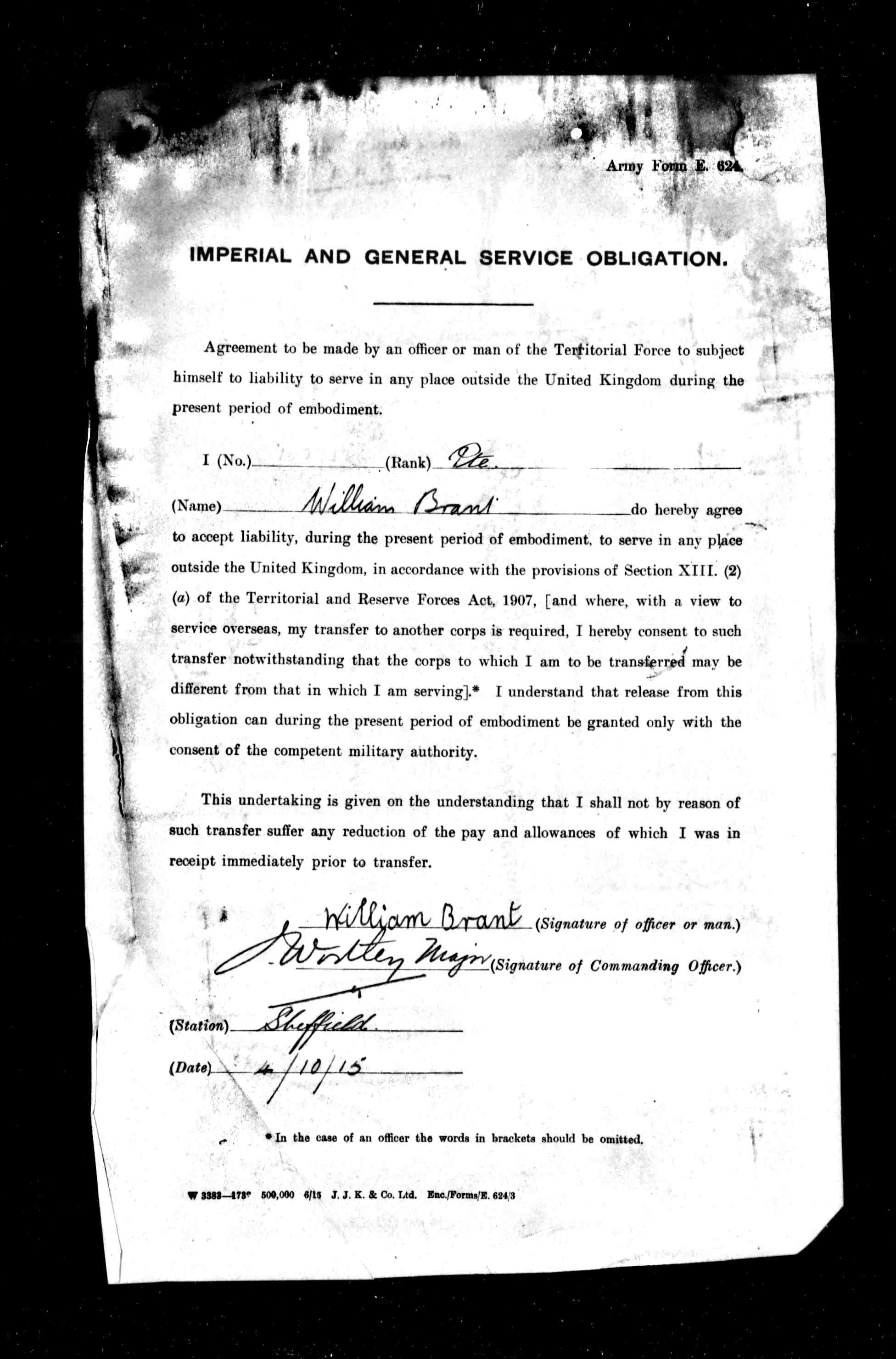
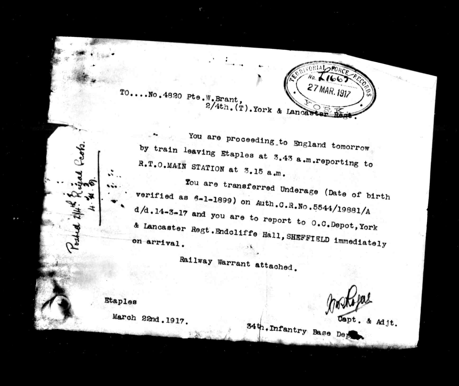
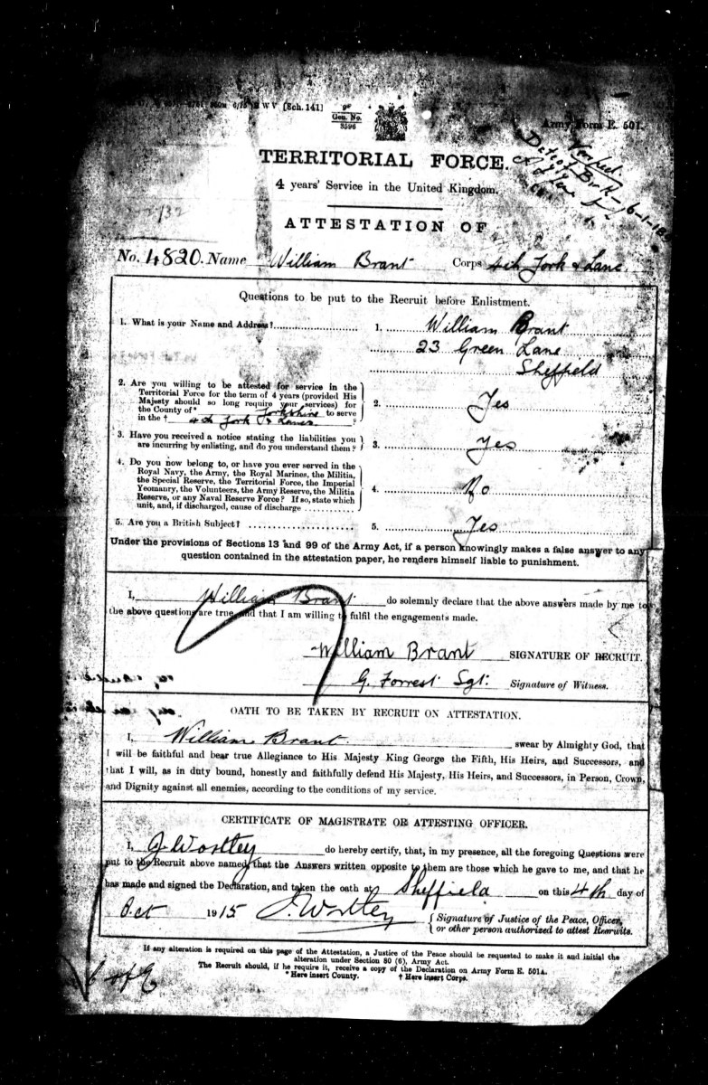
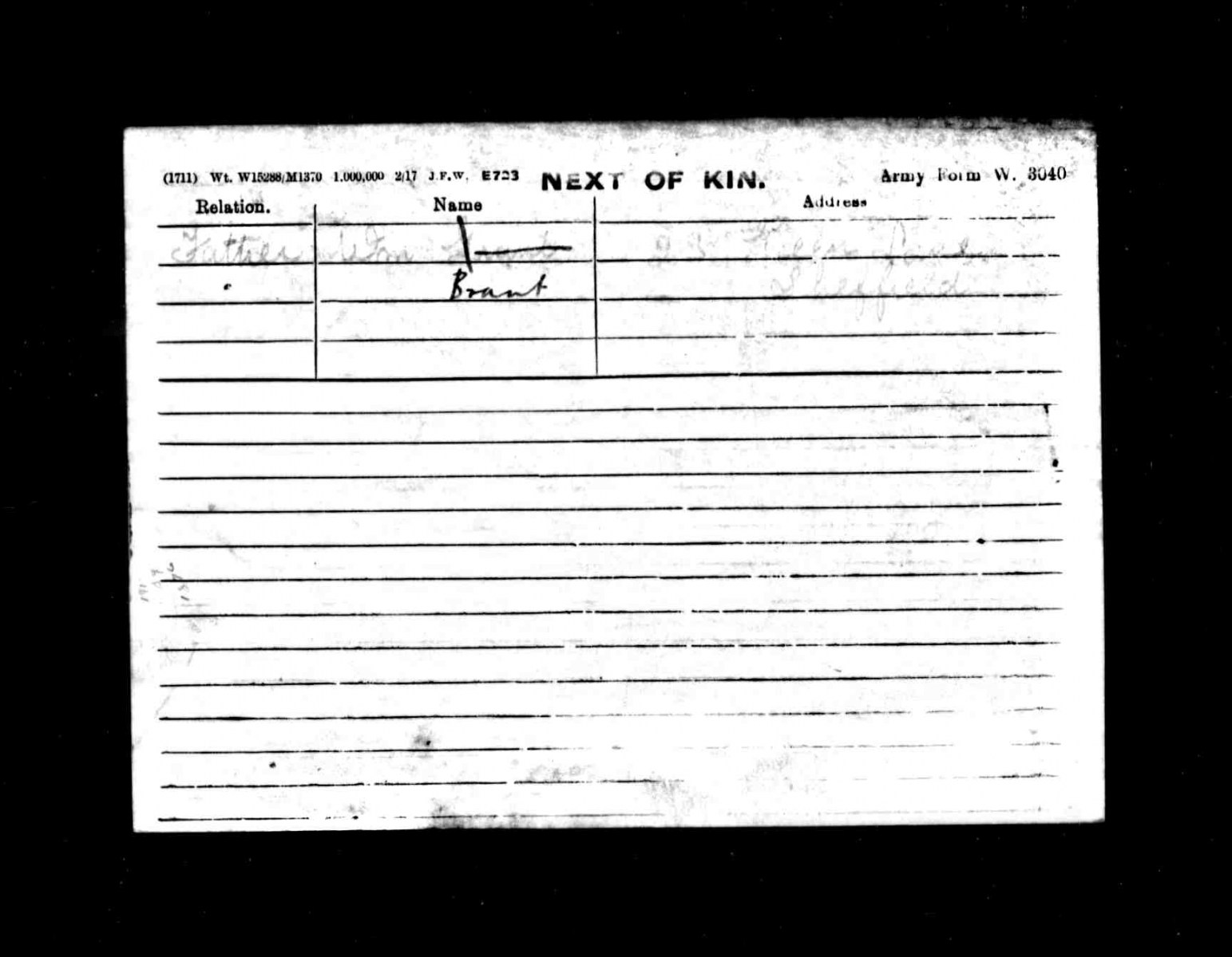
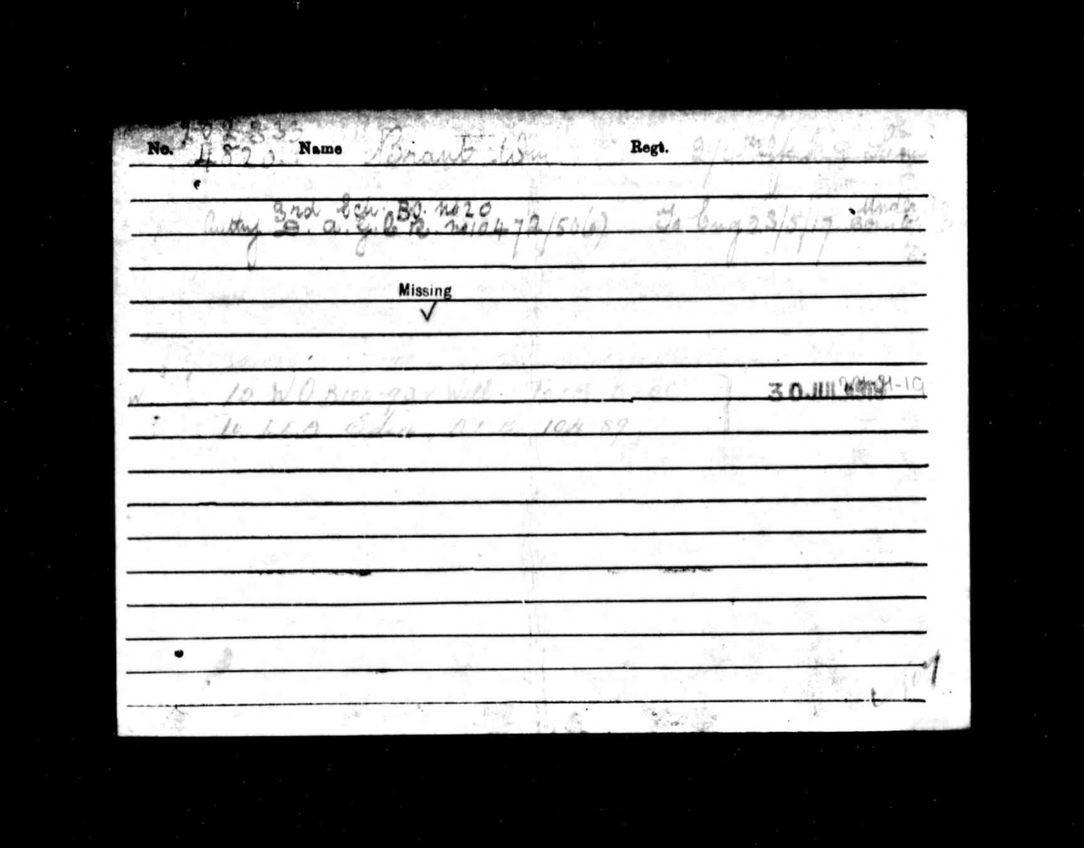
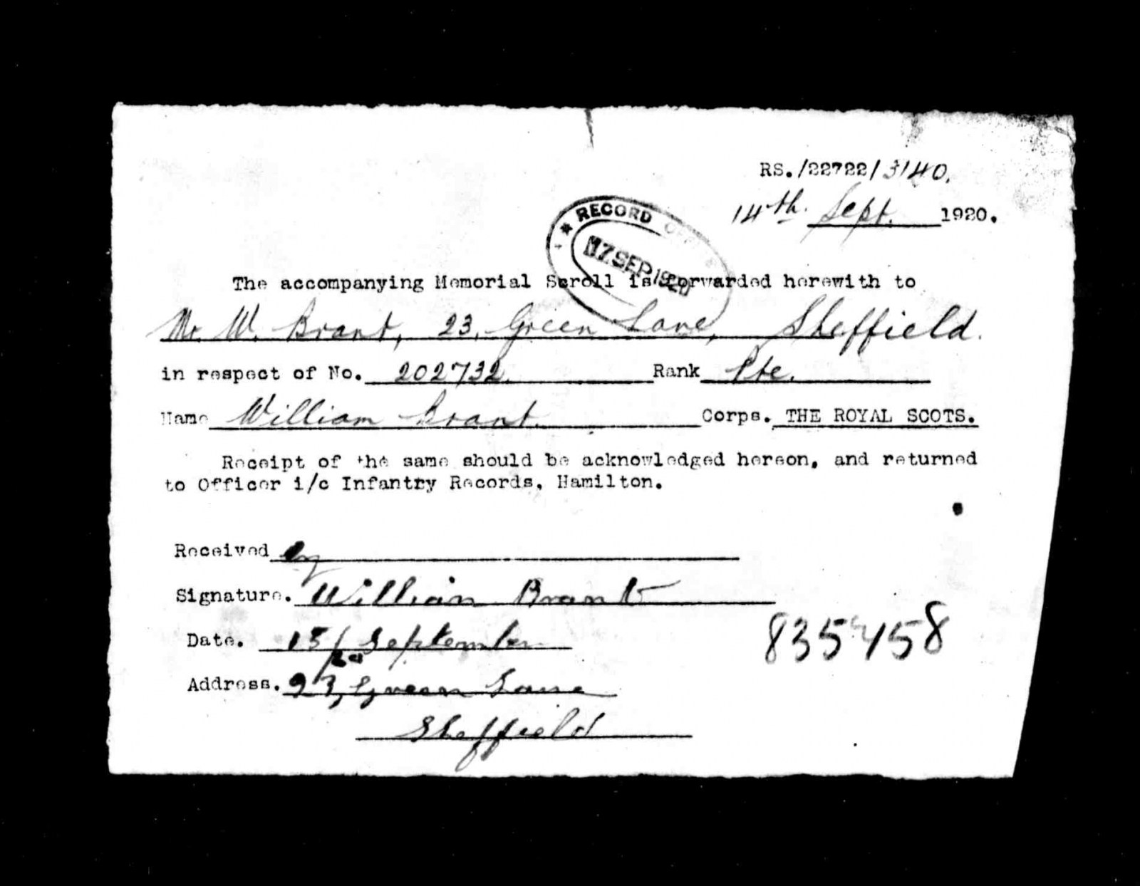
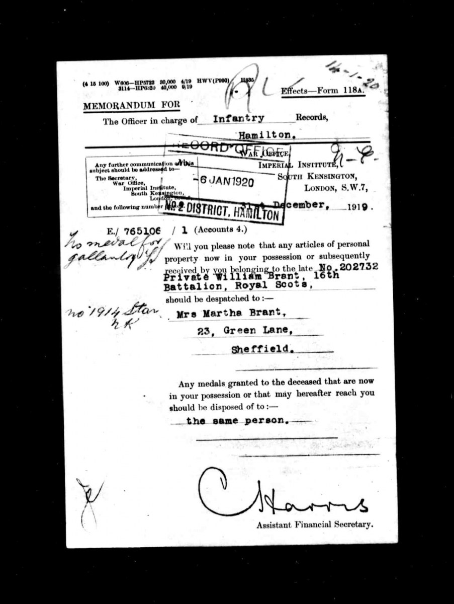
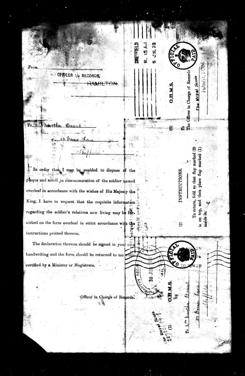
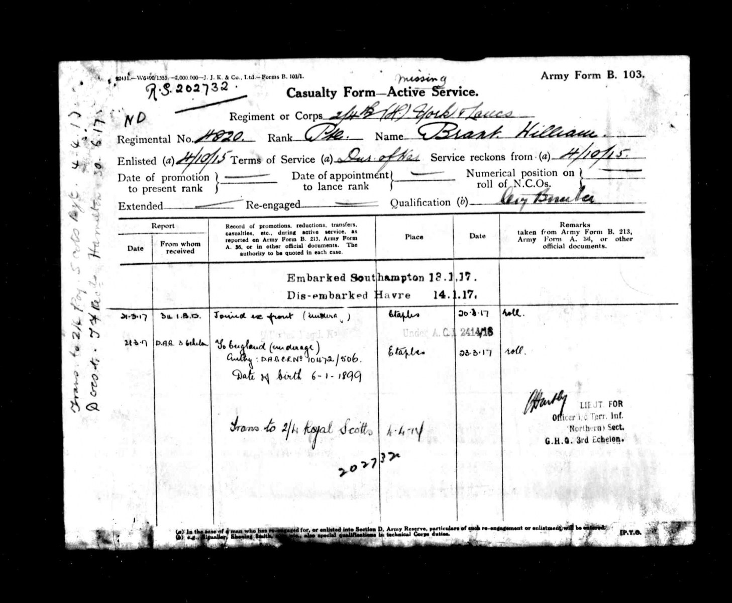
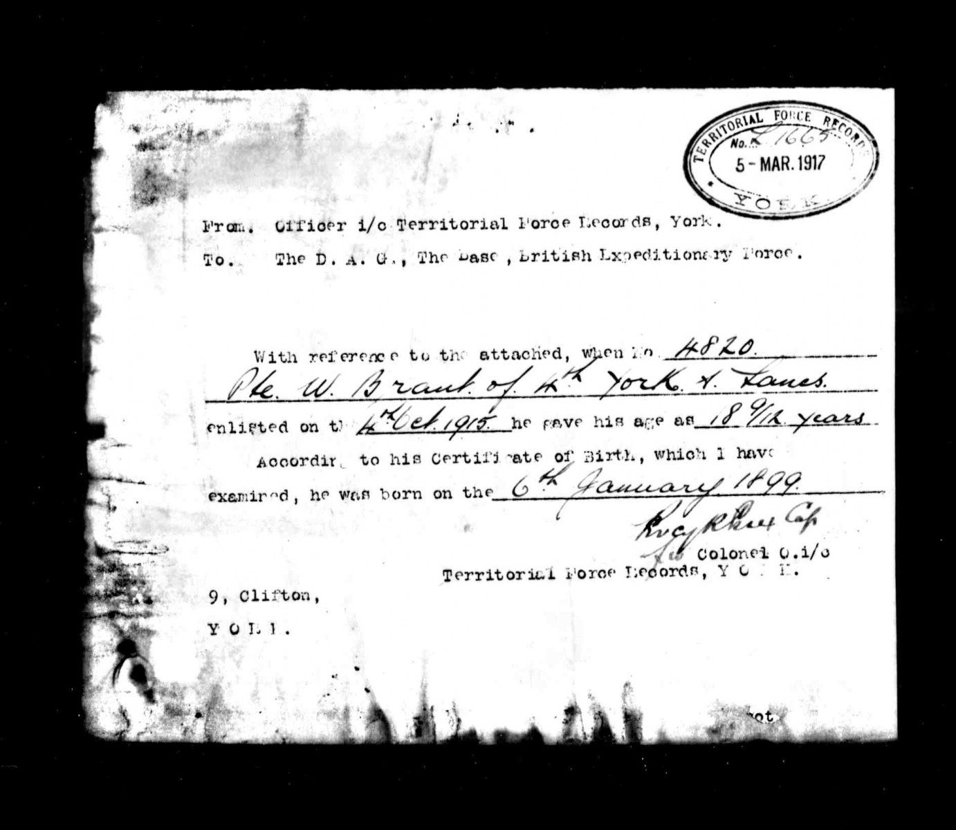
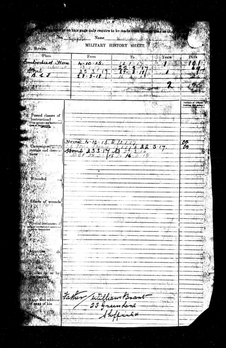
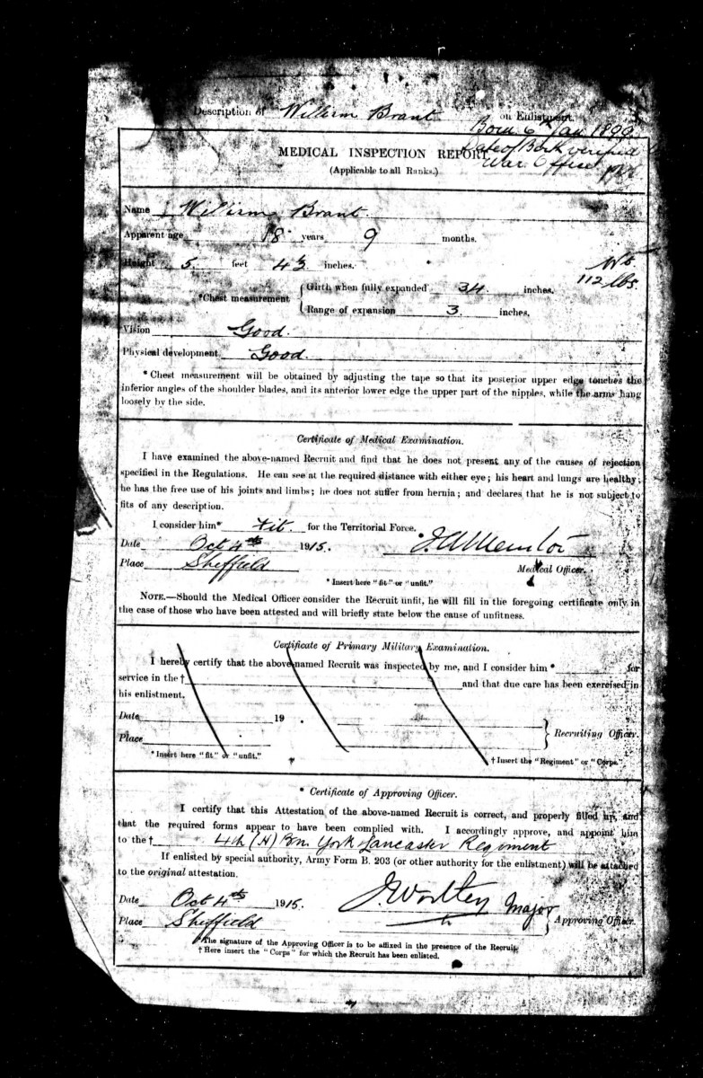
I've posted this once before, briefly, before copying it here from another thread, then deleting both .... Buffoon. My Uncle William from Green Lane, you can trace his "progress". Chilling to see a signature (and description from the Medical) of a relative you never met, and his Mother, my Great Aunt. Enjoy.


-
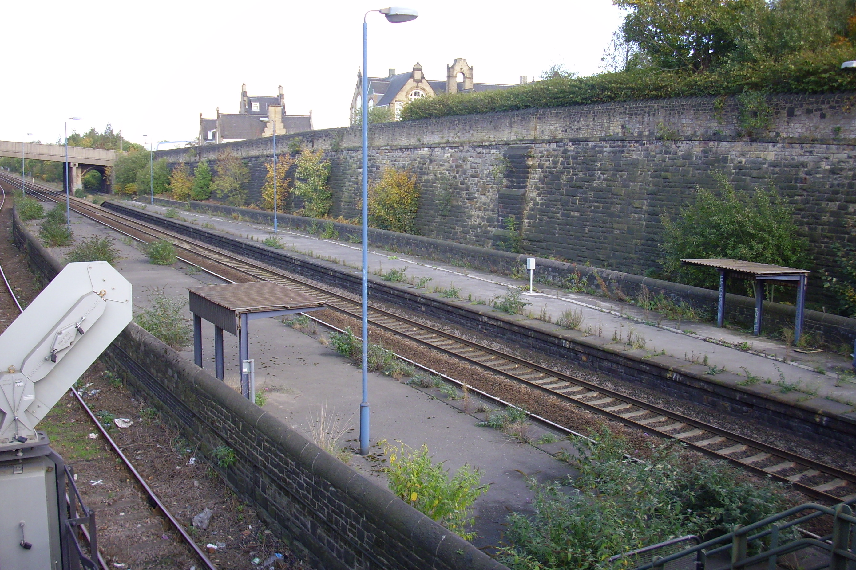
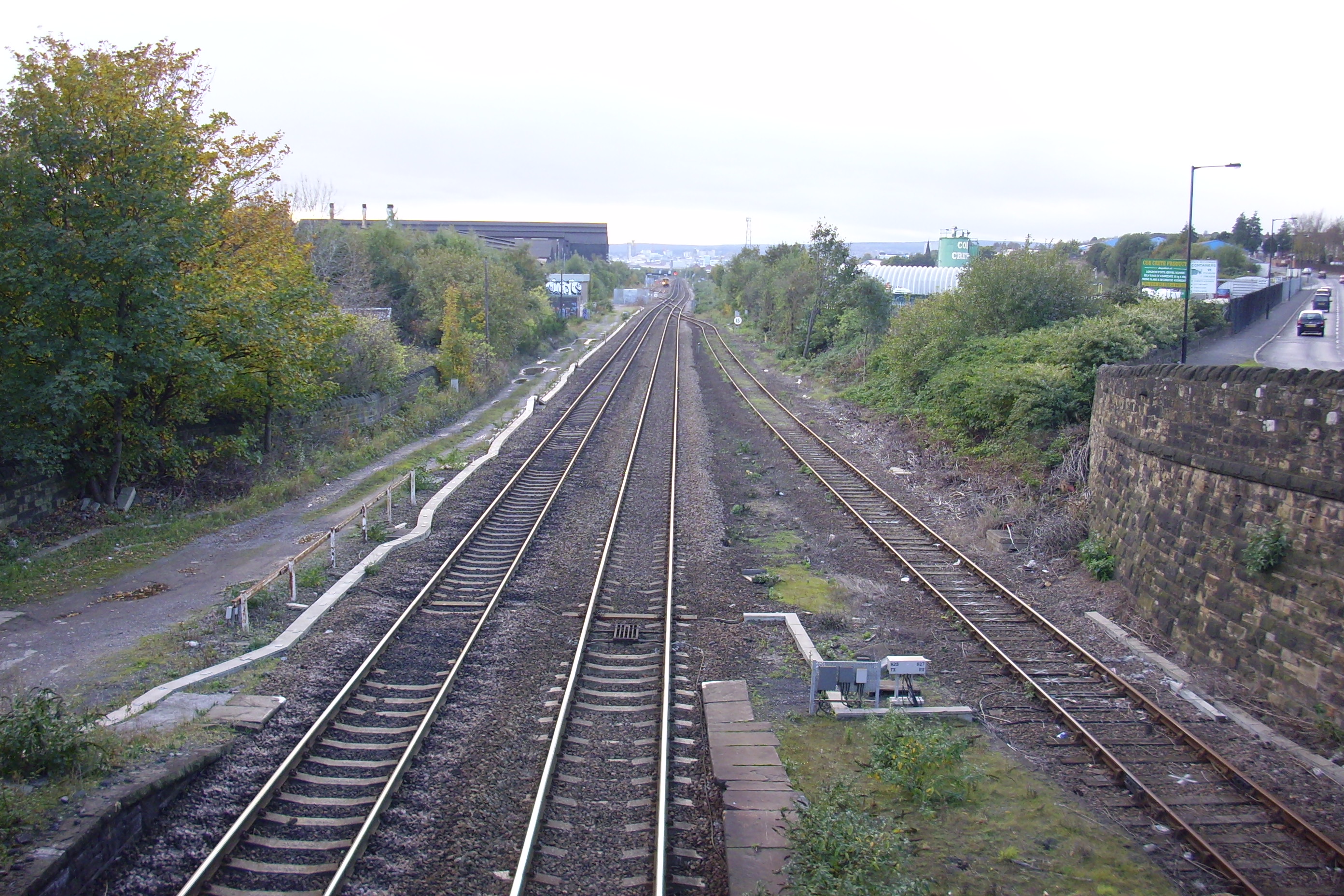
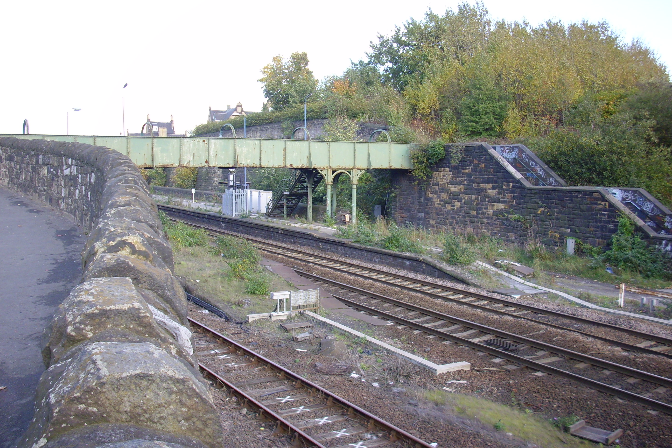
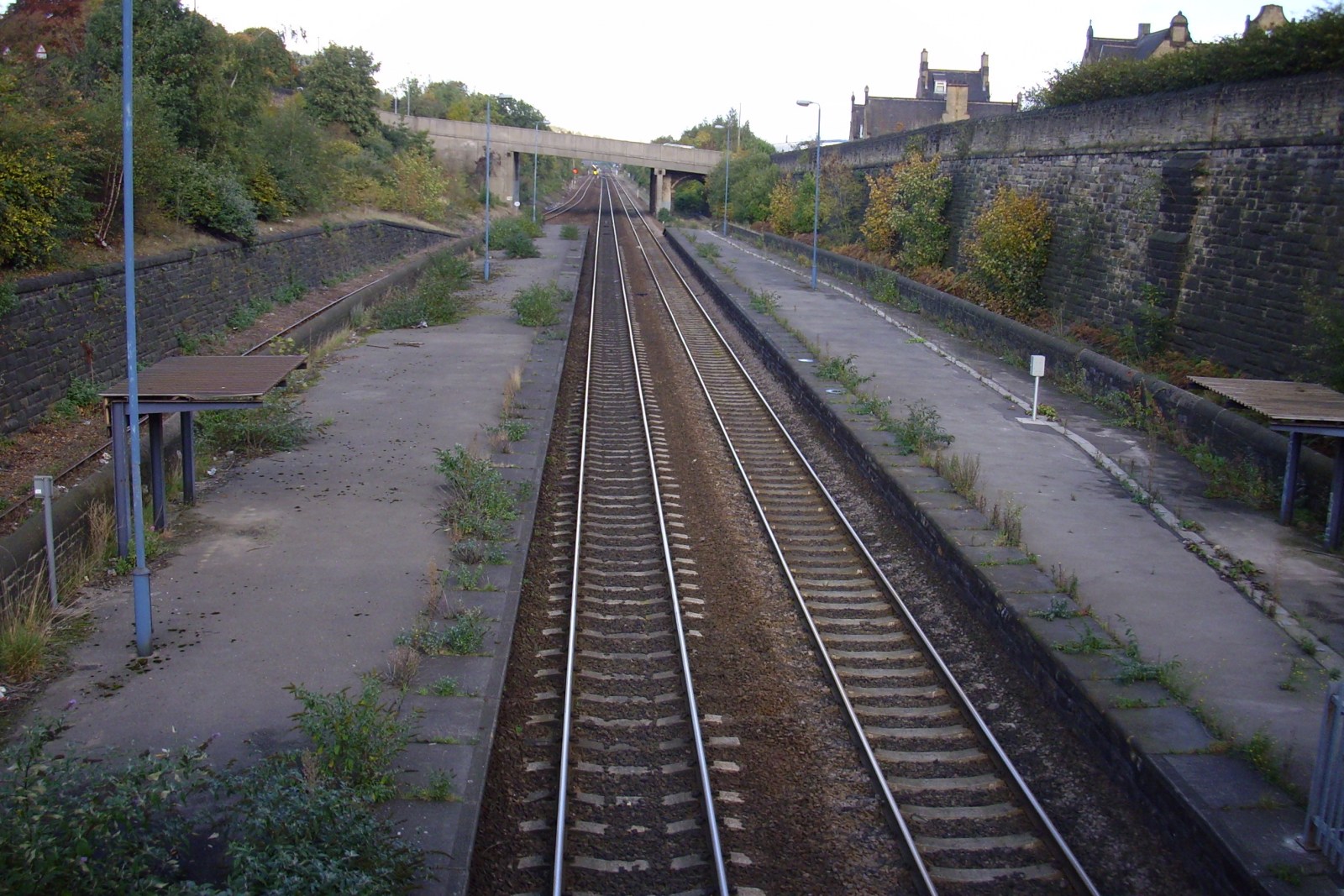
Brightside Railway Station Brightside railway station From Wikipedia, the free encyclopedia Brightside railway station in early 2004Brightside railway station was a railway station in Sheffield, South Yorkshire. The station served the communities of Brightside and Wincobank and was situated on the Midland Main Line on Holywell Road, lying between Attercliffe Road and Holmes Station. The station opened in 1838, at the same time as the Sheffield and Rotherham Railway from Wicker Station and had two platforms although four tracks went through. The two outside tracks were for freight use whilst the two inside tracks were used by both stopping and express trains. Despite the opening of Meadowhall Interchange in 1990, the station remained open until 1993. A limited service had continued in its last three years and the station closed without fanfare with a poster announcing that all remaining trains could be caught at Meadowhall. The standard South Yorkshire style bus shelter that had replaced the station buildings by the early 1980s was removed in early 2006. A footbridge spans across the three remaining tracks and both sets of stairs to the platforms are boarded. The footbridge remains open as it serves as a footpath from the bottom of Dearne Street to Station Lane steps.


-
Can't be the same one then, I'm sure it was Stan and he lived somewhere near Hollinsend Chuch at Hollinsend Road / Ridgeway Road. His chip shop was at Manor Top on the City Road section between the old cinema and the Park 7 Arbourthorne club. To be honest I didn't like his fish and chips that much, preferred the ones from Northern Avenue shopping centre (more convenient) or those from Vinney's on Manor Lane (better chips)
-
This a list taken from White's 1910 Directory of Sheffield and Rotherham. American Skating Rink, Shoreham street and John street. (sic)... I was pushed for time but will check the individual entries at a later date. Attercliffe Skating Rink, Attercliffe road. Royal Alexandra Skating Rink, Hawley street and Sims street. Sheffield Empire Roller Rink Co. Ltd., Aizlewood road. Sheffield Olympia and Provincial Rinks Ltd., Shoreham street and Bramall lane. There were also two more rinks in Mexborough and another in Rotherham. Although not certain about this, I believe the Loxley Bros. printing works on Aizlewwod road is the former Sheffield Empire Roller Rink and retains the original facade - can anyone confirm this ?
-
I don't know whether there's any connection, but on the 1637 Harrison survey there are several fields near Watt Lane at Crosspool called Ramscar Fields. I've not been able to find any explanation for the name, but I wonder whether the connection is to the family gramps mentions?
-
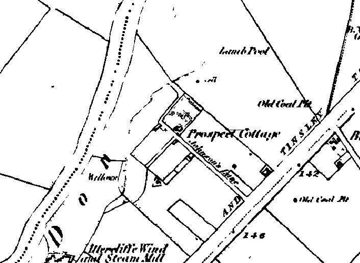
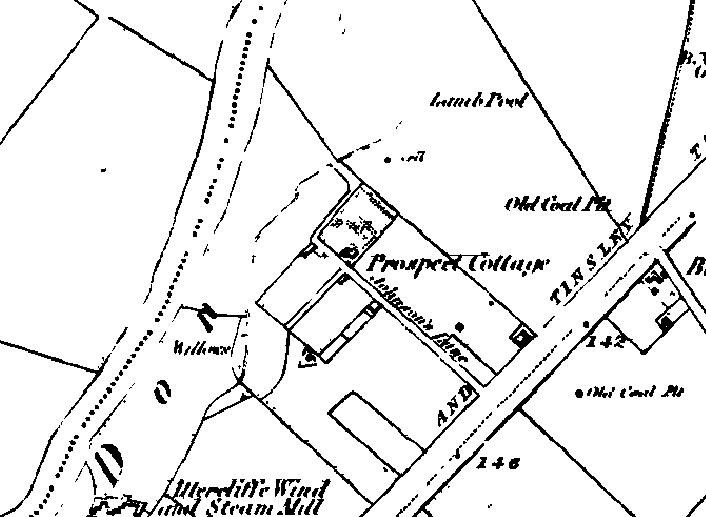
A snippet from R. G. Vine's History of Old Attercliffe. This rather poor map of 1851 gives an idea of the location and shows Johnson's lane and Lamb Pool.
-
There is/was speculation that this was the HQ of the Cutler's Company before the first Cutler's Hall was built in Church lane.
-
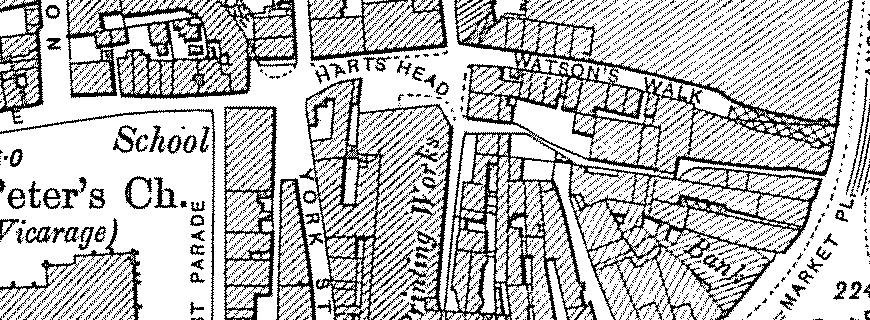
This a plan of the old Watson's Walk... The old Dove and Rainbow stood at the end of it facing up Campo lane The narrow jennel below Watson's Walk may be the old Hartshead Passage.