Search the Community
Showing results for 'coal pit lane'.
-

Anyone know what this building was built as ?
Guest replied to dunsbyowl1867's topic in Sheffield History Chat
I was told it was a B&C branch - selling soft furnishings, millinery, curtains etc. but Patnicks had it when we moved to the area. The B&C grocery stores was on Owler lane along with the butcher's next door. -
Could this have something to do with the ex tram or was it bus terminus on Holme Lane? When they built the new doctors surgery there , they built something in the outer wall saying what used to be there. The next time I pass I shall have a look. :rolleyes:
-
I'm currently researching the postal history of Derbyshire, and need some help on the post offices that are now in the southern suburbs of Sheffield. It is recorded that in the 20th century there were several boundary changes affecting the boundary between Sheffield (and thus Yorkshire) and Derbyshire; notable ones were in 1900 and 1934. The post offices that are in my list as candidates for having been open at some portion of their existence whilst still in Derbyshire are: Abbey Lane; Beauchief; Bradway; Dore; Greenhill; Greenhill Camp; Halfway; Heeley; Lower Heeley; Meadow Head; Meersbrook Bank; Newfield Green; Norton; Parkhead; Thorpe House Road; Totley; Totley Rise; Upper Albert Road; Upper Heeley; and Woodseats. Can anybody clarify for me exactly when each of these areas left Derbyshire?
-
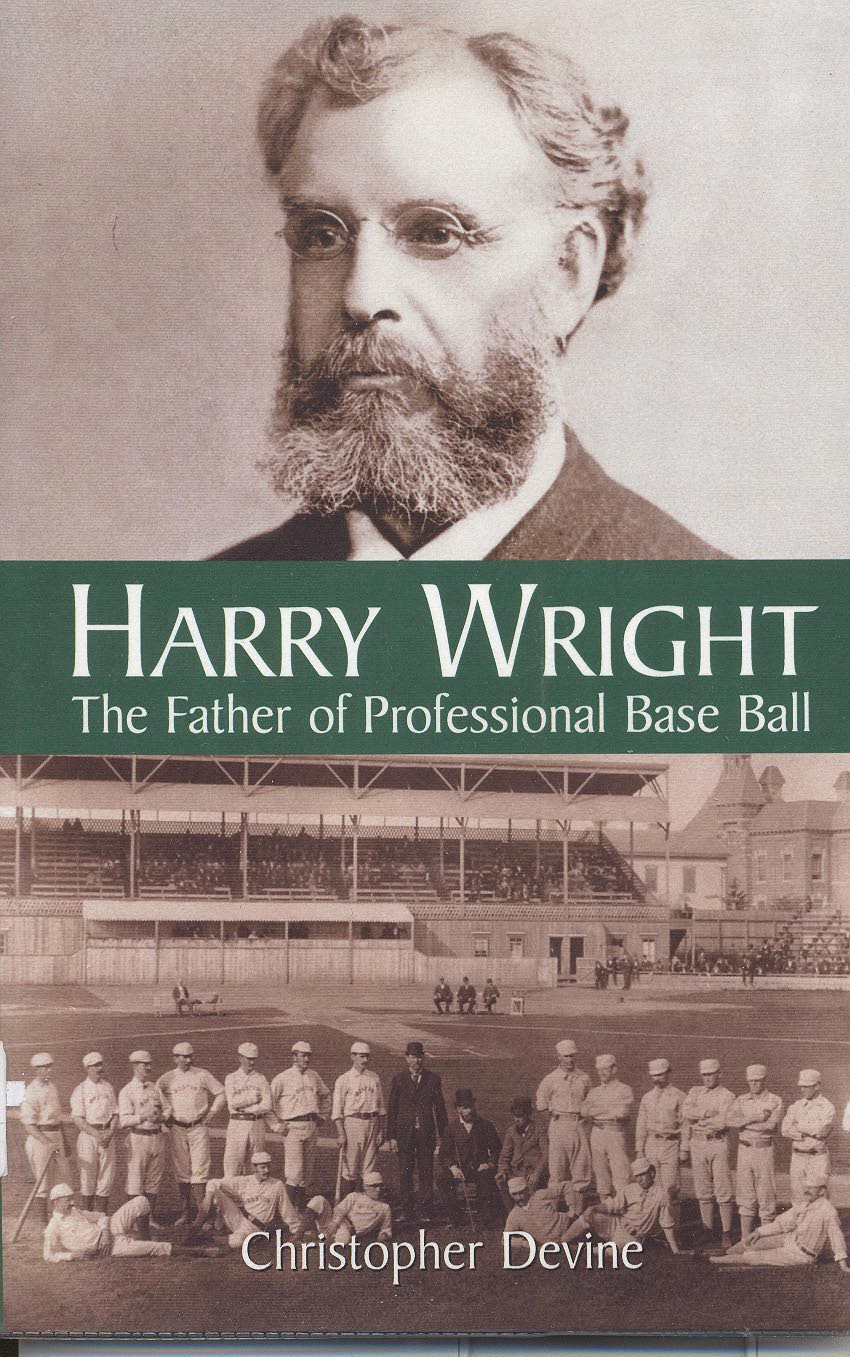
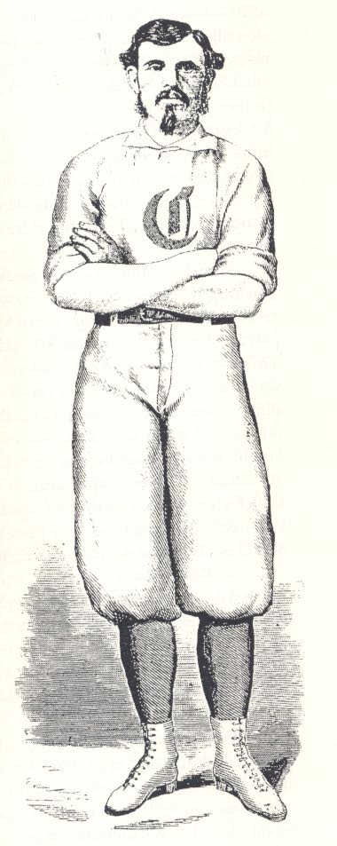
Harry Wright (January 10 1835-October 3 1895) was hailed as the Father of Professional Baseball, and has a lasting place in the US Baseball Hall of Fame. He was the son of Samuel Wright, and his parents took him to America in about 1837, when Samuel, a prominent Sheffield cricketer, accepted a post with a cricket club in New York. The lad was little more than two years old, but he excelled at cricket and baseball from an early age, becoming famous (indeed a legend) in baseball. What Harry Wright achieved in baseball is the subject of a book I have just discovered in the Library. I have been aware of him for a long time, but it is only recently that a book about him has appeared. It is written by Christopher Devine, and is published byMacFarland & Co, Inc, of Jefferson, Carolina. Wright, who brought at least one American baseball team to England (they played at Bramall Lane in the 1870s and 1880s), certainly deserves a place among the giants of Sheffield sporting history --and he probably merits a plaque outside the Town Hall (if only City Councillors knew their history!). I think he might also merit some research into his family at this end. It would, for instance, be interesting to know what part of town he came from and more about his father's background. There may well be some people still in Sheffield who have links with Harry Wright's family but don't know it!


-
Just been litening to Radio 5 and there was an interview with a Cannon from St Marys (Brammal Lane I assume). Anyway during the war the stained glass was removed from the church and hidden down a mineshaft for safekeeping - but they can't remember where! They are keen to find anyone who can remember or has any further information. I wonder why that piece of string was tied reound my finger...........
-
Has anyone seen some stained glass windows?
Guest replied to dunsbyowl1867's topic in Sheffield History Chat
according to todays guardian, it's the st. marys on bramall lane apparently these stained glass windows were of an early "abstract" design. they have funding in place for new ones, which are being fitted shortly -
Mr Reg Varney would always give you sweets after your haircut as a kid, also it was facinating watching some of the old guys having hairs singed on the back of their necks, and how he sharpened the razors on what we thought was a belt. I might be wrong but did Reg Varney then move around the corner onto the left hand side going up Bramall Lane, past the Earl? when that part of Queens Rd disapeared. Also from memory i can recall Walkers actually opening on a Sunday afternoon (or was this due to the early 70s power situation) which was quite unusual back then.
-
Returning to Windmills. These shots are on Windmill Lane, Shiregreen and behind this ancient wall (now allotments) is where the Shiregree Windmill Stood - or so they say! It is a fine wall at least.

-
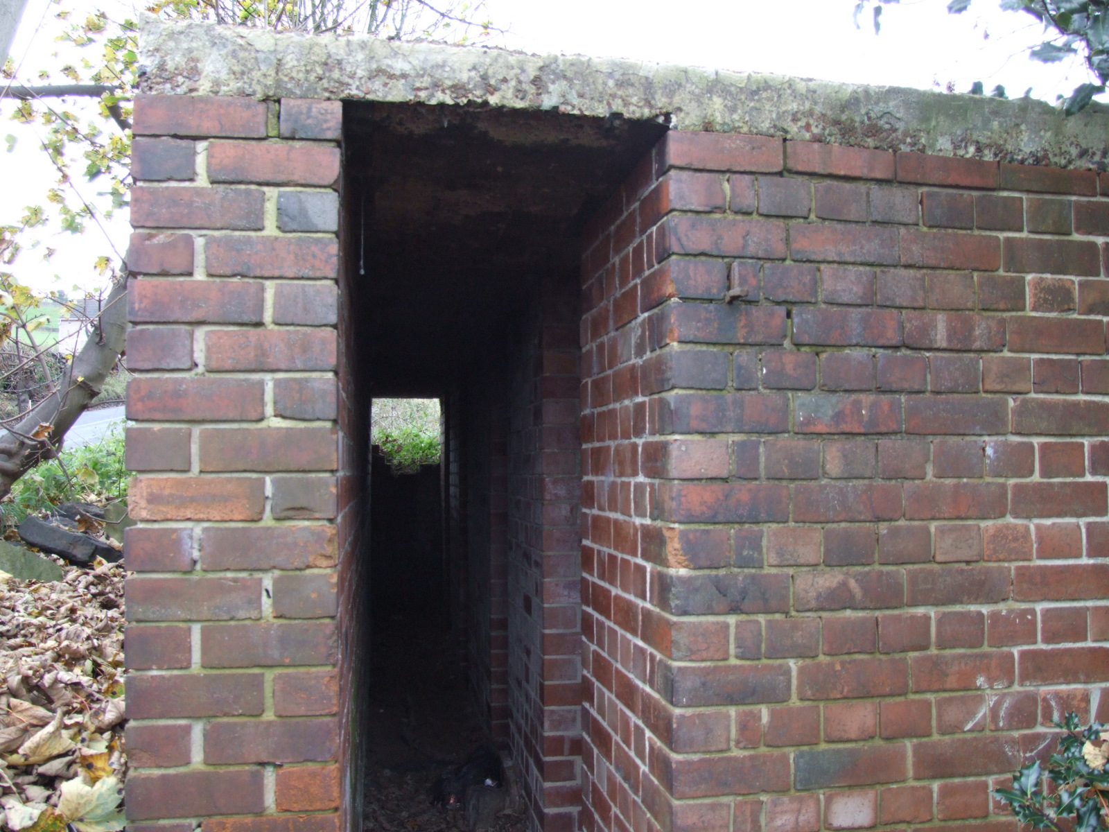
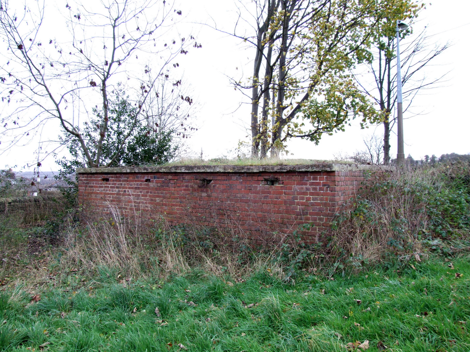
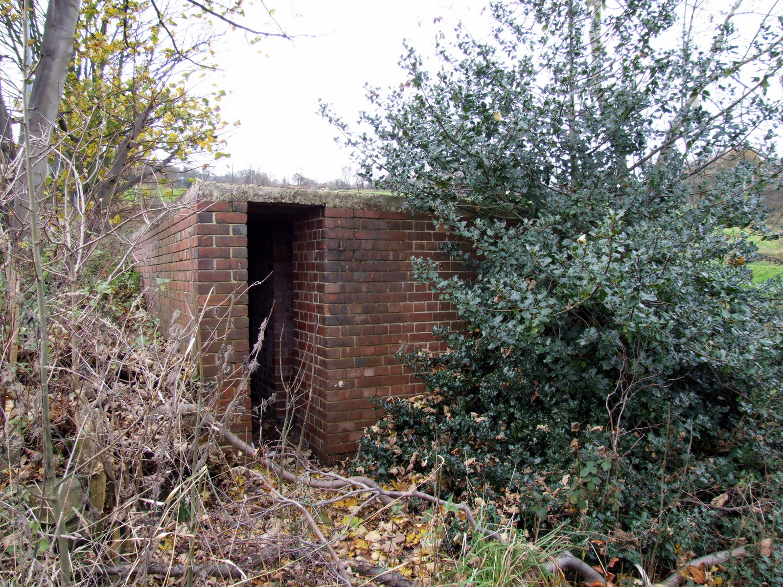
I've been meaning to photograph these 2 for a while now but they've been there for the last 60 odd years ..... so before they disappear. Both are in quite remarkable condition, just a little damage, a bit of vandalism but apart from that almost perfect. Situated a couple of hundred yards apart in fields on Stockarth Lane, about half a mile from the old Middlewood Hospital. Whether they where built for the hospital or nearby houses, I'm not sure, seems strange.


-
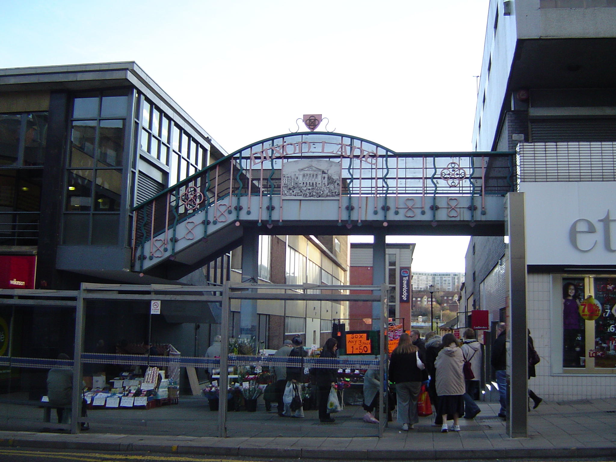
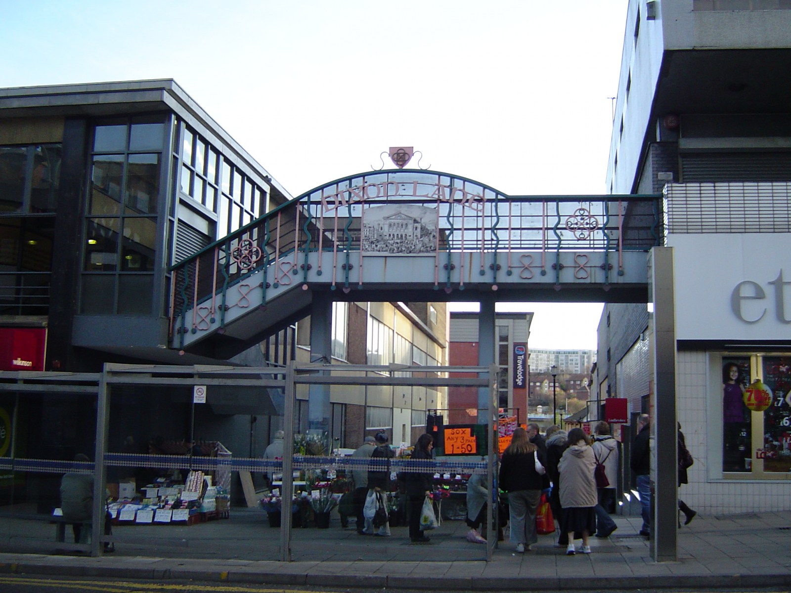
Taken Saturday 22 November 2008 The top end of Dixon Lane has a footbridge over it proudly bearing its name. This type of naming seems quite common in the City centre now.
-
Pashley-Bamforth-Hague link I may have gone some way towards solving this mystery, for it has become evident from later research that the Pashleys living at Mortomley Lane End in 1881 were related to the Hagues and Bamforths. In 1871 George (46) and Lucy (44) Hague were living at Lound Side, Chapeltown, with two daughters Mary (16) and Eliza (12). The 1881 Pashley household was headed by Fred (31) and Mary (26) Pashley, and it would appear that Mary was formerly Mary Hague, daughter of George and Lucy Hague of Chapeltown, and sister of Eliza Hague --Eliza married William Bamforth. By 1881 both daughters had left home, and George and Lucy had their seven year old grand-daughter Sarah for company. The Pashleys of 1881 were: Fred (31), Mary (26), Arthur (5), Lucy (3) and Eliza (1). By 1891 Sarah, now 17, was living with William and Eliza Bamforth, her uncle and Aunt --is is possible that George and Lucy were no longer around? I suspect that George and Lucy Hague must have married about 1854-5, while Fred Pashley and Mary Hague may have wed around 1873-4, with William Bamforth and Eliza Hague marrying in the late 1870s.
-
HI SteveHB , A little snippet while we are on re; Watsons walk on the old map you 've posted, if you draw a line through the words Angel inn right up to the white square,there was a lane named Angel yard,which ran from Angel st to the square and buildings which was a coaching yard and stables, and accom; above for staff, and it was were l went up Angel yard to get to the cabinet shop where l worked before the war, in differing places in this yard was old evidence on walls such as collar res ts on the outer walls , horse shoes ,nailed at varios places, one in particular had Lady cut in the stone under it [ probably the bloke thought more of the horse than his lady at home] these tales were handed down to all that worked up there over the years. Steve it would be interesting if evidence of Angel Yard could be found on some later maps CHEERS sKEETS. MORE LATER
-
White's 1879 Directory lists this on the north side of Love Street. There is no sign of it on Map 3, or on the Godfrey 1905 reprint. However, on the (redrawn) 1851 map I have there is a long street running off Love Street where it turns 90%. This road runs northward to Plum Lane passing by the eastern end of Plum Street. This is completetly filled in by 1905. There is one long narrow works building which seems to be confined to the line of the road! My best guess is that this is Steam Street. The original 1851 maps might show it named. Hugh
-
Cool, so i had the orientation correct, just a few of the premises names mixed up. So with the veiwpoint of that picture being as it was, there seems to be a hill sprouting directly from the back of the yard for the Carbrook and the Arrow. there isn't a hill anywhere near there now, it is the other side of brightside lane where the landscape raises up toward Wincobank etc. Like i said, would this be artistic license? The whole of that hillside cannot possibly have been landscaped to what we see now can it? Also, if the occupents of what used to be the Yellow Lion knew the post had been removed, will anyone find anything now? I think just to pin point the exact spot would be good enough to start.
-
Hello, I'am a woodhouse from mayfield valley, one of my relatives lives in the top cottage on David Lane, Fulwood he knows all the farms in that area Thanks
-
The builder's yard was still there in 1976 - on the map I posted earlier http://www.sheffieldhistory.co.uk/forums/i...ost&id=8822 it was where you see the benchmark 'B.M. 141.4', but has probaly been absorbed in the widening of Broughton lane.
-
Marvellous!! So if it was on a site unnaffected by the widening of the Common, the 'site' may still be there. Once we find the spot, i might have to pay a little sneaky visit, see what i can find. edit - i once read, cant remember where now, it might be in one of my sheffield books, that the gibbett at one point was situated in the corner of a builders yard near the end of Broughton Lane in recent years. I will look later when i get home and update if i find it. This peice of info might narrow it down.
-
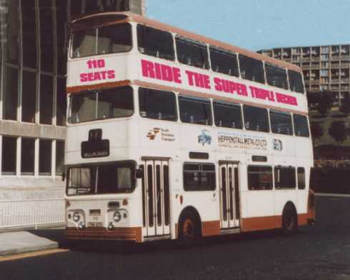
This is the foot note and a link to the site.. During the low fares period of the 1970's overcrowding on buses could be a problem. Although the PTE finally settled on high capacity articulated buses other solutions had been previously tried but amongst other problems the number of low railway bridges within the city limited the use of certain prototypes to just a few routes reducing their effectiveness. This heavily modified 1969 Park Royal Atlantean can be seen in this view of Harmer Lane outside the now demolished sheaf valley swimming baths. Perhaps they should revive the idea to make Harry Potter feel at home if he comes to South Yorkshire on a promotional tour for his third film Harry Potter and the Prisoner of Azkaban which features a triple decker London RT Bus. http://www.pearlgifts.bizland.com/stange_pictures.html

-
My 2 photographs in post #10 and transits comments about them in post #11 show the Sheaf Markets, bearing the large lettering "MARKET (S)" with the Setts market to their right. The Sheaf was behind Woolworths and Setts behind Castle Market. The rag and tag, not in the pictures because it had closed by 1974, was to the left of the Sheaf Market on the other side of Dixon Lane.
-
Having thought about it some more (and having spoken to my sister) the queue did indeed snake up the road, through the tunnel and into Hartshead finally coming to a halt somewhere down Meetinghouse Lane. My Father, of course, took the opportunity to have one or two in the Dove and I can recall the side entrance to the Schofields store (Man, I was bored of queuing by then). Maybe the Star have pictures of the queues ?
-
If there was one picture you could find....
yorkshirecath replied to Sheffield History's topic in Sheffield History Chat
My ancestors used to have a cutlery manufacturers on Broad lane. Would like to see an early picture if poss. Also Radford Street and Upper Hanover Street -
Was this ever preserved, dug out of the ground etc?? Cant see why not, Spence Broughton is quite famous in Sheffield aint he? (or is he just well known amongst us Sheffield History buffs?) Also, without being at home and checking my OS map of the area before Attercliffe Common was widened, does anyone know how far Clifton St/Broughton lane extended in comparison to today? Just wondering if the site will still be accessible, or if it is now in the middle of the road? Dan
-
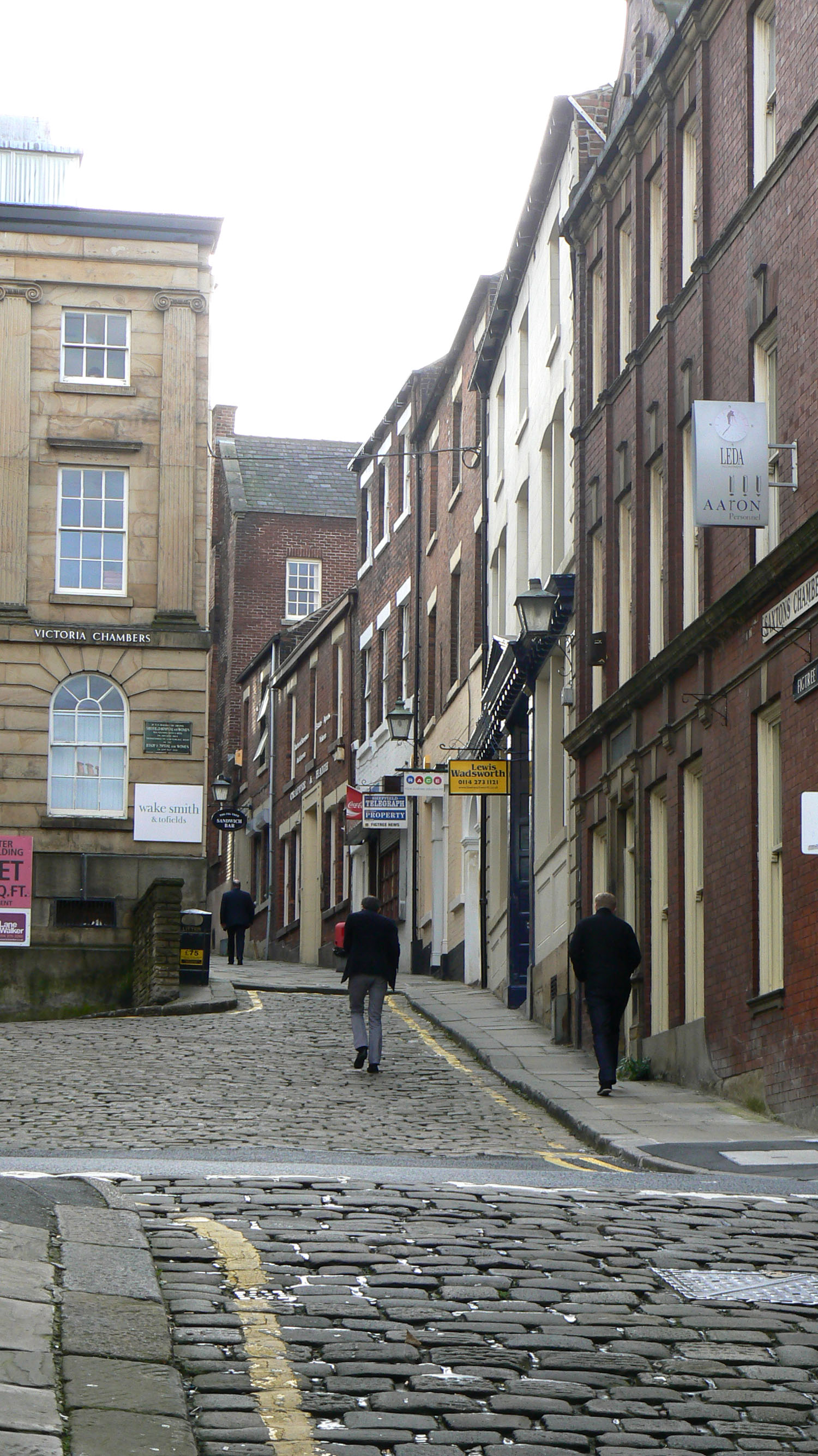
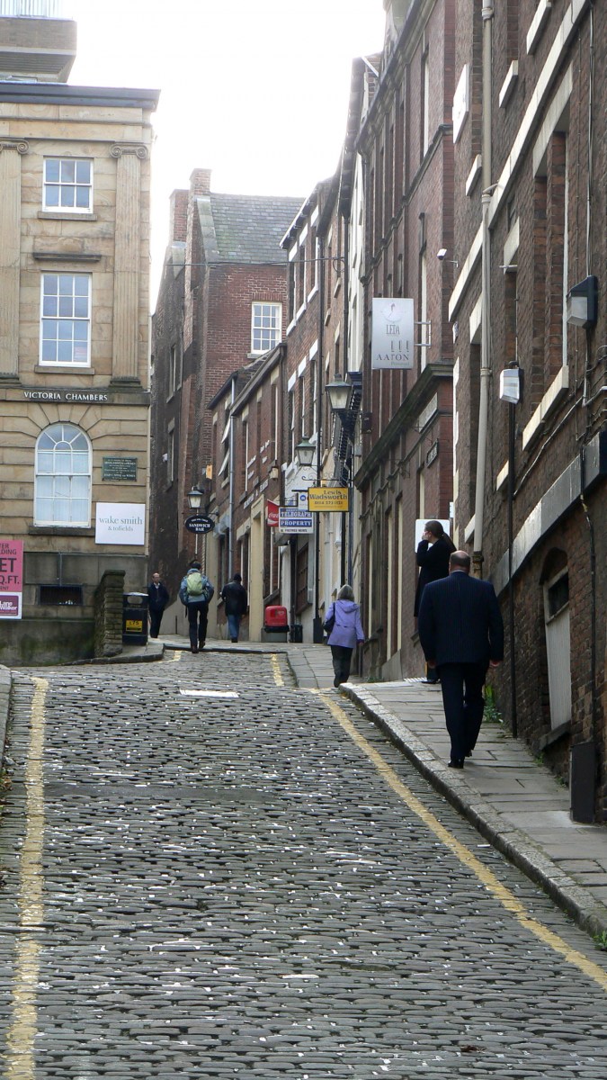
Two Photos of New Street - Figtree Lane 21 November 2008

-
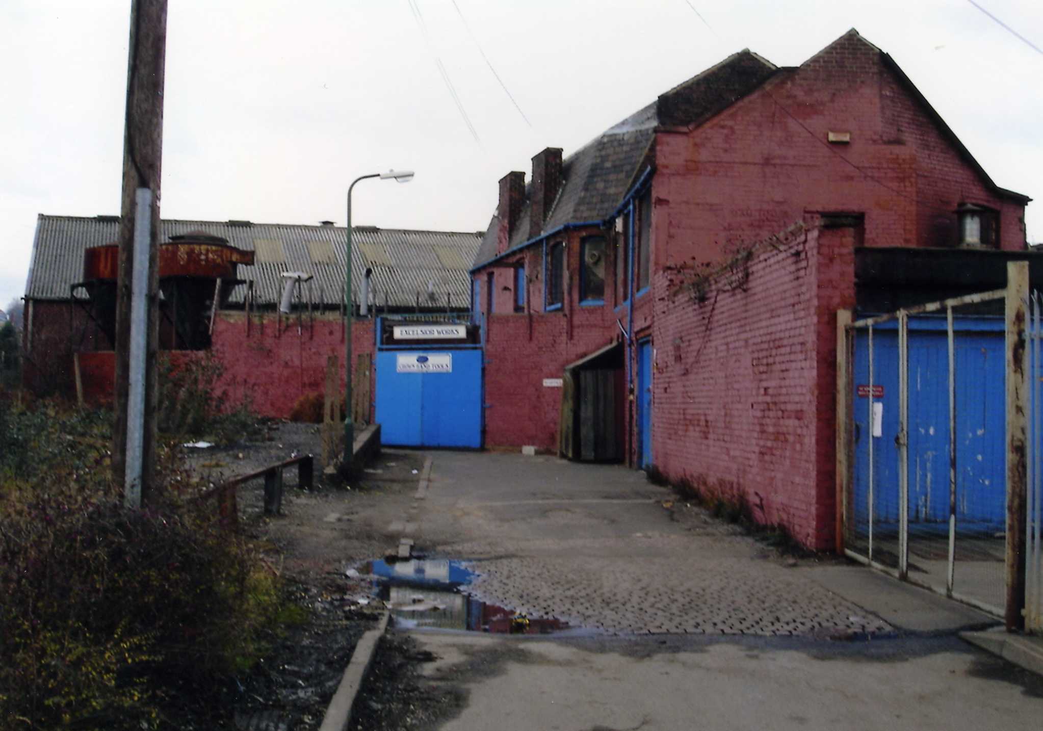
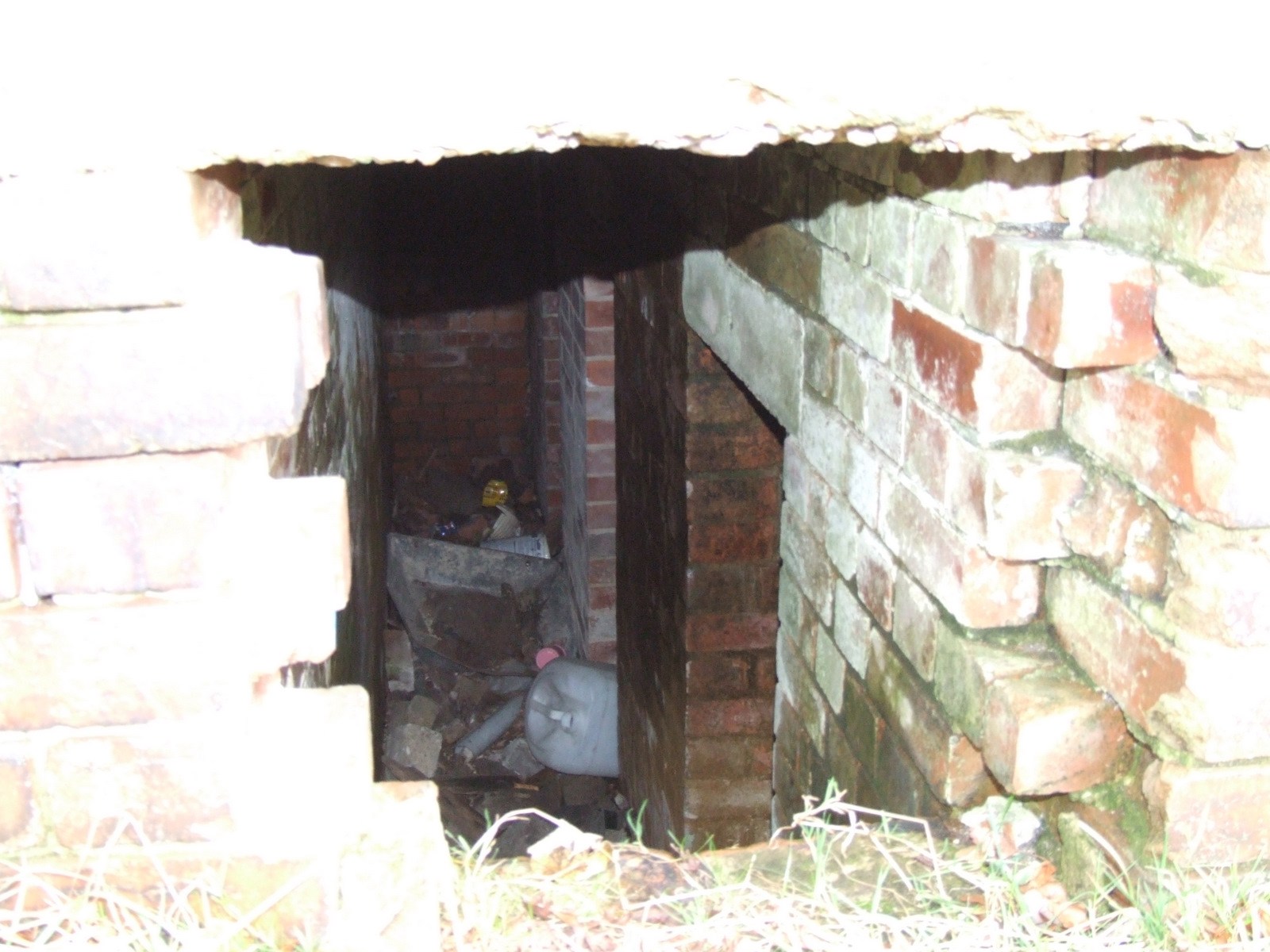
Does anyone know where this is? now gone. As a kid we use to run through one end of the narrow lane and out of the other. It was always a dirty sort of place. To this day I still don't know what sort of manufacturing went on there.

-
Very Good ! I, at least, made it into Paradise Square; the wife only got as far as the railing at the top corner before deciding the whole place was too steep and that she couldn't go any further ! That's the reason we didn't get to go down Figtree Lane/New Street - it wasn't a matter of knowing where it was (bought many a stamp at the Philatelist shop there in the 70's) more a matter of gradient !