Search the Community
Showing results for 'coal pit lane'.
-
Indeed it is - Highfield Cottage in fact which was for a while the home of Geoffrey Sykes. The wagon in the distance has just turned out of Sharrow lane onto London road heading towards town. Above the roof of the cottage can be seen the gables and chimneys of Highfield House and behind the cottage is another row of cottages known as the 'Iron Railings'. It was all lost to road widening not long after this picture was painted, although it is said the iron railings were moved to the raised footway under Heeley railway bridge. Perhaps they still survive ? A slightly different view - www.picturesheffield.com s05716
-
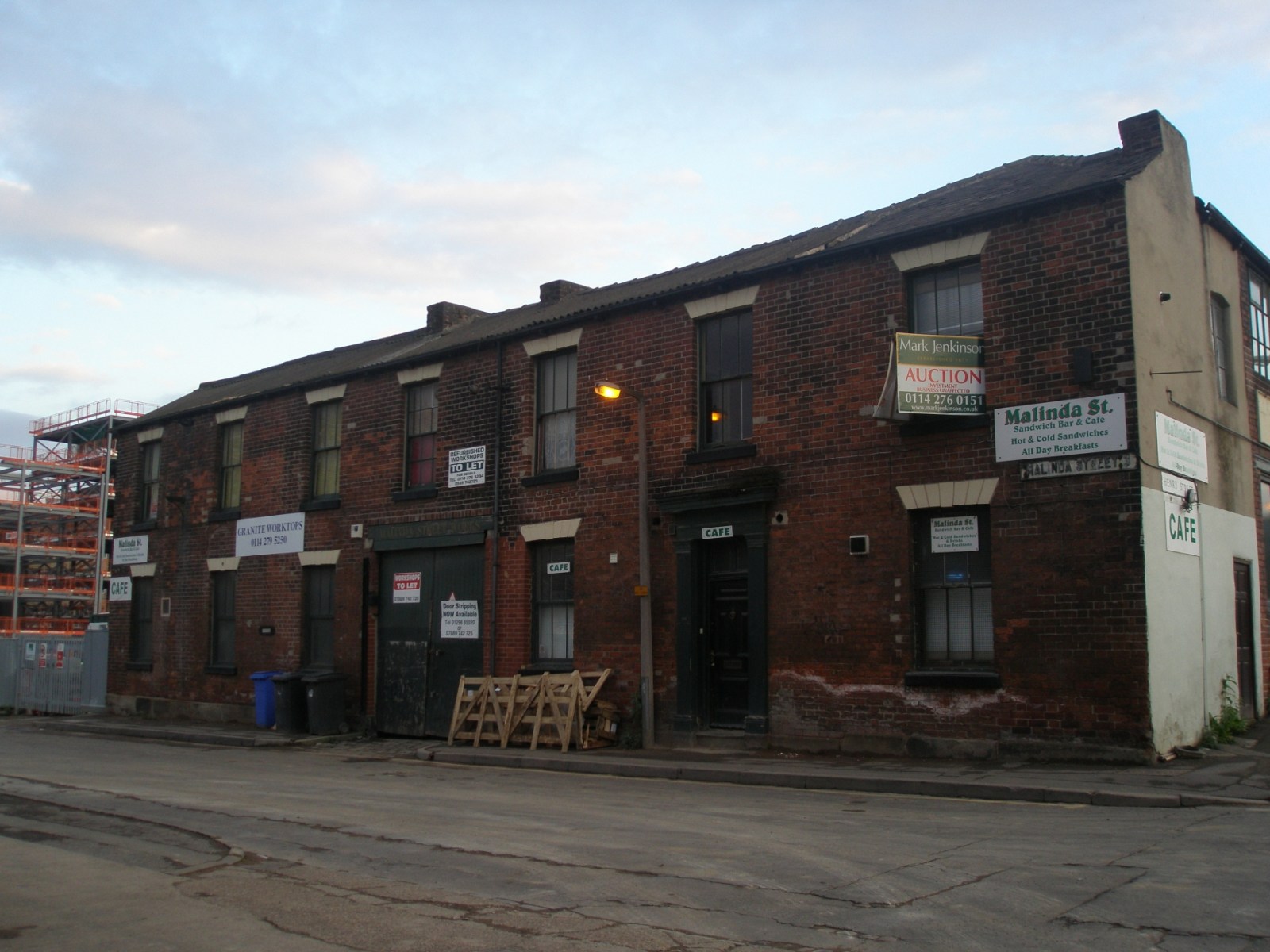
Over the last few weeks (months) I have been wandering the back streets of Sheffield ,looking at old buildings that I thought are Victorian and should be saved. My daughter was looking for some new worktops for the extension that we have built at the back of her house on Derbyshire Lane. I thought that the works that I had photoed a few weeks ago were closed but having gone on the internet I rang the proprietor and found that their works had JUST received Grade 2 Listing for the block.ABSOLUTELY BRILL!!!! I am really pleased that old workshops can still be going amongst the new student flats, http://www.sheafmarble.co.uk/ By the way,the cafe does a good bacon sarnie as well .
-
Another couple of short chapters: XXXII. The Earthwork in Roe Wood About quarter of a mile to the north-east of Shirecliffe Hall, Pitsmoor, is a wood known as Great Roe Wood. Near its western edge is a nameless earthwork, hitherto little noticed, but once or twice described as a "camp." This earthwork originally consisted of one large circular mound and an outer ditch. It is not nearly so well preserved as the earthwork at the top of Wincobank wood, for only portions of the mound and ditch now remain. It is upon a hill side which slopes to the east, not upon the summit of the hill, and there is no ancient road near. With the help of the Rev. W. S. Sykes I examined and measured this earthwork in November, 1893. There are three distinct portions of the mound and ditch now remaining, the most perfect of these being on the east side. Here the mound and ditch are in their original form, and they exaclly resemble the larger and inner mound and ditch of the earthwork in Wincobank wood. The other portions are on the south-east and south-west sides. These are only small pieces, but by their help, and by the help of the fainter traces of the enclosed space still existing, it is possible to make out the original plan. The enclosed area is flat. We took the following measurements: Diameter of the enclosed area measured from north to south - 200 feet Diameter of the enclosed area measured from east to west - 190 feet Inside height of the mound on the east side - - - - 5 feet Perpendicular depth of ditch - - - - - - - 6 feet Width of ditch measured from margin to margin in the three places where it is preserved - 30 feet It will thus be seen that the ditch corresponds in width and depth to the larger ditch of the camp at Wincobank, and to that of the ridgeway. Mr. Winder tells me that, according to plans in the Duke of Norfolk's office, there has been no alteration in the size or shape of Great Roe Wood for the last hundred years, and he says that the largest oak tree he ever saw was felled in it. The six-inch Ordnance map of 1850 marks a spring on the site of the earthwork, though this seems to have been carried away by draining; at all events it is not there now. There can be no doubt as to the antiquity of this earthwork, which seems to have been the site of a protected clan homestead of some old Germanic, or rather Cimbric or Celtic family. Tacitus, as is well known, describes the old Germans not as dwelling in towns, but as inhabiting dwellings scattered here and there in the fields and woods. "Every man," he says, "surrounds his house with a spatium"—whatever that may mean.[1] The names of places in England ending in tún, wurð, etc., show that the enclosed or protected homestead was common here, and what protection could have been better, when stone buildings and castles were not, than an encircling mound of earth and a big ditch? It seems to be almost an instinct in an Englishman to surround himself, if not with a great earth mound, at all events with a big garden wall. The children who make mounds and ditches for their houses on the sea shore are perhaps, unconsciously and by instinct, repeating what their forefathers did ages ago, and what their fathers still do when they build great walls round their parks and gardens, not to shut out their enemies or beasts of prey, but for reasons best known to themselves. Footnotes [1] Germ. 16. As to the word spatium see ante p. 246. XXXIII. The Romans: Scotland Balk An ancient road or raised bank, which in one place bears the name of Scotland Balk, "runs across" (to quote the words of Gibson's Camden) Danes Bank, otherwise Barber Balk, a little to the north of Templeborough. I take this Scotland Balk, which Gibson describes as "Kemp Bank," to have been the great northern Roman road, which passed through or near Templeborough and went forward to Legiolium (Castleford) and York. These words "Scotland Balk" and "Kemp Bank" would at first suggest that this was a ridgeway or an embankment made by the people who made the neighbouring Barber Balk. And these two "balks," which run so near together, appear on the map to resemble the two nearly parallel embankments or dikes at Bradfield already described. But Scotland Balk does not run parallel to Barber Balk. As the plan shows, the two lines get gradually wider apart as they go respectively towards the north and north-east. The opinon here advanced that Scotland Balk is the great northern Roman road is founded upon an examination of the work itself, and upon the negative evidence afforded by the fact that if this be not the great northern road which passed through Stretton, Chesterfield, and Beighton, and went forward through or near Templeborough to the north, it is nowhere else to be found. I doubt whether any inference of this kind can be drawn from the name Scotland Balk itself; it is hardly likely that it means Scotland road, or road to Scotland. I have said something about this word on a previous page.[1] Scotland Balk, otherwise "Kemp Bank," is not so well preserved as Barber Balk; its remains are apparent in fewer places, and it has suffered more from the cultivation of land. It never, like the ridgeway or Barber Balk, takes the form of a rounded embankment with an adjacent ditch. Its summit is never less than twelve or more than fifteen feet wide. In every place where I have examined it its top is flat, and it has a decided appearance of having been a road. I have seen no signs of pavement, but I have had no section cut, or examination made beneath the soil. At the Kimberworth end, or near Gilberthorpe Hill Top, Scotland Balk appears as a slightly-raised road, twelve or thirteen feet broad, the raised sloping bank being most apparent on the eastern side, and having a perpendicular height of four or five feet on that side, whilst on the western or opposite side the perpendicular height is never more than two feet, and in many places there is no bank at all on this side. Nowhere could I detect any sign of a ditch, and only in one small portion, about 300 yards in length, did I observe that the road was in actual use, this portion being merely a lane leading from a turnpike to a field. Further to the north of Gilberthorpe Hill Top the course of the "balk" is not so apparent, though the raised bank appears here and there, but its site and direction can usually be traced by means of two parallel rows of big trees which grow on either side of it, this feature of the road being especially apparent in and near Wentworth Park. In the park the course of the road has been partly obliterated by artificial sheets of water, but a portion of the raised bank running in a straight direction, with a row of trees on either side, is very well preserved. Here, as before, the bank is highest on the eastern side, and the breadth of the "balk" nearly corresponds with its breadth at Gilberthorpe Hill Top, being about fourteen feet. Here, too, the top of the "balk" is flat, and looks like a disused road, and as though it had been an old coach road leading to the north. I have examined it in many places, and have always found its top flat, and at least twice as wide as the path or way which in some places runs on the top of Barber Balk. This feature of Scotland Balk is so uniform and persistent that I incline to regard it, on this ground alone, as an ancient road. Again, Scotland Balk is not, like Barber Balk, a ridgeway; it does not run upon a ridge, or show any trace of having been intended for a barrier against an enemy, or as a defence against attack from the east or south-east. It is, however, possible that this absence of any sign of military engineering is owing to the nature of the ground over which it runs, and the long period during which the contiguous land has been cultivated.[2] It is interesting to compare the breadth of Scotland Balk with that of some of the great Roman roads in Italy, such as the Via Appia, which were from thirteen to fifteen feet wide between the trenches. Two great Roman roads then met at Templeborough, or a little to the north of that town. The exact point where they crossed each other has not been exactly made out, but probably it was somewhere in the line of the turnpike road leading from Meadow Hall to Kimberworth. That part of the Long Causey—if I may so describe the road which led from Crookes to Templeborough—has been little explored to the east of the last-named town. It appears to have led to Lincoln, but if that city is the Lindum colonia of the Ravenna geographer, and if Templeborough is Bannovallum, it seems strange that no town is mentioned between those two distant places. It can hardly be doubted that Lindum colonia is Lincoln, but, as Mr. Bradley has lately shown,[3] it is very doubtful whether -coln in that word translates colonia, or whether Lincoln was a colony at all. Footnotes [1] Ante, p. 144. [2] 1 would here refer to an interesting chapter on "Roman Roads in the Neighbourhood of Rotherham" by Henry Payne, M.D., and John Hugh Burland, in Guest's Rotherham, p. 613, seq. [3] Academy, Nov., 1893.
-

Sheffield History - Then and Now Photo Thread
Guest replied to DaveH's topic in Sheffield History Chat
I also notice that the three ground floor windows on the pub, on the part nearest the Polytechnic are slightly altered. They weren't half-timbered in the old picture. oh, and I'm sulking, again :- not a Mini to be seen in either the then or the now pic! (although the Hillman imp near the bottom of Surrey Lane is a fine example of small car design! hehe) -

Sheffield History - Then and Now Photo Thread
mike142sl replied to DaveH's topic in Sheffield History Chat
Interesting feature about this one is that Surrey Lane has gone from pedestrian to road rather than the other way. -
Thanks - I found it with Flash Earth... http://www.flashearth.com/?lat=53.377508&a...223&src=msa I'd say that corner is part of the original development in the early 1800s. The taller works buildings along Brown lane, if they're still there, look to be a little later.
-
Ok with the golf theme but not Abbey Lane Question now is where else can you play golf?
-
The golf course of Abbey Lane, near the junction with Abbeydale Rd South?
-
a. I think it is an old hand powered petrol pump b. Stag Public House Psalter Lane, if not no idea!
-
The last time I checked, Harry Truelove was living in Bridlington. In fact, he moved to Bridlington many years ago. When Harry moved out of one of the offices at Intal, he was succeeded by a lad called George Vaughan. George came from Unstone, where his parents kept a pub, and he was a rare character. He used to sign himself "George Vaughan II" because he was the second George in his family! I vaguely recollect that after George left, a lad called Bryan Moss took his job. I remember a Brenda Lowery in the main office, also a Duggie Gyte and a John Forrest. John Forrest emigrated to South Africa. The telephonist at W St was Madge Gill. The main man at Watery Street was Tony Neill, the sales manager. His sidekick was a chap called Swallow. There was a director based at W St called Schindler, but the top man was a guy called Shuttleworth. However, I think Shuttleworth spent most of his time at the Claywheels Lane site, where Intal had a link of some kind with a firm called the Pickford Tool Company. Top man at the PTC was Bill Crookes.
-
hi richb, the photo tha you have put on. do you think the hedge row with the 2 trees that is coming down the field, would that be known as corker lane.
-
It might help if I say that several members on the course were employed by the Hope & Anchor Brewery on Claywheels Lane, and Sheffield Transport had two people attending. One of them was the late Ronnie Nott, who was personnel officer at the Transport department for many years. There was also a great lad called Ken Swindells on the course. Ken came from Dalewood Avenue. I did hear that Ken, having been a sales rep for a chocolate firm in York, took a post office somewhere in Yorkshire. Sadly, when I tried to find Ken a few years ago, I learned that he had died. Bill Ward is another name I recall, and Ray Straw (although I think he was one of the H&A crew). A Mr & Mrs Malthouse (he was in the building trade), and Dorothy Thompson are other names.
-
Yes, Ken Lee was a classy batsman, tall and elegant. He was also a gentleman, a great guy. For many years he was a director of Sheffield United, serving on the old cricket committee in the days before wee pipe Wragg decided to kick cricket out of Bramall Lane. Sheffield United had a number of class acts in the old days, and if I can find a picture of one of the old teams I will post it on here. In the meantime, I am hoping that a number of the people who have discussed local cricket on the Sheffield Forum site will join us here and add a few stories and pictures!
-
When I used to watch Sheffield United at Bramall Lane on saturday afternoons they had a prolific batsman by the the name of Ken Lee?am I right?
-
Constable Road School (AKA Hemsworth County Primary) Gleadless Valley 1968-73 Sharrow Lane School 1973-5 Abbeydale Grange Secondary 1975-78 High Storrs 1978-1980
-
Ambrose Langley, Victualler Cricketers' Arms, 106 Bramall Lane (Kelly's 1925)
-
Christmas at Crimicar Lane Hospital (1920's) http://www.picturesheffield.com/cgi-bin/pi...ff.refno=t03653
-
XVIII. The Unfree—The Irish Element—"Scotland" In the last two chapters we discussed the history of the Burgesses, or, as they were first called, the Free Tenants of Sheffield. It was they who formed the ruling caste. They held their land in "free" socage, and we may infer from the negative evidence afforded by the Furnival Charter and the books of the "Town Trustees" that at an early period they had attained a high state of social development, the evidence contained in these books being little more than echoes or scanty survivals from a long and unremembered past. The very mention of a "free" class of men necessarily implies the existence of a class which was not free, and which, if not in actual serfdom, had not, at all events, the same social rights as the Burgesses. We have seen[1] that the Burgesses held their land in free socage, and that the "sokemen" of the Doomsday Book are only found in the Danish parts of England. There is some reason therefore for believing that the Burgesses of Sheffield were originally a band or colony of Danish settlers. We have seen that this ruling or higher caste has left traces of its early existence amongst us, and we have also seen that its system of local government survives to this very day in the bodies known as the "Town Trustees" and the Twelve Capital Burgesses. Although, as I have said, the existence of a free class necessarily implies the existence of an unfree class, yet the traces or remains of such a class are not now to be found, except, indeed, in the copyholder or tenant in pure villenage, who, in the manor of Sheffield, holds his land "by the straw," and "at the will" of the lord, the freeman only being capable of holding real estate in fee simple.[2] But there is evidence that in early times a body of men known as "Irish," or perhaps as "Scots," settled in Sheffield by the side of the Teutonic colonists, and occupied a quarter of their own. I have no evidence to show that these "Irish" were ever in a state of serfdom under the dominant inhabitants, but it is clear that they formed a separate class or caste. At the bottom of Prior Gate, otherwise High street, stood a cross which in Gosling's plan is called Market Cross. On the same plan the street below is called Market Place, now Angel street, and it extends to the Irish Cross, which stood at the junction of Snig hill, Water lane, and Castle Green head, Bank street not having been made at the date of the plan. Both these crosses are figured in the plan, and the Irish Cross is mentioned in a deed of the year 1499.[3] We may infer from this that, at a remote period, the inhabitants of Sheffield were divided into at least two distinct races, each having its own market. If, for the sake of argument, we call the Market Cross the English Cross, to distinguish it from the Irish Cross, we shall get an idea of what the distinction was. These two market crosses imply nothing less than the division of Sheffield into two distinct races. "If," says Mr. Gomme, "we only possessed early maps of all our towns it would be seen how the formation of the village was almost invariably based upon the aggregation of different clans."[4] Further on he says "the mode of settlement in some of our great towns exhibits clear traces of tribal divisions. At Nottingham, until so recently as 1715, the market place was divided lengthwise by an ancient wall breast-high, supposed to have been erected to provide separate market-places for the irreconcilable Saxons and Normans. This wall was taken down about this date, and the market-place for the first time was paved. This division is most probably much older than the Norman era, as at Nottingham we have that remarkable instance of a difference between the two parts of the town in the modes of descent of property, one part following the rule of primogeniture, the other that of junior right, or borough English, and junior right is, at all events, older than political history."[5] Mr. Gomme quotes the "Statistical Survey of Roscommon" thus: "In many of the ancient corporate towns and boroughs in Ireland, certain quarters are known under the appellation of Irish Town,[6] and were occupied by the so-called 'mere Irish,' in contradistinction to the more favoured inhabitants of a different caste. In walled towns the quarters very commonly stood outside."[7] In Sheffield the lower caste seems to have been settled under the castle walls, and to have extended thence in a northerly and westerly direction towards Shales Moor, or Shale Moor, and towards Scotland street. In Fairbank's plan, 1771, Scotland street is described simply as "Scotland," and I have noticed in the indexes to the Duke of Norfolk's maps that the place is referred to simply as "Scotland." The street, then, appears to have taken its name from a portion of ground which was called Scotland.[8] This field-name is found in many other places; for instance there are places called Scotland and Scots Bank at Wedmore in Somersetshire. I might even mention Scotland Yard in London, which is a very ancient name. I think it is likely that "Scotland" here means "Irish land," especially as Scotland street and the neighbourhood of West-bar are at this very day the quarters of the so-called "Irish." The Scots, as is well known, were an Irish sept, and the old Germans regarded a "Scot" as a roving trader from Ireland.[9] It is possible that these roving traders established at an early period a settlement in Sheffield, forming a distinct class or caste. It is however possible that Scotland means "conveyed land," or land conveyed by a symbolical act. The old laws of Norway and Sweden mention a way of conveying land by throwing a handful of earth, or a straw, into the lap (O. N. skaut, Swed. sköt) of the purchaser, the witnesses holding up his lap. From this process there arose an Old Norse verb skeyta, Swedish sköta, to convey, and an Old Norse skeyting, Swedish skötning, Low Latin scotatio, a conveyance.[10] Now we have seen that in the manor of Sheffield copyhold land is still held "by the straw," a straw being still twisted into the purchaser's conveyance, or copy of court roll, technically known as a surrender and admittance. It was not the land of the freemen, but the land of a lower class of men, holding at the will of the lord, which was conveyed in this way. The freeman usually acquired his estate by inheritance; it did not pass, at all events in early times, by conveyance. But the copyholder required "admission"to his land, whenever a change took place by death or otherwise, and this "admission" was performed by the symbolical act of throwing a handful of earth or a straw into his lap in the name of the whole estate. Hence land acquired in this way may have acquired a distinctive name; it may have been regarded as land conveyed by a symbolical act, as distinguished from land which in early times was not usually conveyed at all. And then we have the Old English sceot, meaning payment, and also a furlong or division in a field. But "portion land," "furlong land," "payment land" would not make sense. It seems to me therefore that the choice probably lies between "conveyed land" and "Irish land." Now Scotland meaning Irish land is a known word; as meaning "conveyed land" it does not appear to be known. It is most likely then that the word here means Irish land, more especially as we have distinct proof of an ancient Irish element in the population, and as the part once called "Scotland" is now occupied by "Irish." Another proof of the different origin of the inhabitants of the "Irish" quarter is to be found in the fact that their dialect differs in some respects from the dialect of their neighbours. Thus they speak of a shilling as a deenar, a word which is plainly derived from the Latin denarius.[11] This word, however, is found in Old English as dinar. A curious custom kept up upon this very place once called "Scotland" seems to afford evidence that it was formerly inhabited by a race of men differing in nationality from the Burgesses or freemen, and possibly from other inhabitants of Sheffield. A feast formerly held in the neighbourhood of West-bar was called, as old inhabitants have told me, "Scotland feast," and not, as a late writer has described it, "Scotland Street feast." In 1827 a writer in Hone's Every-Day Book gave an account of a Sheffield feast which he called "Scotland feast." After a brief mention of other feasts in the town he says: "Scotland feast, however, in point of interest, bears away the bell from all the other district revels of Sheffield. It is so called from Scotland-street, already mentioned; a long, hilly, and very populous one, situated in the northern part of the town. On the eve of the feast, which is yearly held on the 29th of May, the anniversary of the restoration of our second Charles, parties of the inhabitants repair into the neighbouring country; whence, chiefly however from Walkley-bank, celebrated as Sheffield schoolboys too well know for birch trees, they bring home, at dead of night, or morning's earliest dawn, from sixteen to twenty well-sized trees, besides a profusion of branches. The trees they instantly plant in two rows; one on each side of the street, just within the curbstone of the flagged pavement. With the branches, they decorate the doors and windows of the houses, the sign-boards of the drinking-shops, and so on. By five or six in the morning, Scotland-street, which is not very wide, has the appearance of a grove. And soon, from ropes stretched across it, three, four, or five superb garlands delight the eyes, and dance over the heads of the feast-folk. These garlands are composed of hoops, wreathed round with foliage and flowers, fluttering with variously coloured ribands, rustling with asidew, and gay with silver tankards, pints, watches, &c. Before the door of the principal alehouse, the largest tree is always planted. The sign of this house is, if my memory do not deceive me, the royal oak.[12] Be this as it may, certain it is that, duly ensconced among the branches of the said tree, may always be seen the effigy, in small, of king Charles the Second: to commemorate indeed the happy concealment and remarkable escape of the merry monarch, at Boscobel, should seem to be the object of creating a sylvan scene at 'Scotland feast;' while that of holding the feast itself on the anniversary of his restoration is, there can be little doubt, to celebrate with honour the principal event in the life of him, after whose ancient and peculiar kingdom the street itself is named. To the particulars already given, it needs scarcely be added, that dancing, drinking, and other merry-making are, as a Scotsman would say, rife at the annual commemoration thus briefly described."[13] I am told that the feast lasted about a week. It was kept up not only in Scotland street, but in the streets adjoining. The trees planted in the streets were young birch trees, which were brought, without their roots, from Walkley and Upperthorpe, and planted on each side of the street. We may ask why the people in the Irish quarter of Sheffield, to the exclusion of the rest of the inhabitants, were so interested in the restoration of Charles II. that they kept up a feast for a week, and, as I have been told, drank up all the ale in the district? Were the other inhabitants of the town less loyal to the English Crown than these "Irish," or these inhabitants of the "Irish" quarter? It cannot have been so. It is true that "Scotland feast," in its later days at all events, was kept up on the 29th day of May, and during the week following. It is also true, I believe, that an innkeeper in the street used to plant an oak tree in front of his house, and hang up an effigy of Charles II. This "Scotland Feast" was really an ancient ceremony which had been observed in the district from a remote antiquity. In its last days the feast got mixed with the restoration of Charles II., and such mixings of old things and new are well known to students of custom and folklore. If this feast was first instituted in memory of the king's restoration why were birch poles and not oak poles eredled in the street? "In Germany," says Aubrey, "almost every where at Easter, and especially at Whitsunday, they set in their houses, parlors, and chambers young birch trees which they keep a fortnight or longer green in keeping the same in tubs with fresh water, and in some places the churches are also full."[14] He also says that "at Westchester[15] on St. Johns Baptist Eve [June 24th or Midsummer Day] they bring a multitude of young birch trees and plant before their dores to wither." In Brand's "Popular Antiquities" some old churchwardens' accounts are given showing payments for birch treqs for Midsummer Eve, and "agenst Midsummer."[16] Gerard, in his "Herbal," says that the birch "serueth well to the decking up of houses, and banquetting roomes, for places of pleasure, and beautifying of streets in the crosse or gang weeke, and such like." In the "cross or gang week," a day or two before Holy Thursday, the cross was carried and the bounds of townships were beaten. It appears from these accounts that the birch was used at various summer festivals, or ancient ceremonies. The 29th of May comes nearest in point of time to the Whitsun Ale, but whether "Scotland Feast" represents the Whitsun Ale or not it is clear that it is far older than the restoration of Charles II., and is a survival of an old pagan festival. At the village of St. German's in East Cornwall a mock mayor was chosen on the 29th of May—the same day, be it noted, as "Scotland Feast" in Sheffield—and the election was followed by drinking and rude festivities. This is one of the examples from which Mr. Gomme draws a parallel between the festivals of races which settled in Britain and those of India. "All the vagaries and nonsense practised at these festivals in India are so many symbolical expressions of the power of the non-Aryan tribes during the admitted period of license. There is no reason why in Britain they should not express, in survival, the same village festival with all its significant ethnic symbolism."[17] I think we may lay some stress on the Cornish parallel here advanced, the day of celebration being identical with that of "Scotland Feast." The inferior race, whether non-Aryan or not, clung to its old customs, such customs being tolerated by the Teutonic overlords. We have no record of the election of a "mock mayor" in Sheffield on the 29th of May, but the "Scotland feast" which began upon that day is evidence of a racial and social difference between the free men and the unfree, between the burgesses and the lower caste belonging in part at least to another nationality. The distinction of races is still maintained in the clannish habits of the people who bear the name of Irish. It must not be supposed that these people are all recent emigrants from Ireland. The mention of the Irish Cross in 1499 is alone enough to prove that they existed as a separate race in that year. The Irish of 1499, and of a much earlier time, are identical as a nationality with the people who inhabit the Irish quarter of Sheffield in 1893, though their numbers may have been increased by recent emigration from Ireland, and though the race may have been modified by the introduction of new blood. Footnotes [1] Ante, p. 122 n. [2] Grimm's R. A., p. 290. [3] Hunter's Hallamshire, p. 138. The Irish Cross was an erection of considerable size, and upon its summit was a weather cock. Amongst the accounts of the "Town Trustees" not yet printed I find, under the year 1715, the following "Charges Reparing Irish Crosse Paid Hesketh work there ut per receipt 0 2 6 Luke Ratclifle ut per bill and receipt 0 6 1 Thomas Rhodes ut per receipt 0 10 0 Thomas Nowe ut per bill and receipt 0 6 0 R. Wilson ut per Do. 0 3 0 Mending the weather Cock 0 2 0" [4] Village Community, p. 240. [5] Ibid., p. 246. [6] There is a field called Irish Close at Tickhill near Rotherham. [7] Village Community, p. 252. [8] Gosling does not mention Scotland street by name. The street existed in 1736, but he calls it Lambert Knoll, which was evidently the name of the hill. Fifty years ago, I am told, many of the houses in the street were thatched. [9] Wackernagel's Altdeutsches Handworterbuch. p. 256. [10] Vigfusson, s. v. skeyta; Grimm's R. A., pp. 116, 124; Ihre's Glossarium, s. v. sköta. [11] See more on this subject; in the Supplement to my Sheffield Glossary, 1891, p. vii. [12] "In my boyish days, one Ludlam kept it. Was it he to whom belonged the dog which gave occasion to the proverbial saying, 'As idle as Ludlam's dog, that lay down to bark'?" [No such public house as the " Royal Oak " occurs in a Sheffield Directory dated 1822 (Baines, Leeds), in Scotland street, but two other "Royal Oaks" are mentioned. Nor does it occur in a Directory of 1849. The Directory of 1787 has "Ludlam George, victualler, Scotland Street."—S. O. A.]" [13] Hone's Every-Day Book, 1827, ii., 1261. The article is dated from Paisley, Sep: 21, 1826, and is signed "Gulielmus." [14] Remaines of Gentilisme, p. 119. [15] Chester. [16] Ed. 1849, i., 307. [17] Village Community, p. 110.
-
Navigation Hill can be found on our Map 94 Nr Blast Lane & Bernard Rd See this extract

-
The first football match you went to...
hougomont replied to Sheffield History's topic in Sheffield Sport
Absolutely correct, and I can remember very clearly sat on the wall at Leppings lane end and seeing Robinson breaking through to score, and we payed fourpence, four old pennies, to get in.What would Wednesday give for "Robbo"today??????????????? If anyone is wondering about the Owls playing Lincoln,during the war leagues were formed on a geographical basis to cut down excessive travel, and of course many players were serving in the forces and "Guest"players were allowed from other clubs players in the vicinity.My apologies for the histrory lesson folks -
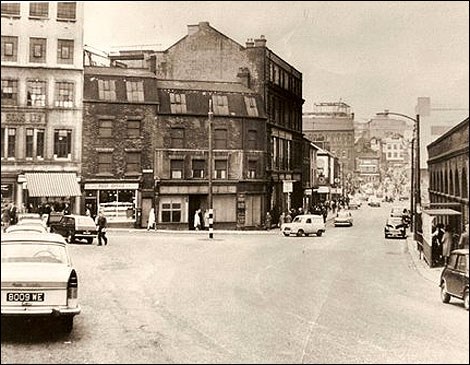
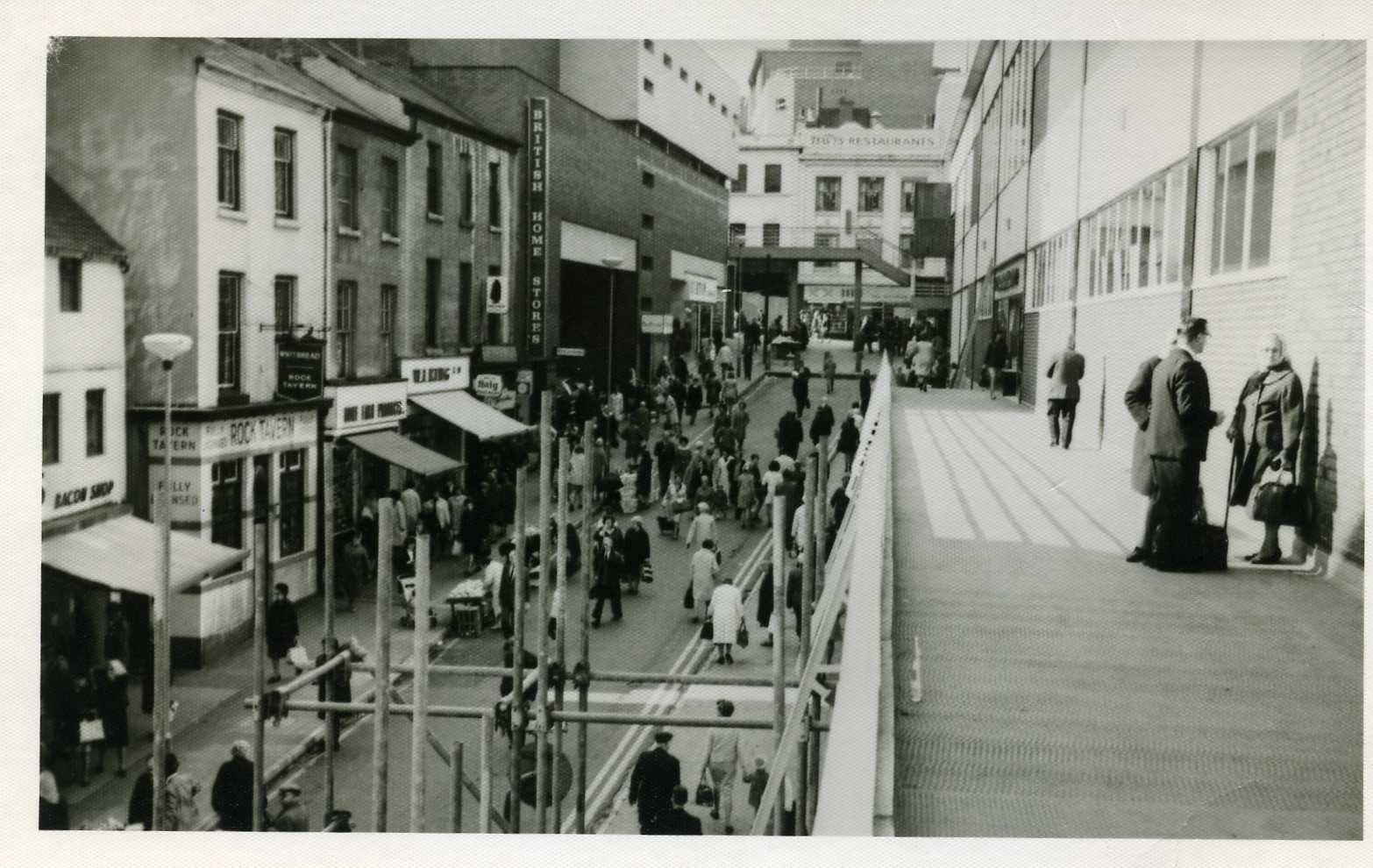
....sourced this one taken from where Granellis still stands !, looking the OTHER way - can just about pick out the Norfolk Arms/ Dixon Lane in the distance. The road in front is the junction/bottom of Duke St. Almost everything in this pic up to the Norfolk Arms was demolished to make way for Park Square roundabout ! :o

-
One of the England-Australia cricket 'Victory Tests' was played at Bramall Lane in 1945. Italian POWs were employed to give the ground a much-needed tidy-up including repainting railings etc in readiness for the match.
-
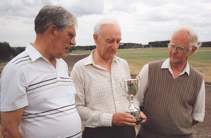
Oh dear! Still nobody responding! I suppose I'll have to put up another picture showing three more local cricket figures --Eric Burgin, Frank Melling and Jack Bland. Burgin and Melling were both outstanding players with Sheffield United in their Bramall Lane heyday. Burgin played for Yorkshire 50 or more years ago, and he was a great servant of United. Melling, of course, was United captain for many years, and he was known as one of the best fielders in local cricket. He was the man who took George Pope to United after they had played together in the Bradford League. Jack Bland, who played for many clubs, is best known today as an official of the Sheffield & District Junior Cricket League --putting something back into the game by helping in the development of the stars of tomorrow!
-
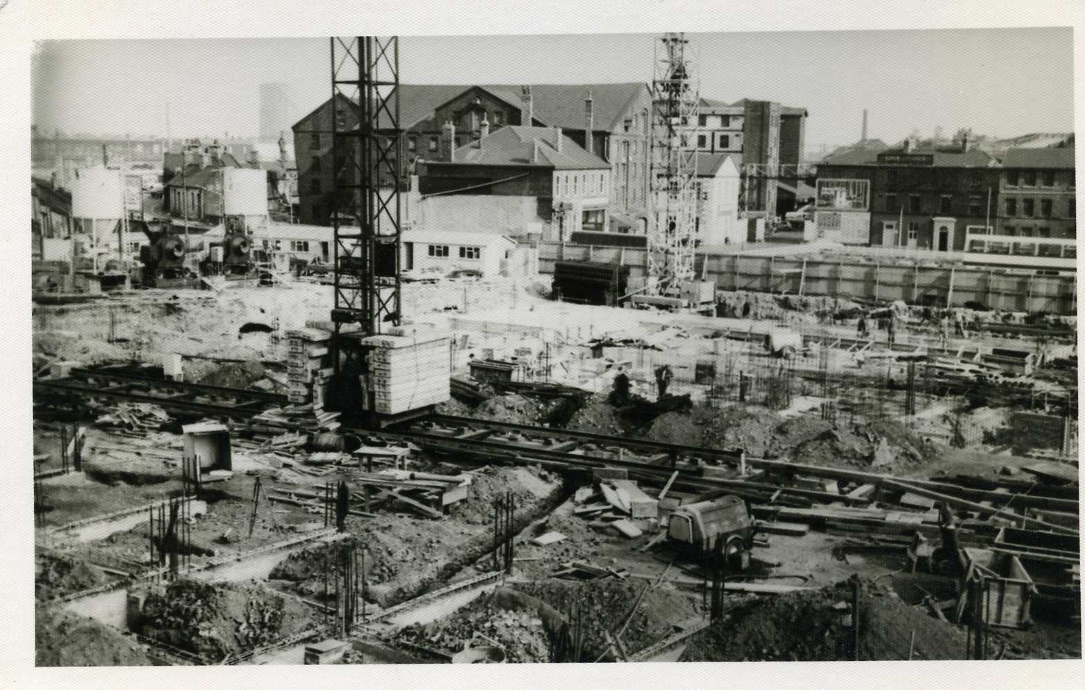
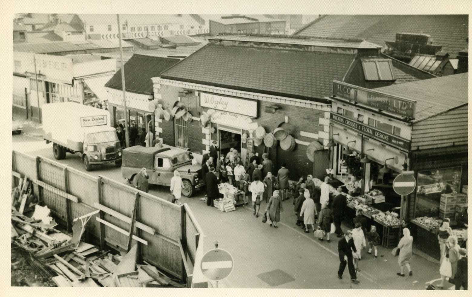
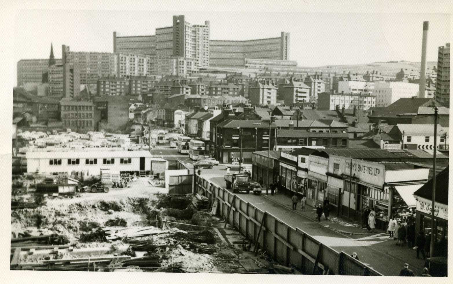
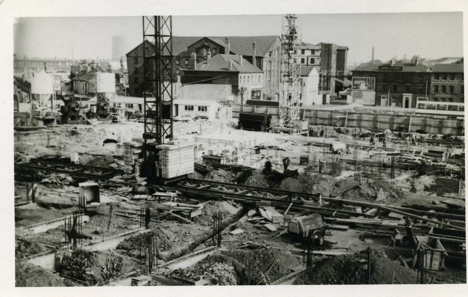
Some more pictures of Dixon Lane and the building of the Sheaf Market.

-
Time to investigate the slums I think I'll start tomorrow when I've recharged my batteries.. Here's a starter for 10.. Apparently in the seventeenth century the locals (working class) lived in filthy cellars mostly half full of dirty water. They existed on scraps of food, never changed their underwear-if they had any at all, and the average life span was just twenty one years. The ones who lived in the city centre around campo lane area, threw the rubbish and sewage out of the window into channels which ran down the centre of the alley where it lay stinking in the sun-in summer- until the rains came and washed it away.