Search the Community
Showing results for 'coal pit lane'.
-
Hello. Thank you for your message. I did manage to get in contact with a Mark Whiehouse who I think is on the Loxley Council and he found the graves. I received an email from him on 8 April this year and I quote: "I’ve found the graves of your grandparents and aunt. I’ve taken a few photos and will try and download these and email them to you later. Next time that you come to visit let me know and my wife or myself will show you where the grave is.". But since then I have heard nothing despite sending Mark several emails. He did not give his contact number and I could not find any details in the phone book! Pity because we passed through Loxley in August this year and we could have seen the graves. I think your assumption that the grave is near Long Lane is probably right. I did ask Mark if he could decribe where on the plan the grave is but there was no reply. I will now try and send to him again. Regards CDWL
-

St Michaels Neepsend & Holy Trinity Wicker
neddy replied to dunsbyowl1867's topic in Sheffield History Chat
The last time I looked Holy Trinity was still there on Nursery Street-corner of Johnson Street, Flash Earth St. Michaels and All Angels stood on the area between Burton Road and Neepsend Lane, Flash Earth St Michaels Vicarage and later hall at Vale Road Parkwood Springs -
Sorry, but the Lees are not in the bit of the churchyard I've mapped. I've only done the Eastern section in any detail and there are six other sections including the terrace. I was interested in early burials of the 19th century, and it would appear that yours are more than likely in the later Section NE2 near Long Lane. I'll have alook in the records when I'm next at Sheffield Archives. There is a site plan at: http://freepages.genealogy.rootsweb.ancest.../planloxley.htm As you will see, there are only row J's in the west and NE2 sections. Greenfieldswood
-
For the last twenty years I have been collecting mill/grinding stones from Cat Lane Woods. Someone else in the area has been doing the same but they have now moved house and taken the stones with them .I know of a couple more stones that are still there but can only be seen in a dry summer. Anyone any idea why so many grind stones are in the Meersbrook?
-
I also just decided to Google for McCloskeys Apocalypse as I suddenly remembered them during an exchange on Friends Reunited. I lived near the Minerva Tavern until I left home for Uni in 1971. I'm also sure that I once saw McCloskeys on stage at the Art College at the top of Psalter Lane as support to a band called the Pink Fairies (I think!). It's all very hazy now but that would have been 1970 or 1971. I can't really remember the performances but this was the same time as I was seeing the likes of Rory Gallagher and Led Zep in Sheffield and I certainly remember them! Anyone else at the McCloskeys / Pink Fairies gig? Richard
-
Thankyou all for your replies . We made our visit .starting at the site of FCH..We found the school that my Gt Aunt attended .It was Moorfield School in David lane .then onto Christhurch Fulwood....It all went well and we enjoyed the day and Annie recalled many memories.. Dave
-
Hi Gill A bit negative this one but apparently Hague Lane was named after William Hague, a mason, beerhouse owner, shopkeeper and property owner, ( a busy lad!), who died in 1894. He owned the Oxford Hotel, 4 shops and 14 cottages in the area. (From Peter Harvey's 'Street Names of Sheffield)
-
HI, I can recall living at4 houses that had coal chutes, [coyle olyes] the coal grate had a ring on the inner side, with a chain that was hooked to the wall of the cellar,these grates were fitted in a rebate, in a large slab of stone, in my early days we lads used to earn a penny or so[ if the person had lost or misplaced their key] by squeezing down into the cellar chute and up into the house to let them in that is if the gratechain was off, which most were, even if this chain was on with countless bags of coal hitting the stone slab the rebate was worn away so with a bit of [jiggerling theres an old Sheff; saying] we were able to get down the chute, these grates were used for other things like throwing at shop windows and such like, l remember a bloke on our street being locked out, blind drunk, throwing one though the window and climbing in, he was not in a position to do it again for along time, as l recall, even when people advanced? to the estates, with a coal store at the side under the stairs it was still called the[coyle oyle] Happy days Skeets
-
MR. WILSON'S LETTER ON SHEFFIELD. To the Editors of the Northern Star. If you think the inclosed extract from a letter, addressed by Mr. Wilson, late of Broomhead-hall near this place, to Mr. Andrews of Sheffield, will be sufficiently interesting for your pages, the insertion of it will oblige ANTIQUUS. Sheffield, Nov. 20, 1817. The Oltl Church is said by Camden to have been built in the time of Henry I. but from what authority is uncertain : if this be the time, probably Wm. de Lovetot wae the founder, or principal benefactor, being lord of the manor and a very religions man, for he was the founder of Worksop Priory, in the county of Notts. From them it came to the Furnivals by Maud, daughter of William de Lovetot, who married Gerald de Furnival : he gave a third part of the Tithes, Oblations, Obventions, and the glebe of Sheffield Church to the Abbey of Worksop, where several of their predecessors were buried. The Vicarage of Sheffield was first instituted in the year 1308. Thomas Furnival procured a license from King Henry III. in the fifty-fourth year of his reign, 1270. to make a castle at Sheffield; it was a place of considerable strength ; and was surrendered to the Earl of Manchester the 10th day of August, 1644, by Major Thomas Beaumont, the governor, and was raised in 1648 and 1649. Thomas de Furnival obtained a charter, twenty-fourth Edward I. 1296, for a weekly market at Sheffield, and a fair yearly, on the eve-day and morrow after the feast of Holy Trinity, with free warren in all his land« here. He granted a charter of privileges to his free tenants of the town of Sheffield, 4th August, 1297. He claimed a custom, which had continued from the conquest, of assembling all his men. or tenants, in Sheffield, Whiston, and Treeton manors, holding by military service, who met in the Wicker, in armour, and were led in ranks to the town-hall and back again, every Easter Tuesday, which was continued to the year 1715. My father always lent one Thos. Bamforth, of Water-lane, his horse and sword that day ; who, from leading them up a great many years, acquired the appellation of Captain Bamforth. I suppose the custom of heading these men up, which had continued in my family, arose from Adam Wilson, of Broomhead, having been shield-bearer or esquire to Thomas Lord Furnival in the Scotch wars, in the time of King Edward I. who gave him some lands which I still possess, for his good services in those wars : several old men, not long since dead, remembered this custom, as old Mr. Wade, Mr. Thos. Radford, &c. and perhaps some still living. I am uncertain who built the Manor, but think it was built by the Talbots, probably about the time of Henry VII. or perhaps sooner. Lady's Bridge, so called from the chapel of the Virgin Mary, upon or near it, was built 1 Henry VII. 1486. The School was first established by patent from King James I. 1604.* The Church Burgesses were first instituted by Queen Mary's letters patent, 8th of June, the first of her reign, 1554. The Cutlers were incorporated 21 James 1. 1623, by act of parliament.] When clasped knives or tnrntangs came in use, or were first made, I cannot find. Before the Cutlers were incorporated, they were governed by orders from the Earl of Shrewsbury, to whom they paid their marks-money ; when the Town Burgesses were first made I cannot find, having mislaid the papers relating thereto. • ------------------------------------------ * It will be seen from a former paper in our work, page 411, that the first step towards tbe formation of the school was the bequest of Smith of Crowland, Lincolnshire, though it was not regularly established an a Free Grammar-School till the grant of the patent from King James I. ------------------------------------------ http://books.google.co.uk/books?id=2AkIAAA...brr=1#PPA515,M1
-
My grandparents had a grate at the front of their house on Jenkin Road, Brightside. That was inded a bugger of a hill! The coalman would come and tip the coal straight into their cellar through the opened grate. The cellar was a spooky place. After the houses were demolished it was quite sad to see the coal grates still there in the pavements. My great grandad was a carter and lived on Hawke street. Luckily he had a clever horse who when after a session, my G-Grandad was in his "cups", the horse would make its own way home whether he was conscious or not!
-
I was doing a bit of family history research and found that in 1851 my great-great-grandfather, William Green, was a coal dealer in Netherthorpe. I took this to mean that he would have used a horse and dray to carry bags of coal from one of the Sheffield collieries to houses in his trading area. It struck me that, since Sheffield, like Rome, is built on seven hills, the poor old horse would have had a bugger of a job once it got away from the level suburbs by the Don. I can vaguely remember "coal holes" and chutes going from the pavement to the cellar, but I can't remember much about horse-drawn stuff (except for the rag-and-bone man). I'd be interested in comments from anyone else who has looked into the subject.

-
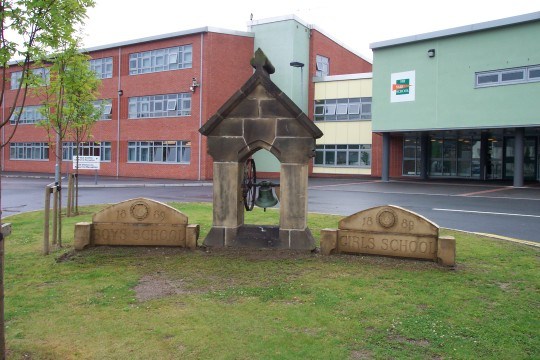
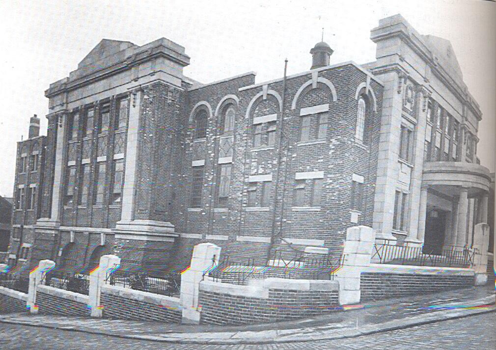
Yes, I could not agree more ! Dunsbyowl. Owler Brook Nursery First School (formerly Owler Lane County School, Owler Lane) 1990 picturesheffield From Map #61.

-
Came across this photo - even the small remaining stones have more character than the abomination behind!
-
Fulwood Cottage Homes are now called 'Moorside'. They are off Blackbrook Road just north of Harrison Lane. Have you come across Marjorie Dunn's book For the Love of Children about the homes? It is out of print but you may find a second hand copy or there are copies in the Local Studies Library in Surrey Street. Hugh
-
Sorry if this as been mentioed but as a child in the 60's (And before transit says anything I mean the 1960's) I remember walking down the little lane next to woolworths at hillsborough and comming out in the pub yard on bradfield road - sorry cant remember name. But on the left behind woolworths was a place that always had lorrys (ERF's/AEC's) with floor sacks on dont know if it was a warehouse or a mill.
-
Horse and Garter 24 Water Lane Open 1821 Closed Comments 1822 address 35 Water Lane 1821 Thomas Crownshaw 1822 Thomas Crownshaw 1825 Thomas Crownshaw 1828 Thomas Crownshaw Earlier 19 May 1812 Mortgage by way of lease Richard Sellers Mexborough to Thomas Crownshaw 16th August 1831 Thomas Crownshaw, Sheffield victualler, Insolvent. 28 October 1831 Thomas Crownshaw Bankrupt.
-
Just a couple of bits of background - The Wilson Road Synagogue opened in April 1930. The Jewish burial Hall and Cemetery at Blind Lane, Ecclesfield was consecrated on 4th September 1932. (When I was a school a father of one of the boys was the caretaker of the cemetery and this lad always had loads of pocket money because he used to dig graves for his dad! - beats a paper round!)
-
Opened 18th September 1939 - which was lucky, as on the 3rd of September all cinemas (aswell as school & theatres) had been closed on the declaration of war - only to reopen on the 15th of September!
-
My family were millers in and around Sheffield for over two centuries. They owned a mill at Aldewarke and in 1773 took over Pond Mill. The latter was roughly in the area of Leadmill Street today and had both steam and water power. My Great Great Grandfather Joshua Wigfull built a Maltings alongside the mill. The lease on Pond Mill terminated in 1860 by which time he had sold Aldwarke. By 1866 Pond Mill was demolished. The business continued as Joshua Wigfull and Sons at Sheaf Steam Corn Mill on Forge Lane. In 1885 they moved into the newly built Star Corn Mill on Walker Street swithcing to roller milling in 1890. A new mill was built on the same site in 1911 and by 1947 it was a very large mill by any standard. I believe it closed shortly afterwards due to family circumstances. Pond_Mill.BMP
-
A tram incident my father was involved in whilst working as a tram driver. It was early one thursday afternoon, as thursday was half closing there was not a great deal of traffic on the road. He had reached the terminus at Abbey Lane and was waiting for his point time to set back off to town. In the downstairs saloon was a woman and her son. As he looked up towards Meadowhead he saw a large lorry coming down the hill. as it got nearer he could see it was driver less and was a coal lorry. It was heading directly for the tram, he shouted a warning out to the passengers and got under the stairs. The lorry hit the tram taking it up a slopping shop frontage and deposited it in the shop. As the dust settled he was concered over the Lady in the downstairs saloon as it had filled up inside to the window level. He asked how she was due to the fact she was pinned up to her upper body with coal. The lady replied that she was ok but she had concern for her son who had been flung across the tram. All you coud see of him was two legs waving im=n the air. At the end of it all everyone was ok.
-
Here is an allphabetical list as at today, also a full alphabetical list in pdf format and the location grids at the bottom Map Area Map Area 52 Abbeydale 263 Abbeydale 307 Abbeydale Park 146 Aperknowle village 261 Archer Rd 114 Aston 66 Attercliffe 87 Attercliffe 92 Attercliffe 93 Attercliffe 178 Attercliffe 180 Attercliffe 181 Attercliffe 142 Attercliffe Common 183 Attercliffe/Darnall 95 Attercliffe/Hyde Park 94 Attrercliffe 202 Banner Cross 205 Banner Cross 49 Barlow area. 216 Beauchief 58 Bellhouse Road 59 Bellhouse Road 302 Bents Green 313 Bents Green 237 Birkendale 249 Birley Carr/Foxhill 242 Botanical Gardens 243 Botanical Gardens 213 Bradway 212 Bradway/Totley Rise 10 Bridgehouses 160 Brightside 174 Brightside 175 Brightside 56 Brincliffe 229 Brincliffe 151 Brinsworth 155 Brinsworth 273 Broomhall 271 Broomhall/City Centre 230 Broomhill 232 Broomhill 207 Broomhill/Tapton 38 Burncross 5 Burngreave 86 Burngreave 11 Burngreave Road 176 Carbrook 177 Carbrook 179 Carbrook 63 Carlisle Road 64 Carlisle Street East 57 Carterknowle 258 Chancet Wood 26 Chapeltown 293 Chapeltown 39 Charltonbrook / Burncross 39 b Charltonbrook / Burncross 74 Chesterfield (part of) 1 City Centre 2 City Centre 4 City Centre 272 City Centre 101 Coal Aston village (part) 148 Concorde Park 219 Crookes 235 Crookes 186 Crookes/Broomhill 187 Crookes/Walkley Bank 233 Crookesmoor 208 Crosspool 283 Crosspool/Broomhill 116 Dalton 209 Damflask 123 Darnall 125 Darnall 143 Darnall 144 Darnall 166 Darnall 182 Darnall 184 Darnall 191 Darnall 15 Derbyshire Lane 45 Derbyshire Lane 311 Dore 266 Dore 278 Dore 279 Dore 309 Dore 310 Dore 214 Dore & Totley Station 42 Dronfield 41 Dronfield 43 Dronfield/Quoit Green 44 Dronfield/Snape Hill 203 Ecclesall 215 Ecclesall Woods (part) 217 Ecclesall Woods (part) 204 Ecclesall/High Storrs 24 Ecclesfield 25 Ecclesfield 76 Ecclesfield 294 Ecclesfield 77 Ecclesfield / Shiregreen 81 Firth Park 85 Firth Park 147 Firth Park 300 Firth Park 83 Firvale 84 Firvale 158 Folderings / Onesacre 170 Frecheville 222 Fulwood 281 Fulwood/Goole Green 280 Fulwood/Stumperlowe 82 General Infirmary (Northern General) 124 Gleadless 145 Gleadless 105 Gleadless Common 73 Gleadless Rd 128 Gleadless Townend 231 Glossop Rd 51 Greenhill 225 Greenhill 227 Greenhill 254 Greenhill 28 Grenoside 251 Grenoside 200 Grenoside North West of 192 Greystones 292 Greystones Cliffe 60 Grimethorpe 132 Hackenthorpe Estate (part) 163 Hackenthorpe Estate (part) 133 Hackenthorpe old village 298 Hackenthorpe (South of) (Present Day Waterthorpe/Westfield) 286 Hallamhead 320 Hallamhead 156 Handsworth 159 Handsworth 161 Handsworth 167 Handsworth//Darnall 140 Handsworth/Darnall 75 Harley Village 107 Harthill village 20 Heeley 21 Heeley 100 Heeley 19 Heeley Green 62 High Wincobank 172 High Wincobank 13 Highfields 23 Highfields 253 HighGreen 31 Hill Foot Bridge 33 Hillfoot 196 Hillsborough 211 Hillsborough 239 Hillsborough 241 Hillsborough 244 Hillsborough 195 Hillsborough 246 Hillsborough Park 40 Hoyland Common 228 Hunters Bar 70 Hurlfield 127 Intake 168 Intake 169 Intake 118 Killamarsh (part) 119 Killamarsh (part) 134 Kimberworth 106 Kiveton Park (part) 14 Lees Hall 47 Longley Lane 126 Low Wincobank 171 Low Wincobank 50 Lower Bradway 240 Lower Walkley 288 Loxley 193 Malin Bridge (part) 194 Malinn Bridge (part) 185 Manor Estate (part) 104 Manor Top 255 Meadowhead 71 Meers Brook 17 Meersbrook 264 Meersbrook 190 Meersbrook Park 199 Middlewood Hospital 53 Millhouses 55 Millhouses 218 Millhouses 54 Millhouses Park 201 Millhouses/Whirlowdale 103 Mosbrough (part) 262 Nether Edge 265 Nether Edge/ Little London 88 Nethergreen 109 Netherthorpe 274 Netherthorpe 275 Netherthorpe/Walkley 97 Norfolk Park 98 Norfolk Park 162 Normanton Springs 138 Northern General Hospital 322 North Anston 299 Norton (Old Map) 290 Norton Lees 291 Norton Lees 16 Norton Lees 46 Norton/Meersbrook 153 Orgreave 61 Owler Lane 238 Owlerton 245 Owlerton 96 Park Hill 32 Parkwood Springs 22 Parson Cross 34 Parson Cross 35 Parson Cross 36 Parson Cross 29 Philadelphia 8 Pitsmoor 89 Pitsmoor 90 Pitsmoor 91 Pitsmoor/Grimethorpe 102 Plumbley village 12 Queens Road 206 Ranmoor 210 Ranmoor 284 Ranmoor 164 Ridgeway (part) / Ford 221 Ringinlow 287 Rivelin 189 Rivelin Valley Rd 9 Roe Wood 48 Roe Wood 135 Rotherham Bradgate 150 Rotherham Canklow and Ickles 120 Rotherham Clifton Park 165 Rotherham Hilltop 154 Rotherham Holmes 137 Rotherham Meadowbank 121 Rotherham Morgate 149 Rotherham Town Centre 67 Salmon Pastures 68 Salmon Pastures 285 Sandygate 6 Shalesmoor 226 Sharrow 267 Sharrow 268 Sharrow 269 Sharrow 270 Sharrow 224 Sharrowvale 65 Sheffield and Tinsley Canal 69 Sheffield Park 78 Shiregreen 79 Shiregreen 301 Shiregreen 80 Shiregreen / Firth Park 7 Shiregreen Lane 99 Sky Edge 122 Sothall 277 South of Holmesfield 234 Spring Bank 223 Stannington 318 Stannington 282 Stannington 117 Swallownest 115 Swinton 27 Thorncliffe 129 Thorpe Salvin West of 136 Tinsley 139 Tinsley 141 Tinsley 305 Totley 306 Totley 308 Totley Rise 220 Totley West of 112 Ulley village 113 Ulley village South of 72 Unstone Village 30 Upperthorpe 247 Wadsley Bridge 198 Wadsley/Hillsborough 197 Wadsley/Hollowmoor 108 Wales 110 Wales Court 111 Wales village (part) 236 Walkley 188 Walkley Bank. Bole Hill Rd 18 Well Road 3 West Bar 252 West of Grenoside 276 Wharncliffe Side 317 Wharncliffe Side 312 Whirlow 37 Whitley 37 b Whitley 173 Wincobank 314 Wisewood 319 Wisewood 316 Wisewood/Wadsley 130 Woodhouse 157 Woodhouse / Beaverhill area 152 Woodhouse Mill 131 Woodhouse/Coisley Hill 256 Woodseats 257 Woodseats 259 Woodseats 260 Woodseats 289 Worrall 304 Worrall Village 315 Worrall/Wadsley 295 Wybourn (part) Maps_Master.pdf Maps_Master_Grid.pdf


-
St Mary's Lane was a narrow street of Hermitage Street, so Hermitage Steel was probably somewhere in the area. Hugh
-
Unfortunately although buildings are marked on the maps, there are no farm names. The maps for the 1637 survey have disappeared, but have been painstakingly reconstructed by G Scurfield. Ask at the library for the Yorkshire Archaeological Journal Vol 58, 1986. His report starts on page 147, and includes his reconstructed maps. The Enclosures maps are in the Sheffield Archives on Shoreham Street. If you've never been to the Archives have a look at their website as you have to join before using any material, and they require various bits of ID. There was at least one other of these 'double' farms in the valley. Hangingwater Farm stood where the block of flats now stands on Hangingwater Road, but at the other side of a small lane was Manor Farm. They were so close they look like one farm on the map. The research threw up quite a number of farm names which do seem to have disappeared, and one of the on-going tasks is to try to track them down, though I suspect many or most are underneath the houses now. Bole Hill is also 'Bore Hill' in the Sheffield A-Z. I think it's one of the deliberate errors map publishers incorporate to trace whether anyone is copying their maps for publication without their permission. Aren't maps wonderful things!
-
Hello Hugh and thank you for the reply. I know it is Frank Wood, I have a letter here to Frank Wood Esq and the address you gave : 36 Sharrow is on it....Frank Wood is my husbands father. The letter I have is a Notice of a call on shares.... Addressed to Frank Wood Esq, 23 Harefield Road, Sheffield. Telegrams: Wood 36 Sharrow: The letter is dated August 9th 1917 and there is a heading on the paper reads: Wood, Walsh & Company Ltd. General Engineers. There appears to be an address something like: 65 St Marys Lane but then that is blacked out and a new address of Aizlewood Road is added. It is signed Wood Walsh and Co. E Scott Robinson (Secretary). We also Know Frank had shares in Hermitage Steel? this is another we know nothing about.. Thank you kindly Woody
-
OK, here comes the commercial break! The Friends of the Porter Valley are about to publish a history of farming in the Porter and Mayfield valleys, and I did a lot of the research for it. It appears on the 1791-1805 Upper Hallam Enclosures Act map, and earlier in the Harrison Survey of 1637. Field names in the valley are a fascinating topic. many still have names that go back centuries. A couple of years ago I organised some fieldwalking in a field at School Green Lane near some field boundaries that show evidence of dating from Romano-British times, and we found pieces of pottery from every century from the 13th to the present, as well as some lead slag that may be from the furnace on the Bole Hill off Blackbrook Road.