Search the Community
Showing results for 'coal pit lane'.
-
Can someone tell me if there is a list of Coal Miner Deaths for the period 1860 to 1890 for the mines in and around Sheffield. One Tom Mellor was a Coal Miner in 1881 and then disappears. Regards Rick
-
Can anyone tell me when it opened? Was it before electric trams and if not where did the Horse Trams go?
-
MY maiden name is Jean Quibell lived on nether shire lane Married Brian Shaw who lived 3 doors away would like to see old class pictures of this school Or Beck Road thanks
-
"the charity school on psalter lane has had the school part pulled down ....original house kept and new builds on way in similar materials to main house"
-
trying to locate abode of ancestor,accoding to the 1881census he lived at 19,boden lane in the municipal ward of st George. I wondered if it was renamed bailey lane.
-
I read with some profound amazement that the now disused pub is liable to become a Mosque. A pub has been there on the side of the cross-roads since at least the 1840's and , when I started drinking as a teenager, in the 1960's, it was an extremely busy place and the focus of much community activity. I was told, the other day, that Lillie Langtry and a a certain King would privately meet there ( in a room ...upstairs) on their way to spend weekends at Wentworth! I wonder if there is any truth in the tale?
-
I don't know if all of this has been pulled down, would like to know what is there in its place

-
I was taking a few photos of houses in Mushroom Lane as they would appear to have some age to them. They now belong to the University. One large Victorian Mansion (I think) and an impressive terrace. Can't find any history to these houses. Can anyone tell me their age and who lived their? Are they connected with Dam House?
-
Rodley Lane ran from Leadmill Road to Suffolk Lane. I always assumed that it was named after the Rodley Inn. The earlist trace of the name Rodley Inn seems to be the 1891 Census, however Rodley Lane appears as far back as the 1871 Census. Where did the name Rodley Lane derive from.
-
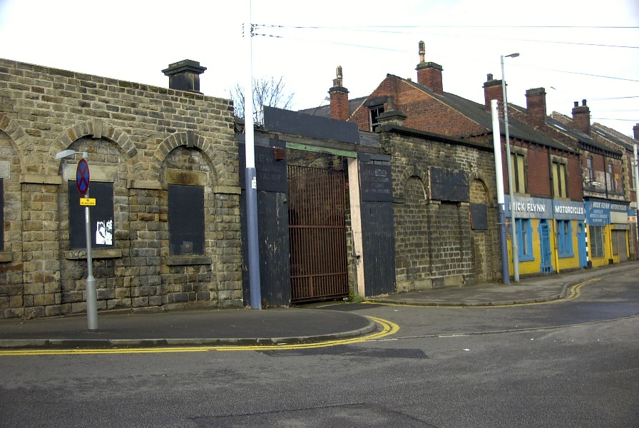
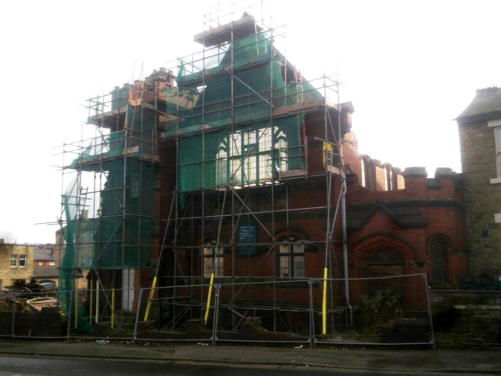
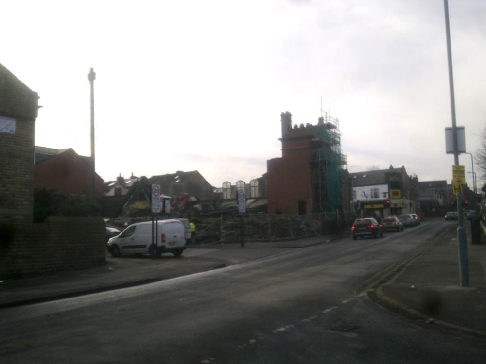
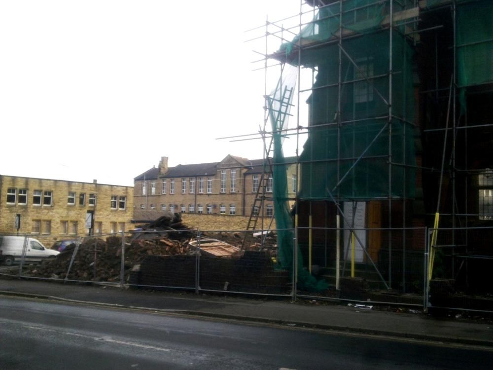
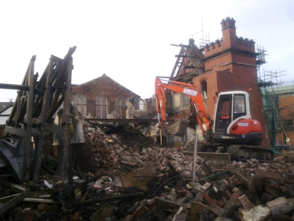
Just saw this on my way past. I asked if the front was being saved but no, it is to be completely flattened.

-
Found this mentioned briefly in 1855 in Newspaper Article. Don't have exact address. Might this be earlier name for Cricketers Arms?
-
Can anyone please point me at a map of Bramall Lane on here which shows house numbers . I want to see where 208 was & whether it was next to the Ebenezer Wesleyan Reform Chapel (before it was demolished) Thanks, John
-
I know Ive mentioned this before, but after seeing the site the other day, i thought it would be better under the title " Sheffield places - now gone " I went to have a look at the old ww1 gun site saturday, only to find out most of it has either been bulldozed or filled in, only the circular gun pit still survives intact.....up to now! To get a good idea what the site used to look like, if you go on google earth, look at Manor Cottage Farm, the site is at the side of Manor Lane in between the farm house and the road then use the time line to 2005, the whole area is in a shadow, so all the plateaus, gun pit and other dug outs are clearly visible. im just glad i took plenty of photos of it last year.
-
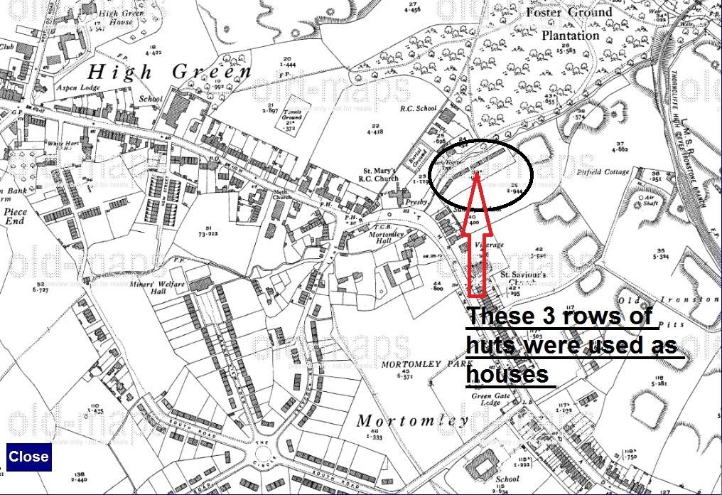
On the right going down pack horse lane there was 3 rows of huts that were used as housing. These were around in the 1920s & early 30s. When the new housing estate was built ( jeffcock rd / south rd / vickers rd / greno view rd / miles rd / holland rd green gate lane ) at the start of the 1930s. The families in these huts were re housed into them. These huts were knocked down not long after. point on map below
-
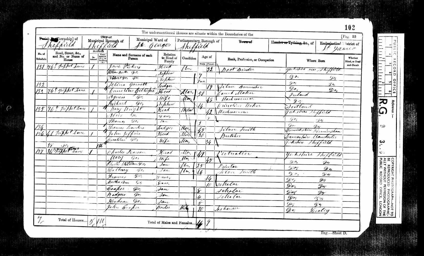
36 Trippet Lane, Charles Pearson - illegible but its the Seven Stars

-
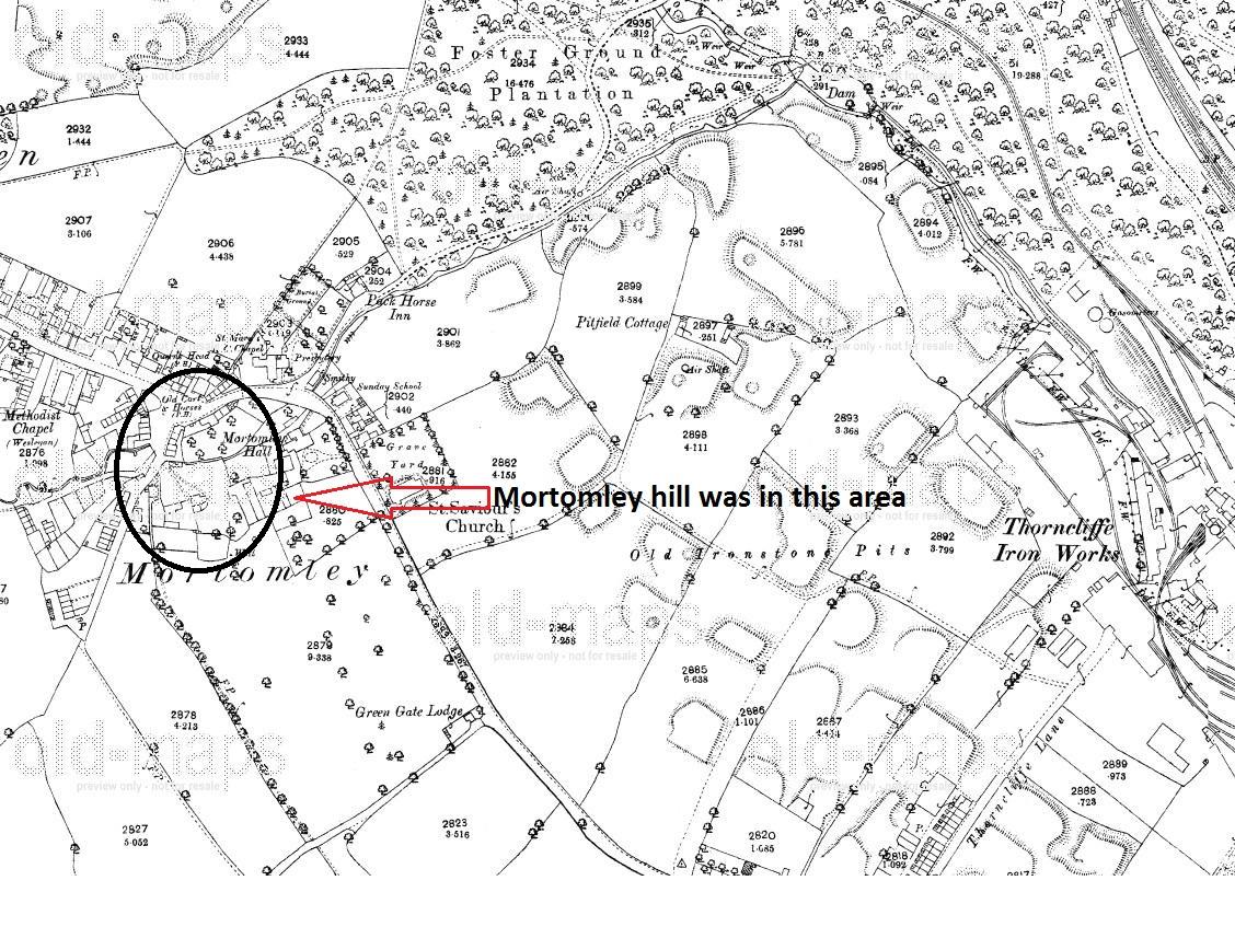
I have been researching my family tree in high green & come across a road thats not around any more. Its name is Robin Lane At Mortomley Hill. I have talked to some one who believes it was on the land of mortomley hall. & the access road to it was from the start of jeffcock road. There is still a short access road there but its been blocked off just before the start of mortomley park/greengate lane park. Map Below.

-
I have a very vague memory as a young child of being shown (for all of one minute) some kind of muddy spring between Crosspool and Crookes. This would have been about 1979-1981. It wasn’t until I was a bit older and saw some TV pictures of foreign hot springs in grey mud (I think in New Zealand) that I understood what I had been looking at that day. Is my memory playing tricks on me? If there were hot springs or geysers in Crookes we’d all know about it surely?!! As I recall we were on a school trip to the Headland Road cemetery, when an allotment holder got chatting to our teacher. Some moments later we were invited by the teacher to follow this gentleman through a locked gate into his allotment (which must have adjoined the cemetery – hence me assuming it was in the Marsh Lane allotments, possibly the other cluster nearer Clough Fields, but I think we were near the chapel building when we were led away so I think more likely the former location). The allotment was fenced off with closed boards up to at least 6 ft high so this site wouldn’t be visible to the public; I can’t remember whether, once through the gate, it was the first allotment or whether we has to follow a short path through a couple of others to get to the one in question. I know that I didn’t imagine being told by our teacher that this was a spring, and I can definitely remeber seeing somthing bubbling in the mud. But I’ve never found anything on old maps or heard anyone else mention it, so I wonder if it was more like a fractured drain or something eaually unremarable? I think the idea of it being a steaming hot geothermal spring is my boyhood imagination running away with itself. What is interesting is that the old St Antony’s Well is not that far from here, effectively on the same headland; so there is a precedent for water coming out of the ground in this vicinity.
-

Chuck Ranch - Holme Lane - Hillsborough - Remember It ?
Sheffield History posted a topic in Sheffield History Chat
Anyone remember 'Chuck Ranch' on Holme Lane at Hillsborough ? Burnt to the ground in the 1980's it had the schoolkids of the day coming up with their own stories as to why/how it happened but that's not the point of this post I'm looking for photos of the place either internal or external pics Anyone know how to find some pics of this infamous diner ? -
From the album: various old photos
-
Does anyone know where they met in Fig Tree Lane? I know 13 was a ladies school but other than that I don't know.
-
No keeper, but I can't place it - Help ! (please)
-
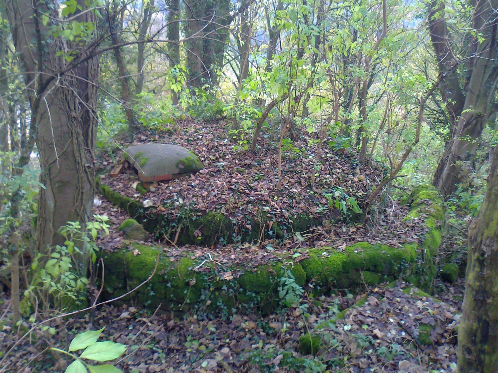
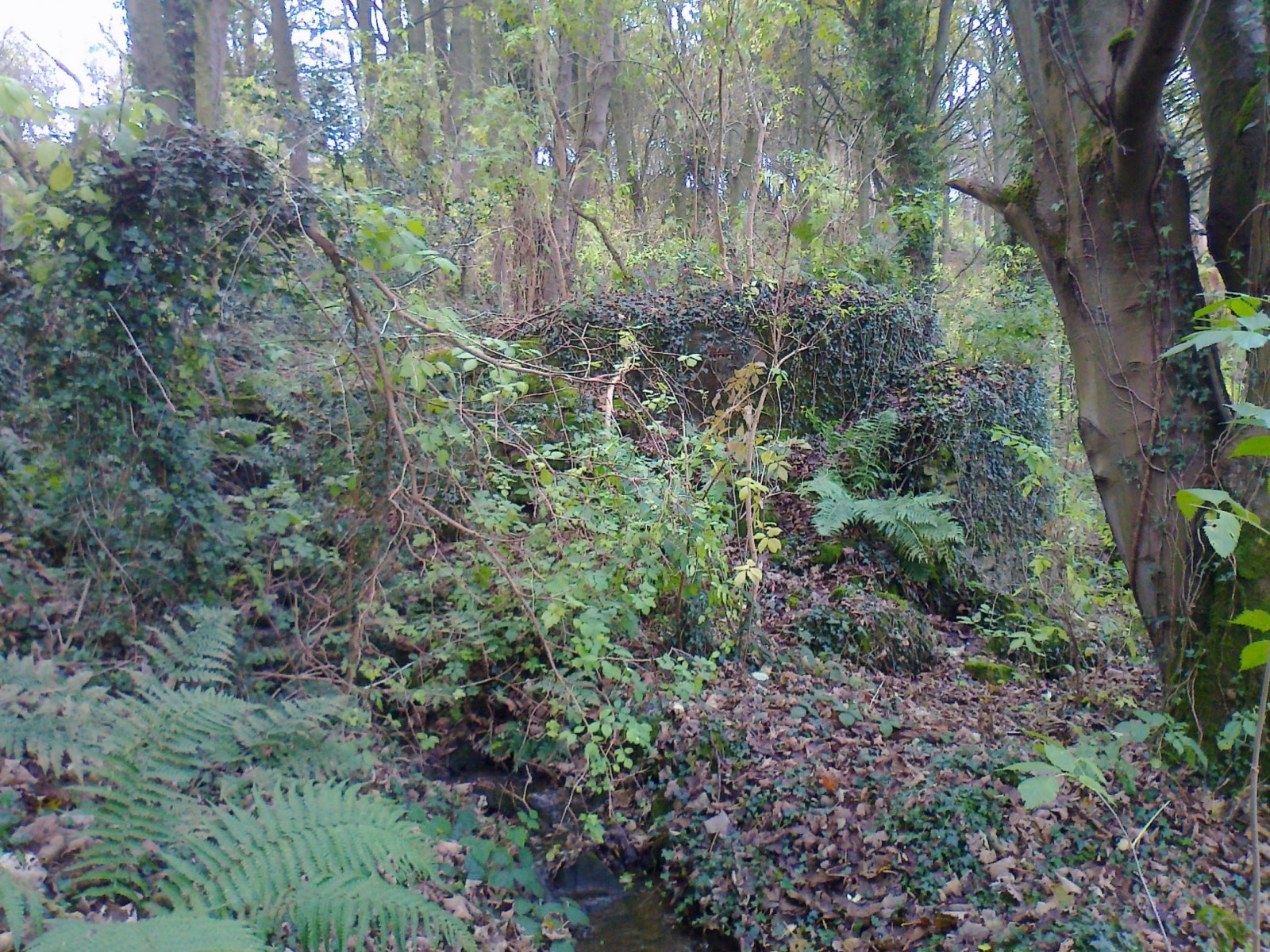
Any ideas what this might be ? It is on (or just off) Ronksley Lane at Rivelin. Somewhere around here near the bend Satellite view Spotted it over the wall about half way up on the right. Almost completely overgrown now. It is a concrete dome with as far as I can see no entrance apart from a small brick slot on top. The whole thing is surrounded by (or it seems) clad in a neat stone wall which has partially collapsed on the lower side. A short piece of broken pipe is visible leading in (or out) on the lower side. There is a small stream running down the side of it, but water doesn't appear to go inside at any point. It resembles a pill box, but is far too small and (one would think) completely in the wrong place. Very difficult to get anything like a clear picture because of the trees.

-
Found an old form the other day that was handwritten and tricky to decipher the address, but it says something like Caupes Buildings, Pothouse Lane, Attercliffe. It's from about 1880. I think Pothouse Lane is now Coleridge Road (?), but does anyone know of the "Caupes" Buildings?
-
Has anybody got a map of Abbey Lane cemetary please..... I have just found out that one of my Willoughby ancesters is buried there. (Can I cancel the above request as I have found a map of Abbey Lane Cemetary on the Sheffield Indexers website.) Edit Also is there a searchable database about Sheffield cemetary occupants in general because there are some relations that I would like to know where they are buried. Thanks in anticipation .....
-
I think the map that I need is SK3487 (maybe) - but the forum search feature doesn't seem to be working. Can anyone suggest where to find it ? TIA. Dave.