Search the Community
Showing results for 'coal pit lane'.
-

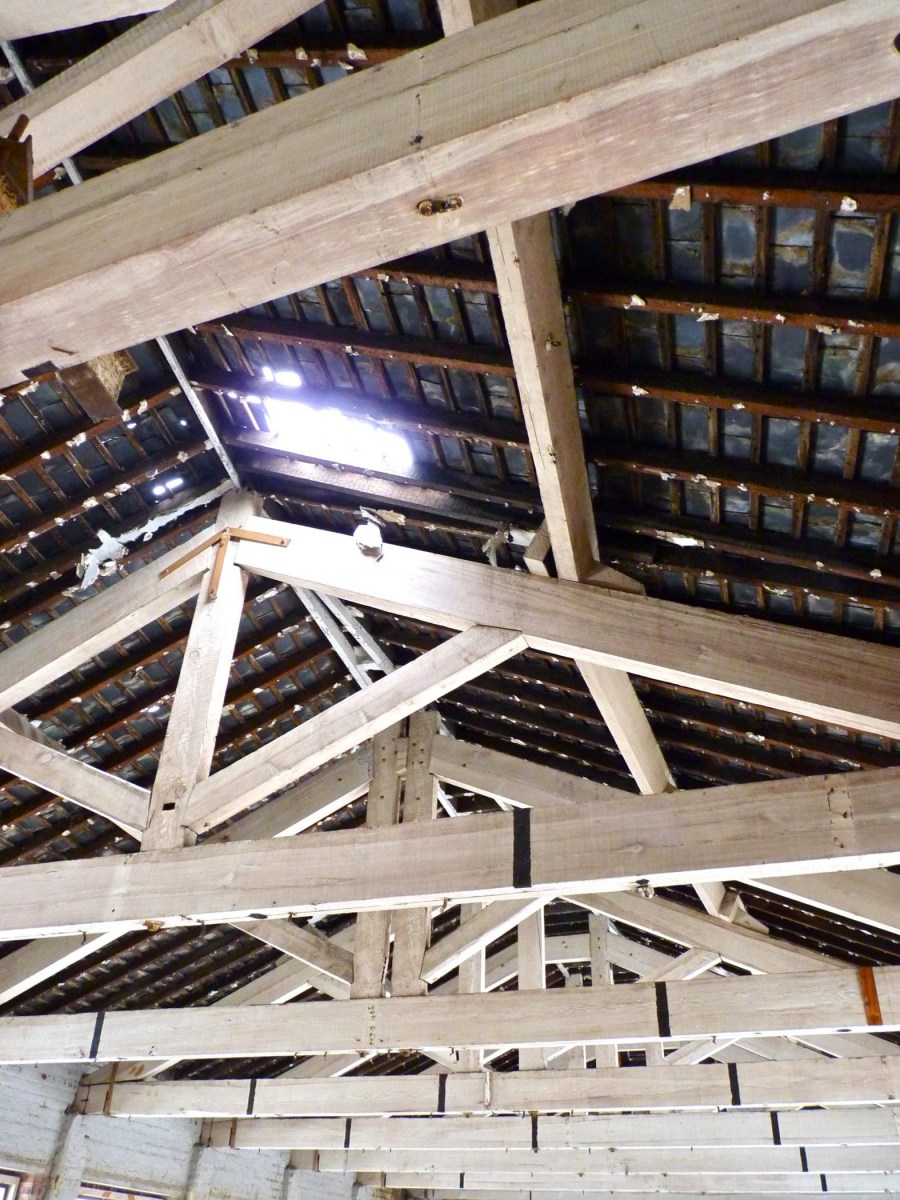
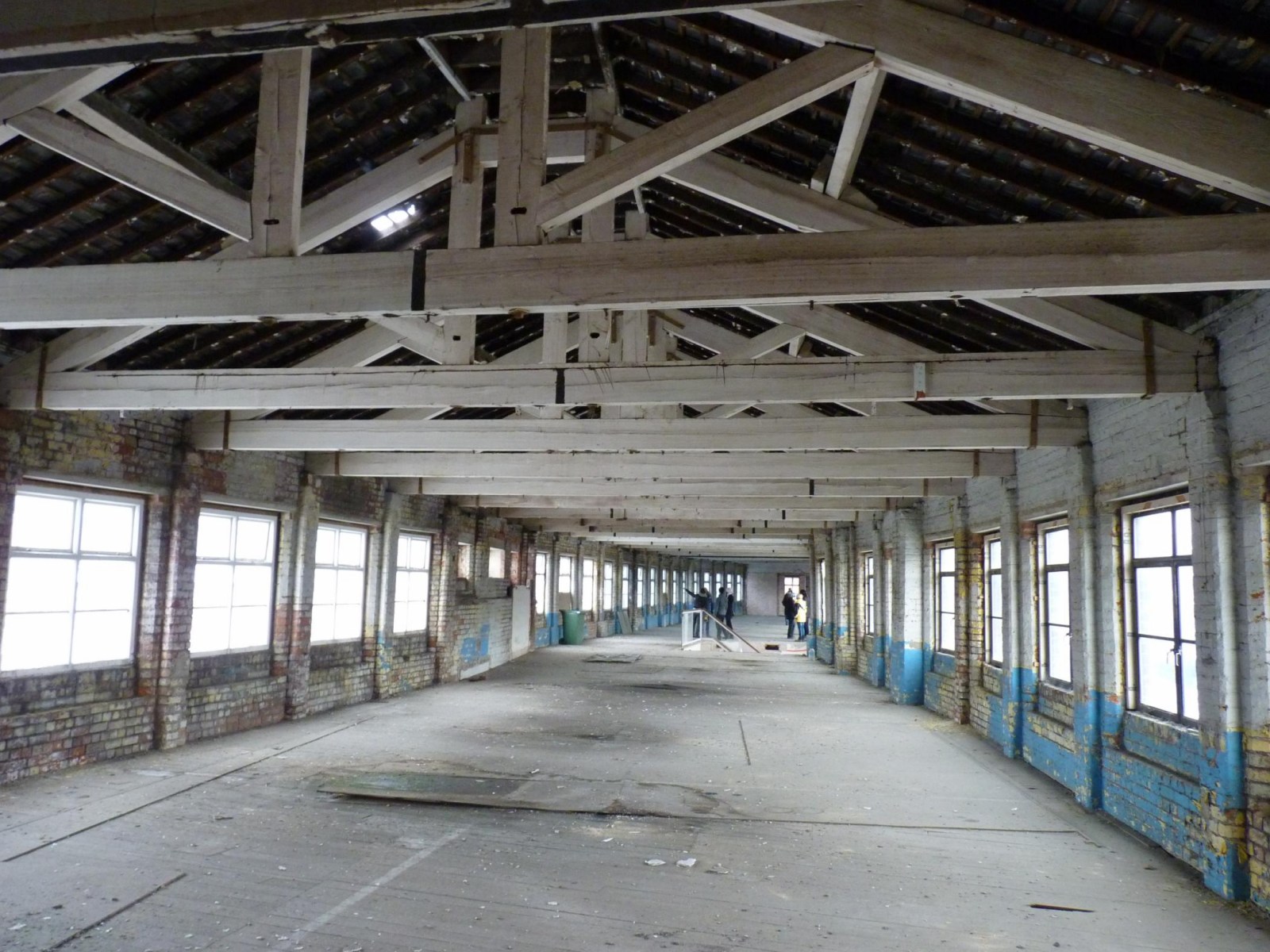
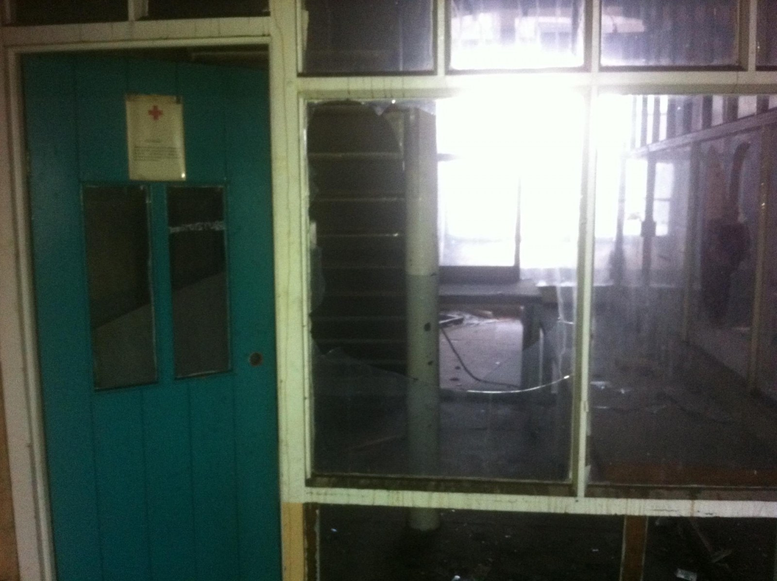
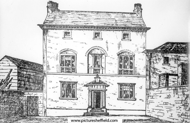
Lancasterian Special School Shalesmoor and Wales Court
Ponytail replied to winter64's topic in Sheffield History Chat
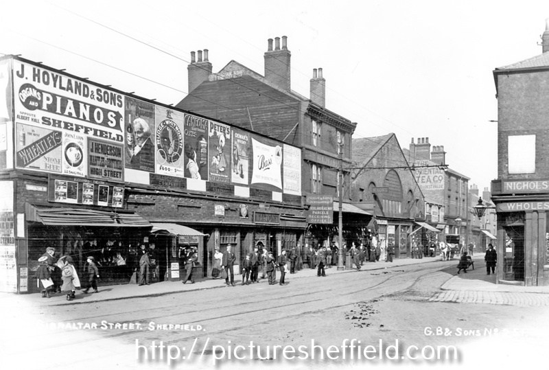
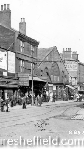
Moorfields. Plan of the ground between Green Lane and Gibraltar. 1824. By John Leather, land surveyor. https://www.picturesheffield.com/frontend.php?keywords=Ref_No_increment;EQUALS;arc04168&pos=105&action=zoom&id=104372 Shows: Green Lane, Dun Street, New Street [Dun Fields or Acorn Street], Ebenezer Square, Ebenezer Chapel, Bowling Green Street, Hunters Lane, Ebenezer Street, Spring Street, Cotton Mill Walk, Lancastrian School Gibraltar, Chapel Street, Moor Fields [Moorfields], school, Allen Street, Holmes Lane. Owners / tenants marked: Abraham Ibbotson, Thomas Cornshaw, James Parkinson, Richard Holmes, John Brown, James Jenkinson, Richard Holmes, and Joshua Fowler. The property where Lancastrian School is shown on 1824 Map is No. 56, John Hinchliff on the 1782 Map. The Earl of Surrey’s tenements in Long Croft, Gibraltar [Street] and Bower Springs 1782. https://www.picturesheffield.com/frontend.php?keywords=Ref_No_increment;EQUALS;arc04123&pos=100&action=zoom&id=103838 The names of a later date have been added by Josiah Fairbank, and the line of Russell Street and Green Lane, and Bowling Green Street, added. Kelham Wheel marked. List of tenants given: John Anderton, - Lenthwaite, Hannah Patten, John Hughes, Joseph Broomhead, William Thompson, Robert Owen, Robert Milnes, John Stacey, Charles Kelk, Widow Jewel / William Jewet, Joshua Jackson, John Tricket, John Henfrey, John Ashwell, John Brownell, George Goodlad, John Ellis, Ruth Brewster, George Dyson, Joseph Dyson, Widow Jackson, Thomas Francis, Joseph Yeadon, Mary Yeadon, John Brownell, William Fowler, Benjamin Wood, Josh. Staniland, Jon. Wilde, Mary Yeadon, Thomas Kippax, Thomas Pinder, Thomas Pindar, Ellis Morton, Godfrey Rowley, William Bradshaw, Robert Dore, Stephen Gibson, Matthew Ingram, William Simpson, Overseers of Sheffield Poor, The Town of Sheffield, Joseph Ashforth, John Ibberson, John Goodall, Charles Stewardson, Charles Townsend, George Wilkinson, Elizabeth Holden, Joseph Swan, Thomas Bell, John Parkin, John Taylor, John Hinchcliff, John Brownell, William - , Jonn. Wa-, John Read, Joseph Bower. Gibraltar Street - draft of the widening scheme, 1837 https://www.picturesheffield.com/frontend.php?keywords=Ref_No_increment;EQUALS;arc04122&pos=84&action=zoom&id=103833 Marked: Bowling Green Street; Lancastrian School; Gibraltar Street; Trinity Street; Copper Street; Cupola Lane; Bower Spring; Furnace Hill; West Bar Green. If this is looking towards Gibraltar Street then the old Lancastrian School could be featured on the left. Drinking Fountain at the junction of Shalesmoor/ Gibraltar Street/ Allen Street and Bowling Green Street, looking towards businesses including Thomas Nixon and son, pawnbroker, Gibraltar Street. s19331 A clearer image, but is it the old Lancastrian School? Gibraltar Street from the junction with Trinity Street (right) showing businesses including No. 220/4 Thomas Nixon and Son, pawnbrokers, Midland Railway Co., parcels receiving office and Nos. 204/6 The Oriental Tea Co., Nichols and Co. s16240
-
Joseph Clarke & Co., Coal Merchants, Canal Wharf & Midland Station, Saville Street East
Ponytail posted a topic in Made In Sheffield
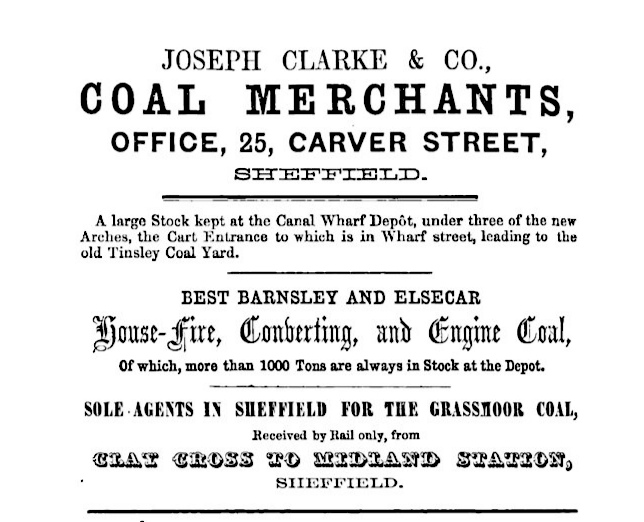
Joseph Clarke & Co., coal merchants, 171 Western Bank, depots under Arches No. 4, 5 and 6, Canal Wharf and at Midland Station, Saville Street East, Office Canal Wharf. Advertisement from Illustrated Guide to Sheffield, Pawson and Brailsford. 1862. Not recored in Whites Directory 1849 Whites Directory 1852 Clarke, Joseph & Co. factors and general agents, 25 Carver Street, Northumberland Road Advertisement from Whites Directory 1856 Whites Directory 1856 Clarke, Joseph & Co., coal merchants, 25 Carver Street, Midland Depot & Canal Wharf. h. 10 Northumberland Road. Whites Directory 1862 Clarke, Joseph, coal merchants, Midland Station, Canal Wharf & Effingham Street. h. 171 Western Bank. What happened to Joseph Clarke? Whites Directory 1879 Clarke, William, coke and coal merchant, 85 Bright Street, Carbrook Clarke, Wm, coal merchant and draper, 123 West Street. Clarke, William, coal leader, 176a Pitsmoor Road. Lundhill Colliery Explosion 1854 https://www.nmrs.org.uk/mines-map/accidents-disasters/yorkshire/lundhill-colliery-explosion-barnsley-1854/ Explosion 1857 https://www.nmrs.org.uk/mines-map/accidents-disasters/yorkshire/lundhill-colliery-explosion-barnsley-1857/ https://hemingfieldcolliery.org/2021/02/19/lundhill-colliery-disaster-19th-february-1857/ Grassmoor Colliery https://www.oldminer.co.uk/grassmoor.html Explosion 1933 https://www.nmrs.org.uk/mines-map/accidents-disasters/derbyshire/grassmore-colliery-explosion-chesterfield-1933/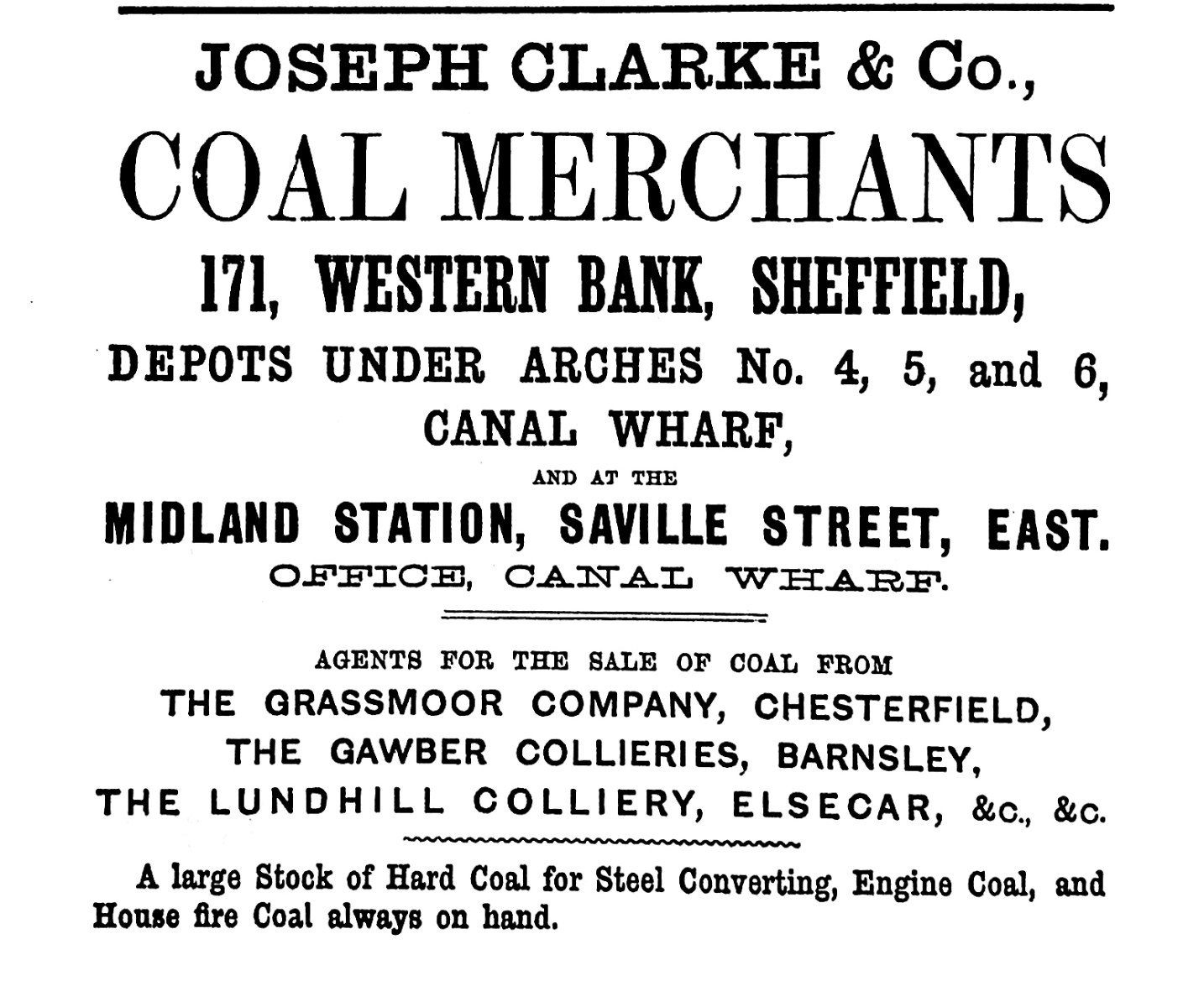
-
https://www.ebay.co.uk/itm/354629914775
-
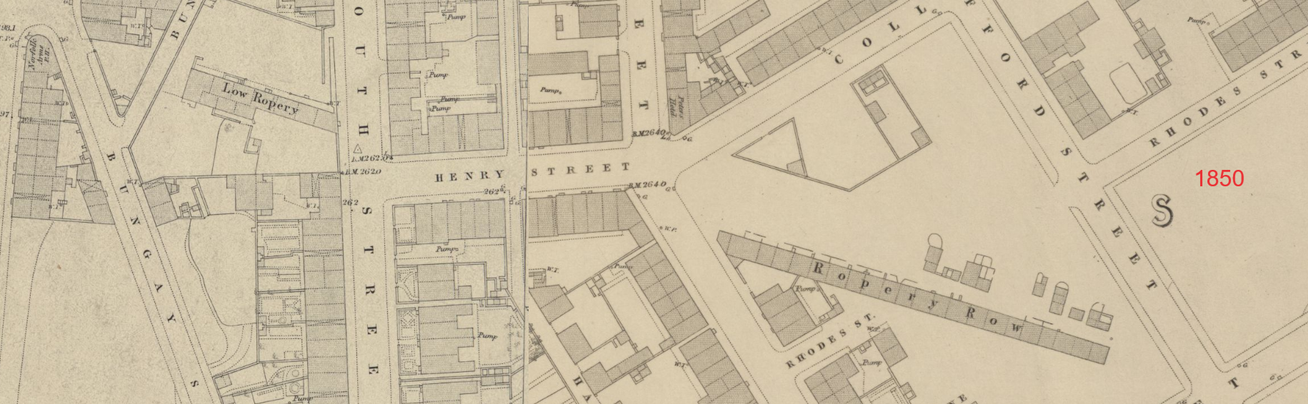
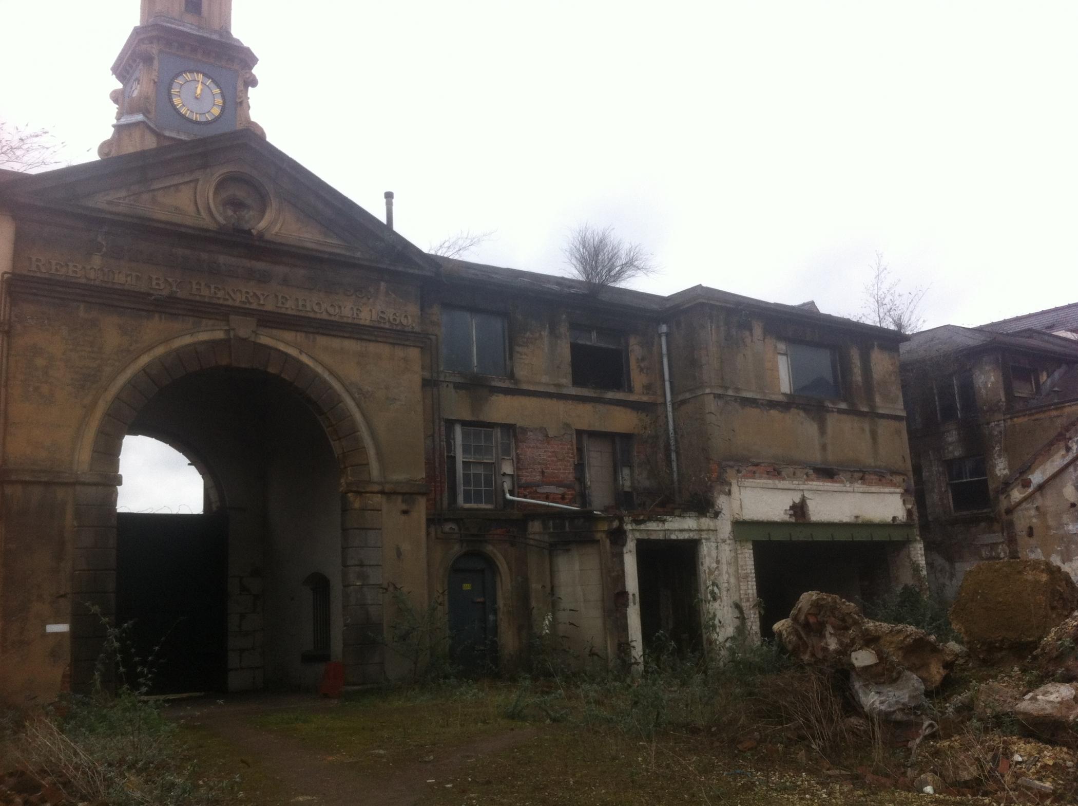
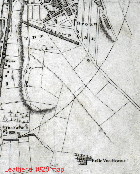
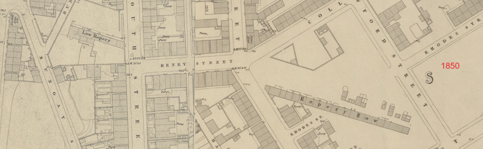
John Curr obtained a patent for flat rope in November 1798. John Currs 1798 flat rope patent The rope was made by stitching together several round ropes. The advantage was that for winding up coal from a pit the flat rope effectively increased the diameter of the pulley as the load neared the top, allowing the speed to increase, the weight of rope decreasing as it wrapped around the pulley. Initially he bought in round rope from others, to stitch together using machinery which was situated on the site that would later be the lake in the grounds of "The Farm" and was within yards of his new 1803 house, Belle-Vue. By 1803 he had made arrangements for a warehouse in Tipton to service the West Midland Coal industry with his products. In April 1803 the cost of the ropes was a shilling per pound, with a month's credit, and the coal masters to pay for the carriage by barge. The ropes were warranted to last as long as six to eight round ropes of equal weight. Almost immediately though, users found problems with durability due to the quality of the round rope incorporated in Curr's product. Curr investigated and obtained two further patents: in March 1806 for spinning hemp to make yarn, and in August 1806 for twisting that yarn to make round rope. He then commenced making his own round rope in various sizes up to 7 inches in circumference. In 1807 Curr's patent round ropes were also being made in the ropery of W.Bourne and Son at Hull, for shipping use. Curr's round rope was a good product in itself and contributed to the quality of his flat ropes. Description of Currs Rope patents By 1813 rope production was so successful that it warranted a dedicated ropery building. The works he put up in 1813 (see Fairbanks' plan), was between his house, Belle-Vue, and the town, the land being an addition to the land already on lease from the Duke. Plan of Currs Leases from the Duke There were four storeys to the works, the three lower ones were occupied as cottages or perhaps warehousing, and the rope making was carried out on the fourth, which was continuous for the length of the building. The ropery crossed the already existing South Street, so an arch was required to allow traffic along the street. Derbyshire Archaeological Society Bulletin No 15 (Spring 2000) refers to two Josiah Fairbanks field books in Sheffield Archives (ref SAFC FB 137 & 138 ) which supposedly show a railway between Curr's (flat) "Rope place" on the site of The Farm's lake, and the later (round) Ropery. By 1820 Curr had sold the rope patent rights and manufacturing machinery to Richard and William Furley of Gainsborough, who also maintained a warehouse in Tipton. When no longer required to operate as a ropery, probably in the 1840s, the building was reduced in height and partitioned, to facilitate its use as 2 room cottages. Possibly some of the lower storeys had previously been used as warehousing for raw materials and finished goods. The length of Ropery Row was originally about 270 yards and it was still the full length in 1823. By 1831 the row had been broken up with a section in the centre removed, so it was down to about 180 yards. The 1850 map shows it as comprising 2 sections - "Low Ropery" which was probably where the meeting rooms were, west of South street, and the eastern section comprising 22 dwellings, 100 yards long. Large rooms remained in existence above the Low Ropery section. In the 1850s there was a school there. The United Methodist Church (Shrewsbury Road) were based in the Row in the late 1850s, and in 1872 there was a Temperance Hall. Political meetings of 500 electors were held there in 1886 and 1892. In 1876 Sale Memorial Church (St Lukes) was erected on this site of the western end of the Ropery, part of which had been purchased and demolished for the purpose. In 1841 the census showed almost half the one-up-one-down cottages in the Row unoccupied and in that year Mr. Mudford was operating a ropery in a large room above three of the cottages. From the 1851 to the 1911 census the cottages were numbered 1 to 21 and fully occupied. The Row was demolished in 1912, at which time there was a chip shop at one end, seen in the PictureSheffield photo (incorrectly dated as 1925 - it appears in a 1912 newspaper article about the demolition). Ropery Row before demolition 1912
-
List of Streets, &c. in Sheffield, in 1700, ⦁ Balm green ⦁ Broad lane ⦁ Bull stake ⦁ Campo lane ⦁ Castle fold ⦁ Castle gn. head ⦁ Castle green ⦁ Castle hill ⦁ Church lane ⦁ Far gate ⦁ Fig tree lane or New street ⦁ Hartshead ⦁ High street ⦁ Holling lane or Blind lane ⦁ Irish cross ⦁ Mill Sands ⦁ New hall street ⦁ Pinfold lane ⦁ Ratten row ⦁ Redcroft ⦁ Scargill croft ⦁ Snig hill ⦁ The Isle ⦁ The Underwater ⦁ Townhead st. ⦁ Waingate ⦁ Water lane ⦁ West bar green ⦁ Westbar IN 1821, ⦁ Ainley yard, 72, Newfield ⦁ Albion row, Broad lane end ⦁ Albion square, 20, Solly street ⦁ Allen Street, Gibraltar street ⦁ Allen yard, 13, Smithfield ⦁ Allot's yard, 18, Porter lane ⦁ Alpha cottages, Highfield ⦁ Alsop row, 5, Porter lane ⦁ Andrew street, Wicker ⦁ Andrew's yard, 29, Furnace hill ⦁ Angel street, Market place ⦁ Appleyard's yard, 21, Furnace hill ⦁ Armitage yard, 13, Gaol street ⦁ Arundel lane, Arundel street ⦁ Arundel street, Norfolk street ⦁ Back broad street, Park ⦁ Back lane, 18, Wicker ⦁ Back lane, Division street ⦁ Back lane, Rockingham street ⦁ Backfields, Division street ⦁ Bacon island, near Hillfoot ⦁ Badger's row, 25, Portobello ⦁ Bail yard, 56 Pond street ⦁ Bailey lane, Trippet lane ⦁ Bailey street, Trippet lane ⦁ Baker's hill, Market street ⦁ Baker's yard, 36 Peacroft ⦁ Ball yard, 1, Young street ⦁ Balm Green, Bailey street ⦁ Bank street, Angel street ⦁ Barber nook, Crooks moor ⦁ Barber's court, 20, Radford street ⦁ Barker's yard, Backfields ⦁ Barlow's yard, Broad street, Park ⦁ Barnet street, Snowhill ⦁ Barns yard, 12, Cross Smithfield ⦁ Barracks, Pennistone road ⦁ Barrel yard, 15, Edward street ⦁ Barrel yard, 17, Little Pond street ⦁ Barrett's yard, 14, Allen street ⦁ Bates square Top of Westbar green ⦁ Bath yard, Philadelphia ⦁ Batty's yard, 17, Young street ⦁ Batty's yard, 22, Furnace hill ⦁ Batty's yard, Dyer's bridge ⦁ Beach's yard, 1, Solly street ⦁ Beal's yard, 43, Solly street ⦁ Bealey's yard, 37, Hereford street ⦁ Bealey's yard, t2, Young street ⦁ Beardshaw's court, 39, Allen street ⦁ Beardshaw's yard, Allen street ⦁ Beast market, Wicker ⦁ Beaver's Buildings, 2, Pye bank ⦁ Beet street, Broad lane ⦁ Belk's court, 60, Scotland Street ⦁ Bell's square, Trippet lane ⦁ Bennett's court, 12, Radford street ⦁ Bennett's lane, Forge lane ⦁ Bingham's yard, 10, Young street ⦁ Bingham's yard, 35, Radford street ⦁ Birkenshaw's yard, 11, Orchard street ⦁ Birtle's yard, 1, Young street ⦁ Bishop street, Tudor street ⦁ Black Swan yard, 3, Fargate ⦁ Black Swan yard, 7, Burgess street ⦁ Blank street, Wicker ⦁ Blast lane, Canal bridge ⦁ Blue bell yard, 43, High street ⦁ Boot and Shoe yard, Pinstone street ⦁ Boot yard, Redhill ⦁ Bower spring, Westbar green ⦁ Bower street, Spring street ⦁ Bower's buildings, 27, Pye bank ⦁ Bower's yard, 33, Nursery ⦁ Bowling green street, Gibraltar street ⦁ Bradley's yard, 5, Hollis croft ⦁ Bradow row, 83 Rockingham street ⦁ Bradwall row, Baley lane ⦁ Brammall lane, Bennett's wheel ⦁ Brick pond side, Broad lane ⦁ Brick yard, 20, Green street ⦁ Bridge Inn yard, Bridgehouses ⦁ Bridge houses, near iron bridge, Nursery ⦁ Bridge street, Lady bridge ⦁ Bridgefield, Barnsley road ⦁ Bright street, South street ⦁ Bright's row, Hawley croft ⦁ Bright's yard, Lee croft ⦁ Brightmore's yard, 6, Garden street ⦁ Brightmore's yard, Church street ⦁ Britannia place, 41, Garden street ⦁ Broad lane end, Tenter street ⦁ Broad lane, Townhead street ⦁ Broad street lane, Broad Street ⦁ Broad street, Park ⦁ Brocco street, Solly street ⦁ Brook hill, head of Broad lane ⦁ Brook's open, 20, Nursery ⦁ Broomhall lane mill, Shemeld's croft ⦁ Broomhead square, Park hill ⦁ Broomhead yard, 39, Hoyle street ⦁ Brown Cow yard, 7, Brighouse hill ⦁ Brown's yard, 106, Eyre street ⦁ Browne street, End of Pond street ⦁ Bunting's yard, Hereford street ⦁ Burdekin's yard, Bridgehouses ⦁ Burgess Yard, 44, Pond street ⦁ Burgess street, Balm green ⦁ Burgin's Yard, 6, Harvest lane ⦁ Burton bridge gardens, Pond street ⦁ Button lane, Foot of Carver street ⦁ Buxton's yard, 8, Copper street ⦁ Cabbage alley, Cheney square ⦁ Cadman's court, 13, Fargate ⦁ Cadman's yard, 67, Eyre lane ⦁ Calver square, Duke street ⦁ Campo lane, Hartshead ⦁ Canton place, Upperthorpe ⦁ Carpenter street, near Iron bridge ⦁ Carr's yard, 24, Smithfield ⦁ Carr's yard, 68, Newfield ⦁ Carver lane, Division street ⦁ Carver street, West street ⦁ Castle folds, Castle hill ⦁ Castle green, Castle street ⦁ Castle hill, Bottom of Hay market ⦁ Castle street, Foot of Angel street ⦁ Caton square, 33, Nursery ⦁ Cayley's yard, 45, Garden street ⦁ Centre fields, Infirmary road ⦁ Change alley, 29, Fruit market ⦁ Chapel lane, 23, Chapel street ⦁ Chapel street, Bridgehouses ⦁ Chapel walk, 5, Fargate ⦁ Chapman's yard, Redhill ⦁ Charles lane, back of Charles street ⦁ Charles street, Union street ⦁ Cheney row, Norfolk street ⦁ Cheney square, New church street ⦁ Cherry tree yard, Gibraltar street ⦁ Church street, top of High street ⦁ Clay hole, 78, Bridgehouses ⦁ Clayton's row, 20, Wicker ⦁ Cliff's yard, 3, High street ⦁ Cloth houses, 10, Gaol street ⦁ Clough hill, near Clough o ugh wheel ⦁ Club mill yard, 20, Smithfield ⦁ Club, yard, Mill sands ⦁ Coal pit lane, Balm green ⦁ Coaldwell's yard, 54 Porter lane ⦁ Colley's yard, 28, Lambert Street ⦁ Colliers row, Mansfield row, Park ⦁ Copley's yard, 6, Portobello ⦁ Copley's yard, 88, Broad lane ⦁ Copper street, Gibraltar street ⦁ Corn hill, Sully street ⦁ Corn market, Market place ⦁ Cotton mill bridge, Cotton mill lane ⦁ Cotton mill lane, Longcroft ⦁ Cotton mill row, Cotton mill lane ⦁ Cotton mill walk, Cotton mill lane ⦁ Cotton street, end of Bridge street ⦁ Coulson croft Coulson street ⦁ Coulson street, Westbar ⦁ Cranshaw's court, Shales moor ⦁ Cranshaw's yard, Green lane ⦁ Crawshaw's yard, 39, High street ⦁ Creswick square, 24, Pond hill ⦁ Cricket Inn lane, Snowhill, Park ⦁ Crook's yard, 43, Hollis croft ⦁ Crooks croft Hospital walk ⦁ Crooks moor, end of Broadlane ⦁ Crosland square, 72, Allen street ⦁ Cross Burgess street, Burgess street ⦁ Cross Keys yard, 4, Shade hill ⦁ Cross Orchard street, Orchard street ⦁ Cross Smithfield, Smithfield ⦁ Cross street, 12, Chapel street ⦁ Crossland yard, Broad street, Park ⦁ Crossland's yard, 81, Allen street ⦁ Crown alley, Duke street, Park ⦁ Cumberland street, South street ⦁ Cupola street, 21, Gibraltar street ⦁ Daisy walk, 52, Allen street ⦁ Daniel hill, Upperthorpe ⦁ Davy's yard, 74, Bridgehouses ⦁ Dawson's yard, Snow lane ⦁ Dearman's yard, Trippet lane ⦁ Denton's yard, 3, Chapel street ⦁ Dewsnap's yard, 5, Furnace hill ⦁ Dickenson's yard, Cotton mill lane ⦁ Division street, Carver street ⦁ Dixon's lane, Hay market ⦁ Drury's houses, 30, Gaol Street ⦁ Duke street, Broad street ⦁ Duke street, South street ⦁ Duke's lane, back of Duke street ⦁ Dun wheel, Cotton mill walk ⦁ Dunfield's court, Dunfields ⦁ Dunfields, Shales moor ⦁ Dungworth's yard, 18, Cumberland street ⦁ Dyer's bridge, Pond hill ⦁ Dyer's yard, Wicker ⦁ Eadon's yard, 43, Peacroft ⦁ Earl street, South street ⦁ East bank, Pond street ⦁ East parade, Church yard ⦁ Edward Street, Scotland street ⦁ Eel's houses, 56, Rockingham street ⦁ Elliott's yard, 14, Furnace hill ⦁ Emmett's court, New street, Park ⦁ Emsworth's court, 33, Radford street ⦁ Emsworth's court, 6, Radford street ⦁ Emsworth's yard, 8, Radford street ⦁ Ethcate yard, 13, Edward street ⦁ Eyre lane, bottom of Surrey street ⦁ Eyre square, Wicker ⦁ Eyre street, Surrey street ⦁ Eyre's yard, 28, Fargate ⦁ Fanshaw's yard, 99, Eyre lane ⦁ Fargate, 25, High street ⦁ Favell's yard, 70, Spring street ⦁ Favell's yard, 78, Fargate ⦁ Field's yard, near Hillfoot ⦁ Fig tree lane, 12, Bank street ⦁ Fire brick yard, Wicker ⦁ Fish market, King street ⦁ Fisher's court, Bridge street ⦁ Fisher's yard, 34, Smithfield ⦁ Flat street, near Market street ⦁ Flint well, Balm green ⦁ Flockton's houses, near Allen street ⦁ Flockton's row, 66, Rockingham street ⦁ Flockton's yard, 26, Division street ⦁ Flockton's yard, 7, Jessop street ⦁ Forge lane, 20, Cumberland street ⦁ Forge lane, Shudehill ⦁ Foundry lane, Duke street ⦁ Francis Yard, 29, Peacroft ⦁ Frith's court, Snig hill ⦁ Froggatt's yard, Wicker ⦁ Fruit market, near Haymarket ⦁ Furnace hill, Nursery ⦁ Furnace hill, Westbar green ⦁ Furnace yard, 24, Scotland street ⦁ Furnace yard, 50, Nursery ⦁ Furnace yard, Garden street ⦁ Furnace yard, High street, Park ⦁ Furniss yard, 40, Eyre lane ⦁ Furnival street, end of Union street ⦁ Gaol street, South street ⦁ Garden square, 90, Broad lane ⦁ Garden street, Broad lane end ⦁ Gate yard, Coal pit lane ⦁ Gell street, Portobello street ⦁ George street, High street ⦁ Gibraltar street, Westbar green ⦁ Gill's yard, 6, Chapel street ⦁ Glave's yard, 86, Peacroft ⦁ Gooden's Yard, 8, Bright street ⦁ Goodlad's houses, near Allen street ⦁ Grayson's yard, 19, Scotland street ⦁ Grayson's yard, 62, Newfield ⦁ Greaves yard, 11, Gibraltar street ⦁ Greaves yard, 47, Harvest lane ⦁ Greaves yard, Pond street ⦁ Green Man yard, Broad street, Park ⦁ Green lane, 28, Pye bank ⦁ Green lane, near Roscoe place ⦁ Green street, Gaol street ⦁ Greenwood's yard, 42, Nursery ⦁ Grindlegate, Tenter street ⦁ Grove houses, Hill top ⦁ Hadfield square, 8, Gaol street ⦁ Hadfield's Court, 6, Love street ⦁ Hadfield's row, 9, Gaol street ⦁ Halbert square, 3, Spring street ⦁ Hall's Yard, 56, Sully street ⦁ Hall's yard, 19, Orchard street ⦁ Hallamgate, near Reservoir ⦁ Hallatt's yard, 20, Nursery ⦁ Hallcar place. Wicker ⦁ Haly bank, Highfield ⦁ Hammond's yard, 95, Pond street ⦁ Hammond's yard, Trinity street ⦁ Hancock's yard, 60, Hollis croft ⦁ Hanson's square, Walker street ⦁ Hardy's Yard, Cotton mill lane ⦁ Harmer lane, Pond street ⦁ Hartram's yard, 31, Sully street ⦁ Hartshead, Watson's walk ⦁ Harvest lane, Bridgehouses ⦁ Hattersley's yard, 11, Bright street ⦁ Haukridge yard, Duke street, Park ⦁ Hawksworth's yard, 34, High street ⦁ Hawley croft, Campo lane ⦁ Hawley's yard, 41, Jessop street ⦁ Haymarket lane, Haymarket ⦁ Haymarket, Market place ⦁ Headford court, Headford Street ⦁ Headford street, Young street ⦁ Hereford Street, South street ⦁ Hereford lane, 13, Cumberland street ⦁ Hibberson's yard, 12, Sycamore street ⦁ Hick's lane, West bar ⦁ High house, Pennistone road ⦁ High street, Broad street, Park ⦁ High street, Market place ⦁ Highfield, Little Sheffield ⦁ Hill foot, Pennistone road ⦁ Hill's court, 53, Wicker ⦁ Hill's court, 65, Broad lane ⦁ Hill's yard, 32, Young street ⦁ Hill's yard, 54, Nursery ⦁ Hill's yard, 59, Wicker ⦁ Hobson's court, 8, New church street ⦁ Hobson's yard, 86, Duke street, Park ⦁ Hodgson's court, Little Sheffield ⦁ Hodgson's yard, 2½, Pond hill ⦁ Holbert's yard, 21, Trinity street ⦁ Holdsworth's row, 9, Shales moor ⦁ Holdsworth's yard, 15, Jessop street ⦁ Hollis croft, Broad lane end ⦁ Holly street, Balm green ⦁ Hop yard, Clough wheel ⦁ Horrax yard 79, Fargate ⦁ Hospital walk, near Sheaf bridge ⦁ Howard lane, Pond street ⦁ Howard street, Norfolk street ⦁ Howden's yard, ½4, Hollis croft ⦁ Hoyland's yard, 16, Peacroft ⦁ Hoyle street, 29, Shales moor ⦁ Hudson's yard, 34, Harvest lane ⦁ Hughes yard, 36, Smithfield ⦁ Hughes yard, Lambert street ⦁ Infirmary lane, Shales moor ⦁ Isle, Bridge street ⦁ Jehu Lane, Haymarket ⦁ Jenkinson's yard, Bailey lane ⦁ Jepson's yard, 25, Edward street ⦁ Jerico, Allen street ⦁ Jessop street, South street ⦁ Jessop's yard, Carver street ⦁ Johnson street, 29, Nursery ⦁ Joiner street, 39, Nursery ⦁ Jones's yard, King street ⦁ Keaton's square, Wicker ⦁ Kilham island, Dun wheel ⦁ King and Miller court, 79. Norfolk street ⦁ King street, Angel street ⦁ King's Arms yard, 42, Fargate ⦁ Kirby court, 6, Steelhouse lane ⦁ Kirby lane, High street ⦁ Kirby lane, Park street ⦁ Kirby's yard, 21, Cross Smithfield ⦁ Lambert street, Trinity street ⦁ Lambert's croft, Westbar green ⦁ Lambert's yard. Pye bank ⦁ Law's yard, Hollis croft ⦁ Leavey greave, near Brook hill ⦁ Lee croft, Campo lane ⦁ Lee lane, Brightside ⦁ Lindley's yard, Newfield ⦁ Lindsley's yard, Copper street ⦁ Little Pond street, Shude hill ⦁ Little Sheffield, bottom of South street ⦁ Littlewood's yard, 9, Sycamore street ⦁ Long croft, Dunfields ⦁ Lord's yard, 29, Trinity street ⦁ Love at, eel, Spring street ⦁ Low street, South street, Park ⦁ Machan's yard, 50, Harvest lane ⦁ Maiden's row, 27, Duke street ⦁ Mansfield road, Duke street, Park ⦁ Market place, bottom of High street ⦁ Market street, Fruit market ⦁ Marple's yard, Hollis croft ⦁ Marple's yard, Solly street ⦁ Marshall's yard, 80, Rockingham street ⦁ Marshfield, 32, Portobello ⦁ Martin's yard, 2½, Broad lane ⦁ Matthew's yard, 28, Young street ⦁ Mayer's yard, Duke street, Park ⦁ Meadow bank, Pond street ⦁ Meadow street, 10, Allen street ⦁ Meeting lane, Bank street ⦁ Milk street, Norfolk street ⦁ Mill lane court, 40, Bridge street ⦁ Mill lane, Bridge street ⦁ Millsands, Bridge street ⦁ Moor street, Tudor street ⦁ Moorfields, Gibraltar street ⦁ Morton wheels, Philadelphia ⦁ Morton's court, 3, Brick yd. Green street ⦁ Morton's houses, Allen street ⦁ Moseley's court, 8, Townhead street ⦁ Mulberry street, High street ⦁ Nag's Head court, Haymarket ⦁ Nag's Head yard, Haymarket ⦁ Naylor's yard, Chapel street ⦁ Naylor's yard, Solly street ⦁ Neepsend, Harvest lane ⦁ Nell's yard, Rock street ⦁ Nelson's row, Wicker ⦁ Nether hallam, Crooks moor ⦁ Nether slack, Penistone road ⦁ Netherthorpe, Allen street ⦁ New Church street, Norfolk street ⦁ New meadow street, Allen street ⦁ New street, Bank street ⦁ New street, Park ⦁ New street, Queen street ⦁ New town, Park ⦁ Newbould's court, 9, Young street ⦁ Newfield, near Iron bridge ⦁ Newhall street, Snig hill ⦁ Newhill, Sheffield moor ⦁ Newmarket Street, Norfolk street ⦁ Newton's court, 32, West bar ⦁ Norfolk Street, Market street ⦁ Norfolk lane, Surrey street ⦁ Norfolk row, 62, Norfolk street ⦁ Norrisfield, Love street ⦁ North street, Queen street ⦁ Nowell's yard, 52, Gaol street ⦁ Nursery lane, 15, Wicker ⦁ Nursery row, 20, Nursery ⦁ Nursery walk, Lady bridge ⦁ Nursery, Wicker ⦁ Oakes houses, Duke street, Park ⦁ Oborne street, Bridge houses ⦁ Old Steam Engine yd. Crook's croft, Park ⦁ Old street, Broad street, Park ⦁ Onion's yard, 13, Porter lane ⦁ Orange street, Broad lane ⦁ Orchard lane, Orchard street ⦁ Orchard lane, Park ⦁ Orchard place, 12, Orchard street ⦁ Orchard street, Church street ⦁ Osborne's yard, 11, Smithfield ⦁ Owen's yard, 44, High street ⦁ Palfreyman's yard, 39, Newfield ⦁ Paradise square, Campo lane ⦁ Paradise street, Paradise square ⦁ Park hill, New street, Park ⦁ Parker's yard, West bar ⦁ Parkgate, Broad street, Park ⦁ Parkin's yard, 78, Peacroft ⦁ Parkin's yard, Jehu lane ⦁ Parrot yard, 110, Sheffield moor ⦁ Parsonson yard, 16, Smithfield ⦁ Paternoster row, Pond street ⦁ Peace yard, 4, Smithfield ⦁ Peacroft, Tenter street ⦁ Penistone road, Moorfields ⦁ Pepper alley, 25, Fargate ⦁ Pheasant yard, Sheaf bridge ⦁ Philadelphia place, Penistone road ⦁ Pickle, Wicker ⦁ Pinder's yard, 33, Arundel street ⦁ Pinfold lane, Church street ⦁ Pinstone street, Norfolk street ⦁ Pitts moor, Bridge houses ⦁ Plant's yard, Highfield ⦁ Pond Street, Flat street ⦁ Pond hill, Flat street ⦁ Pond hill, Sheaf gardens ⦁ Pond lane gardens, Dyers bridge ⦁ Port Macon, Meadow street ⦁ Porter brook, Jessop street ⦁ Porter lane, Porter street ⦁ Porter street, Union street ⦁ Portobello, Rockingham street ⦁ Potter's yard, 85, Eyre lane ⦁ Prince of Wales yard, 1, Sycamore street ⦁ Prince's yard, Edward street ⦁ Prince's yard, Young street ⦁ Providence row, Allen street ⦁ Pye bank, Barnsley road ⦁ Queen street, Bank street ⦁ Queen's Head yard, Castle street ⦁ Radford row, Townhead street ⦁ Radford street, Mien street ⦁ Ramsden's court, High street, Park ⦁ Rawson's yard, 21, Harvest lane ⦁ Rayner's yard, 4, Pond street ⦁ Red place, Solly street ⦁ Redcroft, Pinfold lane ⦁ Redhill, Broad lane ⦁ Robert's yard, Garden street ⦁ Robinson a yard, 27, Meadow street ⦁ Robinson's yard, 40, Harvest lane ⦁ Rock street, Chapel street ⦁ Rockingham lane, Garden street ⦁ Rockingham place, Rockingham street ⦁ Rockingham street, Broad lane ⦁ Rodger's court, 3, Norfolk street ⦁ Roscoe place, Hoyle street ⦁ Rough bank, Park ⦁ Rowarth's yard, 43, Charles street ⦁ Royal Oak yard, 9, Pond street ⦁ Royston's yard, 9, Young street ⦁ Russel's yard, 20, Union lane ⦁ Rutherforth's yard, 78, Broad lane ⦁ Sambourn square, 7, Edward street ⦁ Sands paviours, West street ⦁ Sargent's buildings, Wicker ⦁ Sargent's yard, Lee croft ⦁ Saunder's square, New street, Park ⦁ Saville street, Rotherham road ⦁ Saxton's yard, 47, Gaol street ⦁ Scantlebury's yard, 7, Copper street ⦁ Scargill croft, 7, Bank street ⦁ School street, Duke street, Park ⦁ Scotland street, Westbar green ⦁ Senior's row, 20, Spring street ⦁ Shales moor, Moorfields ⦁ Shales square, Duke street, Park ⦁ Sharrow Head, Highfield ⦁ Sharrow grange, Highfield ⦁ Sharrow green, Highfield ⦁ Sharrow lane, Highfield ⦁ Sharrow moor, Highfield ⦁ Sharrow mount, Highfield ⦁ Shaw's yard, 65, Newfield ⦁ Shaw's yard, Meadow street ⦁ Sheaf gardens, the Banks ⦁ Sheaf island, Pond street ⦁ Sheaf street, Pond hill ⦁ Sheard's yard, 14, Orchard street ⦁ Sheffield moor, South street ⦁ Sheldon's square, 24, Orchard street ⦁ Sheldon's yard, Wicker ⦁ Shemeld's croft, Forge lane ⦁ Shepherd's yard, 14, Hollis croft ⦁ Shepherd's yard, 14, Newfield ⦁ Shepherd's yard, 17, Solly street ⦁ Shepherd's yard, 26, Peacroft ⦁ Sherley hill, Sharrow grange ⦁ Shillitoe's yard, 72, Eyre lane ⦁ Shouter's yard, 29, Waingate ⦁ Shude hill, Baker's hill ⦁ Siddall street, Broad lane ⦁ Silcock's square, 16, Pond hilt ⦁ Silver street head, Lee croft ⦁ Silver street, Westbar green ⦁ Simscroft, Townhead street ⦁ Singleton's yard, 8, Chapel street ⦁ Slack's yard, Allen street ⦁ Sleigh's lane, 4, Carver street ⦁ Sleigh's yard, Carver street ⦁ Smith street, Scotland street ⦁ Smith's yard, 10. Edward street ⦁ Smith's yard, 14, Doily street ⦁ Smith's yard, 27, Snow lane ⦁ Smith's yard, 35, Nursery ⦁ Smith's yard, 41, Wicker ⦁ Smith's yard, High street, Park ⦁ Smith's yard, Spring Street ⦁ Smith's yard, West bar ⦁ Snig hill, Angel street ⦁ Snowhill, Broad street, Park ⦁ Snowhill, Scotland street ⦁ Solly street, Peacroft ⦁ Souter's lane, Townhead street ⦁ South street, Park ⦁ South street, Sheffield moor ⦁ Spinning street, Coulston croft ⦁ Spital hill, Pickle ⦁ Spitalfields, Wicker ⦁ Spooner's yard, Tenter street ⦁ Spring gardens, Thomas street ⦁ Spring lane, Broomhall lane ⦁ Spring street, Coulston street ⦁ Spring street, Snig hill ⦁ St. James' row, Church street ⦁ Stacey's yard, 35, Scotland street ⦁ Stacey's yard, Furnace hill ⦁ Stafford yard, Redhill ⦁ Stag's Head court, Pinstone street ⦁ Staley's yard, 27, Young street ⦁ Staley's yard, Rockingham street ⦁ Staniforth yard, Duke street, Park ⦁ Stanley street, 1½, Wicker ⦁ Steelbank, Crooks moor ⦁ Steelhouse lane, 84, Westbar green ⦁ Stephenson's yard, 77, Westbar green ⦁ Stone yard, George's street ⦁ Stoney croft, near Iron bridge ⦁ Styran's yard, 33, Broad lane ⦁ Styring's court, 1, Cross Smithfield ⦁ Surrey street, Norfolk street ⦁ Swallow's yard, 21, Smith street ⦁ Sycamore hill, Union lane ⦁ Sycamore street, Arundel street ⦁ Sykes field, 22, Porter lane ⦁ Sykes square, Pinstone street ⦁ Sykes yard, Church street ⦁ Sylvester gardens, Porter brook ⦁ Taylor's yard, 10, Townhead street ⦁ Taylor's yard, 36, Harvest lane ⦁ Taylor's yard, Millsands ⦁ Taylor's yard, Trinity street ⦁ Tenter street, Westbar green ⦁ The Banks, near Clough wheel ⦁ Thomas street, Broomhall lane ⦁ Thornton square, 23, Green street ⦁ Three Cranes yard, 18, Queen street ⦁ Tilt yard, 50, Pond street ⦁ Timm's yard, Lee croft ⦁ Townhead cross, Townhead street ⦁ Townhead street, Church street ⦁ Trickett's yard, 47, Coalpit lane ⦁ Trinity street, Gibraltar street ⦁ Trippet lane, Pinfold lane ⦁ Trippet yard, 37, High street ⦁ Trough yard, 2, Whitecroft ⦁ Tudor place, Tudor street ⦁ Tudor street, Sycamore street ⦁ Turner's yard, 22, Bright street ⦁ Turner's yard, 31, Norfolk street ⦁ Twelve o'Clock, End of Wicker ⦁ Tyas yard, 26, Meadow street ⦁ Tyas yard, 56, Peacroft ⦁ Type lane, Nursery ⦁ Union lane, Charles street ⦁ Union street, Norfolk street ⦁ Union yard, 60, Peacroft ⦁ Union yard, near Iron bridge ⦁ Upper Edward street, Edward street ⦁ Upper meeting yard, 25, Fargate ⦁ Upper slack, Penistone road ⦁ Upperthorpe, Infirmary ⦁ Vicar lane, Church street ⦁ Vicker's yard, 30, Edward street ⦁ Vicker's yard, 43, Garden street ⦁ Vicker's yard, Hillfoot ⦁ Waingate, Haymarket ⦁ Wainwright's square, '23, Norfolk lane ⦁ Wainwright's yard, 86, Eyre street ⦁ Walk mill, Twelve o'Clock ⦁ Walker street, 23, Wicker ⦁ Walton's yard, Cornhill ⦁ Warbleton's square, 18, Eyre lane ⦁ Ward's court, 58, Scotland street ⦁ Ward's square, 1, Duke street ⦁ Warmbath yard, Green lane ⦁ Water lane, Angel street ⦁ Water street, Spring street ⦁ Waterloo place, Green lane ⦁ Watery lane, Roscoe place ⦁ Watson's walk, Angel street ⦁ Weaver's yard, Campo lane ⦁ Weigh lane, Shales square ⦁ Well's yard, 36, Newfield ⦁ Well's yard, 50, Coalpit lane ⦁ Well's yard, 87, Pond street ⦁ Wellington street, Carver street ⦁ West Don, Philadelphia place ⦁ West bar, Snig hill ⦁ West lane, West street ⦁ West street, Church street ⦁ Westbar green, West bar ⦁ Western bank, Broad lane ⦁ Westfield lane, Pinfold lane ⦁ Wheatcroft row, 12, Chapel street ⦁ Wheats' yard, 70, Carver street ⦁ Whieldon street, Broad lane ⦁ Whieldon's yard, Red hill ⦁ White Bear yard, High street ⦁ White Bear's walk, Norfolk street ⦁ White croft, Tenter street ⦁ Whitehead's yard, Hawley croft ⦁ Whitehouse lane, Infirmary lane ⦁ Whitelock's yard, 2, Long croft ⦁ Wicker lane, Nursery street ⦁ Wicker, Lady bridge ⦁ Wigfold's yard, 2, Smithfield ⦁ Wilkinson's court, 16, Peacroft ⦁ Wilkinson's court, 22, Meadow street ⦁ Wilkinson's street, Gell street ⦁ Wilkinson's yard, 12, 14 & 27, Young st. ⦁ Wilkinson's yard, 85, Duke at. Park ⦁ Willey street, Wicker ⦁ Willey's square, 31, Nursery ⦁ Willey's yard, 61, Wicker ⦁ Wilson's yard, 18, Haymarket ⦁ Wilson's yard, 18, Orchard street ⦁ Windle's yard, 2?, Lambert street ⦁ Wood grove, Hill foot ⦁ Woodcock's row, 66, Eyre street ⦁ Woodcock's yard, 24, Pond street ⦁ Woodhouse yard, 16, Young street ⦁ Woodside, 12, Harvest lane ⦁ Woolhouse yard, 11, Peacroft ⦁ Woolhouse yard, Broad street, Park ⦁ Woollen's yard, 28, Radford street ⦁ Workhouse croft, Paradise square ⦁ Workhouse lane, West bar ⦁ Worstenholm's yard, Carver street ⦁ Wright's houses, Providence row ⦁ York street, 31, High street ⦁ Young street, South street ⦁ Young's yard, 11, Portobello
-
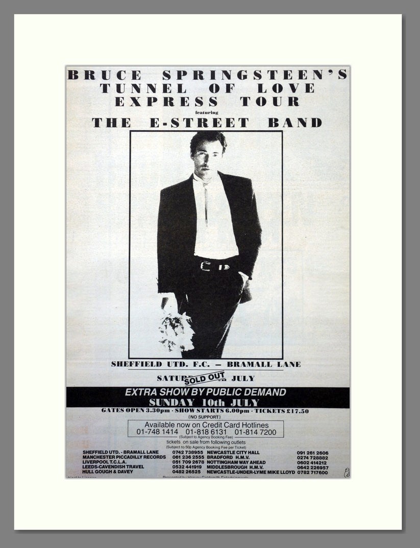
Yes, it was loud!! Living at Brinsworth at the time, we thought the lad who lived over the back was having a loud party outside while his parents were away on holiday. Then realised it was the Springsteen Concert. It was louder than the Def Leppard Concert at Don Valley Stadium some years later, that after the Sound Check the day before was turned down a few notches. Set List: Tunnel of Love Express Tour Bramall Lane 9th July 1988 https://www.setlist.fm/setlist/bruce-springsteen/1988/bramall-lane-sheffield-england-7bd7b294.html
-
Tsavo posted 10th April 2007 Come on Richard, put me out of my misery! Who was it? RichardB posted 10th April 2007. I was sure you were going to get this, you even mentioned the authors name in a posting, saying you hoped for more time now your family had gone back home !!!! At the top of the street, next to the Church Gates, on the site of Pawson and Brailsford's present premises, was the iron- monger's shop of Thomas Heaton, Town Trustee and Church Burgess. When the old Town Hall was built, close to him, in I700, he supplied the "chaines" for the hall candlestick. He was elected a member of the Town Trust in I724. A tombstone in the churchyard records that he died December I9, I734, in the 48th year of his age, and tells us that " He was easy and agreeable in every path of private life, and useful to the publick as a member of the three publick bodies of the Town, the Church, and the Free School, and died generally lamented." Then follow the names of his wife and of a number of their daughters, who long remained in occupation of the High Street premises, ending with " Hellen, the last survivor of this truly Respectable Family, who departed this life, the I8th June, I795." We get an instructive glimpse of the High Street of the past in a reference to Mr. Heaton's property in a document dated I726.* In that year Heaton leased to the Rev. John Balguy " part of his garden adjoining the Boys' Charity School." On this Mr. Balguy built a dwelling-house, and it is evident that Mr. Heaton's garden had extended behind his shop, for the whole length of the churchyard, to the Charity School. Mr. Balguy was at one time a teacher in the Grammar School, where his father had been headmaster from I664 to I696; and mention of him brings us into connection with another High Street worthy and Town Trustee, Mr. Christopher Broomhead, for the Rev. John Balguy married one of Christopher Broomhead's daughters; Mr. Robert Drake, surgeon, another; and Mr. Christopher Robinson, headmaster of the Gran mar School, and the author of various theological books " Local Notes and Queries," Sheffield Indepenednt, March I5, 1877. + Gatty's Hunter's " Hallamshire," pp. 250,255, 308-9. Ante, p. 174. Source : REMINISCENCES OF SHEFFIELD by R. E. LEADER CHAPTER 13 - HIGH STREET and OLD INNS. This is the property of the Heaton's and surrounding. Information from The Story of Sheffield High Street, from 16th Century to Modern Times, by Pat Dallman. "At the beginning of the 1700's the house next to the church gates, which in the previous century has belonged to the Creswick and Joshua Bayes, came into the possession of Joseph Banks, the attorney. He sold it in 1710 to Thomas Heaton, an ironmonger and his shop with its post and chains across the front, became a well known feature of the town centre. Thomas was born in 1686 and married wife Sarah in 1718." They had 7 daughters, one of which, Helen lived there until her death 1795. Advertised for Sale in the Iris 28th August 1795. "Most eligible and advantageous situated in High Street, Sheffield; near the old Church, and consists of two Dwelling Houses with Shops to the front and one other Dwelling House fronting the Church Yard, with several Outbuildings an Appurtenances thereto adjoining and belonging; also a Carriage Road from the uppermost part of the Yard to Campo Lane. The extent of the front to High Street is about 19 yards and fronting the Church near 80 yards." Plan of the tenements and ground belonging to the late E. Heaton (now to John Butcher and John Frith in 1806), extending from the High Street to the Hart's Head, c. 1795 https://www.picturesheffield.com/frontend.php?keywords=Ref_No_increment;EQUALS;arc04144&pos=23&action=zoom&id=103990 Marked: The Hart's Head [Hartshead], John Hoyland's freehold, road common to the Charity School, Samuel Turner, Butcher and Frith, [property of] the trustees of the Charity School / [Dr?] Drake, late John Winter's leasehold, the property of the heirs of Thomas Vennor, High Street, [property] sold to Samuel Turner, [property sold to W. H. Saunders, Town Hall. A plan of the tenements and ground purchased by S Broadbent of W Battie, with a scheme for opening a communication betwixt the High Street and the Hartshead. (not dated.) https://www.picturesheffield.com/frontend.php?keywords=Ref_No_increment;EQUALS;arc04313&pos=25&action=zoom&id=107173 Marked: High Street, Hartshead, brewhouse, property of the late Widow Heaton deceased, Thomas [?] Shaw’s freehold, William Webster’s freehold, John Barlow’s freehold, charity school, and Campo Lane. Part of the property (believed to be The Crown public house) of Thomas Vennor, a draper, made way for York Street in 1770. His drapers shop had bow windows. (Proposed) Plan of a new street along Fig Tree Lane from York Street to West Bar. 1820. https://www.picturesheffield.com/frontend.php?keywords=Ref_No_increment;EQUALS;arc04108&pos=9&action=zoom&id=103671 Note: the suggested improvement was to make a straight wide street of York Street, Figtree Lane and New Street, but it was never carried out. Shows High Street, York Street, Hartshead, Campo Lane, Figtree Lane, Queen Street, Bank Street and West Bar. Also shows Boys Charity School. Names marked: Gunning, W. and G. Foster, John Hoyland, late Joseph Binney, H. Tudor's executors, late Joseph Ward, John Turner, William Cowley, T. C. Burgesses, A. A. Hardy, John Parkes, Ashforth, Widow Pears, Daniel Holy, Sykes, Marchinton, John Fawcett, William Davis, Dyson, Tippet, Mary Seaton, Francis Allwood, and Joseph Fowler.
-
The only Smith listed on Stubbin Lane, 1957 and 1965, Mrs. Emma L Smith, at 98 Stubbin Lane.
-
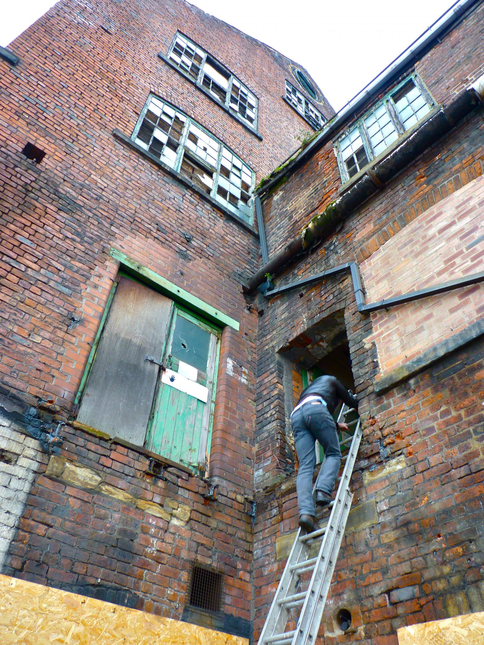
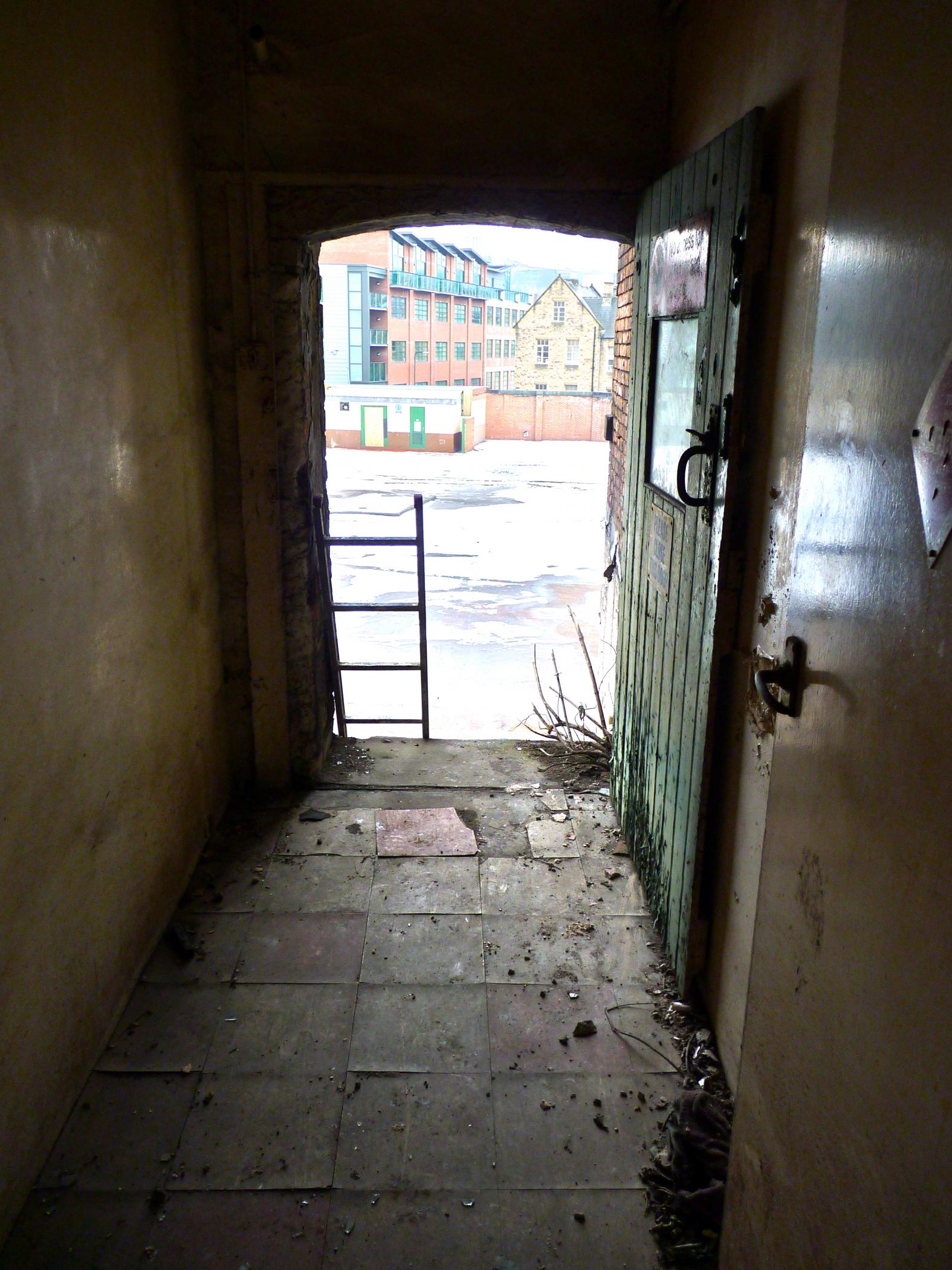
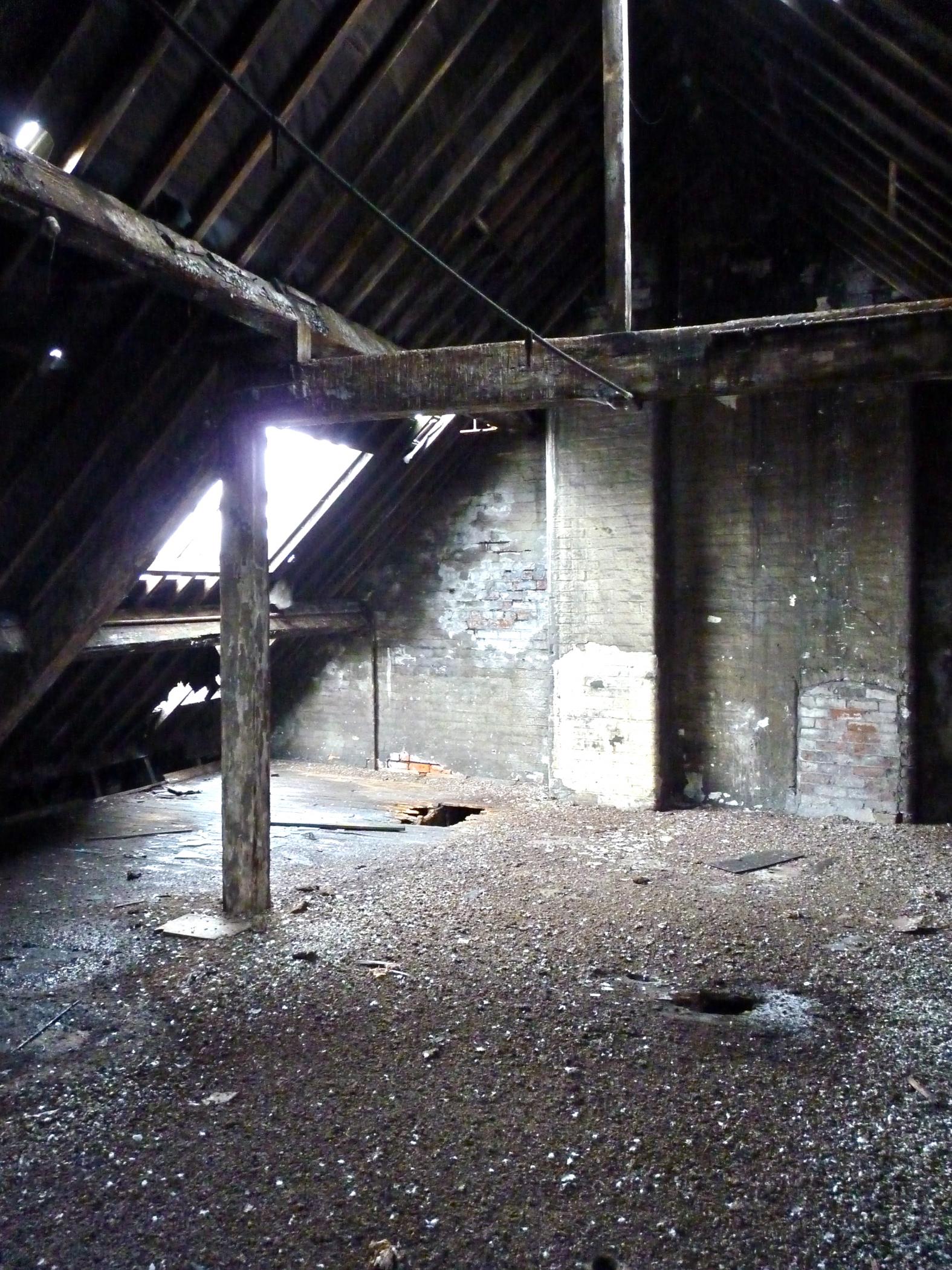
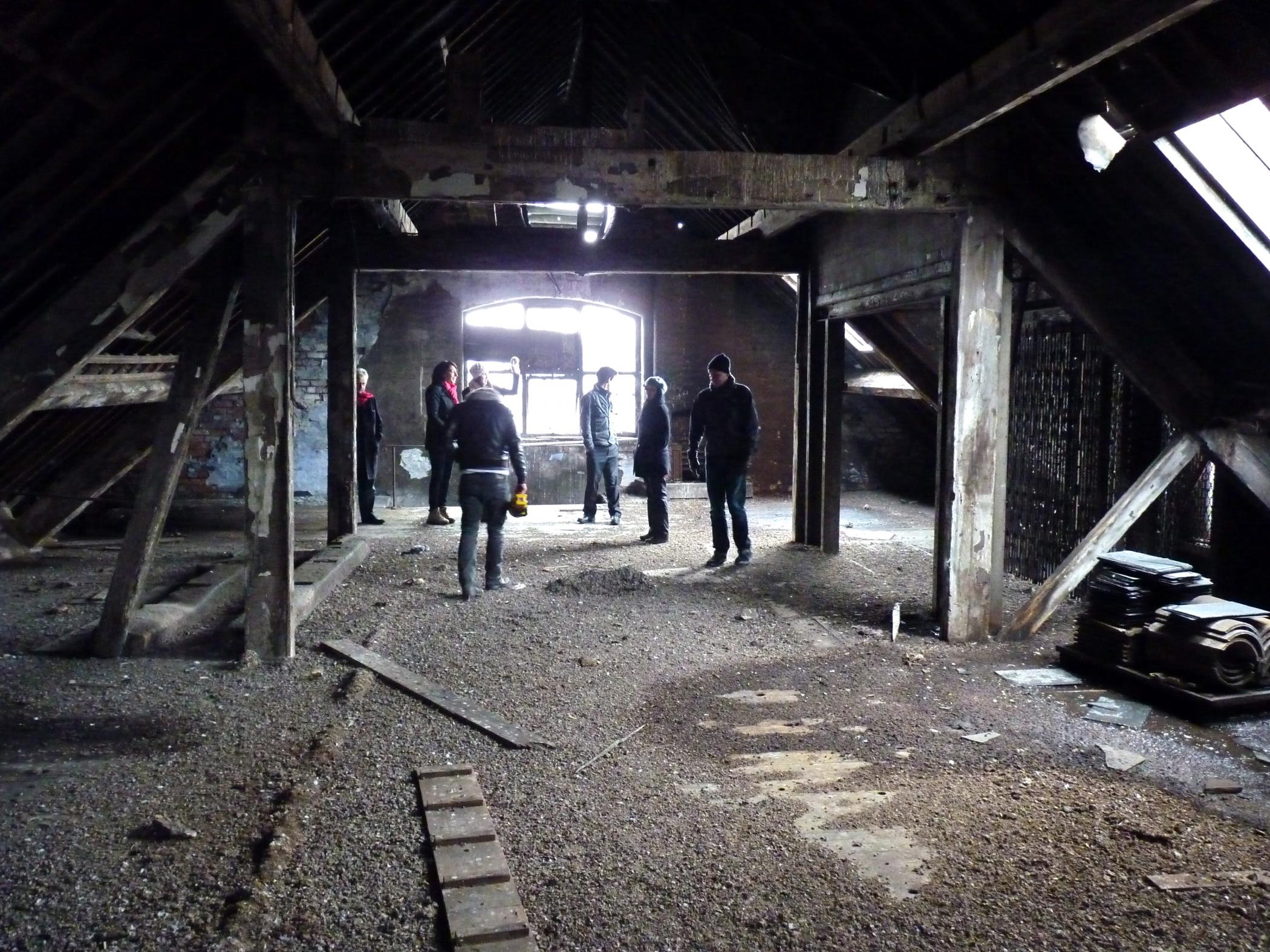
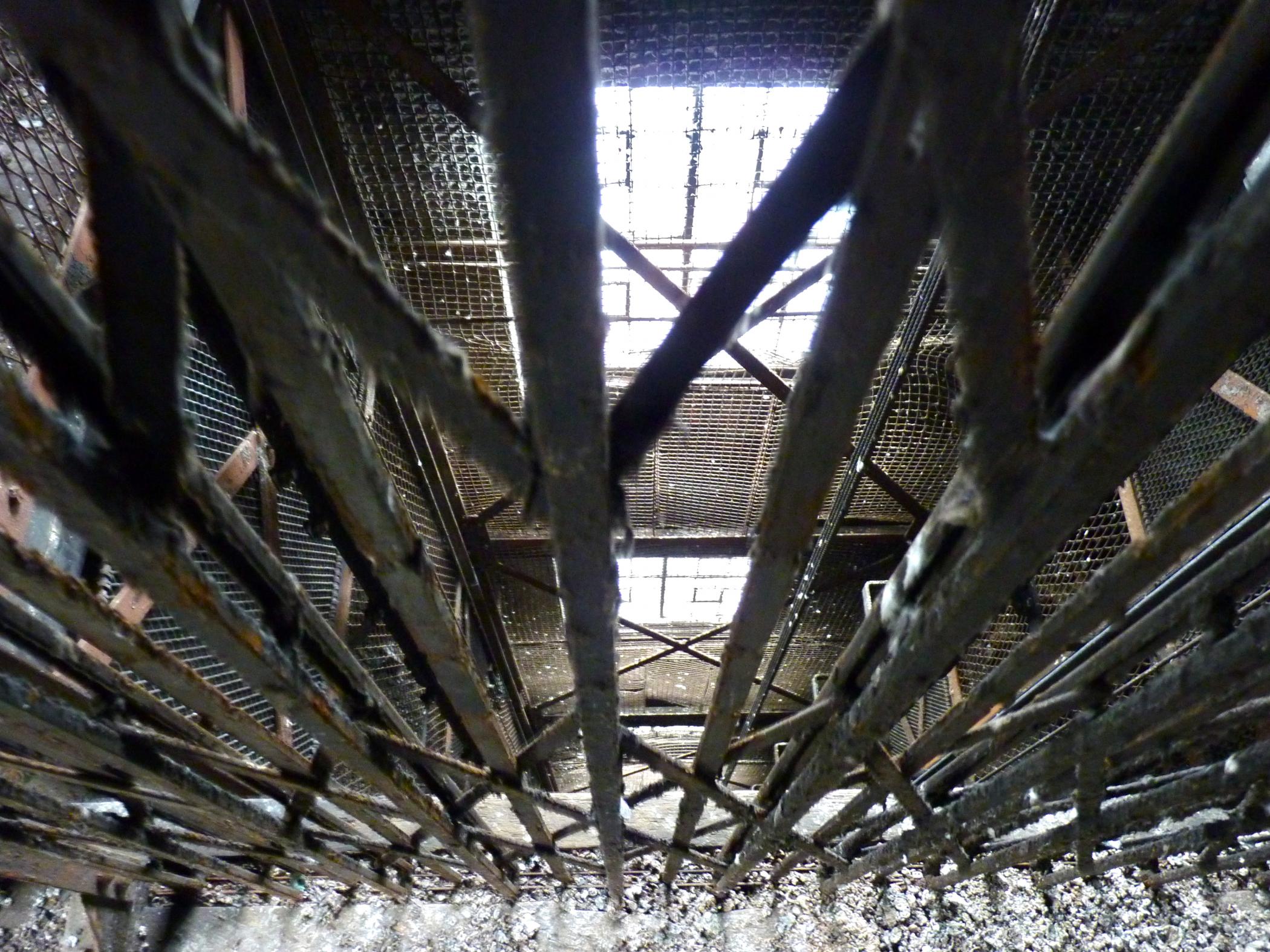
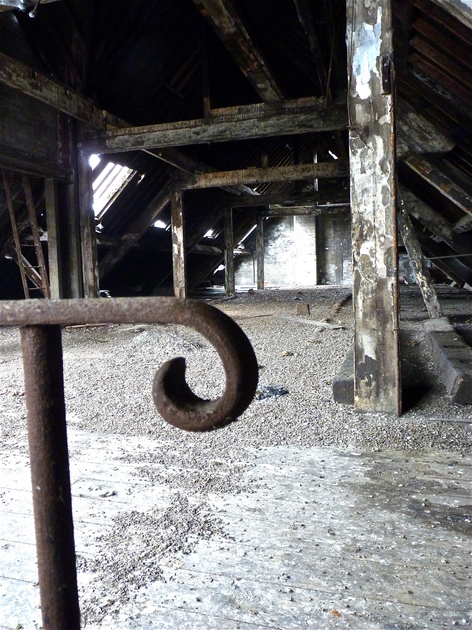
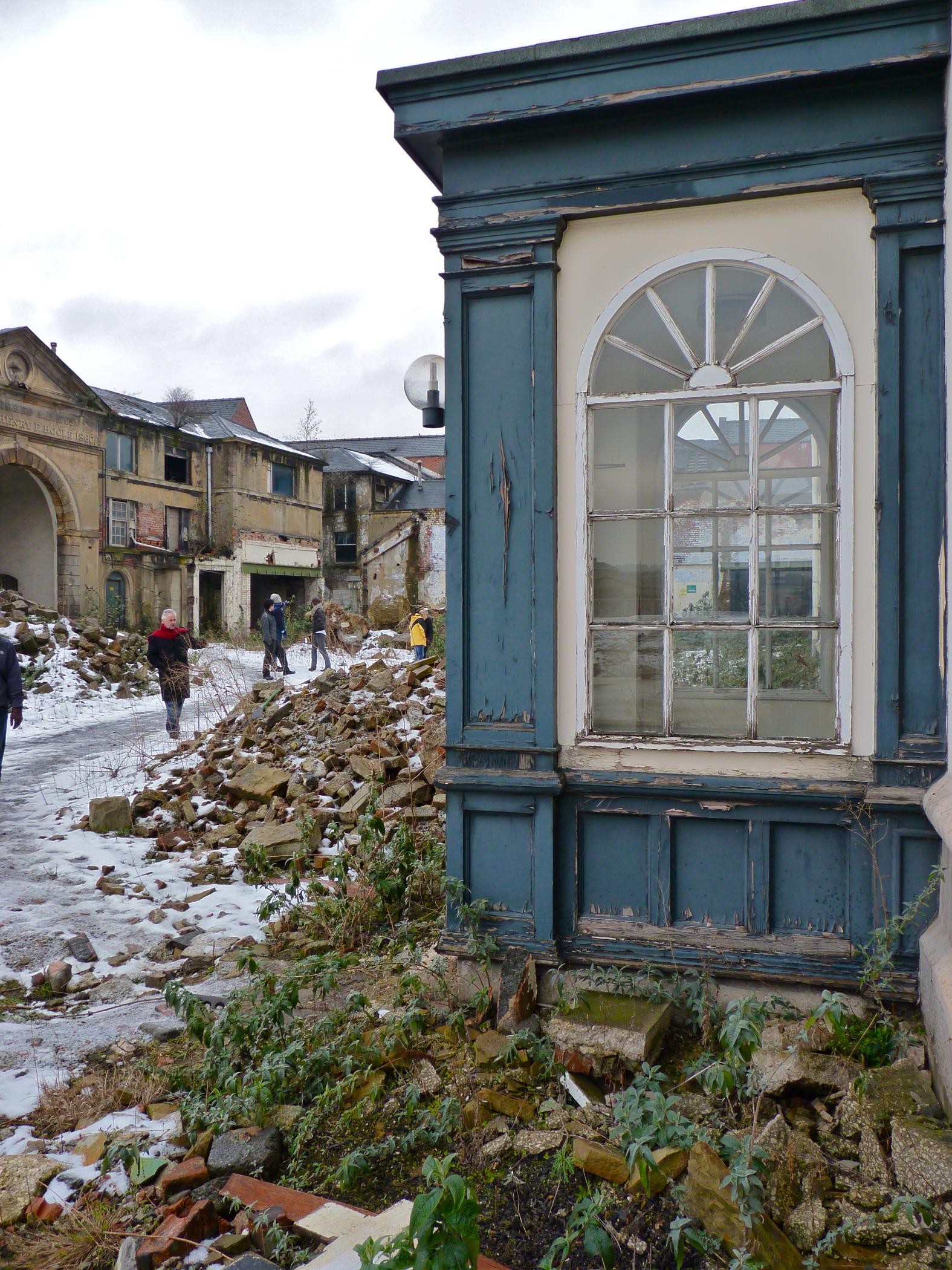
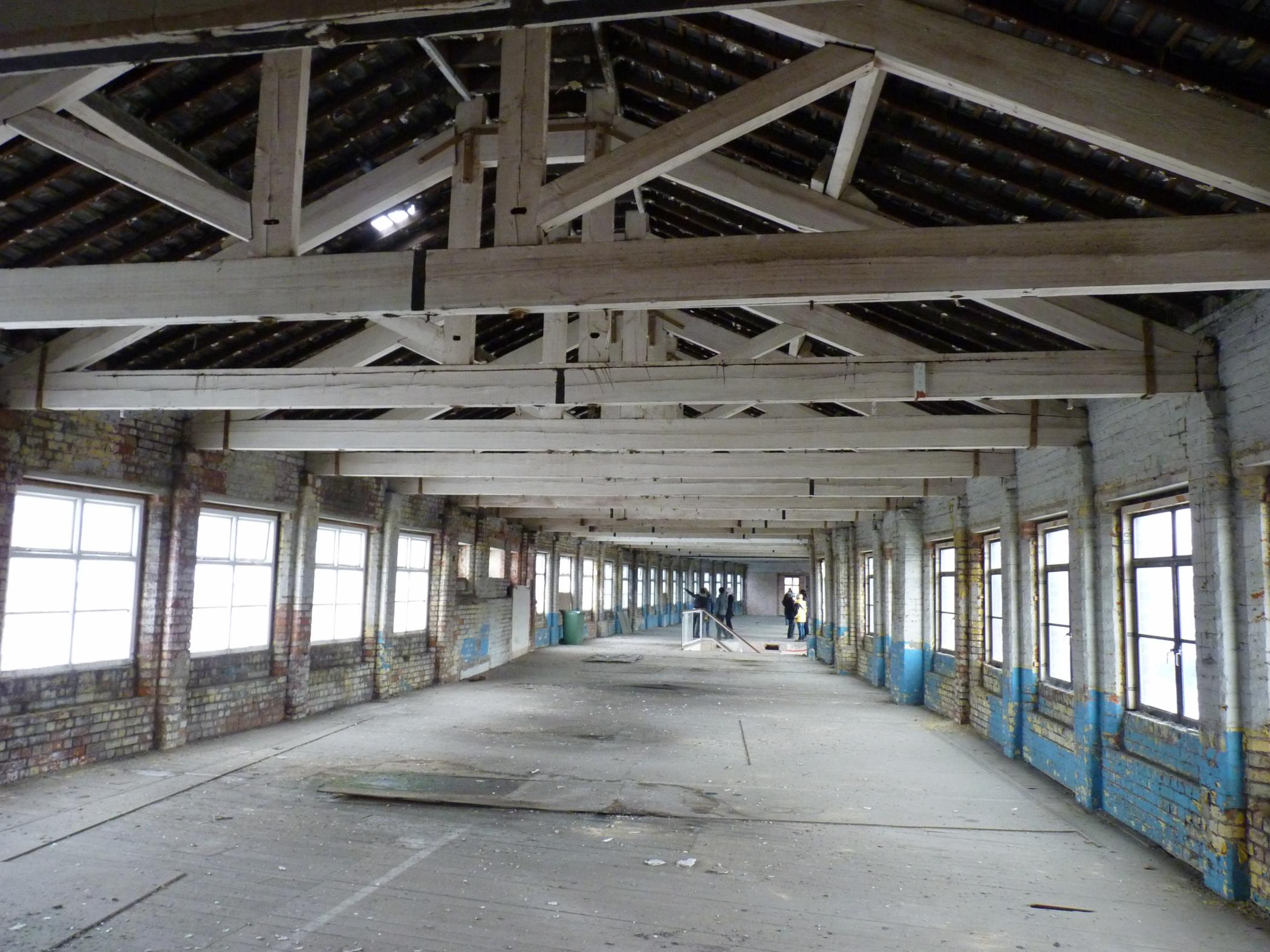
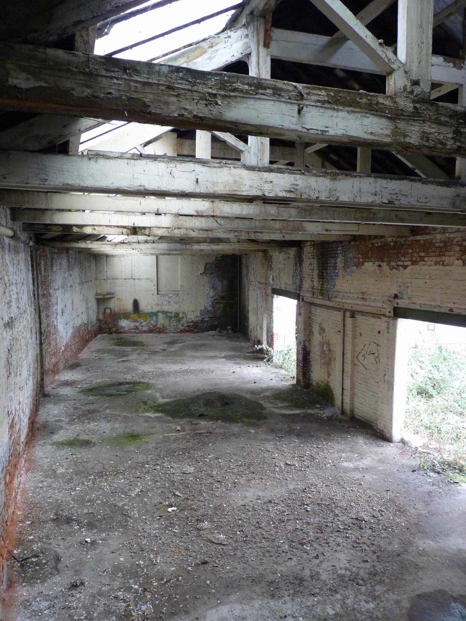
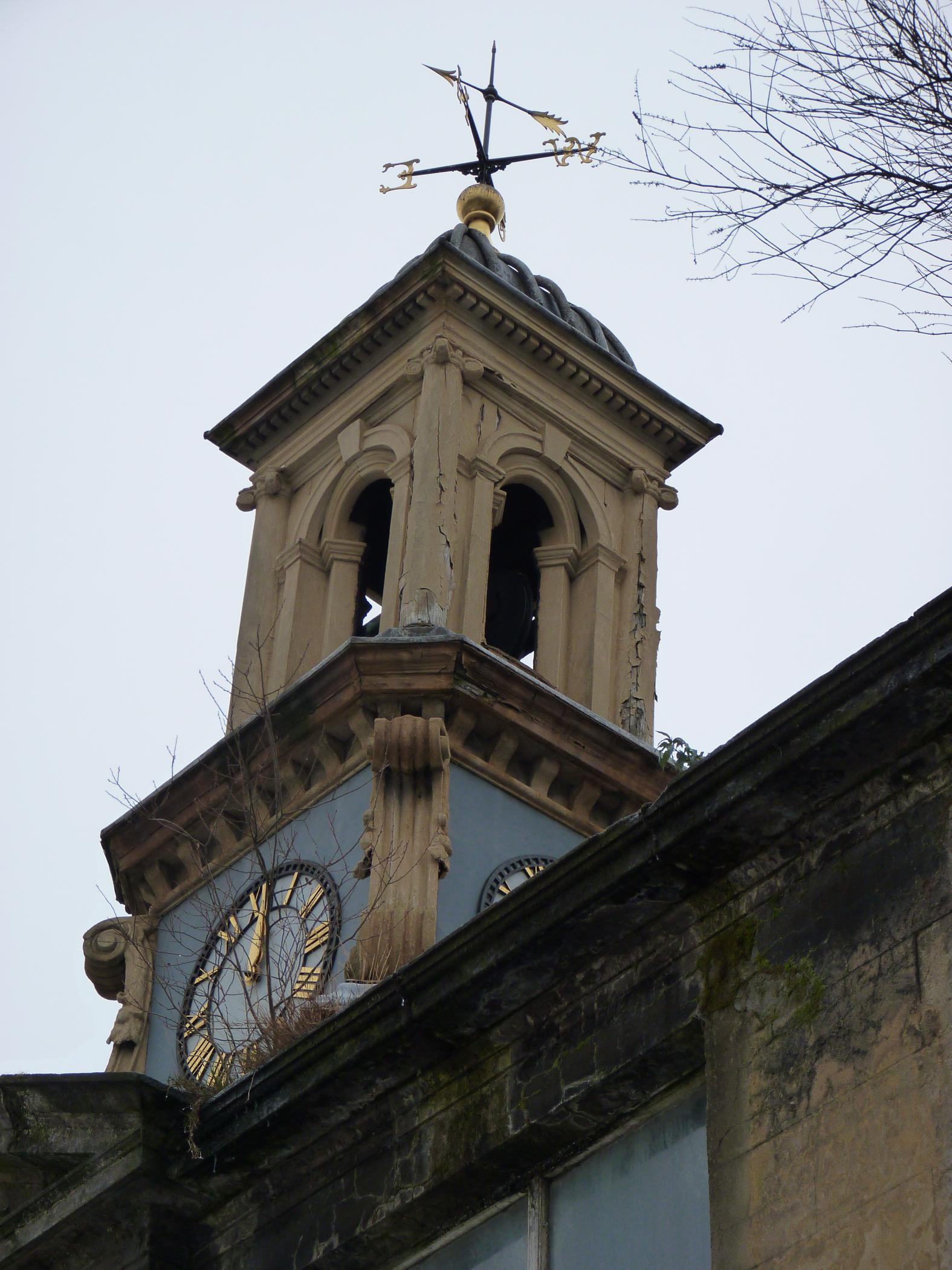
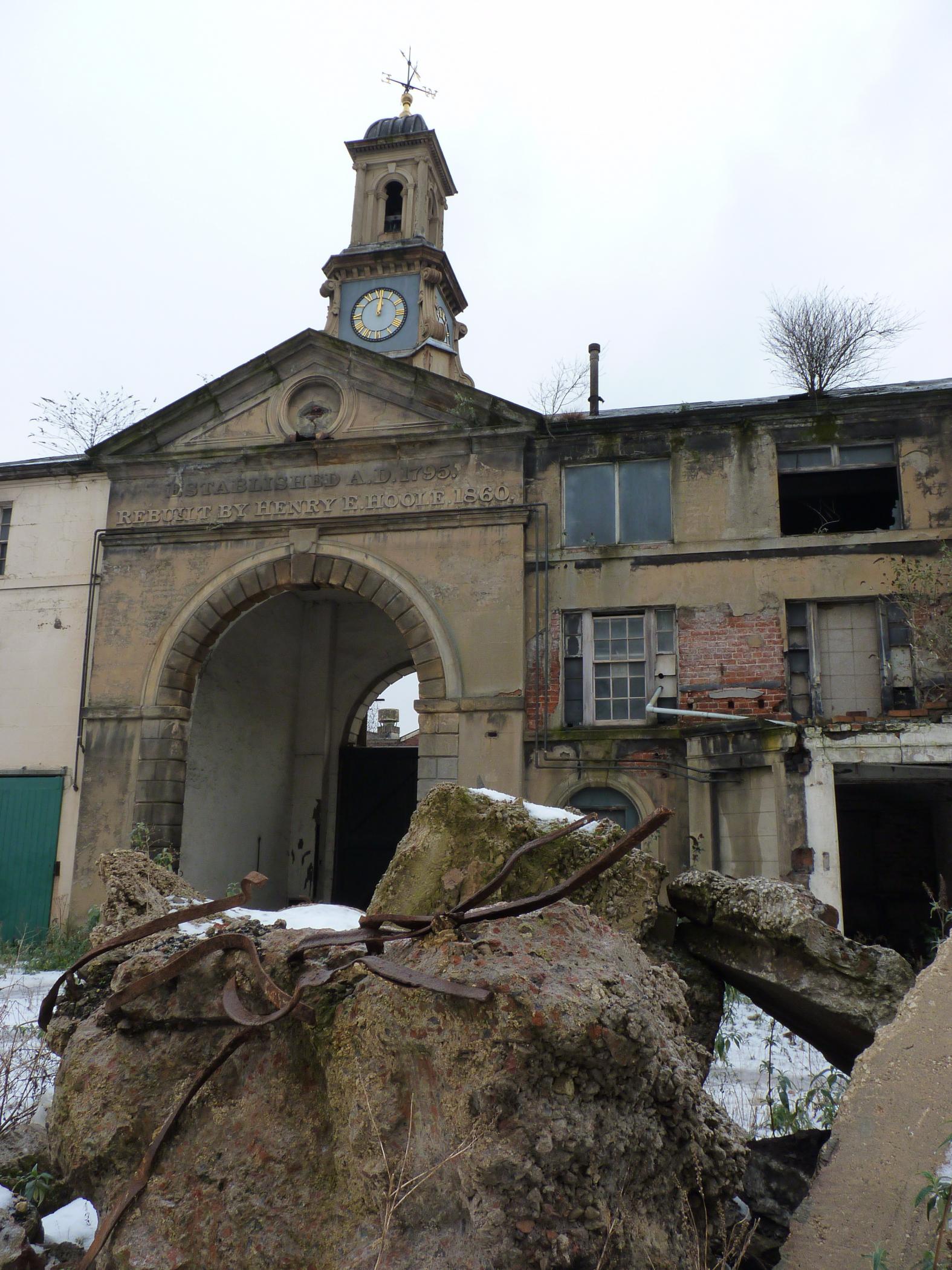
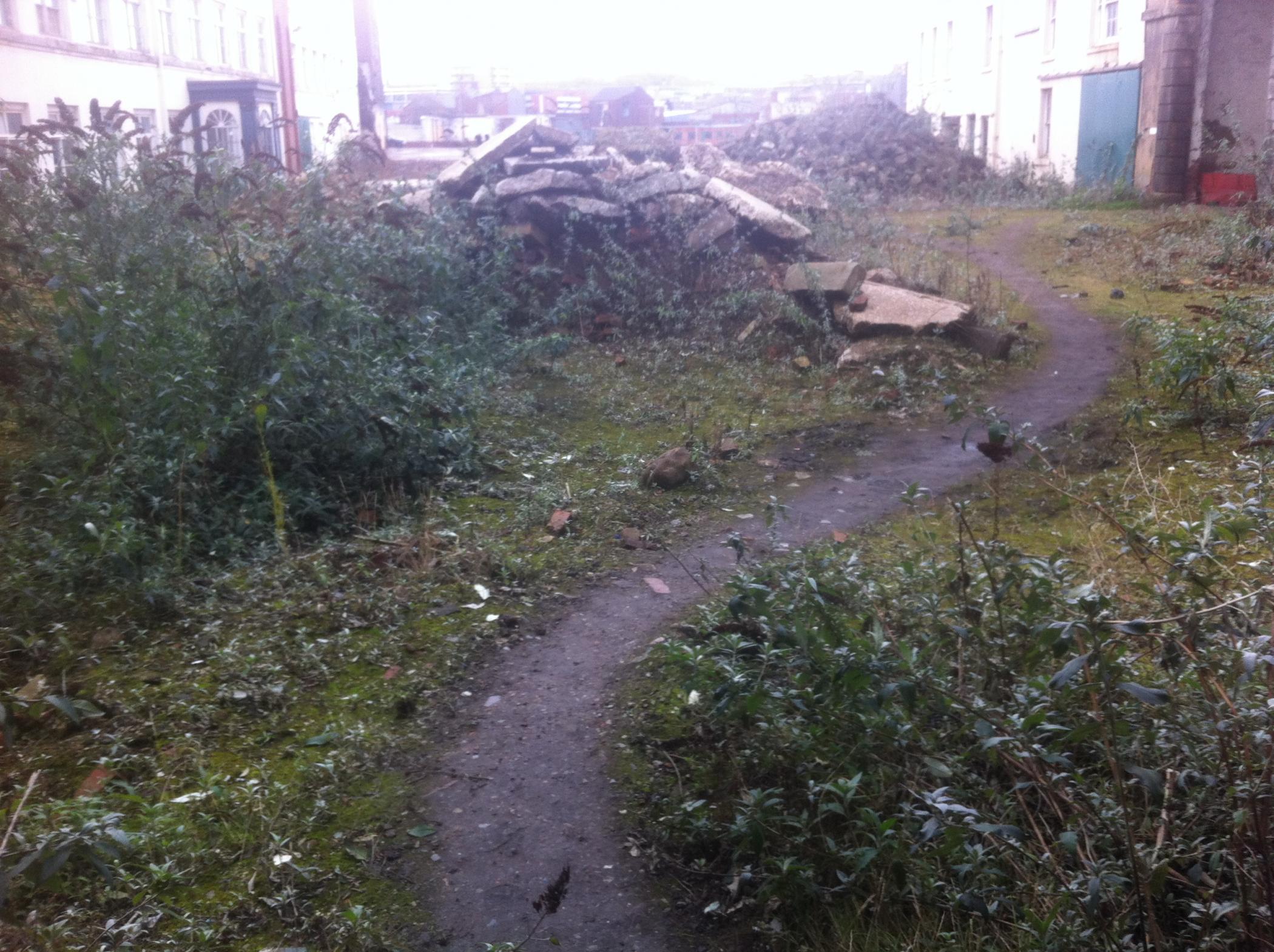
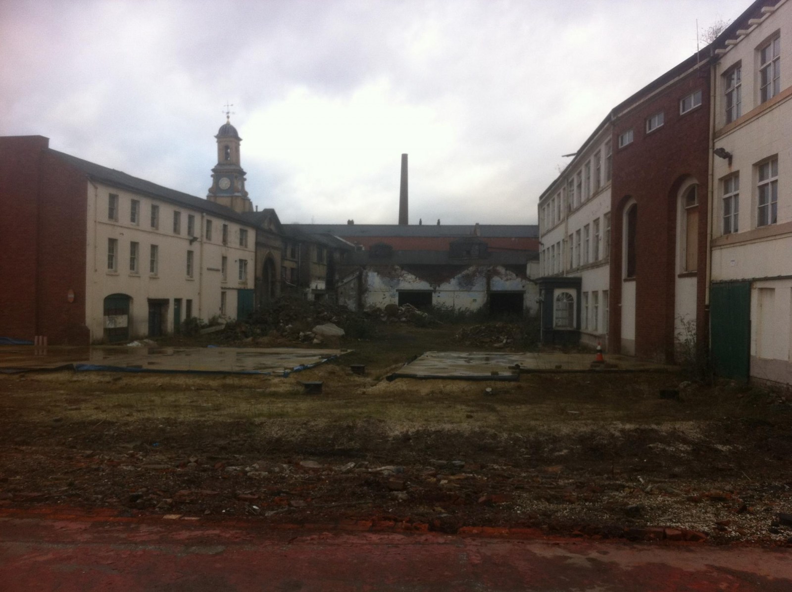
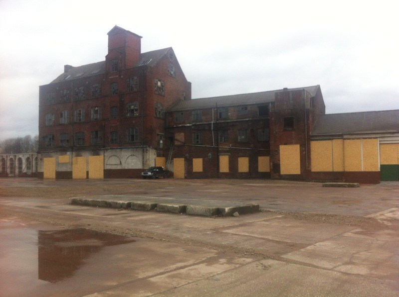
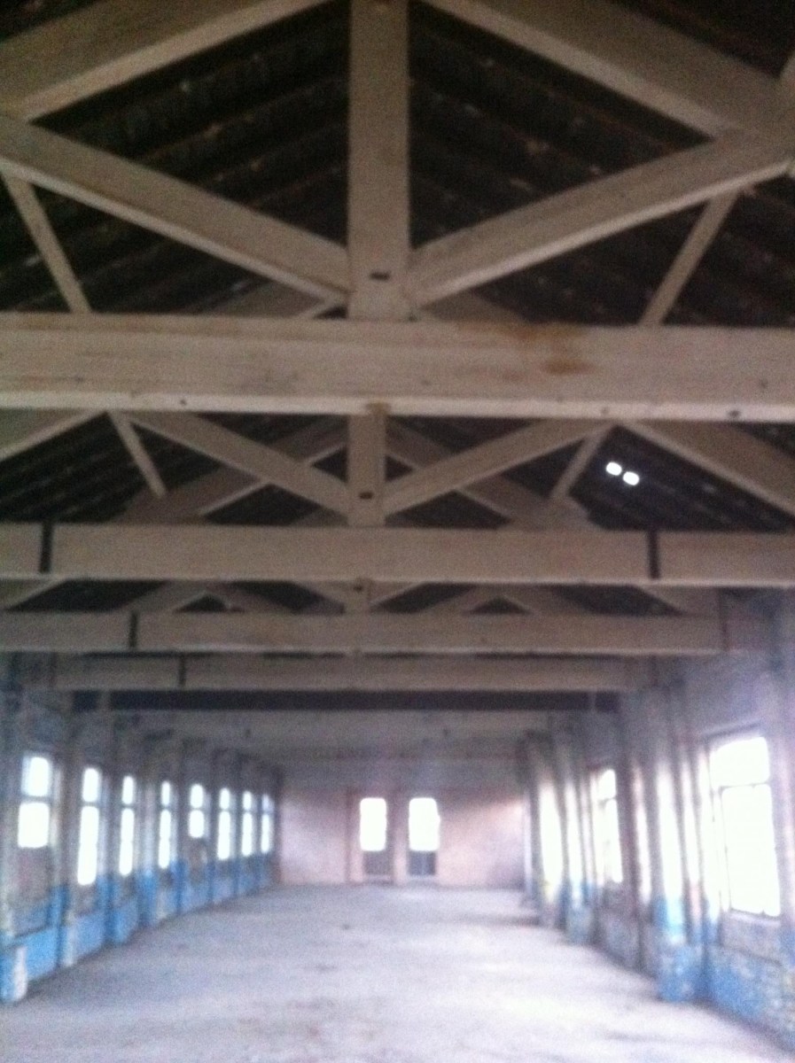
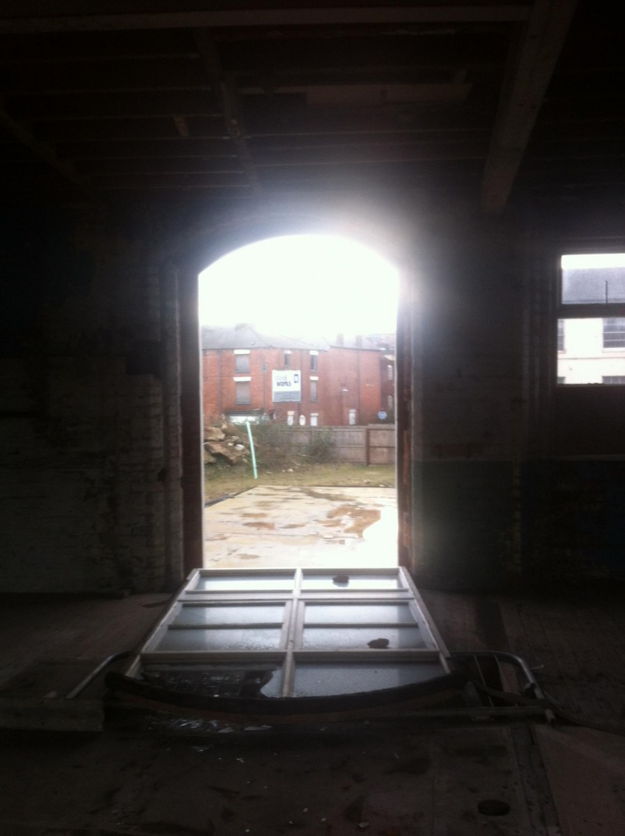
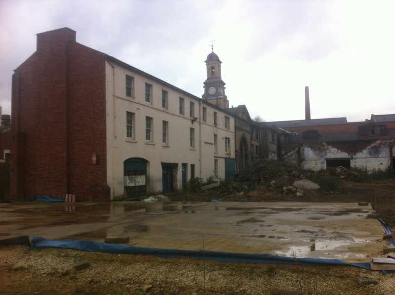
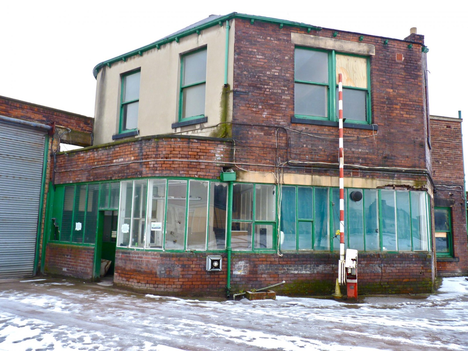
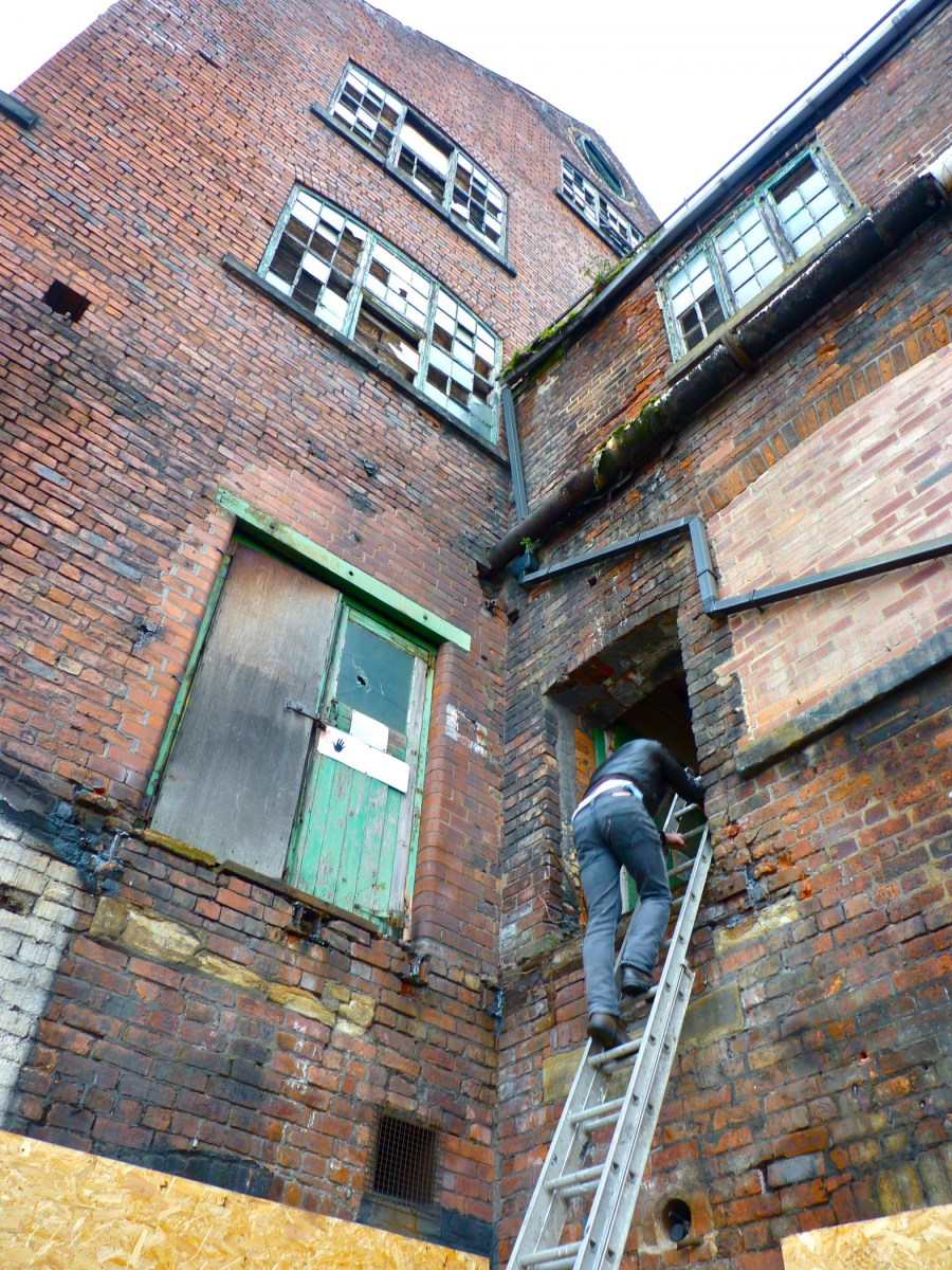
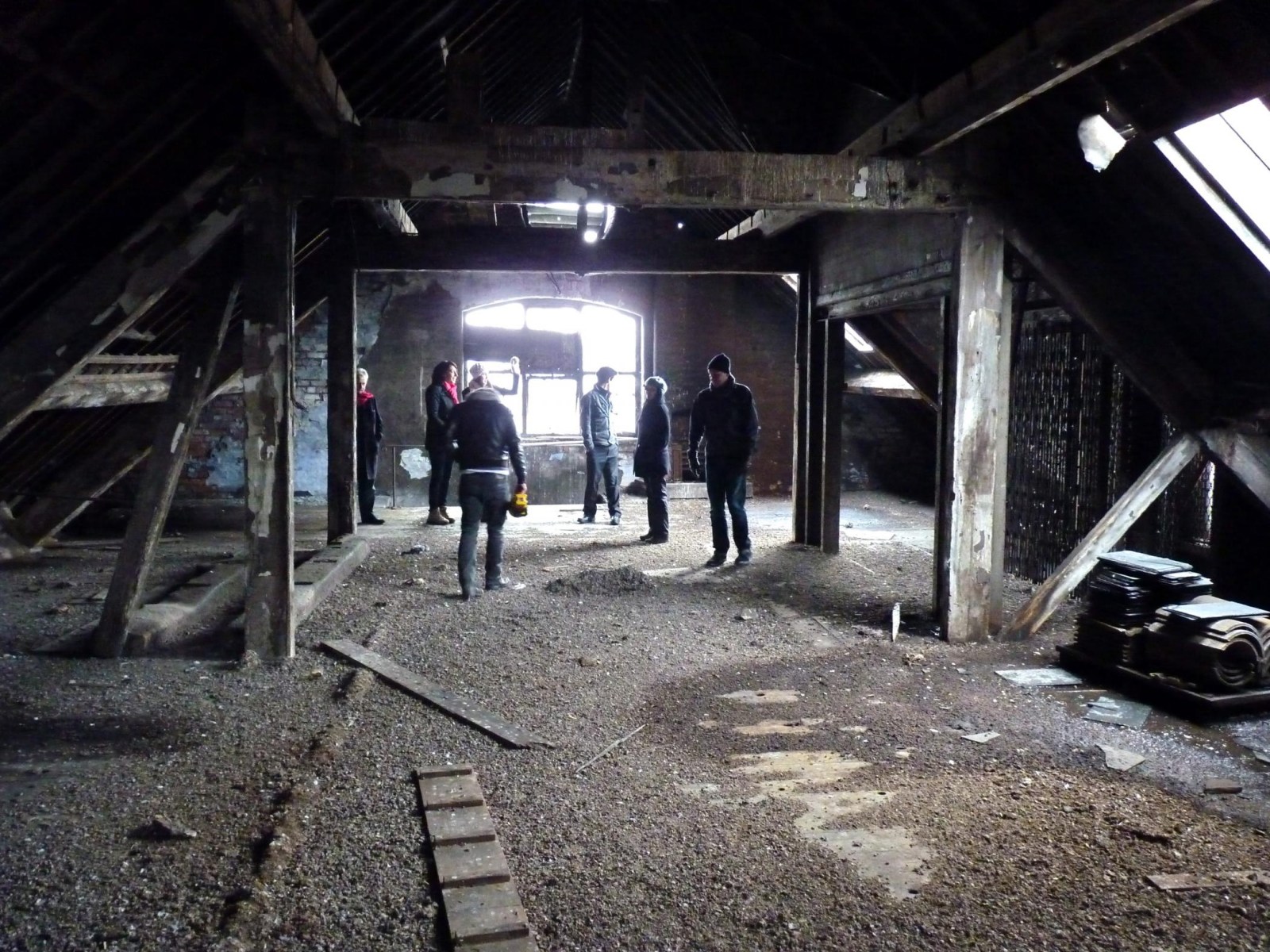
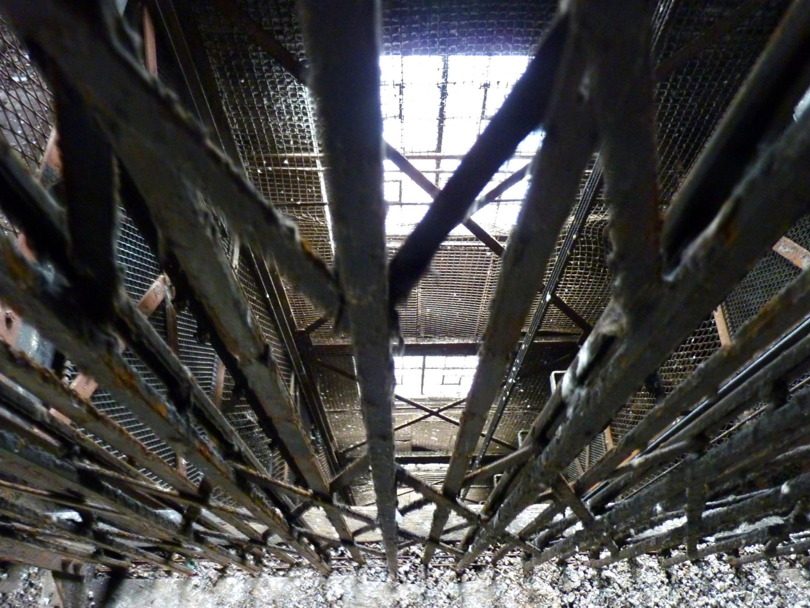
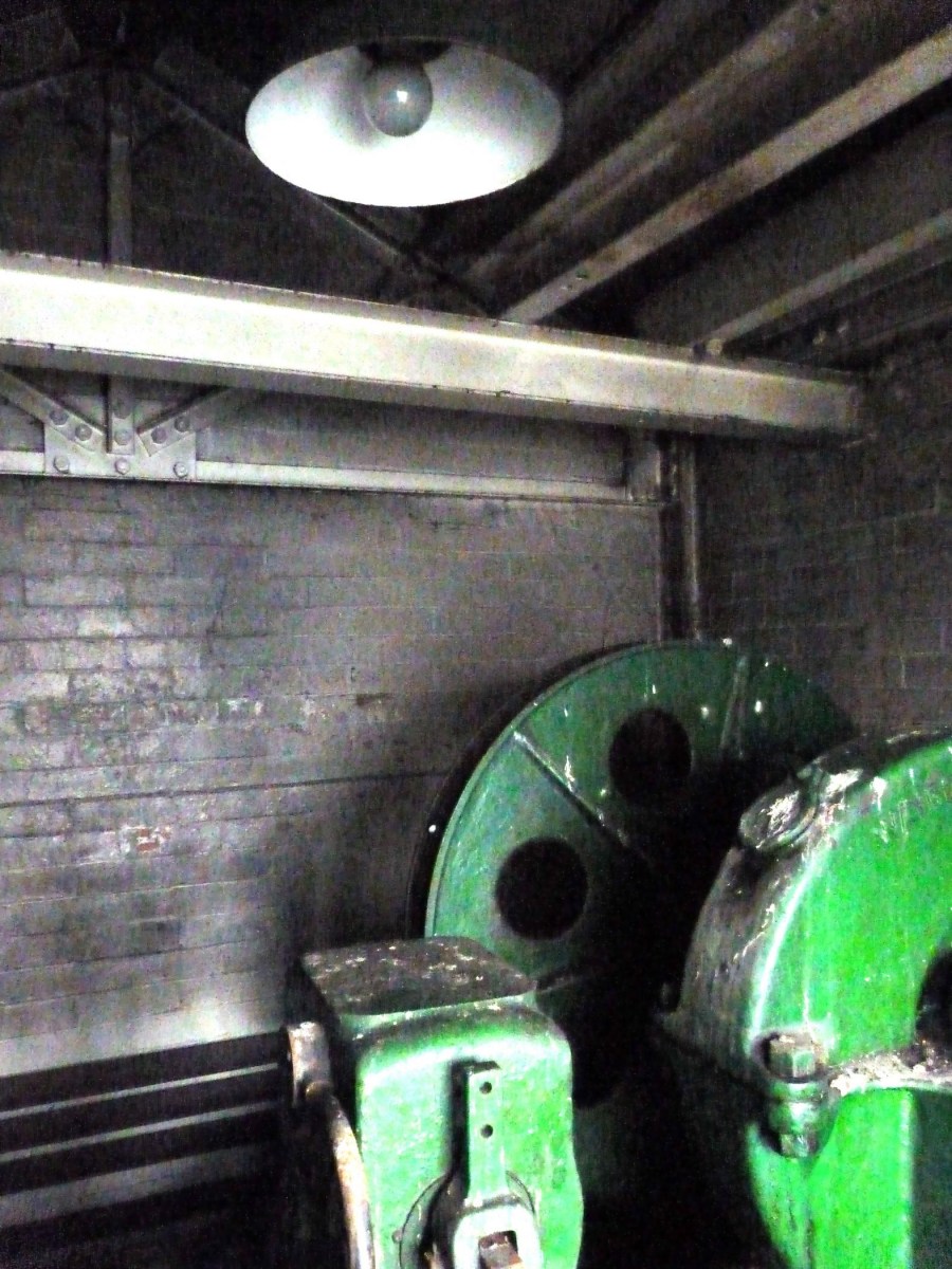
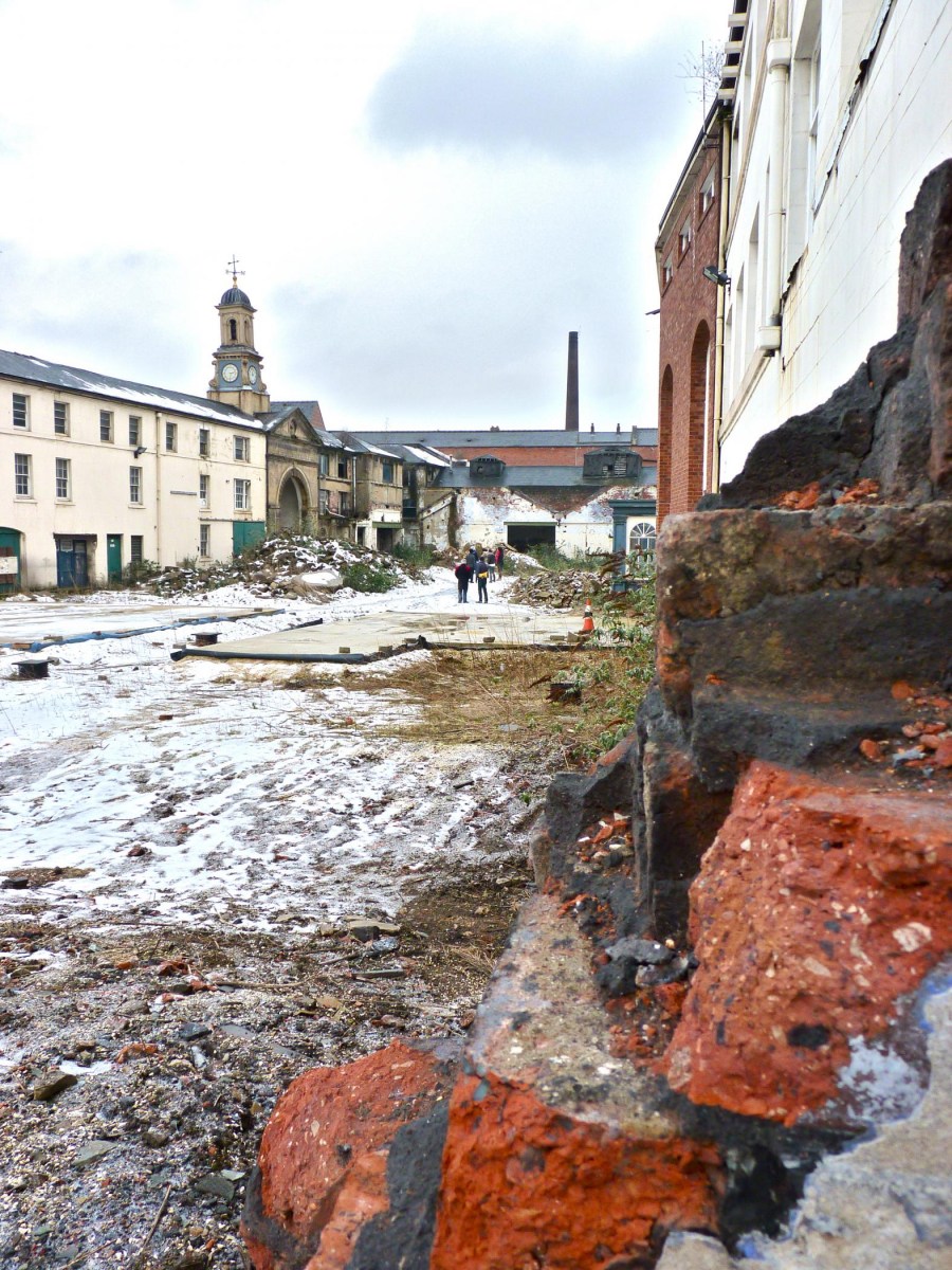
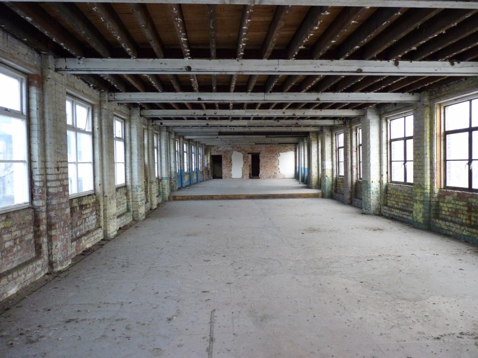
A visit to Green Lane Works and Eagle Works in Kelham just after the site had been cleared of the ancillary buildings. January and February 2012. Please do get in touch in you have any more old photos, or history of the sites. I am trying to compile a historic timeline from the early days of Kelham.


-
I also left home in 1965 to get married. We had bought a house off Elm Lane at Lane Top . “Aunt Gladys” and her sister ran the Mikado Drink Shop. I put a piece on here a while ago reminiscing about the place…the home made ice lollies and the back room where invited kids were invited to watch TV…….when TVs were a rarity!
-
I left home in 1965 to get married and I expect I remember the greengrocers as Roses on the odd occasion I'd gone shopping with my mum to Firth Park (we lived at Sheffield Lane Top) My sister in law knew Jim Smith and he possibly took over the Bellhouse shop in the mid 1960s? I don't remember a Smiths Greengrocers on Stubbin Lane but do remember the Mikado drink shop where my father took myself and my sister every Saturday afternoon after we had visited Firth Park Library.
-
What pit was that big slag heap at end of parkway from 1965
roy preston posted a topic in Sheffield History Chat
what pit was that big slag heap at end of parkway from 1965 -
Steel & Garland, Stove Grate Manufacture, Green Lane, Wharncliffe Works, Green Lane
Ponytail posted a topic in Made In Sheffield
Steel & Garland, stove grate manufacturers, Wharncliffe Works, Green Lane Advertisement from Illustrated Guide to Sheffield, Pawson and Brailsford. 1862 https://www.gracesguide.co.uk/Steel_and_Garland Advertisement 1868 Whites Directory, Steel & Garland, Wharncliffe Works, Cornish Street & Green Lane. https://www.picturesheffield.com/frontend.php?keywords=Ref_No_increment;EQUALS;y12629&pos=58&action=zoom&id=124774 Wharncliffe Works 2000 https://www.picturesheffield.com/frontend.php?keywords=Ref_No_increment;EQUALS;t10174&pos=10&action=zoom&id=131805 Derelict Wharncliffe Works 2004 https://www.picturesheffield.com/frontend.php?keywords=Ref_No_increment;EQUALS;v01964&pos=4&action=zoom&id=43300 Wilson & Murray, surface grinder, Wharncliffe Works former premises of John Lucas Ltd., iron founder. https://www.picturesheffield.com/frontend.php?keywords=Ref_No_increment;EQUALS;v02632&pos=5&action=zoom&id=43905 Wharncliffe Works 2013 https://www.picturesheffield.com/frontend.php?keywords=Ref_No_increment;EQUALS;c04262&pos=8&action=zoom&id=91849 Wharncliffe Works 2016 https://www.picturesheffield.com/frontend.php?keywords=Ref_No_increment;EQUALS;a01997&pos=9&action=zoom&id=117007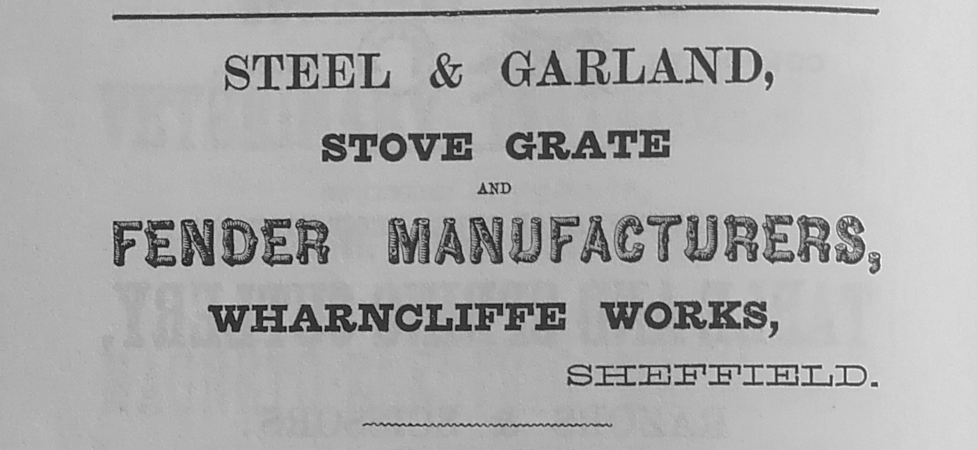
-
It appears the widening of Snig Hill was in the planing for a number of years. Plan of proposed street widening at Bridge Street, Coulson Street and Snig Hill. 1845. https://www.picturesheffield.com/frontend.php?keywords=Ref_No_increment;EQUALS;arc06809&pos=12&action=zoom&id=106240 Marked No. 2. Also shown are West Bar, New Hall Street, Love Lane, Spring Street, Bank Street, Water Lane, Angel Street and Castle Street. From a volume of plans of new streets and street improvements, made by Flockton, Lee and Flockton, 1845. Plan for improving Snig Hill and Coulson Street [Colson Steet], [1830s] https://www.picturesheffield.com/frontend.php?keywords=Ref_No_increment;EQUALS;arc04249&pos=8&action=zoom&id=53522 Marked: Bridge Street, Coulson Street, New Hall Street, Spring Street, West Bar, Snig Hill, Bank Street, Angel Street, Castle Street, Angel Inn, and Bank. Plan for improving Snig Hill and Coulson Street; and Plan for improving Shude Hill and Bakers Hill. 1837. https://www.picturesheffield.com/frontend.php?keywords=Ref_No_increment;EQUALS;arc04248&pos=7&action=zoom&id=48088 Marked: Marked: Bridge Street, Colson Street, New Hall Street, Spring Street, West Bar, Snig Hill, Bank Street, Angel Street, Castle Street, Angel Inn, and Bank. Inset - Pond Street, Shude Hill, Bakers Hill. Houses of John Frith and Joseph Frith at Snig Hill, with adjacent property wanted for street improvement. 1836. https://www.picturesheffield.com/frontend.php?keywords=Ref_No_increment;EQUALS;arc04247&pos=10&action=zoom&id=95321 Marked: West Bar, Snig Hill, Colson Street, Three Travellers, Snig Hill, Black Swan, Bank Street, property of Joseph Firth and John Frith, Bank [Bank Street], Angel Street, Angel Inn, Castle Street and Water Lane.
-
Unidentified Public Houses and Refreshment Rooms
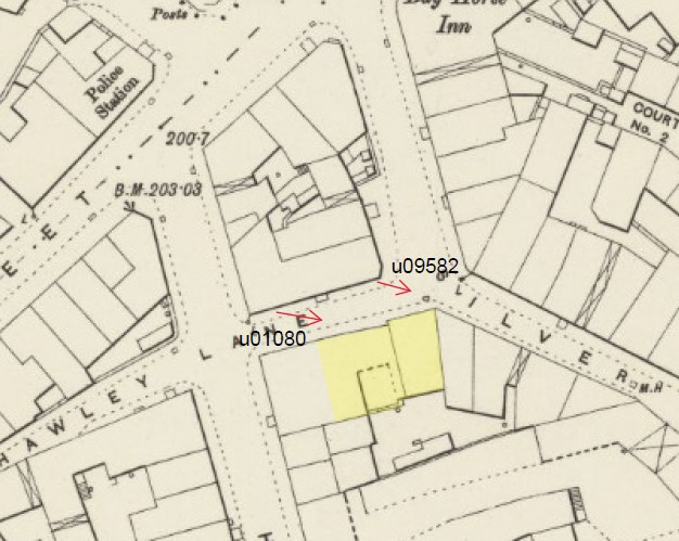
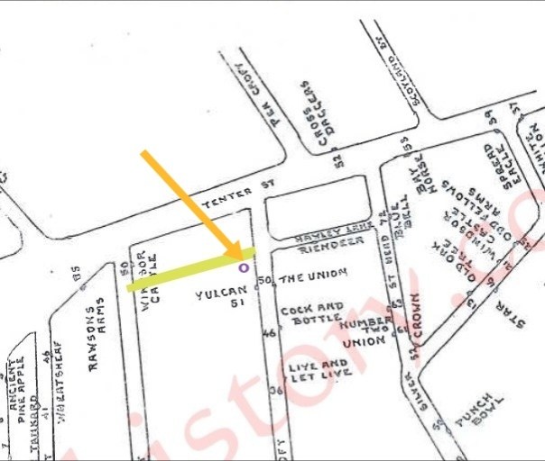
Ponytail replied to Ponytail's topic in Sheffield History Chat
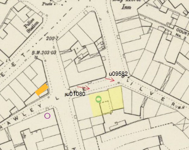
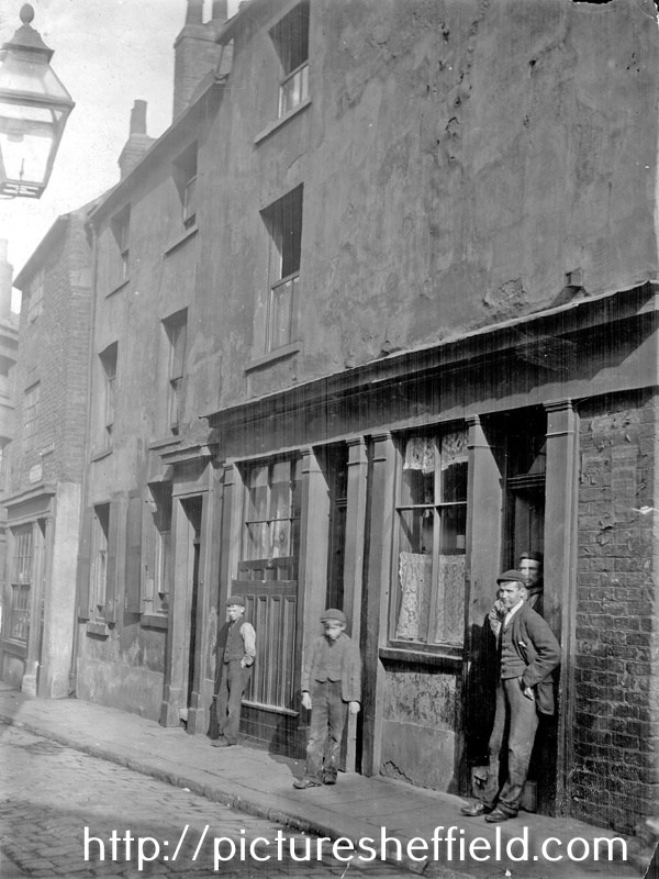
OS Map 1890's indicating the position and angle of the "Unidentified Photograph" u01080. We're hoping to identify the name for the beerhouse/public house. My interpretation of the position is slightly further back, thus bringing into shot the street lamp on the corner of Hawley Croft and Hawley Lane marked on the map with a line and the letter L. Information from Directories and Census Returns indicates it is No. 3 Hawley Lane. Drawn Map from Pub on Every Corner, by Will Bray from 1988. Please be aware the book was compiled before the digitalisation of Local Studies Picture Collection when many photographs were not catalogued or available for study nor were Census of the period available. It doesn't show the whole of Hawley Lane which extended from Silver Street Head, across Hawley Croft to School Croft with the Rawson Hotel (Arms), School Croft opposite. The full length of Hawley Lane is drawn in pale green and the Reindeer PH marked with a purple circle and Identified with the arrow. Information researched from Directories and photographs. OS Map of 1890's with the position of the "unidentified" beerhouse/ public house marked with a green circle. The Reindeer P. H which research from Directories and photographs assumed to be No. 5 Hawley Lane is marked with a purple circle. The property marked in orange is the position of "Back of Becketts" image u01083 Image of Reindeer P. H. Old Reindeer public house (sign on lamp left) and properties, Hawley Lane. Date Period 1851-1899 Copyright: Jill Dalton Notes. 1893-4 Directory- No. 5 Hawley Lane, James Sharp, beerhouse. 1898- No. 5 John Plant, beerhouse. 1902 no beerhouse listed. Hawley Lane not listed 1906 https://www.picturesheffield.com/frontend.php?keywords=Ref_No_increment;EQUALS;v00922&pos=33&action=zoom&id=42714 From Edmund: From Archaeo: In the 1891 census, Mary Horan is at no.3 with her three children and 10 lodgers! It’s easy to see why there might have been considered to be a problem with overcrowding in this area. 1901 Census (only heads named) 1 Hawley Lane - Mary Horan, Provision dealer Back of 1 Hawley Lane - John W Horan, mining engineer 3 Hawley Lane - Joe Adamson, Sheffield Water Co labourer 5 Hawley Lane Old Reindeer - Frederick Booth, Inn Keeper From newspaper articles found by Archaeo, these are possibilities for the name of No. 3 Hawley Lane. Newspapers name a few beerhouses on Hawley Lane. (Omitting references to the Reindeer, as we know that is not our unidentified photo). Patrick Whitton, beer seller, Hawley Lane. Mention in: Sheffield Independent Friday 21 April 1876 (re. fines for short pints) William Hannay, beer seller, Hawley Lane. Mention in: Sheffield Independent Friday 21 April 1876 (re. fines for short pints) Unnamed Beerhouse, Hawley Lane. Mention in: Sheffield Daily Telegraph Friday 29 January 1875 (to let, apply Spring Lane Brewery) Cork and Bottle, Hawley Lane. Mentions in: Sheffield Daily Telegraph Friday 18 March 1881 (referenced in report of assault) Sheffield Daily Telegraph Friday 14 November 1879 (reference in report of someone stealing soldiers’ shirts) Eagle Tavern, 3 Hawley Lane, Silver Street Head. Mentions in: Sheffield Daily Telegraph 13 January 1877 (to let) Sheffield Daily Telegraph Thursday 26 February 1880 (use as committee room) Sheffield Daily Telegraph Friday 30 December 1881 (advert for servant) Sheffield Daily Telegraph Saturday 22 October 1881 (reference in report of abuse of a girl and assault of Henry Bockling, landlord) Sheffield Daily Telegraph Monday October 17 1881 (reference in report of soldier being robbed); Sheffield Daily Telegraph Wednesday 28 June 1882 (re. Henry Bockling, landlord, fined for knowingly having prostitutes on premises); Sheffield Daily Telegraph Monday 14 August 1882 (re. advert for pianist) Sheffield Daily Telegraph December 15 1883 (re. to let, apply Scotland Street Brewery. The information on this post is my understanding of the information we've worked so far. Please feel free to challenge the accuracy of the information or my understanding of it.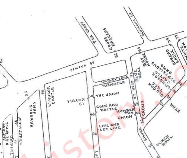

-
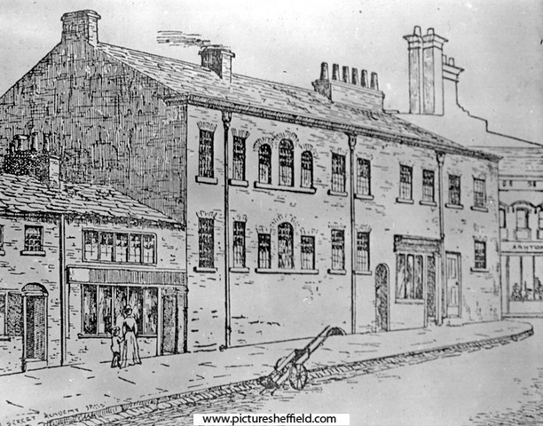
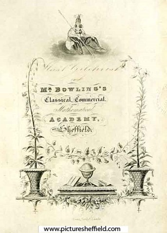
Milk Street Academy. s06474 Brief History of Milk Street and the Academy https://sheffielder.net/2022/11/03/milk-street-swept-away-by-the-construction-of-arundel-gate/ Book Plate for Mr Bowling's Classical, Commercial and Mathematical Academy, Milk Street, Sheffield. y06440 Original at Local Studies MP 6443 M. Leeds Library Special Collections, Milk Street Academy ( Sheffield) https://explore.library.leeds.ac.uk/special-collections-explore/participant/68118 Includes Milk Street Academy. https://blogs.princeton.edu/cotsen/2017/05/good-job-reward-books-from-early-19th-century-english-schools/ Milk Street from Norfolk Street, Nos. 43-45 Harry Hartley and Son Ltd., hardware store (former Milk Street Academy). February 1964. https://www.picturesheffield.com/frontend.php?keywords=Ref_No_increment;EQUALS;s17929&pos=7&action=zoom&id=20613 https://www.picturesheffield.com/frontend.php?keywords=Ref_No_increment;EQUALS;s17930&pos=8&action=zoom&id=20614 A Plan of the Tenements and Ground held of the Earl of Surrey by the Heirs of the late John Trout and assigned by them to John Schofield containing in the whole 398 yards, 1778. Surveyor: William Fairbank II. Property on the corner of Norfolk Street and Milk Street, including the School House (1771 Petticoat Lane); erectors of buildings named; measurements. https://www.picturesheffield.com/frontend.php?keywords=Ref_No_increment;EQUALS;arc03211&pos=22&action=zoom&id=98297 A plan of the tenement and ground held of the Earl of Surrey by the heirs of John Trout and assigned by them to John Schofield. 1778. https://www.picturesheffield.com/frontend.php?keywords=Ref_No_increment;EQUALS;arc03656&pos=23&action=zoom&id=99206 A Plan of the Sundry Tenements [property] of the Earl of Surrey in Norfolk Street, Arundel Street [Sycamore Lane] and Pond Lane. 1780. https://www.picturesheffield.com/frontend.php?keywords=Ref_No_increment;EQUALS;arc04171&pos=25&action=zoom&id=104512 Shows Norfolk Street, Arundel Street, Bowling Green Lane, Pond Lane, Pond Mill Dam, Shude Hill, road to Pond Mill, Slaughter House Lane, Milk Street, Pond Well, Pond Well Hill, and Change Alley. Note: Sycamore Street is named Arundel Street on this plan; probably by a mistake, as the Arundel Street shown on FC/P/SheS/745 (1787) is the same as the modern street. Tenants: Joseph Ibberson, Joseph Mitchell, Ann Genn, Thomas Siddall, Margaret Nutt, Mary Naw, Robert Higginbottom, John Schofield, Eliz. Dickinson, John Linthwaite and sister, Eliz. Rodgers, Titus Salt, George Clark, James Kaye, Thomas Pearson, Robert Baxton, Thomas Lambert, John Hammond, John Walter, Thomas Laycock’s heirs, William South, Edward Hawke, Josephus Parkin, John Greaves, Thomas Law’s heirs, Thomas Darwin, Samuel Shepley, Thomas Wilkinson, The Whitelead Co., The Widow Newton, Samuel Broomhead, Robert Lambert, George Badger, Jonathan Hale, Joseph Hall, Sarah Chapman, William ?, Robert [Unwin], John Parkes, Richard Wilson, and others (illegible). The property which became John Schofield property is The Unmarked Property between Benjamin Damms & Milk Street was later part of the Milk Street Academy. Property between Norfolk Street and Sycamore Street, occupied by Benjamin Damms, John Barber and George Dalton, 1828. https://www.picturesheffield.com/frontend.php?keywords=Ref_No_increment;EQUALS;arc04173&pos=21&action=zoom&id=104514 Shows: Milk Street, Mulberrry Street, George Street, and Sycamore Street.Tenants / owners: Benjamin Damms, John Barber, George Dalton and Thomas Caverley. Extract from: Reminiscences of old Sheffield, it's Street and its People. From letters Editor Robert Eadon Leader, from articles and letters in The Sheffield and Rotherham Independent 1872/3. Page 247-248. Wragg: ..... Near, in Milk Street, is Mr. Bowling's School, celebrated as being kept by the late Mr. J. H. Abraham, who, besides having the best school in the town, was of a mechanical turn of mind, for in 1822 he invented a magnetic apparatus for the protection of persons employed in dry grinding. Twiss: A testimonial was presented to him in that year, "in token of respect for his talents, and in acknowledgment of his services to an afflicted class of workmen by his ingenious invention;" and he also received the gold medal of the Society of Arts for the same invention. Johnson: Like many other things that are theoretically sound, the magnetic apparatus was practically useless. The great complaint against it was, I believe, that it was speedily choked with the fragments of metal attracted, and then the respiration of the workman was distressingly hindered. Holy Green House, The Moor, between Eldon Street and Prince Street. Home of Thomas Holy, who entertained John Wesley there. Mr. Abraham, principal of Milk St. Academy, resided here, also used for boarders and evening classes y01674 Thomas Holy, a member of a very old Sheffield family of manufacturers and merchants lived at Holy Green House which stood in a large garden, with a long green lawn in front, on Sheffield Moor, between Eldon Street and Prince Street. Mr Abraham, the Principal of the Milk Street Academy, had Holy Green House for boarders and evening classes. Mr Abraham also resided here, but left in 1839. It was afterwards used by the Sisters of Notre Dame prior to their premises in Convent Walk. In 1870 it was the Ecclesall Club.
-
I see this roadname from the tram as you come down City Road from Manor Top. been wondering for a while if anyone knows where the name came from?
-

-
This Sale Plan of Norton House, although not part of the Norton Hall Estate, may be of interest to someone as it fits nicely into the gap of the Map and bordered by Norton Church and Maugheray. Plan of Norton House situate in the parish of Norton and County of Derby. 1868. By Fowler and Son, Sheffield. https://www.picturesheffield.com/frontend.php?keywords=Ref_No_increment;EQUALS;y11283&pos=3&action=zoom&id=104274 Shows [Norton Lane, Cinderhill Lane, School Lane], Norton Church, Chantry monument, Norton House, Maugherhay, The Oakes, Norton Hall estate, and a school.Owners / Tenants: Norton Glebe (Rev Henry H. Pearson, vicar), William Gascoigne, James Jenkin, James Addy, Frances W. Bagshawe, H. Cunliffe, James Rhodes, Charles Cammell and Norton Hall Estate.
-

Birley Collieries Branch Line
boginspro replied to Paolo Coopio's topic in Sheffield Buses, Trams and Trains
I may be wrong here and apologise if I am but the original picture put on by History dude looks to me like the tunnel/bridge at Coisley Hill just below the Block Houses on Coisley Road. If that is so as kids it was always known as The Tunnel though I think it was just quite a long under bridge. It seems to me to have been accepted as the bridge under Normanton Hill into Birley West pit but if you look at the 1938 picture above of a wagon loading coal at the land-sale site of the old Birley West site you can see how steep that hill is and the difference in gradient to the first picture. -

The Price Of Coal
Sheffield History posted a topic in Sheffield in Films and TV shows (Sheffield Filming Locations)
Ken Loach film - filmed in Sheffield - starring Bobby Knutt I need to find this on video or dvd Does anyone know where I can get a copy from ? -

Clarity Lack, "Lustre Silver" EP Trademark's Owner.
Edmund replied to Kalfred's topic in Made In Sheffield
Frederick Green and Sons were at 84 Bridge street in September 1895, Henry Brooksbank was the manager there, advertising for a youth about 17 years old, used to filing spoons and forks. In June 1896 Greens wanted a girl for polishing and wrapping, and were at the London Works, 7 Eyre Lane - still there in May 1900 when the works were advertised to let . (From 1862 to 1895 7 Eyre Lane had been occupied by Briddon Brothers, silversmiths). -
Shows Edgestones Jessop Street & South Street. Improvements in South Street, Coalpit Lane, Balm Green and Hereford Street, with a selection of part of South Street and Jessop Street, 1825. https://www.picturesheffield.com/frontend.php?keywords=Ref_No_increment;EQUALS;arc04251&pos=2&action=zoom&id=105413 Marked: South Street [The Moor], road from Manchester, Younge Street [Young Street], Bennets Lane [Bennett Lane], Hereford Street, [Jail, Fail, Tail Street?], Bright Street, Cumberland [Street], Jessop Street, T. Holy's garden [Holy Green], Earl Street, Rockingham Street, Landers Lane, Duke Street, Carver Street, Ward Street, Porter Lane, Union Street, Sugar House, Furnival Street, Coalpit Lane, Burgess Street, Cross Street, Pinston Street [Pinstone Street], St Paul's, Charles Street, Norfolk Street, Balm Green, Far Gate, an Division Street.
-
What does "main" mean in a colliery name ?
Ponytail replied to JS2021's topic in Sheffield History Chat
Hickleton Main Coal Co. https://www.nmrs.org.uk/mines-map/coal-mining-in-the-british-isles/yorkshire-coalfield/doncaster/hickleton/ Manvers Main Colliery. https://www.nmrs.org.uk/mines-map/coal-mining-in-the-british-isles/yorkshire-coalfield/doncaster/manvers/ Yorkshire Main Colliery. https://www.nmrs.org.uk/mines-map/coal-mining-in-the-british-isles/yorkshire-coalfield/doncaster/yorkshire/ Rossington Main Colliery. https://www.nmrs.org.uk/mines-map/coal-mining-in-the-british-isles/yorkshire-coalfield/doncaster/rossington/ -
The Story of Jack Timms, founder and builder of Pinegrove Country Club. University of Sheffield Alumni, 9th June 2022. https://www.sheffield.ac.uk/alumni/news/story-jack-timms Pinegrove Country Club, Myers Grove Lane, Stannington. 11th June 1981. https://www.picturesheffield.com/frontend.php?keywords=Ref_No_increment;EQUALS;s32165&pos=1&action=zoom&id=65384 https://www.picturesheffield.com/frontend.php?keywords=Ref_No_increment;EQUALS;s32166&pos=2&action=zoom&id=65385 Pinegrove Country Club 2008. https://www.geograph.org.uk/photo/971256