Search the Community
Showing results for 'coal pit lane'.
-
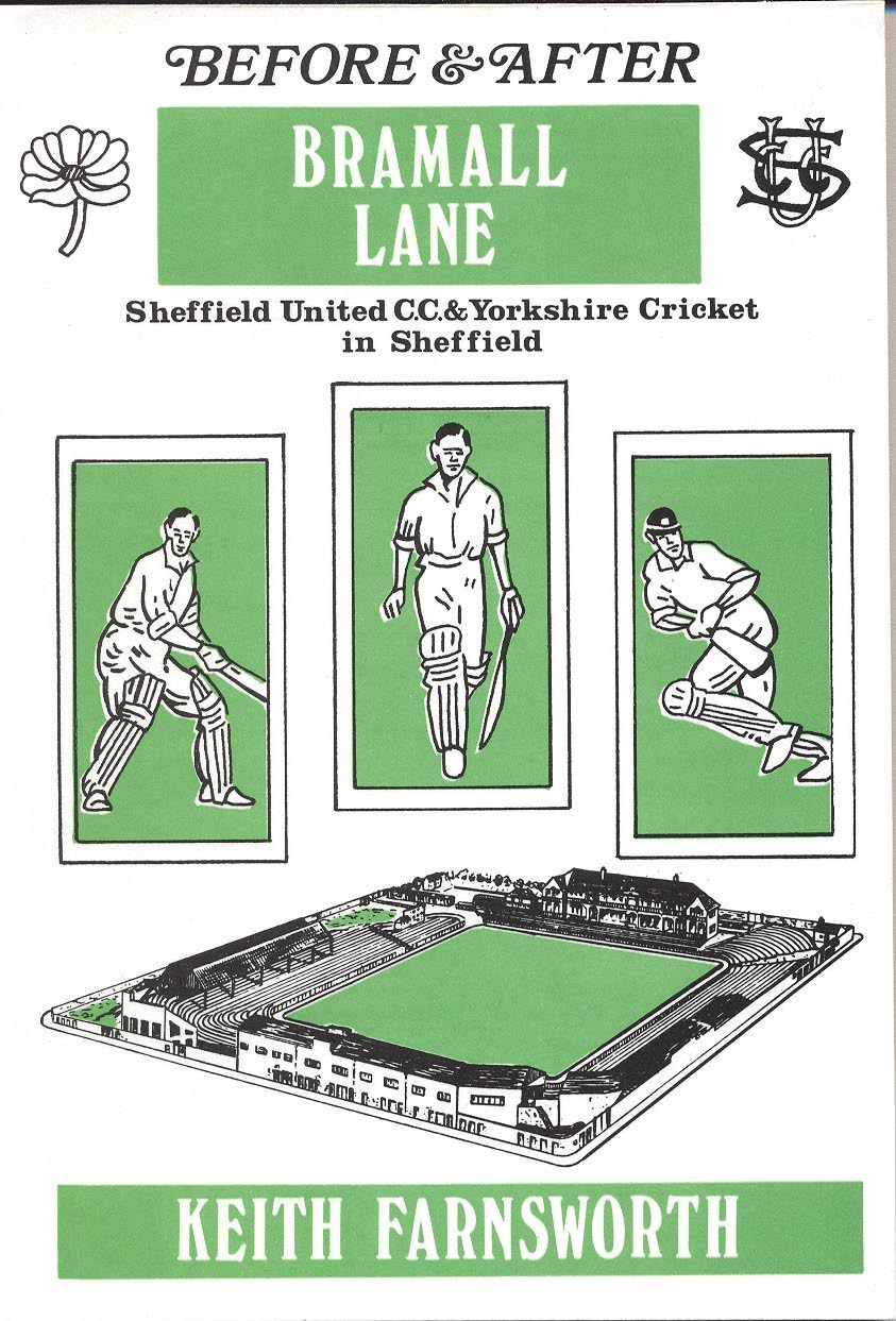
The story of cricket at Bramall Lane is told in this book --it should be available in the Central Library and some branches.

-
You could try the LDS at Wheel Lane Grenoside or the Archives.
-
The photo is of John Robinson at Coopers on Broad Lane. I think it may be 1940s. Anyone have an idea what he had been making? Or any information about Coopers?
-
Joseph Tomlinson (& Sons), Borough Mews, Bedford Street. in 1919 they were also at Oxford Mews, 162 Moore Street & 116 Holme Lane. and in 1925 at Oxford Mews, 287 Hanover Street. Don't know when they closed though.
-
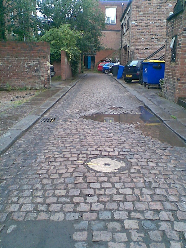
Novotel, Dixon Lane. Now I've not even seen the front of the said building so it is a stab in the dark and probably useless.
-

Firth Park Postcard Publisher - F.A.Kenyon
dunsbyowl1867 replied to dunsbyowl1867's topic in Sheffield History Chat
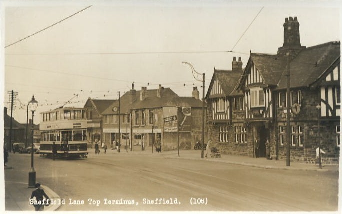
106 Sheffield Lane Top
-
Parkin and Bacon - Engravers, Lithographers, Draughtsmen, Letterpress and Copperplate Printers - Orchard Place, Orchard Street, Sheffield W. Wilkinson & Co. - Plain and Patent Sheep Shears - Australian Works, Fitzwilliam St, Bowden St, Sheffield Taylor Brothers - Manufacturers of every description of saws, files & steel, machine knives, &c. - Adelaide Works, Mowbray Street, Harvest Lane, Sheffield Page0001.pdf
-

Record shop on balcony by Castle Market
Guest replied to dunsbyowl1867's topic in Sheffield History Chat
Hi, My first post on here, me & hubby have just spent hours on this, reminising....., can anyone tell us the name of a pub that was near the Norfolk Arms at the bottom of Dixon Lane, it was on the site that is now a car park, opposite where the Barrow Boys bar/pub was. My husband thinks the pub was demolished in the late 70's. Thanks in advance. Gilly -
Help to identify a pub in Attercliffe area??
dunsbyowl1867 replied to a topic in Sheffield Pubs and WMC's
Hello Sharon, There was a pub at the junction of Attercliffe Common and Broughton Lane called the Broughton Inn - its sounds likely? Here's a photograph http://www.picturesheffield.com/cgi-bin/pi...ff.refno=v03366 -
Anyone remember this on Holme Lane?
hilldweller replied to Sheffield History's topic in Sheffield History Chat
Years ago it used to be a chemist shop staffed by a very superior lady in a dazzling white coat. As a lad I used to go there to buy an obnoxious dye called something like "crysadine" for my father to colour his fishing maggots with. The maggots of course I had just purchased next door at Dawsons, which is still going strong today. I used to deliver papers for Faldings who were located just the other side of Haden Street. On the morning of the "Great Sheffield Gale" I eventually ventured out from home to collect my papers. As I left the comparitive shelter of Haden Street I stepped out into Holme lane and the wind blew open my great big canvas "Star" bag and the next thing I knew I was flying past the upstairs window of Dawson's shop and I made a painful landing about 10 yards nearer to Malin Bridge ! Happy Days !!! -
Well, well,well - lots of wells. Note that Blackbrook Road was Bole Hill lane in 1850. Have you found an old well in the garden ??

-
I don't have a map but do have a picture of the area you are interested in taken early 1960s from Blackbrook Rd towards Crimicar Lane.

-
Thanks for the reply, the area I'm interested in lies between Blackbrook Road and Crimicar Lane. In particular the position of one of the marked wells. The map is terrific but if anyone has a larger scale or more recent map (before circa 1960) that would be even better. Regards, Hilldweller P.S. Perhaps the Hell-hole was a natural pot-hole uncovered by the quarrying and leading down to HELL ???
-
White's 1919 James Brooks Anvil manufacturer (Brooks & Cooper) h. Woodville, Wood Lane, Malin Bridge Brooks & Cooper Manufacturers of anvils, vices, bellows, smiths' tools, hammers, grinders' Mousehole Forge, Malin Bridge J William Cooper (Brooks & Cooper) anvil manufacturer Mousehole Forge, Malin Bridge John C Gillott Engineer ( F Granville & Co.) h. 23 Wostenholm Road Frederick Rimes Engineer (F Granville & Co.) h. 19 Wath Road Wilfred Taylor Anvil maker 49 Rockingham Street
-
White's 1849 M and H Armitage (& Co.) ironfounders, forgers, anvil manufacturers &c. Mousehole Forge & Owlerton Rolling Mill Thomas Binney Anvil maker & smith 48 Holly Street Miles James Mason Fawcett Anvil, vice &c maker Sheldon Row; h. 60 Wicker William Hadfield Anvil maker h. 24 Monmouth Street William Parker Iron forger, steel roller & spade, shovel, mill chisel, chain, anvil, vice, Soho Rolling Mill & Pond Forge, Forge Lane & Attercliffe William Parker Spade, shovel, mill chisel, anvil &c. manufacturer Attercliffe & at Sheffield Joseph Sanderson (Sanderson Bros.) anvil, vice, hammer, press screw &c. manufacturer Vulcan Works, 163 South Street; h. Milton Street, Hanover Street Thomas Sanderson (Sanderson Bros.) anvil, vice, hammer, press screw &c. manufacturer Vulcan Works, 163 South Street; h. Milton Street, Hanover Street Sanderson (Bros.) anvil, vice, hammer, press screw &c. manufacturers Vulcan Works, 163 South Street; h. Milton Street, Hanover Street
-
Pigot's 1841 Henry Armitage Anvil maker Stannington Thomas Binney Anvil maker Holly Street Miles John Mason Fawcett Anvil maker 60 Wicker Hadfield & Sanderson Anvil makers Earl Street Hadfield & Sanderson Anvil makers Wicker George Parker Anvil & chain & vice maker Burton Head William Parker Anvil maker Forge Lane
-
Webb Patent Sewer Gas Destructor Lamps
ukelele lady replied to RichardB's topic in Sheffield History Chat
Rural Lane Wadsley

-
Thomas Sawyer, Collector of highway rates, rents &c. 38 Wicker (White's 1833) John Southern, Collector of highway rates, 2 Paradise Square (White's 1833) Johnathan Buxton, Auditor And Collector Of highway Rates for Ecclesall Bierlow, 2 Rockingham Street (White's 1833) Edward Hallam, Collector of highway rates, Stand Cottage, Tapton Hill (White's 1849) John Southern, Collector of highway rates, 45 Leadmill Road (White's 1849) George Padley, Highway Rate collector, 95 Wentworth Terrace (White's 1852) William Johnson Clegg, Highway Rate Collector, 53 Spring Lane (White's 1852) George Dale, Collector of Highway Rates for Ecclesfield, Grenoside (Kelly's 1893) Joseph Bolsover, Collector of Poor, Sanitary & Highway Rates, Southgate, Eckington (Kelly's 1893) http://www.sheffieldrecordsonline.org.uk/
-
1797 William Ashton 27 Broad Lane
-
I wouldn't mind so much if they were PROPER cycle paths which ran parallel to both road and pavement but were "sectioned off" for cyclists in some way like a bus only lane. But no, these red psychopath cycle paths weave and wander about, moving from pavement to road and crossing pavements at silly angles and with turns in them for no reason. To me they just encourage poor cycling as the routes don't themselves seem to obey the normal rules of the Highway Code. To most of us non-cyclists (or rather ex-cyclists of many years lapsed) the red paths, red being a warning of danger, just seem to mean :- DANGER, - IDIOT CYCLISTS MAY BE FOLLOWING THIS ROUTE. (SENSIBLE CYCLISTS WILL BE ON THE ROAD FOLLOWING THE NORMAL RULES OF THE ROAD)
-
I hate to be the voice of doom on this but having a lot of relatives having lived in courts, I thought I would try and help by looking through my birth, death and marriages certificates too numerous to mention and the census records I have and the conclusion is......... Depending on who recorded or registered the BMD event and depending on who recorded the census information, they seem to basically put what they like whichever way round they like, which doesnt help!!! I remember having the same problem with trying to determine my grandads address as it was shown 2 different ways on 2 census records so I went with the info on the BMD records as these were a bit more specific. On my certificates these addresses have been recorded in the following few ways: 17Ct Scotland Street - no number 19Ct Scotland Street - no number 24 Court XI Court 11 Penistone Road - no number 24 in Court 11 Penistone Road 5 Court Green Lane - no number 3 Ct 4 H Cotton Mill Walk 11/1 Penistone Road 10 Court 2 House Garden Street another top tip is to go back on the census records a few pages as sometimes they will start with the exact court number and then revert to shorthand of 11/1 etc. I have found this helpful in a few cases.
-
Looking at Gramps maps, that route does seem the most direct, almost a straight line in fact. Interesting that the 3 pubs shown on the 1850's map above are all still there but have slightly different names. The Sportsman's Inn now The Sportsman, The Old Cottage, now the Walkley Cottage and then The Hollins Tavern on Hollins Lane, now The Holly Bush. Oddly re-named I think, the latter being similar but completely unrelated (unless someone knows different)
-
Edmund Street Residents White's 1849 Benjamin Smith, National School, 35 Eldon Street; h. Edmund Street George Fletcher, Mason, Edmund Street Joseph Baggaley, Cutler, Edmund Street William Barker, Bricklayer &c., Edmund Street, Hanover Street George Hulley, Shopkeeper, Edmund Street, Hanover Street William Roberts, Sawsmith, Edmund Street, Hanover Street White's 1852 Henry Depledge, Grinder, Edmund Street Robert Wright, Joiner and builder, Edmund Street George Fletcher, Mason, Edmund Street William Barker, Bricklayer and builder, Edmund Street, Hanover Street James Walker, Schoolmaster, Edmund Street; h. 74 Scotland Street Kelly's 1893 William Somerset, Beer retailer, 8 & 10 Edmund Street White's 1911 Robert Coldwell, Beer retailer, 10 Edmund Street Sidney F Hume, Greengrocer, 17 Edmund Street Thomas Bralsford, Plumber, 2 Edmund Street Mrs. Flora Lane, Dress Maker, 30 Edmund Street Robert Winter, Scissors manufacturers (& Son), h. 187 Edmund Street Mrs Mary Ann Markall, Householder, 189 Edmund Street George Henry Reid, Clerk, 194 Edmund Street Kelly's 1925 Marsh (Brothers (Electricians) Ltd.), Power & lighting engineers, 41 & 43 Fargate; works, Edmund Street --------------------------------- Further contributions (other Directories/ Census information etc) gratefully received.
-
2 sections of Ashgate Lane, Broomhill.

-
Going on my childhood memories of this area which I didn't visit very often if you turned right at the top corner of Arbourthorne Road where it turns left to meet Hurlfield Road onto what is now Toll Bar Road there was access on the right to a public footpath which went across a field, behind the houses that now stand on Toll Bar Road and then the path dropped down a steep embankment into what appeared to be a disused quarry (it appears from the previous maps this was the site of a brick works) before finally reaching Gleadless Road. I am sure that the top level used to have the remains of foundations of old buildings which had been demolished. Could this have been the school? Or was it an old farmhouse? Part of the problem seems to be the renaming of most of the roads in this area in the 1930's when the housing estate was built eg Hagg Lane to Hurlfield Road. Would be interesting to find the exact site of this school.