Leaderboard


Popular Content
Showing content with the highest reputation on 12/07/20 in all areas
-
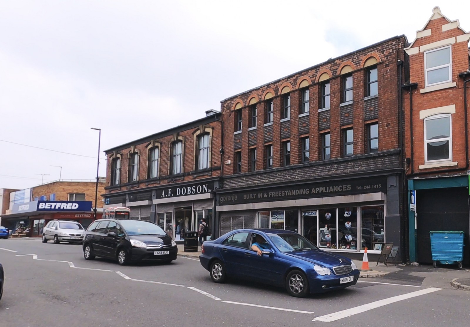
Hi all, On a recent trip to Darnall I spotted these two buildings in the main shopping area. They look like they've seen a bit of history in their time. Have they always been shops? Do we know anything about the history of these buildings?
 1 point
 -
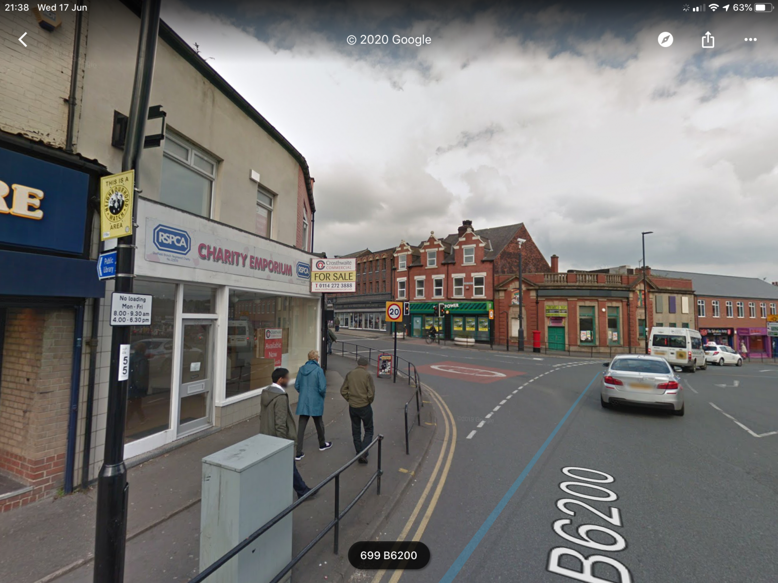
It’s a sad street scene though eh? In the Google street view, the only buildings visible are (left to right of shot) Amusement Arcade Charity Shop - RSPCA (closed) Dobsons (hooray!) Bookies (Paddy Power) Old Bank -Nat West was it? (closed) Charity Shop - Sally Bash Cake Box (hooray!) My Nan lived on the Triangle estate and I remember walking hand-in-hand down Handsworth Road (or sometimes through the bottom of High Hazels Park) to this shopping centre. It was buzzing with shops of all trades, full of life and wondrous place for a little lad. The chippies were legendary also and I might have been treat to a small bag of chips, to take home to my Nan’s, back up the hill on the 52 bus, as she couldn’t juggle me and the shopping bags! 😁 I pass by sometimes and sadly it’s a pale imitation of how it used to be, but symptomatic of most village / suburb centres now I suppose?
 1 point
 -
Research in my tram books tells me the Handsworth tramway extension was opened in 1909 as far as Finchwell Road, and the Darnall spur was opened at the same time, in the early days used by alternate cars, but I suspect not for long.1 point
-
Yes, good shout. I can see the tracks on the maps I posted a while ago. I also just noticed on the old photo of the building with the “OXO” advertisement on the gable end, you can just make it out on the current maps on street view (top image)..... unless it’s my eyes playing tricks and/or wishful thinking?!1 point
-
The chip shops were on the other side of the road, do you remember Lomas's, their fishcakes superb1 point
-
Nice to see those buildings still there, they were certainly there when I was a child in the war. There was a little used tram terminus in the road at that point. There is a picture on the Crich Tram Museum site with a tram standing there and the left hand building in the shot. (I don't think I have permission to put it on here). I don't know when the tram spur was covered over, but the trams finished altogether in 1960.1 point
-
Hi SteveHB, saw a photo of a good stone TROUGH on Ughill Wood Lane, Bradfield1 point
-
Hi all. I have written a biographical piece on my great-great grandfather, PC Thomas Clifford of Derbyshire Constabulary, who was posted to the area of Sheffield's border with Derbyshire in the early 1880s. This has now been published online, as a freely downloadable pdf document, by Derbyshire Family History Society (DFHS). The piece is 82 pages with as many period images, and takes about two hours to read. Many members of the community which PC Clifford patrolled were culters, and others wandered down from the city to drink in the pubs over the border. I therefore devote a significant amount of space to them. In case anyone has any use for links to the pdf, such as adding to a web page or sharing in other ways: The page where DFHS have placed the link to open the pdf - https://www.dfhs.org.uk/member_downloads.php?catid=6 Direct link for the pdf itself - https://www.dfhs.org.uk/filestore/PC_Thomas_Clifford_1880-85_110.pdf To navigate from the DFHS homepage, select 'Data & Downloads', then 'Downloads Area', and the link 'PC Clifford' appears under 'File categories (Public)'; this opens the page on which the link to the pdf appears I lived in Brimington on the north edge of Chesterfield in the mid-1990s when I worked in Sheffield, just off Ecclesall Road. Best wishes, John Clifford1 point
-
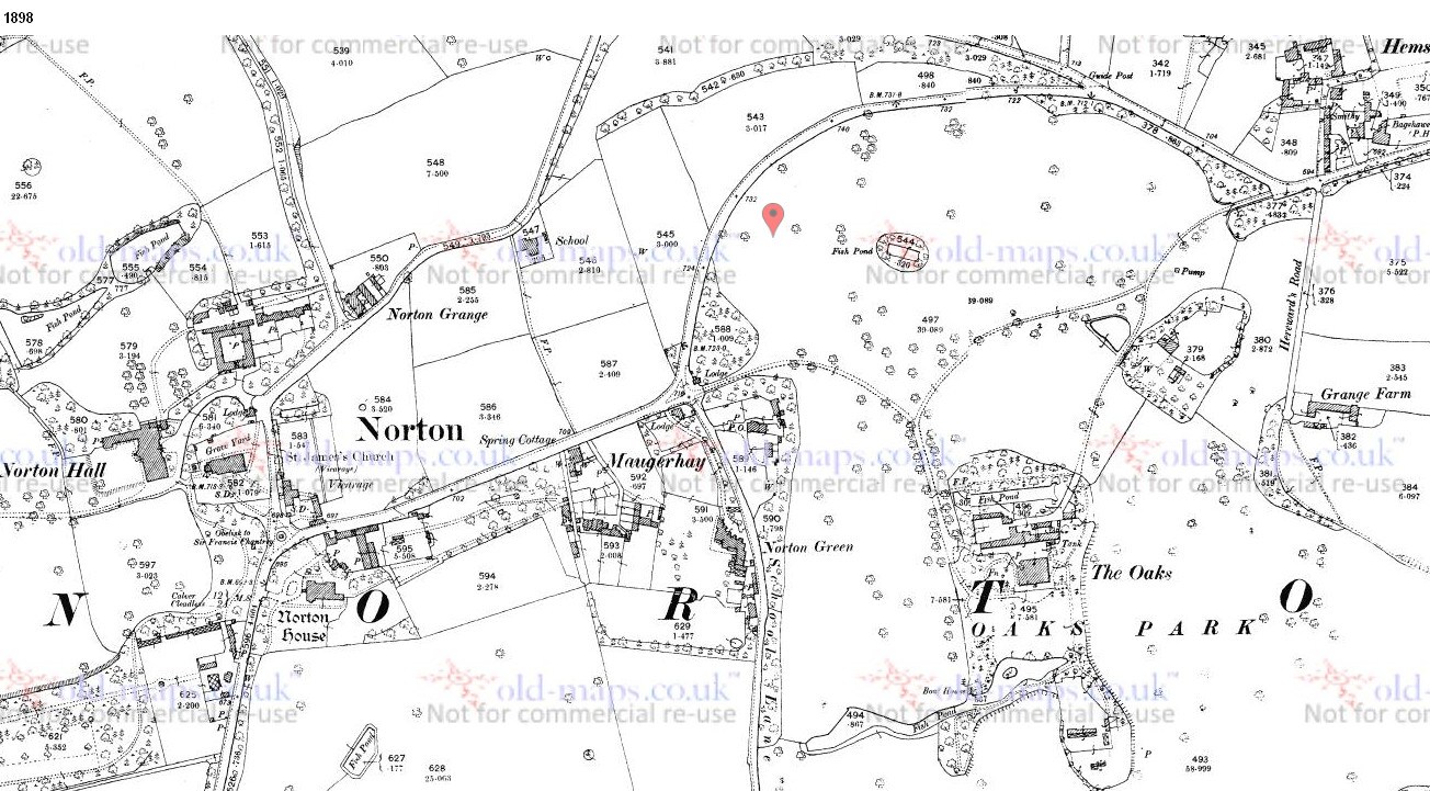
Thanks Guys Here`s the 1898 map of Norton for you LeadFarmer , also the pump at the top of Cobnar Road
.jpg.a9a07f59a3d1dd4f2cff77355e1364b6.jpg) 1 point
1 point -
Thanks for the photo', it's nice to see a few Darnall buildings that have not changed too much from my time round there (50/60 years ago) . From memory and including the building just shown on the right it was a row of smaller but very useful shops. On that part of Main Road there were shops selling virtually everything, plus a couple of good chip shops, pubs, and the club.1 point