
Leaderboard


Popular Content
Showing content with the highest reputation on 13/06/19 in all areas
-
Many thanks for the comments on the maps we have been uploading to Picture Sheffield recently. The City Archives and Local Studies Library has a wonderful collection comprising thousands of maps dating from the 16th century onwards. We are trying to give the collection a higher profile and make it available to as many people as possible. The maps are scanned at exactly the same resolution as the photographs. The difference however comes from the need to compress very large maps down to a size where they fit on a computer screen. In the light of recent comments however we have reviewed how we process the map images. The zoomed image is now larger and presented in a higher quality format. Hopefully this allows you to see more detail without slowing down the performance of Picture Sheffield. We are currently working our way through all of the map images on Picture Sheffield to improve them. The series prefixed ‘arc’ is complete. The other main set of maps (prefixed ‘y’) should be complete within a few weeks. As well as viewing the maps on Picture Sheffield the originals remain available at the City Archives and at the Local Studies Library in the Central Library should you wish to consult them. We welcome everyone who wishes to use the service in person or online. If you have any further comments or suggestions feel free to contact me via archives@sheffield.gov.uk Peter Evans, Archives and Heritage Manager3 points
-
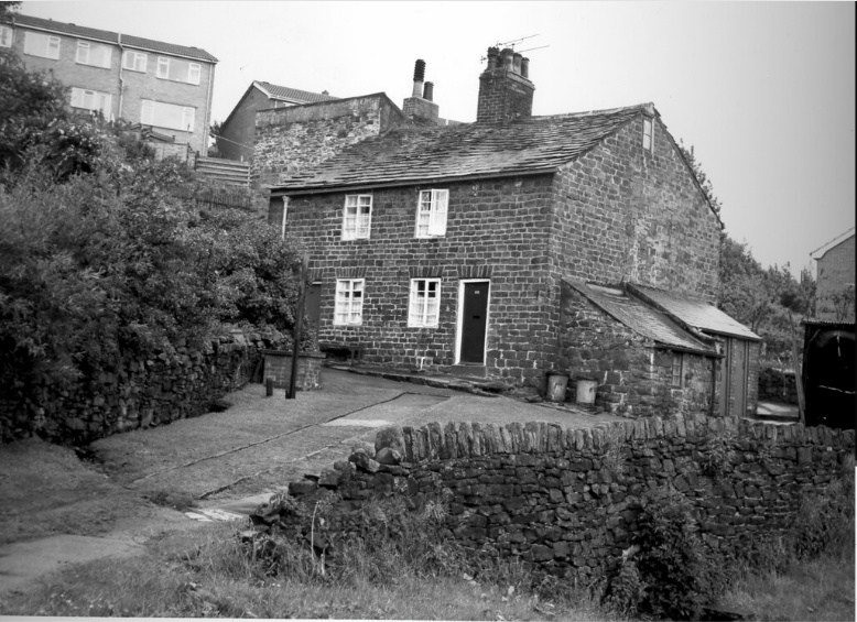
The trough was located on the corner where Brookhouse Hill becomes Whiteley Lane, Fulwood.1 point
-
Here are the old houses that were behind that trough, Unfortunately it is not a very wide view, I think this photo' was taken in the late 60's or early 70's. The houses and the well that fed that trough are shown on 1850's maps standing all on their own, no other houses on the road.
 1 point
 -
A new project I'm working on about Sheffield Stuff... This first full one is a look at the up-and-coming Kelham Island area. The full video Premieres on YouTube live tomorrow (Wednesday) at 7pm here: https://www.youtube.com/watch?v=TiCQN77R1go In the meantime, here's a brief trailer: Watch the first showing live at 7pm on Wednesday on YouTube where there'll be a live chat to discuss the video, places, facts and any possible mistakes(!) here: https://www.youtube.com/watch?v=TiCQN77R1go (If you have a YouTube account log in on that page and click the button to set a reminder for when it goes live - and feel free to subscribe to the channel for more as they are made).1 point