Leaderboard


Popular Content
Showing content with the highest reputation on 19/11/18 in all areas
-
Finally! I found an image showing the building that was shown on the far left of the original photograph. The white gable end with the double chimney appears to be connected with the Abbeydale Mill. At least I think that’s what the signage above the door reads? So, I believe this is the building that was shown with the purple circle in my earlier photo. http://picturesheffield.com/frontend.php?keywords=Ref_No_increment;EQUALS;u03677&action=zoom&pos=6&id=38830&continueUrl= Some more images of the area, in both directions, in different decades.... http://picturesheffield.com/frontend.php?keywords=Ref_No_increment;EQUALS;s12848&action=zoom&pos=41&id=15752&continueUrl= http://picturesheffield.com/frontend.php?keywords=Ref_No_increment;EQUALS;s12951&action=zoom&pos=43&id=15850&continueUrl= http://picturesheffield.com/frontend.php?keywords=Ref_No_increment;EQUALS;s16449&action=zoom&pos=48&id=19166&continueUrl= http://picturesheffield.com/frontend.php?keywords=Ref_No_increment;EQUALS;s12850&action=zoom&pos=57&id=15754&continueUrl= http://picturesheffield.com/frontend.php?keywords=Ref_No_increment;EQUALS;w00051&pos=7&action=zoom&id=45420


 2 points
 -
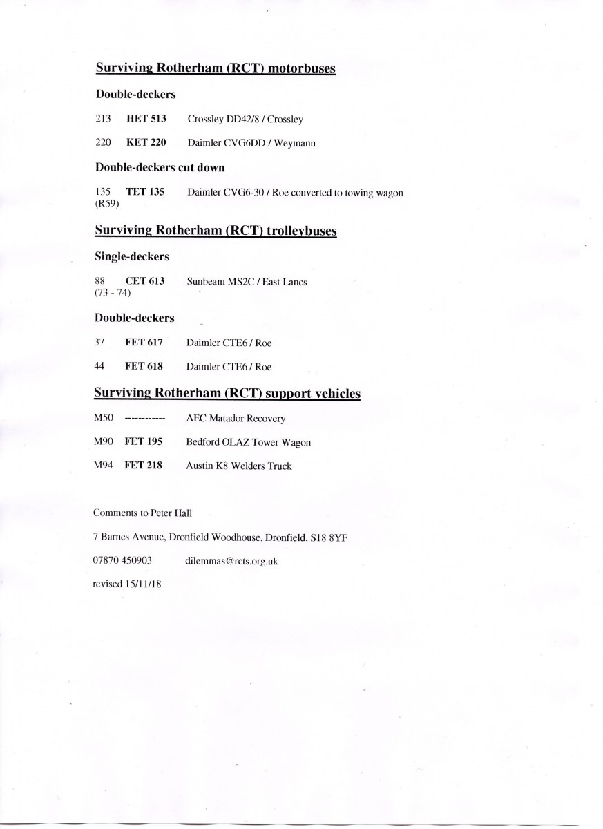
Having not so far been reprimanded for straying over the boundary into Rotherham I will tempt fate by adding an updated list of all known survivors of Rotherham Corporation Transport (RCT) motorbuses, trolleybuses and support vehicles in Great Britain, three in each category. Actually a very small number when compared with other municipal operations of a similar size. Of particular note is FET 218 the Austin K8 Welders Truck dating back to 1949. Although sold into preservation by SYPTE in 1977 it had been presumed the lack of any reports in recent years were an indication that it no longer survived. That however was not the case and in the last couple of months ownership has changed and it has returned to South Yorkshire. Despite being stored in the open for over twenty years it is in reasonable condition with a full restoration expected to get underway shortly No photographs of FET 218 in service have yet emerged so if anyone has any please make contact. It now has a pick-up style of back which during its later days had a frame with canvas cover. Whether this was how it was originally configured is not known for sure as a previous owner recalls that it may have originally had a conventional van body that was cut down by RCT at some point. Thus the appeal for photographs. Although a number of Austin K8's have been restored, pictures of which can be found on the net, none have a similar pick up style back which does suggest that the one on FET 218 may be a product of the Rawmarsh Road body shop.
 1 point
 -
Yesterday was history, today will be history tomorrow! What happened seventy years ago is still a part of my "recent" history, yet to my Grandchildren it really is almost "ancient "stuff!1 point
-
Well done RLongden! Found this (Ecclesall Corn Miller's House) https://friendsofmillhousespark.org/corn-mill-project/the-mill-story-part-14/ interesting history.1 point
-
1 point
-
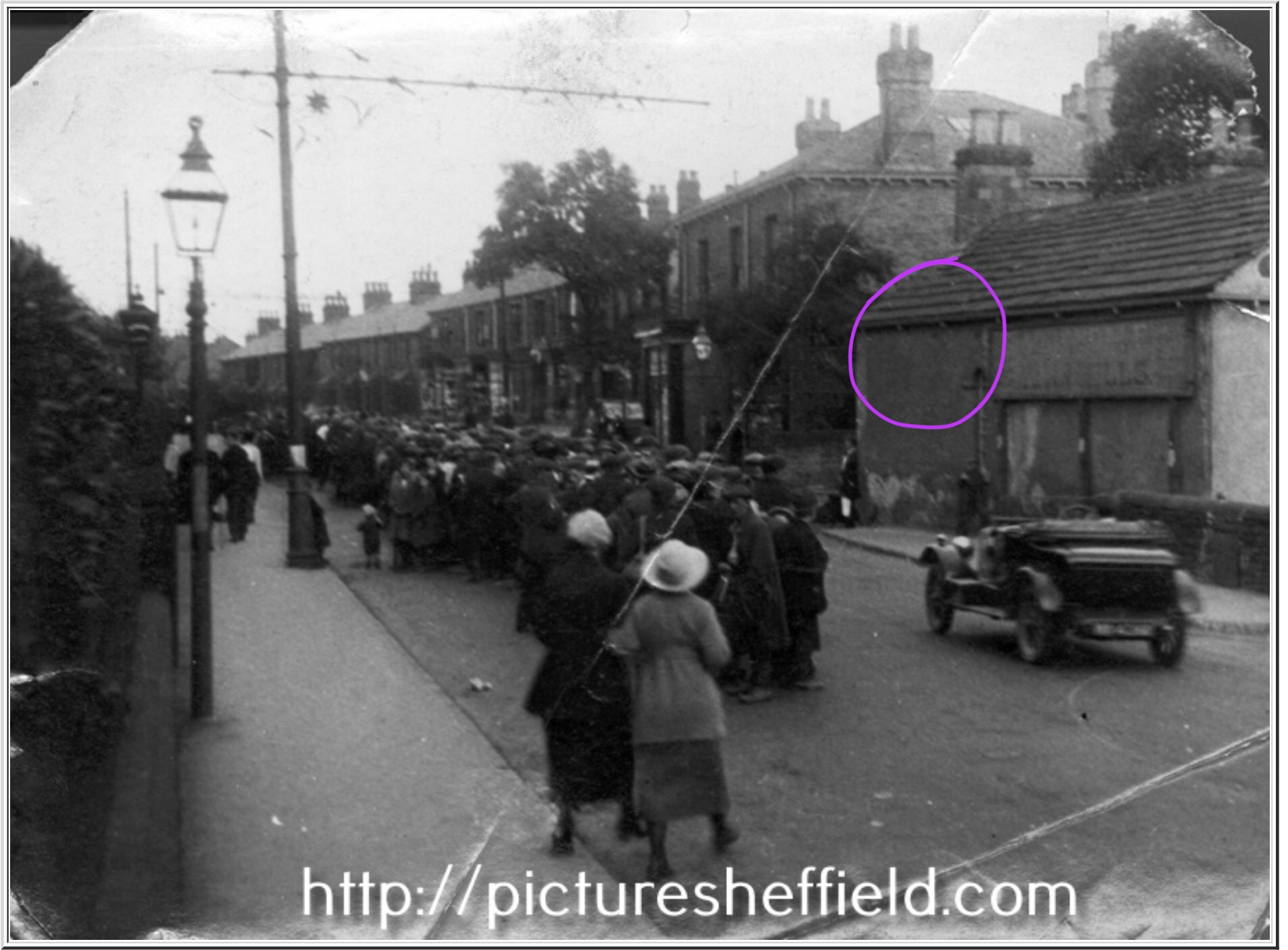
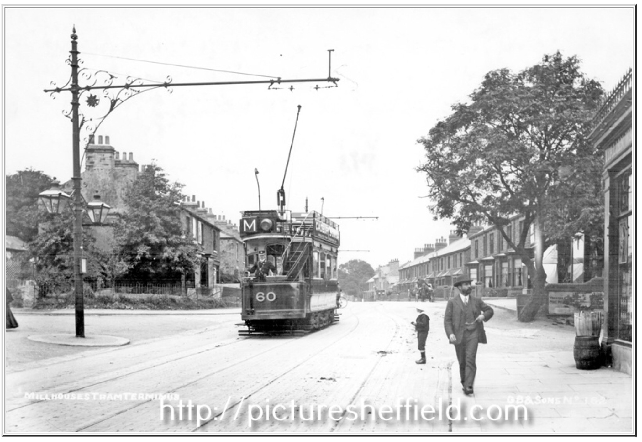
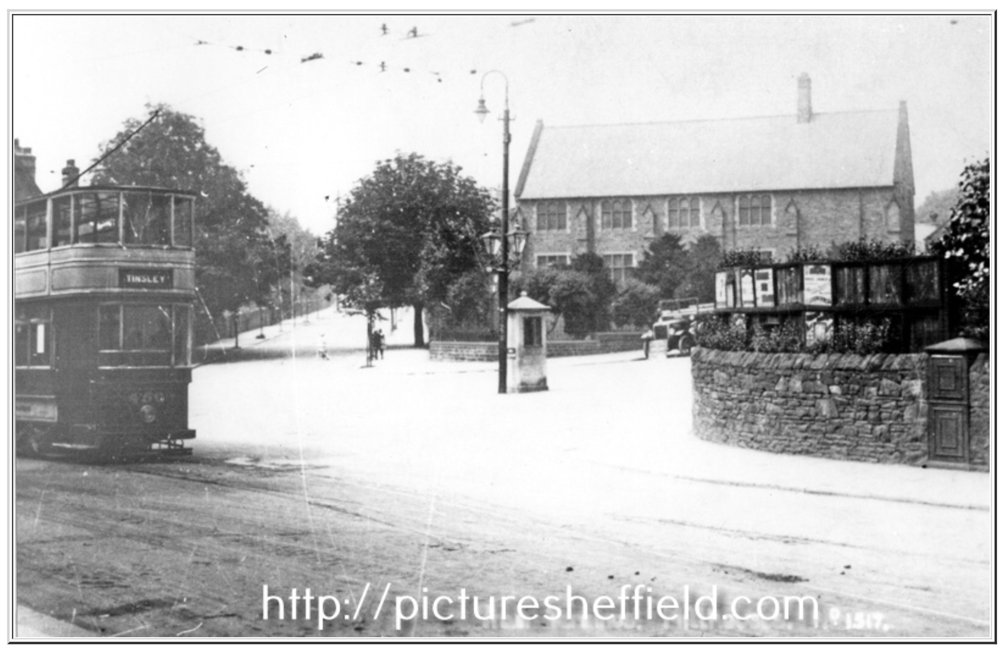
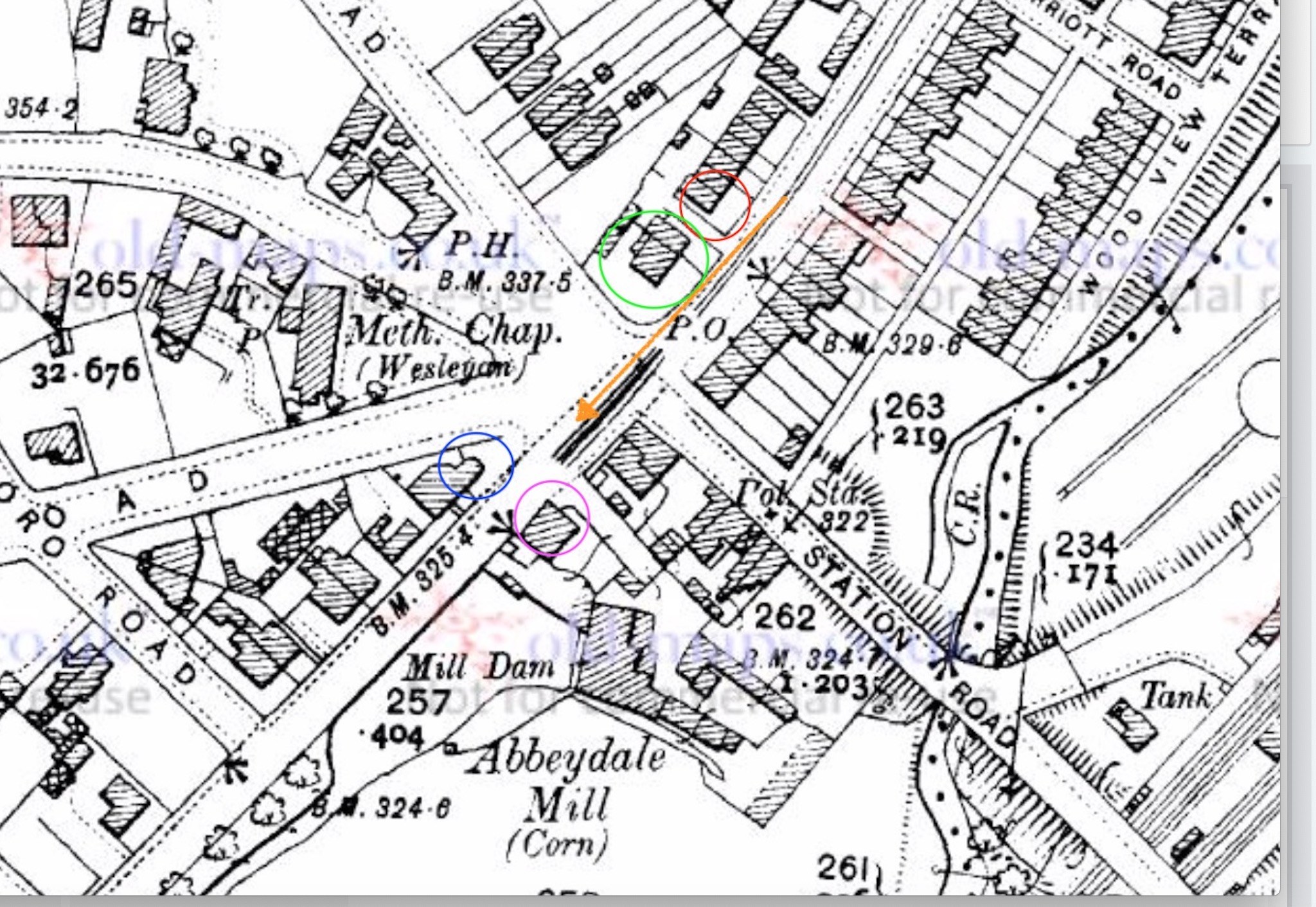
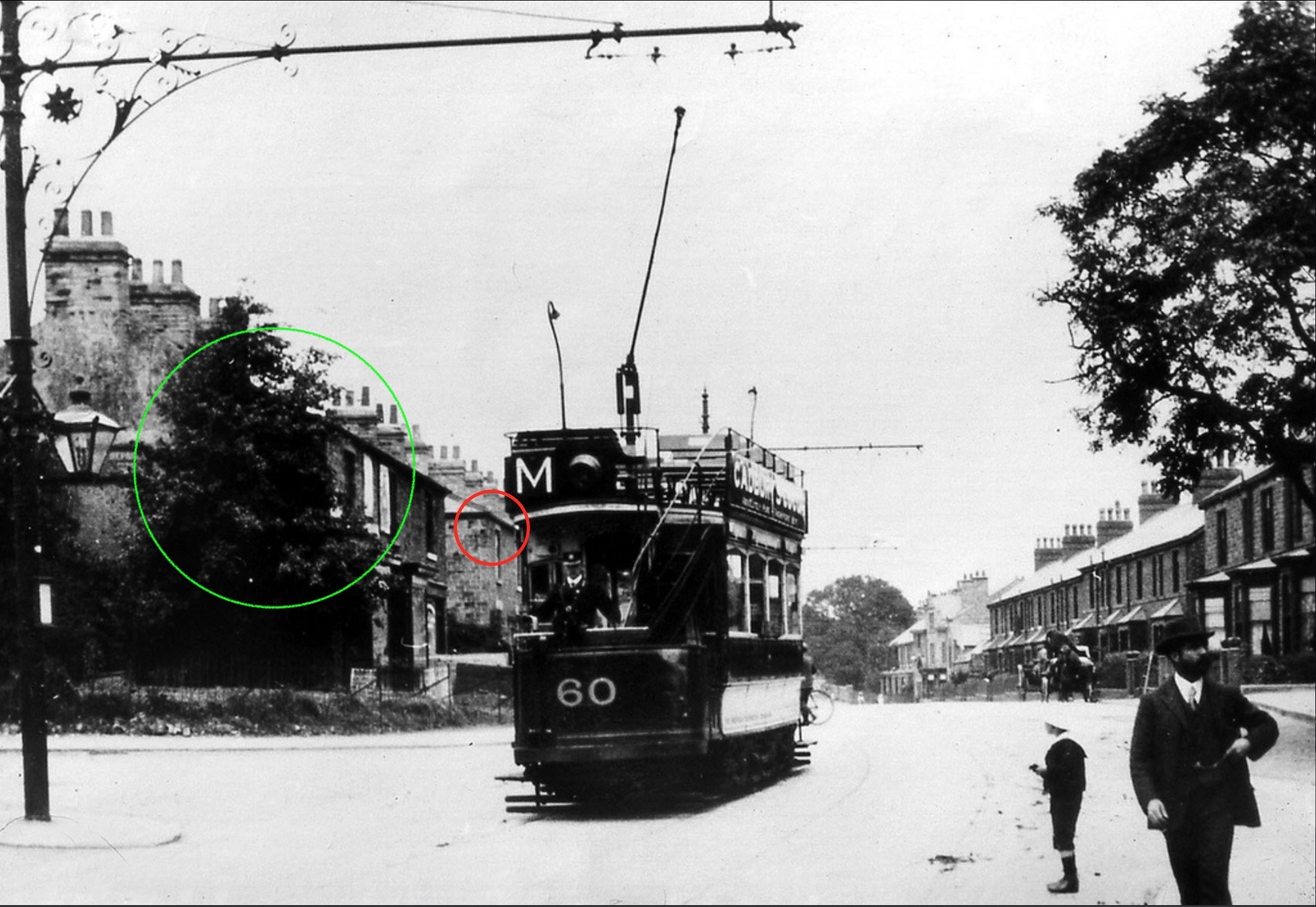
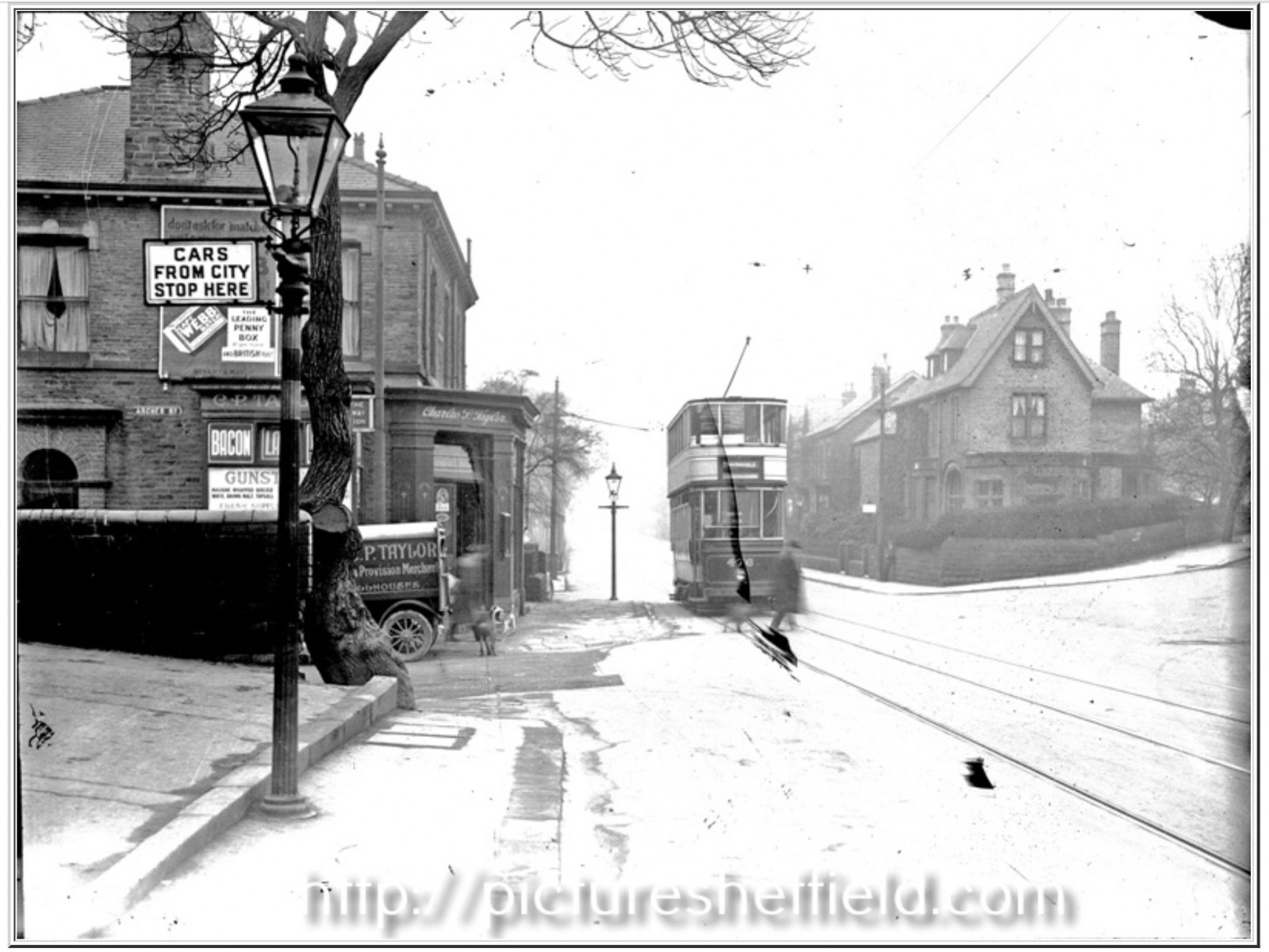
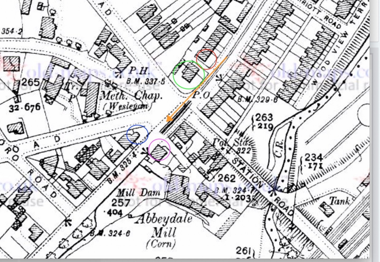
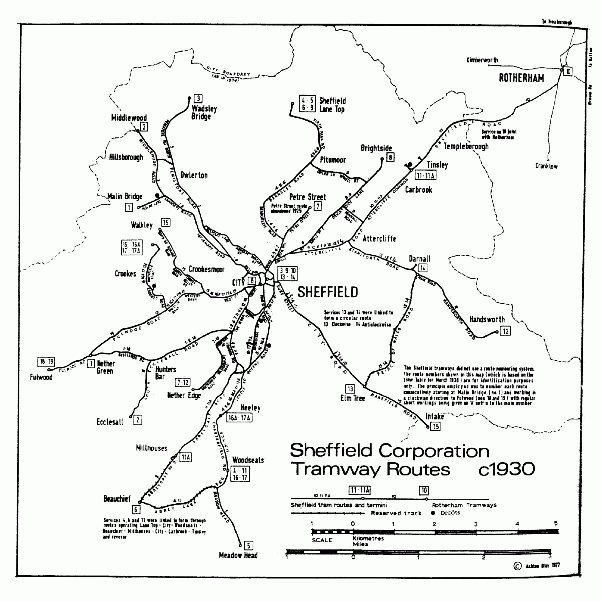
With respect, I'm not convinced that the photo is on Wostenholm Road? I found another image on PS from the opposite direction, at the junction with Priory Place and Albany Road, but several details in this image contradict the original (Catenary Poles on wrong side, wall and trees on Priory Place side, etc.) http://www.picturesheffield.com/frontend.php?keywords=Ref_No_increment;EQUALS;s16495&pos=4&action=zoom&id=19211 Looking at the tram routes of the time, the Tinsley <> Carbrook <> City <> Millhouses (and eventually Beauchief) route, I have a theory that this image might be at the end of Abbeydale Road, where it becomes Abbeydale Road South, at the junction of Archer (prev. Station) Road and Springfield Road. The junction looked a lot different then and some of the buildings have now gone, whereas others weren't even built. The tram tracks are single at this point and the catenary poles are on the right side (and the same design). I marked on a map where I think the photograph was taken from and in which direction (the orange arrow) The red circle is now the Abbey Frier (note the pitch of the roof, the upper windows and high lintels) The green circle are buildings that have been demolished when the junction was widened The blue circle shows the building that is now 'Chirofirst' (note the steep pitch of the roof and the top floor, double mullioned window) The purple circle is the building (now demolished) beyond the junction of Archer Road (the building that is now 'La Scala' restaurant is out of shot on the left) The last photo shows tram No.60 travelling in the opposite direction to the Millhouses terminus, with the buildings marked in the same colour coding. I may be mistaken, but the dip and slight bend in the road look right, as do the buildings that are visible in shot. Of course, I may be a million miles away, but maybe others have an opinion?


 1 point